

Scotland Cycle Routes

Enjoy mountains, lochs, rivers, canals and beautiful coast on the numerous cycle trails running through Scotland. Highlights include the wonderful Clyde Walkway shared cycle and walking path. Also try the Dava Way and the Formartine and Buchan Way for more traffic free cycling along dismantled railway lines.
Use the links to view full route information including elevation profiles, interactive maps and GPS downloads.
You can also view an overview map of all the routes in the using the Scotland Cycle Map>>
| Route Name | Photo | Distance | Description |
| Aberdeen to Maud | 36 miles (58 km) | Follow National Cycle route 1 and the splendid off road Formartine and Buchan Way cycle track from Aberdeen to Maud on this lovely ride which gives great views of the River Don and passes by Haddo Country Park and country park. View Full Details>> | |
| Aberdeen to Stonehaven | 27 miles (43 km) | This ride follows National Cycle Route 1 along the North Sea coast from Aberdeen to Stonehaven. The start of the ride is particularly lovely as you head through the impressive port of Aberdeen and around the splendid Bay of Nigg. You continue south through Cove Bay and Findon, where there are some truly beautiful coastal views. View Full Details>> | |
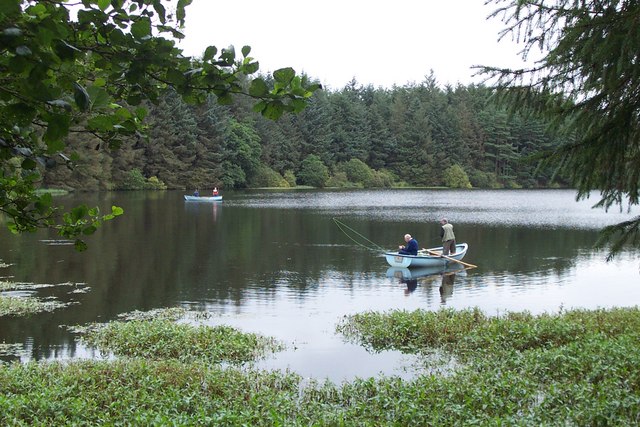
| Aden Country Park | 2 miles (3 km) | Explore 230 acres of parkland in this beautiful country park in the heart of Buchan. Scenery in the park includes peaceful woodland, a lake and a Victorian arboretum. There are also farm buildings built around 1800, a ruined mansion house and a coach house built in 1832 which now houses the award winning Aberdeenshire Farming Museum. In the park there are number of well-maintained tracks perfect for an easy stroll or a safe family cycle ride. Trails include: The Children's Trail - a short family trail visiting various sites of interest in Aden. Woodland Walk Trail - a longer trail of about 2.5 miles visiting the Victorian Arboretum, Ice House, North Lodge, Lake, and SANDS garden. Tree Trail - Enjoy conifer and broadleaf trees with descriptions on this short 1 mile trail. The Formartine and Buchan Way also passes through the park so there is scope for continuing your outing along this popular trail. Just to the north of the park you will find the lovely Pitfour Lake. The lake has good walking trails along the water and through the surrounding woodland. The park is located in Mintlaw, Aberdeenshire about 8 miles east of Peterhead. View Full Details>> | |
| Almondell and Calderwood Country Park | 3 miles (5 km) | Explore 220 acres of country park near Broxburn on this easy cycle or walk. In the park you will find peaceful woodland and a lovely waterside trail running along the River Almond. Almondell is a haven for wildlife - look out for Roe deer, fox, heron, otters and woodpeckers as you make your way through the park. Also of interest is the excellent Visitor Centre with displays, a gallery, information and a conservatory with a cafe. If you would like to continue your outing you could head north to the Union Canal. You could follow the towpath east into Edinburgh on foot or bike. View Full Details>> | |
| Arbroath to Montrose | 17 miles (27 km) | Follow National Cycle route 1 along the North Sea coast on this splendid cycle ride which has wonderful views of Lunan Bay and Montrose Basin. View Full Details>> | |
| Ayr to Maybole | 11 miles (18 km) | Follow National Cycle Route 7 along the coast from Ayr to the town of Maybole on this short easy route. The ride starts on the front in Ayr and follows the coast to Genoch Bridge, crossing the River Doon and giving splendid views of Ayr Beach and the 16th Century Greenan Castle. You then head inland towards Maybole on pretty country lanes, finishing at the train station. View Full Details>> | |
| Ayr to Newton Stewart | 47 miles (75 km) | Travel along National Cycle Route 7 and through the incredible Galloway Forest Park on this lovely ride. View Full Details>> | |
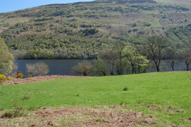
| Balloch Castle Country Park | 3 miles (4.5 km) | Enjoy spectacular views of Loch Lomond in this beautiful country park in West Scotland. There are 200 acres to explore with nature trails, guided walks, peaceful woodland, a delightful walled garden and Balloch Castle which now serves as the visitor centre. You can stroll along the shoreline of the loch and then visit the Chinese Garden, Quarry Pond and the Secret Garden before enjoying refreshments at the loch side kiosk. The Three Lochs Way runs past the park so this is a great option if you would like to continue your walk/cycle. View Full Details>> | |
| Banff to Buckie | 22 miles (36 km) | Travel along the Moray Firth coast of Scotland on National Cycle Route 1 and enjoy some splendid coastal scenery. You will travel through the seaside villages of Portsoy, Cullen and Findochty on your way to Buckie. The countryside on the route is beautiful and the bays at Cullen and Portessie are particularly lovely. Much of the ride follows traffic free paths starting at Cullen and finishing at the end of the ride at Banff. View Full Details>> | |
| Beecraigs Country Park | 5 miles (8 km) | Enjoy a peaceful cycle or walk around this beautiful country park in Linlithgow, West Lothian. There are 913 acres to explore with a multitude of woodland trails suitable for leisure cyclists, mountain bikers and walkers. For cyclists there are several graded trails ranging from Green (easy) to Red (difficult) and Black (Severe). There are also miles of well surfaced paths through the forest for walkers to enjoy. You can climb Cockleroy Hill for fabulous views of the surrounding countryside and follow the waterside path around Beecraigs loch. The park has an excellent visitor centre with maps and leaflets. Wildlife in the park includes a red deer herd and Highland Cattle. Beecraigs is located less than 2 miles south of Linlithgow. If you would like to continue your outing you could head to the nearby Muiravonside Country Park where you will find 170 acres of woodland and parkland with views of the River Avon. A stroll around Linlithgow Loch or along the Union Canal are other good options. View Full Details>> | |
| Bellingham to Langholm | 47 miles (75 km) | This ride follows National Cycle Route 10 and the Reivers Route through the beautiful and tranquil Northumberland National Park, and over the border into Scotland. You start at Bellingham (known as the gateway to Kielder Forest) with an on road section which takes you along the River North Tyne, around Kielder Water and into the lovely Kielder Forest. View Full Details>> | |
| Berwick-upon-Tweed to Dunbar | 34 miles (55 km) | This lovely ride follows National Cycle Route 76 from England into the Scottish Borders giving wonderful coastal views along the way. The ride starts in Berwick-upon-Tweed heading north to the coastal town of Eyemouth in the Scottish borders. You continue along the coast to Cove where you will find the beautiful Pease Bay. The final section takes place on a mixture of country roads and cycle tracks, taking you to the finish point in Dunbar. View Full Details>> | |
| Berwick-upon-Tweed to Melrose | 45 miles (72 km) | Follow National Cycle Route 1 and the River Tweed from Northumberland in England into the Scottish borders. The ride starts near the train station in Berwick-upon-Tweed and heads west along the River Tweed to Kelso, with the crossing of the Union suspension bridge at Horncliffe a highlight. You continue onto the lovely village of Dryburgh in the Scottish borders. Sitting on the river Tweed it is home to the 12th century Dryburgh Abbey which is certainly worth stopping to view. A short on road section finishes the ride taking you into Melrose, where you finish near Melrose Abbey. View Full Details>> | |
| Bonaly Country Park | 5 miles (8 km) | This country park is located a few miles to the south of Edinburgh city centre. The park features cycle and walking trails taking you through woodland and open moorland to a series of reservoirs. There are excellent views of the Pentland Hills, Edinburgh, the Lothians, Fife and the Firth of Forth from the park. The park is located near to the Water of Leith where you will find a lovely, waterside cycling and walking path. This leads to the Union Canal which you can follow into the centre of Edinburgh. Also nearby is the climb to Arthur's Seat. This splendid hike is a real highlight of the area, commanding fine views over city and the coast. View Full Details>> | |
| Buckie to Elgin | 17 miles (27 km) | This ride follows National Cycle route 1 and the Moray Firth coast of Scotland from Buckie to Elgin via Portgordon and Garmouth. Highlights on the route include the wonderful views of Spey Bay as you travel from Buckie to Garmouth followed by a lovely run along the River Lossie into Elgin. View Full Details>> | |
| Calderglen Country Park | 3 miles (5 km) | Follow the Rotten Calder River through this lovely country park in East Kilbride. There is a delightful riverside path passing through a scenic wooded glen forged out by the river. There are numerous pretty waterfalls along the path, woodland wildflowers and important geological features. Cyclists can also use the trails in the park but please beware of other users. View Full Details>> | |
| Caledonia Way | 234 miles (377 km) | This route follows Sustrans National Cycle Route 78 from Campbeltown to Inverness. View Full Details>> | |
| Caledonian Canal | 6 miles (9 km) | Follow the Caledonian Canal from Inverness to Loch Dochfour on this waterside walk or cycle in the Scottish Highlands. The flat towpath is ideal for an easy cycle or walk in beautiful surroundings. The route starts at the Muirtown Basin in Clachnaharry on the Beauly Firth. You then head south through Inverness passing the Ship Space interactive maritime museum and Whin Park where you can board the Ness Islands Miniature Railway. The canal then leaves the city and heads through some beautiful countryside to Loch Dochfour which feeds Loch Ness. You can continue your walking in the area by picking up the Great Glen Way. The long distance trail also starts in Inverness, running parallel to the canal. It will take you to Fort William via Loch Ness and Loch Lochy. The canal also runs alongside the River Ness so you could try the waterside trail to Whin Park, through the city. View Full Details>> | |
| Campbeltown to Tarbert | 39 miles (62 km) | Travel along the Caledonia Way (National Cycle Route 78) and the Kintyre Peninsula on this spectacular ride which gives fabulous of views of Kilbrannan Sound and the west coast of the Isle of Arran. The ride starts by following quiet roads around Campbeltown Loch with terrific views of the striking Davaar Island. You continue along the coast towards Carradale passing the interesting 13th century Saddell Abbey on the way. More quiet coastal roads take you through Grogport to Claonaig where you head inland towards Tarbert. The ride finishes with a beautiful stretch along West Loch Tarbert taking you to the finish point at Tarbert Quay. View Full Details>> | |
| Carlisle to Gretna | 20 miles (32 km) | Follow National Cycle Route 7 from England into the Scottish borders and enjoy views of the Rivers Eden and Esk. The ride takes place mainly on quiet country roads passing through Longtown on your way into the Scottish borders from Cumbria. View Full Details>> | |
| Carrbridge to Aviemore | 11 miles (18 km) | Travel along National Cycle Route 7 and through the stunning Cairngorms National Park on this lovely short cycle ride. The route takes place mainly on off road tracks passing first through Docharn Wood and then along the Speyside Way from Boat of Garten Village to Aviemore. Highlights on the route include views of the Cairngorms, the River Spey and the Strathspey Steam Railway. View Full Details>> | |
| Carrbridge to Kingussie | 26 miles (42 km) | This ride follows National Cycle Route 7 through the stunning Cairngorms National Park. The route takes place mainly on off road tracks passing first through Docharn Wood and then along the Speyside Way from Boat of Garten Village to Aviemore. You then follow the River Spey into Inshriach Forest where you will cross the River Feshie and pass the beautiful Loch Insh on your way to Kingussie. There's some truly splendid scenery on this ride with several wooded sections and wonderful mountain views to enjoy. View Full Details>> | |
| Castle Semple | 3 miles (5 km) | Castle Semple country park is located in the Clyde Muirshiel Regional Park at Lochwinnoch, Renfrewshire. This route starts at the visitor centre and takes you alongside Castle Semple Loch before joining woodland trails to Park Hill. Cyclists can enjoy the lochside path which runs along National Cycle Route 7 from Glasgow to Irvine while the woodland trails are more suitable for walkers. View Full Details>> | |
| Cathkin Braes Country Park | 2 miles (4 km) | Enjoy panoramic views of the city of Glasgow and the mountain peaks beyond in this country park south east of Glasgow. There are a number of walking trails taking you through ancient woodland, grassland, heath and scrub. The park is excellent for cycling having been used for the mountain bike competitions at the 2014 Commonwealth Games. The course is a 5.5 km long figure of eight and is of a very high standard - see the video below for an idea of what you can expect. If you want to continue your activity then Linn Park is just over a mile west of Cathkin Braes. View Full Details>> | |
| Chatelherault Country Park | 6 miles (9 km) | Enjoy a cycle or walk around this large country park located between Motherwell and Hamilton. The park lies along the River Avon gorge with ancient woodland and riverside trails to enjoy. Highlights of the park include the Hunting Lodge and Summer House built in 1732 for the Dukes of Hamilton. In the buildings you will find the visitor centre, the Banqueting Hall and Duke and Duchess Apartments, an Exhibition Gallery with displays, the Gift Shop and Cafe. There's also a wide variety of wildlife including roe deer, otter, badger and various woodland birds. If you would like to continue your walk/cycle you could follow the River Avon north to the nearby Strathclyde Country Park. View Full Details>> | |
| Clatto Reservoir Country Park | 3 miles (5 km) | Enjoy miles of well laid out cycling and walking trails in this lovely country park in Dundee. The route starts by taking you around the large reservoir on the waterside path. Look out for a variety of birdlife including Pochard, Goldeneye, Tufted Ducks, Moorhen, and Coot. The route then heads into the peaceful Templeton Woods where you can look out for red squirrels. If you would like to continue your outing you could visit the adjacent Camperdown Park where you will find another 400 acres of pretty parkland and a Wildlife Centre. View Full Details>> | |
| Clyde Muirshiel Regional Park | 3 miles (5.5 km) | Enjoy a cycle or walk along the beautiful Lunderston Bay in the Clyde Muirshiel Regional Park located on the South Clyde estuary in Scotland. Lunderston Bay has a lovely sandy beach and a central grassy area with picnic benches. National Cycle Network route 75 runs along the bay so its perfect for a safe, easy waterside cycle. Loch Thom is located a couple of miles inland. There's a nice circular trail running around the peaceful loch. Also near here is the Greenock Cut Visitor Centre which provides lots of useful information on all the walks in the area. View Full Details>> | |
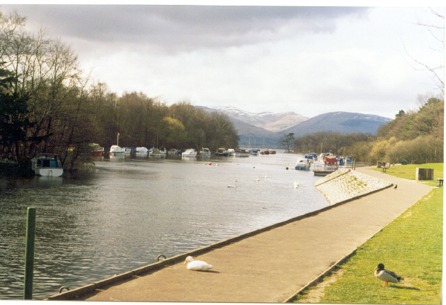
| Clyde Walkway | 39 miles (62 km) | This splendid, waterside cycle and walking route, runs along the River Clyde, from Glasgow to New Lanark, South Lanarkshire. The route starts in Glasgow’s West End where the Rivers Clyde and Kelvin meet, and heads to Cambuslang via Glasgow Green and the Broomielaw. This section takes you through industrial areas with a number of interesting historical buildings. You then head into the countryside through Uddingston, Bothwell (passing the medieval castle) and Blantyre to the delightful Strathclyde Country Park. Here you follow the banks of Strathclyde Loch before following the river to Garrion Bridge, Dalserf and Crossford. The final section takes you from Crossford to the New Lanark World heritage Site and the Falls of Clyde Nature Reserve. The walk is waymarked with a blue fish logo. View Full Details>> | |
| Coast and Castles | 199 miles (321 km) | The complete National Cycle Network Coast and Castles route from Newcastle to Edinburgh via Berwick Upon Tweed. View Full Details>> | |
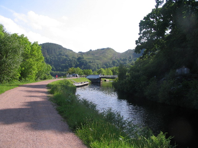
| Crinan Canal | 8 miles (12.5 km) | Enjoy a waterside walk or cycle along the Crinan Canal in Argyll and Bute. It's a stunningly beautiful area with the canal running between Loch Crinan and Ardrishaig on Loch Fyne. Along the way there are a number of pretty locks and bridges with fabulous views of the surrounding Scottish hills and countryside. The flat towpath makes for a nice easy stroll or cycle ride. The route starts at the Crinan Basin with its pretty boats and views over Loch Crinan to Duntrune Castle. You then head in a south easterly direction towards Bellanoch with views of the River Add and Loch A' Bharain. The route continues past the village of Cairnbaan to Lochgilphead. The town sits at the head of Loch Gilp and is the administrative centre of Argyll and Bute. The final section takes you from Lochgilphead to the Ardrishaig canal basin. The pretty village contains a pier, a lighthouse and pubs where you can enjoy refreshments at the end of your exercise. To extend your cycling in the area you could try the Crinan to Taynuilt and Tarbert to Crinan cycle routes. There's also miles of cycling and walking trails in the adjacent Knapdale Forest. It's a splendid place with several lochs and lots of wildlife to look out for. View Full Details>> | |
| Crinan to Taynuilt | 36 miles (58 km) | This stunning ride follows the Caledonia Way (National Cycle route 78) through Kilmartin Glen and includes a wonderful long stretch along Loch Awe. The ride starts overlooking Loch Crinan before joining the Crinan Canal to Bellanoch. You then turn north towards Kilmartin with the fascinating Temple Wood stone circle a highlight on this section. The ride then heads towards Ford passing Loch Ederline before heading into Inverliever Forest where you will pass along the beautiful Loch Awe to Kilchrenan. You then turn north towards Taynuilt passing through the Caledonian Forest Reserve before finishing near Taynuilt train station. View Full Details>> | |
| Culbin Forest | 17 miles (28 km) | Enjoy a cycle or walk around this large coastal forest near Nairn. There are a huge number of tracks to choose from including the easy Hill 99 trail which is waymarked. The route below begins at the car park at the Culbin Forest Nature Reserve and takes you around the forest on various tracks. The route includes a visit to the Culbin Sands Nature Reserve on the coast at Nairn. Here you can see a variety of coastal birds including bar-tailed godwits, oystercatchers and knots. The route then heads back through the forest passing a series of idyllic woodland lochs before returning to the start point. Other highlights in the forest include the beautiful Findhorn Bay where you can see ospreys and seals at the river-mouth and a view over the water towards the village of Findhorn. You can also climb the Hill 99 viewpoint trail where there are fabulous views of the surrounding area from the top of the viewpoint tower. National Cycle Network Route route 1 runs just past the forest so there is scope for continuing your ride if you have time. The forest is located about 16 miles north east of Inverness. View Full Details>> | |
| Cycle around Millport | 10 miles (16 km) | This route follows the coastal roads around the the island of Great Cumbrae in the Firth of Clyde, off the coast of North Ayrshire. The route runs for a distance of about 10 miles on fairly flat roads. As such it should take around 1-2 hours to cycle around the island at a leisurely pace. The route starts in the town of Millport, at the southern end of the island. You can catch ferry boats here from Largs which is easily reachable from Glasgow by train. In the town there are several cycle shops offering bike hire. From the town you head west past Aird Hill to the western side of the island. The path then takes you north past a series of stunning bays including Deadman's Bay, Fintray Bay and Little Skate Bay. The route heads along the northern tip at White Bay and Tomont End before heading along the east coast. There's great views across the water to Ayrshire as you pass Holm Bay and Ballochmartin Bay before coming to the Marine Station at Farland Point. The final section takes you back to Millport via Kames Bay. The island is great for wildlife watching. Look out for golden eagle, cormorants, fulmars, sea eagle and many more. You may also see other marine life including seals, basking sharks, porbeagle sharks and dolphins. View Full Details>> | |
| Dalkeith Country Park | 3 miles (5 km) | This large country park near Edinburgh has a number of excellent walking and cycling paths. The waymarked walking trails run through the ancient oak woodland and along the River Esk which runs through the park. Cyclists can follow the miles of estate roads and then follow a lovely off road path along the River Esk to Musselburgh on the coast. Look out for an abundance of wildlife including deer, foxes, herons and otters. To extend your walking in the area you could head into Holyrood Park in the city and climb to Arthur's Seat. This splendid hike is a real highlight of the area, commanding fine views over city and the coast. Also nearby is Bonaly Country Park where there are more good cycling and walking trails to try. View Full Details>> | |
| Dams to Darnley Country Park | 3 miles (4.5 km) | Enjoy cycling and walking in this large country park near Glasgow. There are 1350 acres to explore including wetland, burn, woodland, grassland and scrub. The main attractions in the park are the beautiful Barrhead Dams with miles of waterside trails alongside a series of connected reservoirs. These include the large Balgray Reservoir and the smaller Ryat Linn and Waulkmill Reservoirs. The dams are excellent for birdwatching - look out for lapwing, ringed plover, redshank, common sandpiper and common gull. The park is located a few miles south west of Glasgow city centre at Barrhead. If you wanted to extend your outing you could head to the nearby Rouken Glen Park where you will find miles of walking paths. View Full Details>> | |
| Dava Way | 23 miles (37 km) | A super cycling and walking route along a dismantled railway line from Forres in Moray to Grantown On Spey, Highland. View Full Details>> | |
| Drumpellier Country Park | 2 miles (4 km) | Explore 500 acres of lowland heath, mixed woodlands, lochs and open grassland in this pretty country park located between Glasgow and Airdrie. You can follow the woodland paths to Lochend Loch and Woodend Loch before enjoying a stroll along the Monkland Canal which runs through the southern end of the park. The park also contains a Visitor Centre, Cafeteria, Peace Garden and Nature trails. View Full Details>> | |
| Dumbarton to Callander | 39 miles (62 km) | Follow National Cycle Route 7 on this incredible cycle ride through Loch Lomond and Trossachs National Park and enjoy fabulous views of Lochs Lomond, Drunkie and Venachar. The ride starts with a great traffic free run along the River Leven from Dumbarton to Balloch where there are splendid views of Loch Lomond and Balloch Castle Country Park. You then continue on road to Drymen, before a lovely run through Queen Elizabeth Forest Park takes you onto Aberfoyle. Here you join a traffic free section that takes you through Achray Forest and past Loch Achray, Loch Venachar and Loch Drunkie. View Full Details>> | |
| Dumfries to Annan | 25 miles (40 km) | Travel along National Cycle Route 7 from Dumfries to Annan and enjoy splendid views of the Solway Firth. You start on the River Nith in Dumfries and follow the river to Caerlaverock where you can see the impressive 13th century Caerlaverock Castle. The route then heads east along the Solway Firth to Powfoot where there are some lovely waterside views. The final stretch takes you to Annan where you finish the ride with a run along the River Annan into the town centre. View Full Details>> | |
| Dumfries to Castle Douglas | 19 miles (30 km) | This ride follows National Cycle Route 7 from Dumfries to Castle Douglas. You start with a lovely traffic free run along the River Nith in Dumfries and head west to Lochfoot where you pass Lochrutton Loch. The route continues on road to Haugh of Urr where you cross Urr Water over the Haugh Bridge. More quiet country roads take you onto Castle Douglas, where you finish by the tourist information centre. View Full Details>> | |
| Dumfries to Gatehouse of Fleet | 45 miles (72 km) | This ride follows National Cycle Route 7 from Dumfries to Gatehouse of Fleet via Castle Douglas and Kirkcudbright Bay . View Full Details>> | |
| Dumfries to Gretna | 34 miles (55 km) | Travel along National Cycle Route 7 from Dumfries to Gretna and enjoy splendid views of the Solway Firth. You start on the River Nith in Dumfries and follow the river to Caerlaverock where you can see the impressive 13th century Caerlaverock Castle. The route then heads east along the Solway Firth to Powfoot where there are some lovely waterside views. You continue to Annan where you can enjoy a run along the River Annan before heading into the countryside towards Gretna Green, where you finish at the train station. View Full Details>> | |
| Dundee to Arbroath | 20 miles (32 km) | Follow National Cycle Route 1 along the Firth of Tay from Dundee to Arbroath on this lovely easy ride which passes by the famous Carnoustie golf course - home of the Open. The ride starts by heading along the Tay to Broughty Ferry with its striking castle and lovely beaches. You continue onto Monifieth before joining a traffic free section through Carnoustie where there are super views of Carnoustie Bay and Westhaven harbour as well as the famous golf links. A final long off road section takes you into Arbroath where you finish near the harbour. At the end of the route we recommend locking up your bike and trying the splendid Arbroath Coastal Path. View Full Details>> | |
| Dundee to Dunfermline | 53 miles (86 km) | Follow National Cycle route 777 and 1 on this long but rewarding route that offers splendid views of the Fith of Tay and Lochs Glow and Leven. The ride starts in Dundee, crossing the Tay Bridge and then heading west along the Firth of Tay to Newburgh. You then head inland towards Falkland where you can see the impressive National Trust Owned Falkland Palace and explore the picturesque waterfalls in Maspie Den before more country roads take you to the beautiful Loch Glow and then on to Kinross where you'll pass Loch Leven. View Full Details>> | |
| Dundee to Perth | 24 miles (38 km) | Follow National Cycle Route 77 along the Firth of Tay from Dundee to Perth on this easy ride. View Full Details>> | |
| Dundee to St Andrews | 19 miles (30 km) | Follow National Cycle route 1 along the Firth of Tay on this short, easy ride. The ride starts on Dundee harbour, crossing the Tay Road Bridge over the Firth of Tay to Newport-on-Tay. You then continue off road to Tayport along the Tay, before heading into Tentsmuir Forest for a lovely wooded section. A short on road section takes you to Guardbridge before another traffic free path takes you along the Eden Estuary and then through the famous St Andrews golf course to St Andrews. View Full Details>> | |
| Dunfermline to Alloa | 15 miles (24 km) | This lovely easy ride follows National Cycle route 764 and the trackbed of a disused railway line from Dunfermline to Alloa via Clackmannan and Carnock. Nearly all of the ride is traffic free making it ideal for families. View Full Details>> | |
| Dunfermline to Stirling | 37 miles (60 km) | Travel along National Cycle routes 1 and 76, taking you along the Firth of Forth from Dunfermline to Stirling. You start of by heading south towards the Firth of Forth via Inverkeithing. Here the route turns west, heading along the Firth of Forth to Stirling on a mixture of on and off road sections. You will pass through Charlestown, Culross, Kincardine and Alloa on the way. Highlights on the ride include the harbour at Charlestown, the strikng Kincardine Bridge and the famous William Wallace Memorial as you approach Stirling. View Full Details>> | |
| Edinburgh to Airdrie | 41 miles (66 km) | Travel along National Cycle Route 75 and enjoy lovely waterside runs along the Union Canal and the River Almond. View Full Details>> | |
| Edinburgh to Bathgate | 26 miles (42 km) | Travel along National Cycle Route 75 and enjoy lovely waterside runs along the Union Canal and the River Almond. The route starts in the centre of Edinburgh, near the famous castle, and soon joins the traffic free canal side path taking you to Balerno. You continue on road to East Calder where you join another scenic traffic free stretch along the River Almond taking you through Livingston. The final stretch takes you from Livingston to Bathgate on more pleasant cycle tracks. View Full Details>> | |
| Edinburgh to Dunbar | 35 miles (57 km) | Travel through East Lothian along National Cycle Routes 1 and 76 and enjoy splendid views of Edinburgh and the Firth of Forth. View Full Details>> | |
| Edinburgh to Dunfermline | 22 miles (36 km) | Travel along National Cycle Route 1 and enjoy fabulous views of the Firth of Forth. The route starts in the centre of Edinburgh, near the famous castle, and heads through the suburbs of Roseburn and Barnton to the coast where you can enjoy a lovely traffic free section that runs along the Firth of Forth to Queensferry. Here you cross the Forth Road Bridge and continue on through Inverkeithing and then on to Dunfermline on a mixture of on road and off road sections. View Full Details>> | |
| Edinburgh to Kirkcaldy | 31 miles (50 km) | Travel along National Cycle Route 1 and 76, taking you along the Firth of Forth from Edinburgh to Kirkcaldy. The route starts in the centre of Edinburgh, near the famous castle, and heads through the suburbs of Roseburn and Barnton to the coast where you can enjoy a lovely traffic free section that runs along the Firth of Forth to Queensferry. Here you cross the Forth Road Bridge and continue on through Inverkeithing before turning east towards the lovely Dalgety Bay. The ride continues along the Firth of Forth to Aberdour where you join a pleasant traffic free section to Burntisland, with views of Silversands Bay. An on road section then takes you to Kinghorn and then onto Kirkcaldy. View Full Details>> | |
| Edinburgh to Melrose | 55 miles (88 km) | This long but rewarding ride takes you along National Cycle Route 1 from Edinburgh to Melrose in the Scottish borders. View Full Details>> | |
| Edinburgh to Stirling | 50 miles (80 km) | Travel along National Cycle Routes 1 and 76 and enjoy splendid views of the Firth of Forth. View Full Details>> | |
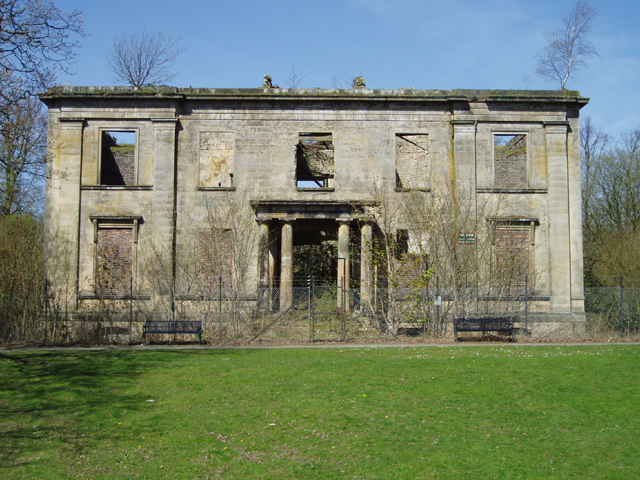
| Eglinton Country Park | 4 miles (6 km) | This large country park in Kilwinning has nearly 1000 acres of parkland to explore on cycling and walking trails. There are peaceful woodland trails and delightful waterside paths running along Eglinton Loch and Lugton Water which runs through the southern end of the park. Other features in the park include the Eglinton Castle ruins, the walled garden and the pretty Clement Wilson gardens. View Full Details>> | |
| Elgin to Nairn | 28 miles (45 km) | Follow National Cycle route 1 from Elgin to Nairn and enjoy splendid views of the Moray Firth and Findhorn Bay. View Full Details>> | |
| Forfar Loch Country Park | 2 miles (4 km) | Follow the 2.5 mile trail around the beautiful Forfar Loch on this circular cycle or walk route in Angus. The loch is surrounded by woodland, grassland and some lovely countryside. Other attractions include pitch and putt, crazy golf and the Lochside Leisure Centre. View Full Details>> | |
| Formartine and Buchan Way | 53 miles (86 km) | A super off road cycling and walking trail through Aberdeenshire following a dismantled railway line. The route runs from Dyce to Fraserburgh with an optional section to Peterhead. Highlights on the route include Aden Country Park where you will find the Aberdeenshire Farming Museum, forest walks and a ruined country house. The path also passes the peaceful Pitfour Lake, the 13th century ruined abbey at Deer Abbey (see video), the Strichen White Horse and the ancient Strichen Stone Circle. View Full Details>> | |
| Fort William to Fort Augustus | 33 miles (53 km) | Travel along the Great Glen Way and the Caledonia Way (National Cycle route 78) on this fantastic cycle ride which takes you along the Caledonian Canal and gives splendid views of Ben Nevis. View Full Details>> | |
| Forth and Clyde Canal | 35 miles (56 km) | Follow the towpath of the Forth and Clyde Canal from Bowling to Falkirk on this super cycling and walking route. The route follows National Cycle Network Routes 7 and 754 so is well signed throughout. At Falkirk you can link up with the Union Canal which will take you into Edinburgh. As such you can cross central Scotland from Glasgow to Edinburgh on traffic free canalside paths. You start off at the Bowling Basin near to Bowling train station on the Glasgow suburban line. The path then heads through Clydebank and the outskirts of Glasgow, crossing the four-arched 120 metre long Kelvin Aqueduct and the Kelvin Walkway as you go. View Full Details>> | |
| Gartmorn Dam Country Park | 3 miles (4.5 km) | This 370 acre Country Park and Nature Reserve is located less than two miles from Alloa and Clackmannan in Clackmannanshire. The centrepiece of the park is the 170 acre Gartmorn Dam reservoir which has a lovely waterside path and is surrounded by peaceful woodlands. The park is very good for wildlife watching - look out for woodpeckers, roe deer, hare and red squirrels in the woodland areas and various wildfowl on the reservoir. Other features in the park include an 18th century Ice House, the 19th century kitchen garden, a bird hide, picnic areas and a visitor centre. If you'd like to continue your walk/cycle then the Dunfermline to Alloa path runs just to the south of the park. It follows National Cycle Network route 764 and the trackbed of a disused railway line from Dunfermline to Alloa via Clackmannan and Carnock. View Full Details>> | |
| Glasgow to Airdrie | 19 miles (30 km) | Follow National Cycle Route 75 from Glasgow to Airdrie and enjoy views of the River Clyde. View Full Details>> | |
| Glasgow to Balloch | 21 miles (34 km) | This ride takes you from the city of Glasgow to the village of Balloch in the Loch Lomond and the Trossachs National Park. The route runs for just over 20 miles, using a largely traffic free section of National Cycle Route 7. It's a fairly flat ride taking you along the Clyde River, the Forth and Clyde Canal and finally through the lovely scenery of the Vale of Leven. As such it's a great way to reach the shores of Loch Lomond using your steam. The route starts near Argyle Street Station and the cathedral, on the River Clyde in Glasgow. From here you can pick up a riverside path called the Clyde Walkway which will take you west along the Clyde to Clydebank. The trail continues west along the Forth and Clyde Canal to Dumbarton where you turn north to follow a nice trail along the River Leven into Balloch. View Full Details>> | |
| Glasgow to Dumbarton | 16 miles (25 km) | Follow the River Clyde and National Cycle Route 7 on this easy traffic free ride. The route heads first to Clydebank passing the eyecatching Clyde Arc bridge and the 1896 built Glenlee tall ship on the way. You continue along the river through the lovely villages of Old Kilpatrick and Bowling where there are some wonderful waterside views to enjoy. The ride finishes by the River Leven in Dumbarton. Here you can take a visit to the peaceful Loch Humphrey where there are some nice trails in the Kilpatrick Hills. View Full Details>> | |
| Glasgow to Edinburgh | 66 miles (106 km) | This is the complete route from Glasgow to Edinburgh along the Forth and Clyde Canal and the Union Canal. The route follows National Cycle Network Routes 7, 75 and 754 so is well signed throughout. It follows the towpath of these two major canals and is traffic free for the duration so it is also suitable for walkers. The route runs for a distance of about 66 miles so it is possible to complete it in one day if you have a good level of fitness. You start at the Bowling Basin and head through Clydebank, Kirkintilloch, Falkirk and Linlithgow to the finish point in the centre of Edinburgh. There's beautiful countryside, nature reserves, country parks, rivers and spectacular aqueducts to enjoy as you make your way across central Scotland. Route highlights include the four-arched 120 metre long Kelvin Aqueduct and the Kelvin Walkway in Glasgow. View Full Details>> | |
| Glasgow to Greenock | 28 miles (45 km) | This ride takes you along National Cycle Route 75 from Glasgow to Greenock on the Firth of Clyde. The route starts with a pleasant run along the River Clyde before heading through Pollok Country Park with its National Trust owned 18th century house and attractive gardens (see video below). A pleasant mixture of quiet roads and cycle tracks, including a stretch along White Cart Water, take you onto Paisley. You then join a fantastic long off road cycle path which takes you through Bridge of Weir and Port Glasgow to Greenock, where there are excellent views of the Firth of Clyde. View Full Details>> | |
| Glasgow to Lochwinnoch | 21 miles (33 km) | This lovely short easy ride takes you along National Cycle Route 75 from Glasgow to Paisley and . The ride starts with a pleasant run along the River Clyde before heading through Pollok Country Park. View Full Details>> | |
| Glasgow to Paisley | 10 miles (16 km) | This lovely short easy ride takes you along National Cycle Route 75 from Glasgow to Paisley. The ride starts with a pleasant run along the River Clyde before heading through Pollok Country Park with its National Trust owned 18th century house and attractive gardens (see video below). A pleasant mixture of quiet roads and cycle tracks, including a stretch along White Cart Water, take you onto Paisley. View Full Details>> | |
| Glen Orchy | 14 miles (23 km) | This large area of woodland in Argyll and Bute has miles of cycling and walking trails to follow. There's also a series of impressive waterfalls, streams and rivers to enjoy. You can start your outing from the car park next to the Eas Urchaidh waterfall on the River Orchy. Cross the bridge over the river to enter the woodland and pick up the trails. They run through the woods to the village of Bridge of Orchy where you can cross the river and follow country lanes along the river and back to the car park. Here you can get great views of the surrounding hills. To extend your walk you can pick up the West Highland Way at Bridge of Orchy and follow it to the nearby Loch Tulla on the Bridge of Orchy to Kingshouse Walk. View Full Details>> | |
| Gleniffer Braes Country Park | 5 miles (8 km) | Explore 480 acres of woodland, farmland and moorland in this country park near Paisley. There are a number of way-marked walking and cycling paths running through the park. You can also enjoy fabulous views of Paisley, the Lower Clyde Valley and Ben Lomond from the popular viewpoint. If you head to the eastern end of the park you will find Gleniffer Burn, waterfalls near Braemount, the Glenburn Reservoir and Thornley Dam. Also of interest is the 50 ft deep Gleniffer Gorge on the Tannahill walkway and the Craigielinn waterfall where icicles can be seen hanging in the winter months. Gleniffer Braes is located just to the south of Paisley, about 7 miles west of Glasgow. View Full Details>> | |
| Glenmore Forest Park | 6 miles (9 km) | This forest in the Cairngorms National Park has miles of fantastic cycling and walking trails to enjoy. This circular route starts at the excellent visitor centre and follows cycle and walking trails into the forest and alongside the lovely Loch Morlich. The loch has a pretty beach perfect for relaxing on after your ride/walk, while the visitor centre has a great cafe with refreshments. There's also a wide variety of wildlife to look out for including Scottish Crossbill, Crested Tit, Capercaillie and Red Deer. The magnificent Cairngorms mountains make a wonderful backdrop for the route. From the nearby town of Aviemore you could pick up the excellent Speyside Way for more cycling and walking in the area. View Full Details>> | |
| Great Glen Way | 73 miles (117 km) | Follow the Great Glen, running from Fort William in the west to Inverness in the east. The route is suitable for walkers and cyclists with a mountain bike or robust hybrid. The stunning trail follows the Caledonian Canal and the shores of Loch Lochy, Loch Oich and Loch Ness with the mountains of the Ben Nevis range making a splendid backdrop. The route also passes Fort Augustus and includes several woodland sections, most notably through Creag nan Eun Forest. The final section along the River Ness to the finish point at Inverness Castle is also noteworthy. View Full Details>> | |
| Greenock to Tarbert | 40 miles (65 km) | This fantastic ride follows National Cycle Route 75 from Greenock to Tarbert and includes two ferry crossings. View Full Details>> | |
| Gretna to Lockerbie | 19 miles (30 km) | This ride follows National Cycle route 74 from Gretna to Lockerbie. You first head to the pretty village of Ecclefechan, following Kirtle Water for most of the way. More country roads take you onto Lockerbie, finishing near the train station. View Full Details>> | |
| Inverness to Carrbridge | 32 miles (52 km) | Travel along National Cycle routes 1 and 7 on this fascinating cycle ride which takes you past Culloden battlefield and the historic Bronze Age Clava Cairns. The ride starts on the River Ness at Inverness, heading east to the historic village of Culloden. You then pass the famous Culloden Battlefield where the Jacobites were defeated by the British in 1746. View Full Details>> | |
| Inverness to Nairn | 25 miles (40 km) | Travel along National Cycle Route 1 in this fascinating cycle ride which takes you past Culloden battlefield and the historic Bronze Age Clava Cairns. The ride starts on the River Ness at Inverness, heading east to the historic village of Culloden. You then pass the famous Culloden Battlefield where the Jacobites were defeated by the British in 1746. View Full Details>> | |
| Inverness to Tain | 41 miles (66 km) | Travel along National Cycle route 1 from Inverness to Tain and enjoy some fabulous highland scenery as you pass through the Black Isle and cross both the Moray Firth and then the Cromarty Firth on the Cromarty Ferry. View Full Details>> | |
| Isle of Arran Explorer | 15 miles (24 km) | This fabulous 55 mile cycle route takes you around the whole of the beautiful Isle of Arran. You'll follow a series of quiet coastal roads, visiting pretty villages and beautiful bays with fabulous views throughout. The route starts in Brodick, next to the ferry terminal and begins by heading south to the lovely Lamlash Bay and beach. It's the largest village by population on the Isle of Arran and provides great views over to the nearby Holy Isle. The route continues south to the village of Whiting Bay. The spectacular Glenashdale Falls with a nearby Iron Age fort and a prehistoric burial site the 'Giants' Graves' are an easy walk from the village. The next stage takes you to Kildonan on the south coast of the island. You then turn west to Lagg and Kilmory where there's a lovely long beach. Also nearby is Torrylin Cairn, a set of Neolithic chambered cairns in which skeletal remains and a flint knife were found. The route then turns north along the western end of the isle, taking you to Blackwaterfoot in the Shiskine valley. The little village has a tiny harbour and is a short walk from Drumadoon Point, home to the largest Iron Age fort on Arran. The next stage takes you to Machrie, notable for the Machrie Moor Stone Circles. Here you'll find six fascinating stone circles, formed of granite boulders, and tall red sandstone pillars. The road then clings the coast, heading to Pirnmill and Lochranza on the north coast. The village is set on the shore of Loch Ranza, a small sea loch. Ferries run from here to Claonaig on the mainland. The village is great for wildlife watching with the area around 16th century Lochranza Castle a favoured spot to observe red deer. On the northern shore, grey seals are found year-round while Otters and golden eagles are also spotted in the area. From Lochranza you follow the road south east to Sannox and Corrie on the east coast. Corrie lies just two miles to the east of Goatfell, the highest mountain on the island. The final section takes you past Merkland Point and Brodick Castle Country Park before returning to Brodick. View Full Details>> | |
| Isle of Skye | 29 miles (47 km) | Cycle from Broadford to Portree on this terrific, waterside cycle route on the Isle of Skye. View Full Details>> | |
| Killin to Callander | 25 miles (40 km) | Travel through the beautiful Loch Lomond and Trossachs National Park along National Cycle Route 7 on this stunning cycle ride. The route uses a dismantled railway line for most of the way so is also suitable for walkers. The ride starts at Killin following the River Dochart past the beautiful Falls of Dochart. You continue on the off road track through the scenic Glen Ogle towards Lochearnhead, where there are fantastic views of Loch Earn. From here you pass through Strathyre Forest to Balquhidder where you join a short on road section to Strathyre. The ride then joins a final traffic free section taking you around Loch Lubnaig to Callander. View Full Details>> | |
| Kilmarnock to Ardrossan | 17 miles (28 km) | Travel along National Cycle route 73 from Kilmarnock to Ardrossan where you can catch the ferry to the beautiful Isle of Arran and continue along route 73. View Full Details>> | |
| Kilmarnock to Ayr | 27 miles (43 km) | This ride takes you along National Cycle route 73 to Irvine and then along route 7 along the coast to Ayr. You start in Kilmarnock and head west to Irvine along a lovely long traffic free cycle path. The route then turns south taking you along the coast on more cycle tracks to Troon, where you'll pass the famous golf club. The ride continues along the coast to Prestwick and then onto Ayr, finishing with a pleasant run along the prom. View Full Details>> | |
| Kilmarnock to Troon | 17 miles (28 km) | This ride takes you along National Cycle route 73 to Irvine and then along route 7 along the coast to Troon. You start in Kilmarnock and head west to Irvine along a lovely long traffic free cycle path. The route then turns south taking you along the coast on more cycle tracks to Troon. Highlights on this ride are the excellent views of Irvine Bay and a splendid final run along the front in Troon. View Full Details>> | |
| Kingussie to Pitlochry | 47 miles (75 km) | Follow National Cycle Route 7 on this incredible cycle ride through the breathtaking Cairngorms Walks. View Full Details>> | |
| Kinnoull Hill Woodland Park | 5 miles (7.5 km) | Follow numerous, peaceful woodland trails through this lovely park in Perth. From Kinnoull Hill there are fabulous views of the River Tay and the surrounding countryside. View Full Details>> | |
| Kirkcaldy to St Andrews | 31 miles (50 km) | Follow National Cycle routes 766 and 1 on this lovely route through Fife. You start with a pleasant stretch along the prom at Kirkcaldy before heading to Markinch on a mixture of quiet roads and traffic free paths. The rest of the ride takes you onto St Andrews on road, with the final stretch taking you past the famous golf course in St Andrews. View Full Details>> | |
| Kirkhill Forest | 7 miles (11.2 km) | This forest near Aberdeen has some good walking paths and mountain bike trails to try. There's also a series of hills to climb with great views over the surrounding area. You can start your exercise from the car park at the south eastern corner of the forest, just off the A96. Head west and then north and you can climb to Tyrebagger Hill at a height of 306m. On the top of the hill you will find a viewing tower with a spiral stairway. Climb to the top for fine, far reaching views over Aberdeenshire. From Tyrebagger Hill you continue to the Hill of Marcus before descending to easier woodland trails. Use the open street map link below to see the mtb trails mapped out. View Full Details>> | |
| Knapdale Forest | 3 miles (5 km) | Enjoy miles of cycling and walking trails in this expansive forest in Argyll and Bute. It's a great place for outdoor exercise with a series of pretty lochs, waterfalls, woodland trails and lots of wildlife to look out for. This walking route starts at the Barnluasgan car park and takes you around Loch Coille-Bharr. The car park also gives access to a number of other good cycling and walking trails. You can visit Barnluasgan and Dubh Loch where you can look out for beavers, ospreys, eagles and red squirrels. The whole of this route is designed for walkers but if you follow the western edge of the loch you can pick up a great cycling trail which will take you to Caol Scotnish and the wonderful Loch Sween. To extend your outing head north and pick up the towpath of the Crinan Canal. View Full Details>> | |
| Lairg to Tongue | 37 miles (60 km) | Follow National Cycle Route 1 through the Scottish Highlands and enjoy fabulous views of the stunning Ben Hope and Ben Loyal mountains and the beautiful Loch Shin and Loch Loyal. The route takes place on (very) quiet country roads leading you through wooded areas and along the River Vargastie to Loch Naver. A splendid long section running along Loch Loyal and then Loch Craggie take you towards Tongue where there are wonderful views of the beautiful Kyle of Tongue. View Full Details>> | |
| Lanark to Lockerbie | 53 miles (85 km) | Travel through the beautiful South Lanarkshire countryside along National Cycle route 74 on this lovely ride. View Full Details>> | |
| Linn Park | 2 miles (2.5 km) | At 200 acres, Linn Park is the second largest park in the city of Glasgow. There are lovely woodland and riverside walks and the park is also suitable for cyclists - please take care on certain sections and on loose fill paths. View Full Details>> | |
| Loch Ard | 4 miles (6 km) | Enjoy a walk or cycle along the beautiful Loch Ard, near Aberfoyle in the Loch Lomond and the Trossachs National Park. This circular route starts in the car park at the eastern end of the loch and takes you along the loch and through the surrounding woodland on good paths. On the way there are lovely view points with picnic benches where you can sit and admire the view over Loch Ard to the forests and surrounding hills. The route also passes a number of interesting sculptures with riddles and the pretty Lochan Ghleannain. You can easily extend your outing by continuing west along the miles of cycle and walking trails in the Loch Ard Forest. The Forestry Commision have created a number of fine waymarked trails to try including the Ben Lomond Viewpoint Trail and the Loch Ard Sculpture Trail. There are also great cycling and walking trails to Loch Katrine, Loch Achray and Loch Venachar and Loch Drunkie. View Full Details>> | |
| Loch Katrine | 13 miles (21 km) | This super cycle and walking route takes you on the lochside path around Loch Katrine in the Loch Lomond and the Trossachs National Park. You start off at the Trossachs Pier and Visitor centre at the south eastern end of the loch where cycle hire is available. You then pick up the excellent tarmac path which starts off fairly flat but does have some climbs along the way. There are great views over the loch and to the surrounding hills and mountains. You'll also pass Glengyle House, the birthplace of Robert Roy MacGregor, the Scottish outlaw and folk hero. The path runs for about 13 miles through woodland and countryside to Stronachlachar on the western side of the loch. Here you can catch the ferry back to Trossachs Pier or if you'd like to extend your outing head to the nearby Loch Arklet or Loch Ard. There's also another great cycling and walking trail along Loch Venachar and Loch Drunkie. Just to the east you will find Glen Finglas where you can enjoy a waymarked walk to the Glen's rivers, streams, waterfalls and reservoir. The climb to Ben Venue also starts from the car park at Loch Achray, close to Loch Katrine. It's a popular walk with great views back down to the lochs. View Full Details>> | |
| Loch Lochy | 11 miles (18 km) | Enjoy a waterside cycle or walk along the magnificent Loch Lochy on this route in the Scottish Highlands. On the northern/western side of the loch there is an excellent traffic free cycle and walking trail running along the Great Glen Way. You can park at the little Hamlet of Clunes and then pick up the waterside trail. The trail runs through the woodland of Clunes Forest with the option of extending your walk in the woods. To extend your exercise you could continue north east along the Great Glen Way and visit Loch Oich, Loch Garry and the Caledonian Canal. At Loch Oich you'll find a great circular cycling and walking trail which explores the woods above the loch. You could also climb to the munros which rise above the loch. Sron a Choire Ghairbh and Meall na Teanga are just to the west of the path and provide wonderful views over the area. Just a mile to the west of the car park at the start of this route you will find the more peaceful Loch Arkaig with its lovely pine forest. View Full Details>> | |
| Loch Lubnaig | 9 miles (15 km) | This cycling and walking route follows National Cycle Route 7 from Callander to Strathyre along Loch Lubnaig. It's a great traffic free path, running for just over 9 miles along the Garbh Uisge river before heading through the woodland of Queen Elizabeth Forest Park alongside the loch. The route finishes at the little village of Strathyre at the northern end of the water. It's a lovely area with the beautiful loch surrounded by attractive forestry and the mountains of the Trossachs. You'll also pass the wonderful Falls of Leny at the Callander end of the loch. The loch is popular with fishermen while canoes can be rented at the north end. Car parks are available at the southern end of the water. It's easy to extend your cycling and walking in this beautiful area. You could head a few miles west of Callander and visit Loch Venachar and Loch Drunkie. . If you are looking for a more challenging walk then you could climb to Ben Ledi for fabulous views back down to the loch. View Full Details>> | |
| Loch Ness | 12 miles (19 km) | This cycling and walking route follows cycle tracks and the Great Glen Way from Invermoriston to Drumnadrochit. The track runs through Creag Nan Eun Forest with splendid views of Loch Ness as you go. It's a 12 mile walk with some moderate climbs on the way, so a good level of fitness is required. The loch is the second largest Scottish loch by surface area at 56 km2 (22 sq mi) after Loch Lomond, but due to its great depth, it is the largest by volume in the British Isles. However it is best known for alleged sightings of the famous Loch Ness Monster, also known affectionately as "Nessie". View Full Details>> | |
| Loch Oich | 10 miles (16 km) | Enjoy a circular cycle or walk around Loch Oich in the Scottish Highlands. On the western side of the loch you can follow challenging woodland trails through the forest above the loch in Invergarry. On the eastern side you can follow a flatter, waterside trail along the Great Glen Way. Good start points for the route are at the villages of Invergarry or Aberchalder. You could also start from the Forestry Commission car park at the southern end of the loch. Along the route you will pass the River Garry and the ruins of the 17th century Invergarry Castle. There's also attractive woodland and great views of the surrounding hills. You can extend the route by continuing along the Great Glen Way and the Caledonian Canal to the nearby Loch Lochy. Here you'll find a great traffic free cycle and walking trail running along the huge loch. View Full Details>> | |
| Loch Venachar and Loch Drunkie | 19 miles (30 km) | This route in Queen Elizabeth Forest Park follows National Cycle Route 7 through the Achray Forest to two beautiful lochs in the Loch Lomond and the Trossachs National Park. The route starts in the village of Aberfoyle and follows good woodland paths to Lochan Reoidhte and then on to Loch Drunkie. You continue on more forest tracks before a long lochside stretch along Loch Venachar. There's great views across the water to the surrounding woodland, hills and mountains. If you'd like to explore the area further then you can head to the nearby Loch Katrine for more wonderful waterside cycling and walking trails. Loch Ard also has some great woodland cycle and walking trails while the fascinating Inchmahome Priory is only a few miles east of Aberfoyle. Just to the north of Loch Venachar you can pick up a nice waymarked trail through Glen Finglas. Here you will find rivers, streams, waterfalls and the lovely Glen Finglas Reservoir. The walk to Ben Venue also starts from near to Loch Achray, just to the west of Loch Venachar. It's a popular climb with great views back down to the loch. View Full Details>> | |
| Lochore Meadows Country Park | 3 miles (5.5 km) | Enjoy lovely waterside walking and cycling in this country park in Fife. The centrepiece of park is the beautiful Loch Ore which is surrounded by woodlands, meadows, grasslands, ponds and a Nature Reserve. You can explore the park on four way-marked trails of varying lengths and difficulty. The routes take you to Lochore Castle, Harran Hill Wood (with ancient woodland), Harran Hill (where there are fine views of the park) and over the Clune where there are archaeological features dating back to the Bronze Age. The park is located just north of Cowdenbeath and Dunfermline and just a couple of miles south of Loch Leven. View Full Details>> | |
| Lochwinnoch Cycle Loop | 14 miles (22 km) | This circular route follows National Cycle Route 7 and 75 from Kilbirnie to Paisley. It runs along a disused railway line and is largely traffic free so suitable for cyclists and walkers. View Full Details>> | |
| Maud to Banff | 28 miles (45 km) | Follow National Cycle route 1 from Maud to the coastal Banff and Macduff via Turriff. This ride takes you through Aberdeenshire on country roads with highlights a spell through Delgaty wood and a lovely stretch along the River Deveron from Turriff to Banff. The finish is also pleasant crossing the Deveron at Banff with splendid views of Banff Bay and Macduff harbour. View Full Details>> | |
| Montrose to Stonehaven | 28 miles (45 km) | This wonderful coastal cycle ride follows National Cycle Route 1 through St Cyrus, Johnshaven and Inverbervie giving splendid views of Montrose Bay, Inverbervie Bay and the North Sea coastline. View Full Details>> | |
| Mugdock Country Park | 4 miles (6 km) | This super country park in Milngavie has miles of footpaths and cycle routes to enjoy. This route takes you alongside Mugdock Reservoir, through Mugdock Wood, along Allander Water and past Mugdock Loch before returning to the start point at the car park by the reservoir. The combination of peaceful woodland trails and waterside paths makes for a lovely cycle or walk. The park also includes the remains of the 14th-century Mugdock Castle and the ruins of the 19th century Craigend Castle, a Gothic Revival mansion. To extend the walk you can follow the waterside footpaths around the Milngavie Reservoirs on the eastern side of the park. It will take you around the Craigmaddie and Mugdock reservoirs with lovely views and woodland trails to enjoy. Glasgow is only about 6 miles south of the park so if you are coming from the city, one option is to follow the Kelvin Walkway to Mugdock. The West Highland Way also runs through the park so you could continue your cycle/walk along this trail if you have time. Mugdock Country Park has excellent facilities with a visitor centre, shop and a garden centre located within the walled garden. View Full Details>> | |
| National Cycle Route 77 | 54 miles (87 km) | National Cycle Route 77 runs from Dundee to Perth and Pitlochry for a distance of about 54 miles. On the way there are some splendid riverside sections, traffic free paths and some challenging climbs with excellent views over the area. View Full Details>> | |
| Newton Stewart to Gatehouse of Fleet | 19 miles (30 km) | Follow National Cycle Route 7 on this pleasant ride through
Dumfries and Galloway. You start on the bridge over the River Cree in Newton Stewart and head into Kirroughtree Forest for a lovely traffic free wooded section. You then join another cycle track taking you along the River Cree to Creetown before an on road section leads you to the beautiful Galloway Forest Park. The final section runs along the Water of Fleet and takes you into Gatehouse of Fleet, finishing near the tourist information centre. View Full Details>> | |
| Orkney Islands Explorer | 78 miles (125 km) | This is the complete National Cycle route 1 for the Orkney Islands, taking you on a wonderful cycling tour around these beautiful islands. View Full Details>> | |
| Palacerigg Country Park | 4 miles (6 km) | Enjoy miles of walking and cycling trails through this large country park in Cumbernauld. View Full Details>> | |
| Perth to Dunkeld | 17 miles (28 km) | This lovely route follows the River Tay and National Cycle Route 77 from Perth to Dunkeld. View Full Details>> | |
| Pitlochry to Aberfeldy | 16 miles (25 km) | Follow the Rivers Tummel and Tay along National Cycle Route 7 on this lovely short route through the Highlands.
The ride starts in Pitlochry and first follows the River Tummel to Logierait. Here you join the River Tay, following it west towards Grandtully and then onto Aberfeldy on quiet roads. The ride finishes by crossing the Tay on the impressive Wade's bridge in Aberfeldy, and coming to a stop outside the tourist information centre. View Full Details>> | |
| Pitlochry to Dunkeld | 14 miles (23 km) | Follow the Rivers Tummel and Tay along National Cycle Route 7 on this lovely short route through the Highlands.
The ride starts in Pitlochry and follows the River Tummel to Logierait. From here you join the River Tay, following it through the atmospheric Tay Forest Park before joining a traffic free riverside path which takes you into Dunkeld. View Full Details>> | |
| Pitlochry to Killin | 39 miles (62 km) | Follow the Rivers Tummel and Tay along National Cycle Route 7 on this stunning cycle ride through the Highlands.
The ride starts in Pitlochry and first follows the River Tummel to Logierait. Here you join the River Tay, following it west towards Grandtully and then onto Aberfeldy on quiet roads. A short wooded section follows through Tay Forest Park before you come to Kenmore and the beautiful Loch Tay. View Full Details>> | |
| Plean Country Park | 2 miles (4 km) | Enjoy peaceful walking and cycling trails in this large country park in Stirling. View Full Details>> | |
| Pollok Country Park | 2 miles (4 km) | This splendid park in Glasgow was named the best park in Britain in 2006 and in 2008, was named the best park in Europe. Highlights in the park include a riverside section along the pretty White Cart River, a beautiful walled garden with glasshouses, a delightful woodland garden and the very grand Pollok House - Scotland’s answer to Downton Abbey. The park is a lovely place for a peaceful stroll but National Cycle Network route 75 also runs right through the grounds so you can bring your bike too. View Full Details>> | |
| Queen Elizabeth Forest Park | 3 miles (5 km) | Enjoy miles of mountain bike trails and footpaths in this expansive forest in Perthshire. This 3 mile circular walk take you around the Lime Craig Trail from the excellent visitor centre in Aberfoyle. There's attractive oak woodland, waterfalls and a steep climb to Lime Craig. From the viewpoint there are excellent views of Ben Lomond, Ben Venue, Ben Ledi, the Carse of Stirling and the Campsie Fells. The area is great for wildlife too. Look out for red squirrels and crossbills as you make your way through the woods. There's lots of other trails to try with more details from the Lodge Visitor Centre. This route is designed for walkers but there's plenty of trails for mountain bikers to try. For example you can follow the National Cycle Route 7 to Loch Venachar and Loch Drunkie through the Archay Forest from the centre. If you head north west you can visit Loch Achray and the wonderful Loch Katrine. A few miles east of Aberfoyle you will find Inchmahome Priory on Lake Mentieth. It's a special place with the 13th century ruins of the priory surrounded by woodland trails. Just to the west of the visitor centre you can pick up the cycling and walking trails along Loch Ard. The Rob Roy Way long distance footpath also passes through Aberfoyle so you can pick this up to head deeper into the forest. If you were to head north east along the path it would take you to Callander where you can visit the beautiful Falls of Leny and Loch Lubnaig. If you are looking for a more challenging walk then you could climb to Ben Ledi for fabulous views over the park. View Full Details>> | |
| Roslin Glen Country Park | 2 miles (3.5 km) | Enjoy a super cycle or walk along the River North Esk in this country park in Midlothian. You will pass along the Penicuik to Musselburgh cycle/walkway which makes use of disused railway lines. It's ideal for a peaceful off road cycle or walk, taking you through wooded glens with views of the rushing River North Esk as you go. You will also pass a number of interesting historical sites including Rosslyn Chapel, Roslin Castle, Wallace's Cave and Hawthornden Castle. The park is excellent for wildlife with otters, kingfishers and dippers around the river. Look out for buzzards, woodpeckers and badgers in the gorge woodland area. Owls, field voles and butterflies can be seen in the pretty meadows and grasslands. View Full Details>> | |
| Shetland Islands Explorer | 109 miles (175 km) | This is the complete National Cycle route 1 for the Shetland Islands taking you on a fabulous tour of these beautiful islands. View Full Details>> | |
| Speyside Way | 65 miles (105 km) | This splendid route is one of the four official Long Distance Routes in Scotland. It follows the River Spey from Buckie, on the Moray Firth, to Aviemore. View Full Details>> | |
| St Andrews Cycle Path | 9 miles (15 km) | This nice ride around St Andrews uses the signed National Cycle Network Route 1 to create a circular route through the surrounding countryside. The route runs for just over 9 miles with a flat section at the start before some moderate climbs on the return leg. You start of on the western side of the town, near to the bus station. From here you can pick up a traffic free path heading north west along the A91. The path runs along the A91 and the Eden Estuary to Edenside and Guardbridge, crossing the River Eden on the way. After exploring the riverside village the route heads south to Kincaple and Strathkinnessm on a country lane. Here you join up again with NCN Route 1 which will guide you back into St Andrews. View Full Details>> | |
| Strathclyde Country Park | 4 miles (6 km) | Explore nearly 1000 acres of parkland in the valley of the River Clyde in this large country park located between Hamilton and Motherwell. The main feature of the park is Strathclyde Loch which has a super waterside cycling and walking track. Surrounding the loch are woodlands, wetlands, wildlife refuges and attractive open parkland. There are miles of miles of surfaced footpaths and nature trails to follow through the woodlands and wetlands areas. The river Clyde also runs through the park so there is a particularly lovely section with the loch on one side and the river on the other. The park has an excellent watersports centre where you can hire rowboats, canoes and windsurfs. Bike hire is also available in the park. The Clyde Walkway walking route passes through the park so there is scope for continuing your walk/cycle along the river. You could also follow the River Avon south along the Avon Walkway to the nearby Chatelherault Country Park. View Full Details>> | |
| Tain to Lairg | 27 miles (43 km) | Prepare yourself for some truly breathtaking scenery as you travel along National Cycle route 1 through the Scottish Highlands. The ride starts in Tain and soon passes the famous Glenmorangie Whiskey Distillery before following the stunning Dornoch Firth to Ardgay. You then continue along the Kyle of Sutherland and the River Shin to Shin Forest for a lovely wooded section. The ride continues along the River Shin to Lairg where you can enjoy views of the beautiful loch Shin. View Full Details>> | |
| Tarbert to Crinan | 40 miles (65 km) | This incredible ride takes you along the Caledonia Way (National Cycle route 78) through Argyll and Bute giving fabulous views of the Isles of Jura and Islay. The ride starts at Tarbert Quay and heads along West Loch Tarbert and then past Loch Stornoway to Kilberry. You continue along the coast with wonderful views of the Paps of Jura - also look out for seals as these are common in the area. The route then heads inland through woodland towards Ardrishaig and Lochgilphead where there are views of Loch Fyne and Loch Gilp. The final traffic free section takes you along the Crinan Canal from Lochgilphead to Crinan. View Full Details>> | |
| Taynuilt to Oban | 12 miles (20 km) | This stunning short ride takes you along the Caledonia Way (National Cycle route 78) from Taynuilt to the beautiful resort of Oban on the Firth of Lorn. The ride follows quiet country roads through Glen Lonan with highlights including views of Lochs Nell and Luachrach and and beautiful Oban Bay at the end of the ride. View Full Details>> | |
| Three Lochs Way | 33 miles (53 km) | This super route is suitable for both walkers and mountain bikers. View Full Details>> | |
| Thurso to John o' Groats | 22 miles (35 km) | Travel along the north coast of Scotland along National Cycle route 1 from Thurso to the famous village of John o' Groats where you can catch the ferry to the splendid Orkney Islands. View Full Details>> | |
| Tongue to Thurso | 43 miles (70 km) | Travel along the beautiful north coast of Scotland on National Cycle route 1 and enjoy fabulous coastal views and a succession of pretty coastal towns and villages. View Full Details>> | |
| Townhill Country Park | 1 miles (2 km) | This country park is located in Dunfermline and is very popular with water-skiers. View Full Details>> | |
| Union Canal | 31 miles (50 km) | Follow the Union Canal towpath from Falkirk to Edinburgh on this super, waterside cycling and walking route. The route follows National Cycle Network Routes 75 and 754 so is well signed throughout. At Falkirk you can link up with the Forth and Clyde Canal which will take you into Glasgow. See the Glasgow to Edinburgh route for full details of this. The route starts at Falkirk near the train station and follows the canal to Linlithgow, passing Polmont and Muiravonside Country Park. Here you will find 170 acres of woodland and parkland with views of the River Avon. Also in Linlithgow you'll pass the splendid Beecraigs Country Park which has miles of woodland cycling and walking trails. You can also enjoy a stroll around Linlithgow Loch. The next section runs from Linlithgow to Ratho, passing farmland, woodland and the settlements of Broxburn, Winchburgh and Philpstoun. You also pass the Almond Aqueduct which carries the canal 23 metres above the wooded River Almond gorge. Not far from here you will find the pretty Almondell and Calderwood Country Park with peaceful woodland and a lovely waterside trail running along the River Almond. The final section takes you from Ratho in Edinburgh. The first few miles take you through farmland before entering the suburbs of Edinburgh. You soon come to Slateford Aqueduct which carries the canal over the Water of Leith. View Full Details>> | |
| Vogrie Country Park | 2 miles (4 km) | Explore this beautiful Victorian Parkland Estate located in the heart of the Midlothian countryside. View Full Details>> | |
| Water of Leith | 12 miles (20 km) | This waterside cycling and walking trail follows the Water of Leith through Edinburgh. View Full Details>> | |
| West Highland Way | 93 miles (150 km) | This is a fabulous long distance walking and cycling* route from Milngavie, north of Glasgow, to Fort William in the Scottish Highlands. View Full Details>> |


Your Submitted Routes
| Route Name | Distance | Difficulty |
| Cross Border 100 | 100 miles (161 km) | ***** |