Grenofen Bridge to Double Waters
![]()
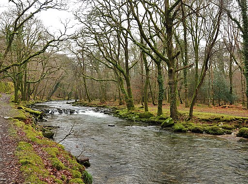
![]() This lovely riverside walk in Dartmoor takes you from Grenofen Bridge to Double Waters where the River Walkham joins the River Tavy. You'll pass through the pretty Walkham Valley with attractive woodland and the rushing rapids and quiet pools of the river.
This lovely riverside walk in Dartmoor takes you from Grenofen Bridge to Double Waters where the River Walkham joins the River Tavy. You'll pass through the pretty Walkham Valley with attractive woodland and the rushing rapids and quiet pools of the river.
The walk starts from the car park at Grenofen Bridge and follows the River Walkham through woodland to the point where the two rivers meet. It's a lovely spot with the rushing water surrounded by peaceful woodland. The walk returns to the car park along the West Devon Way and woodland trails through Sticklepath Wood.
You can reach Grenofen bridge by walking or cycling from nearby Tavistock. If you are on foot then you can follow the West Devon Way from the town.
If you are coming by bike then you can follow National Cycle Route 27 to reach the river.
Postcode
PL19 9ES - Please note: Postcode may be approximate for some rural locationsGrenofen Bridge to Double Waters Ordnance Survey Map  - view and print off detailed OS map
Grenofen Bridge to Double Waters Open Street Map  - view and print off detailed map
Grenofen Bridge to Double Waters OS Map  - Mobile GPS OS Map with Location tracking
Grenofen Bridge to Double Waters Open Street Map  - Mobile GPS Map with Location tracking
Explore the Area with Google Street View 
Pubs/Cafes
One option is to head into nearby Horrabridge for some rest and refreshment at the Leaping Salmon. The historic inn has a charming interior with inglenook fireplaces, stone walls, beamed ceilings, and lots of natural light. Outside there's a lovely tiered garden area with views over the village. They serve good quality food and also have a car park. You can find them at postcode PL20 7TP for your sat navs. The pub is dog friendly.
The village is also worth exploring with its ancient packhorse bridge over the River Walkham.
Further Information and Other Local Ideas
The 22 mile Drakes Trail passes the bridge. The trail starts in nearby Tavistock and visits the Tavistock Canal and the bridge before linking up with the popular Plym Valley Trail. The shared cycling and walking route is named after the explorer Sir Francis Drake who was born in Tavistock and has a statue at the other end of the route in Plymouth.
Cycle Routes and Walking Routes Nearby
Photos
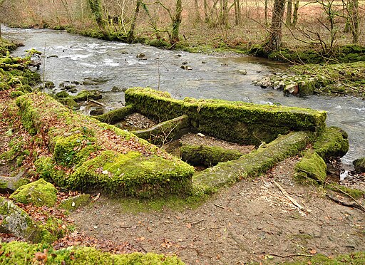
The remains of the weir above Grenofen Bridge on the River Walkham on Dartmoor. The weir provided the take-off for a leat to mines further down the valley.
Buckland Monachorum: at Double Waters Looking north east by a rock outcrop – known as Goat Rock in 1836 – to the right and the river Tavy hidden beyond, left. The footbridge crosses the river Walkham just above its confluence with the Tavy


