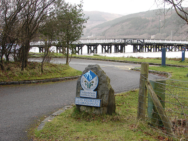
Wales Walks

With the beautiful Welsh mountains and a stunning coastline Wales is a walker's paradise. Don't miss the wonderful Brecon Beacons, Pembrokeshire Coast and Snowdonia National Parks. The Cambrian Mountains are also gorgeous and were nearly granted National Park status in the 1970s.
Some of the best coastline in the UK can also be seen in the
stunning Gower AONB and along the Llyn Peninsula.
Also of note is the wonderful
Isle of Anglesey. This beautiful island off the north-west coast of Wales is a wonderful place for walkers. With beautiful coast, lovely beaches, imposing mountains, lush countryside and pretty nature reserves there is something for everyone to enjoy.
Popular bases for walkers include the lovely town of Abergavenny, near the Brecon Beacons, and the village of Beddgelert in Snowdonia.
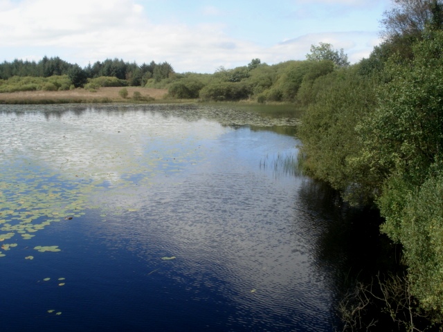
Use the filter to show walks of a certain type such as woods, reservoirs, hills, long distance, country parks, canals and rivers.
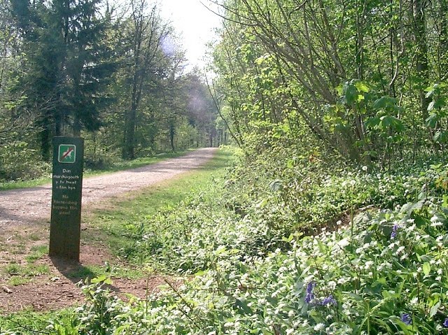
In the spring walkers flock to the beautiful bluebell woods in the Wales area. Click the 'Woodland' button below to see these.
Use the links to view full route information including elevation profiles, interactive maps and GPS downloads.
You can also view an overview map of all the routes in the using the Wales Walk Map>>
*New* - Walks and Cycle Routes Near Me Map - Waymarked Routes and Mountain Bike Trails>>
| Filter: |
| Route Name | Photo | Distance | Description |
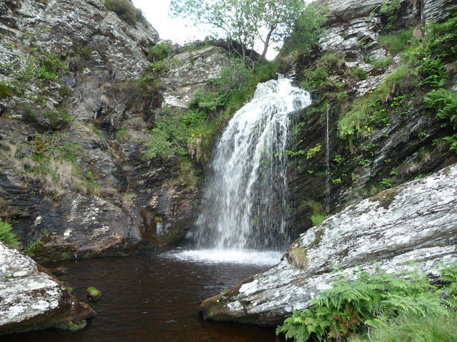
| Aber Falls | 4 miles (6.5 km) | Follow a splendid walking trail up to the beautiful Aber Falls on this circular walk in the Snowdonia National Park. Aber Falls (Rhaeadr Fawr in Welsh) is located near the village of Abergwyngregynin Gwynedd. The walk starts at the car park at Bont Newydd and follows the North Wales Path along the Afon Rhaeadr Fawr to the 120 ft high falls. You'll pass through the stunning scenery of the Coedydd National Nature Reserve with its wonderful woodland and mountain scenery. There's also a variety of wildlife to look out for including treecreepers, sparrowhawks, woodpeckers, tree pipits, skylarks and buzzards. If you're lucky you may spot polecats, stoat and lizards too. The walk involves a moderate climb but you're rewarded with magnificent views of the surrounding countryside and mountains from the high points. View Full Details>> | |
| Aberaeron to Llanerchaeron | 3.1 miles (5 km) | A lovely walk from the Ceredigion town of Aberaeron to the Grade I listed mansion of Llanerchaeron. The walk starts in the coastal town of Aberaeron, next to the pier. You then pass along the harbour before picking up a trail along the River Aeron. The trail branches off the river before passing through woodland and arriving at Llanerchaeron. There's some nice trails to follow around the grounds of the attractive Georgian villa. Features include a working farm, an ornamental lake and walled gardens. On the farm you can see a variety of animals including Welsh Black cattle, Llanwenog sheep, rare Welsh pigs, chickens, geese and doves. The walled gardens date from the 18th century and feature kitchen gardens, 200 year old fruit trees, beautiful herbaceous borders and a herb garden. In the woodland areas you can see wild daffodils, wood anemone and bluebells depending on the time of year. Also look out for birdlife including nesting herons, goldcrests, redstarts and nuthatches. After exploring the estate you can return to Aberaeron on the same path. View Full Details>> | |
| Aberdulais Falls | 2.2 miles (3.5 km) | This circular walk in Neath visits the lovely Aberdulais waterfall and explores the woodland trails in Craig Gwladys Country Park. Along the way there are splendid views of the River Neath Valley and a nice waterside stroll along the Tennant Canal. The walk starts at the car park just a short stroll from the falls. It's a lovely area with the rushing water of the River Dulais surrounded by cliffs and vegetation. The falls are also home to Europe's largest electricity-generating water wheel. Aberdulais has a fascinating history as power has been drawn from the waterfall since the late 16th century. It first provided energy used in the manufacture of copper and later corn-milling and tin. After leaving the falls the walk continues through the mixed woodland of Craig Gwladys Country Park. The park is fabulous for wildlife spotting with butterflies, green woodpeckers, owls, buzzards and herons to look out for. At Cadoxton you pick up the Tennant Canal and follow the towpath along the water back to the car park. It's a nice stretch of canal with little stone bridges, waterside cottages and old churches. If you would like to continue your walking in the area then you could visit the nearby Gnoll Estate Country Park. Here you will find 240 acres of woodland and wide open spaces with miles of walking trails to try. You could also continue along the Neath Canal. View Full Details>> | |
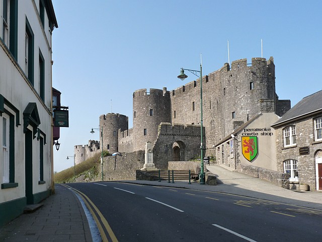
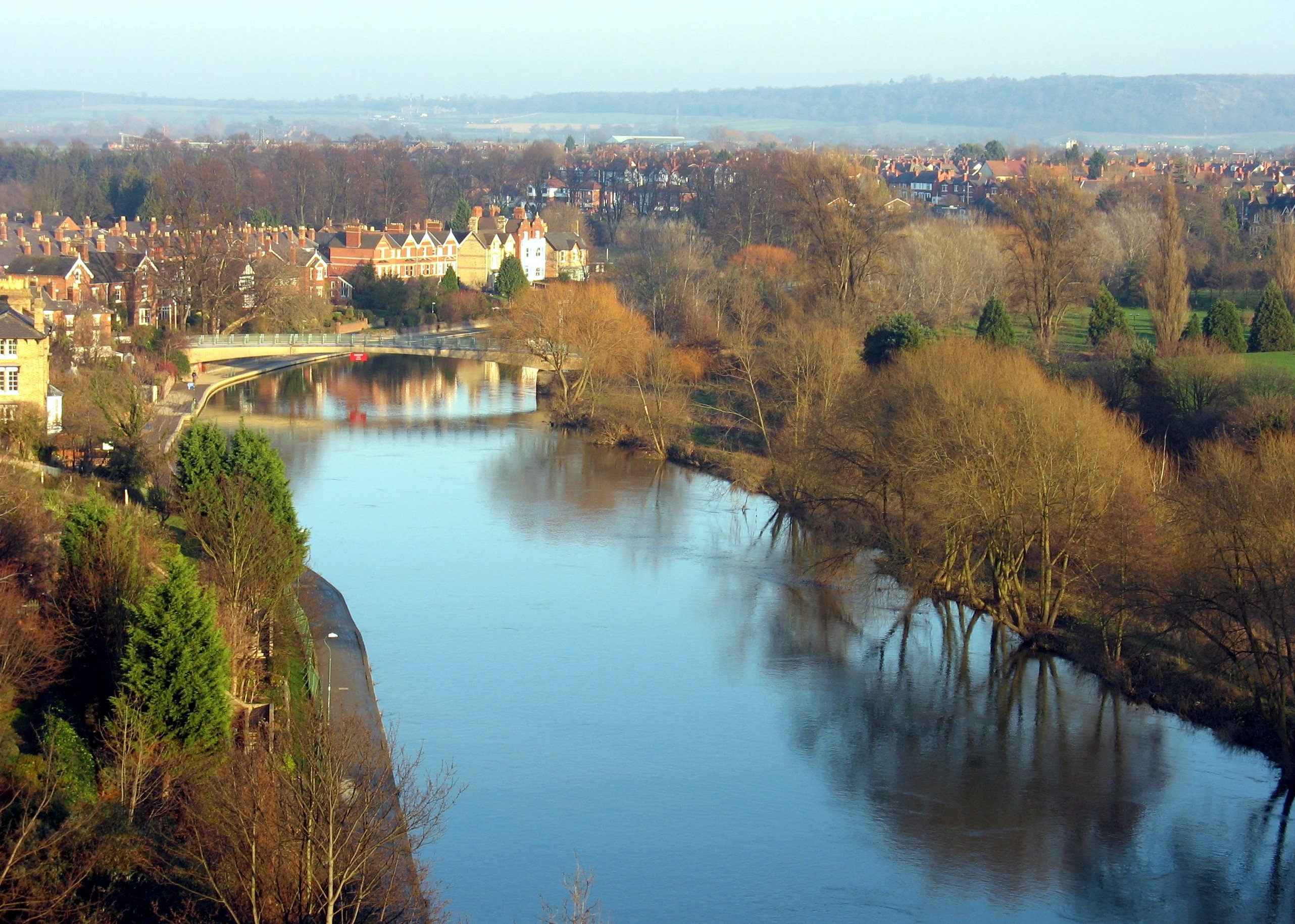
| Abergavenny Castle and River Usk Circular Walk | 1.2 miles (2 km) | This lovely circular walk takes you around the pretty meadows surrounding Abergavenny Castle. You'll also enjoy a riverside stroll along the River Usk and a visit to the delightful Linda Vista Gardens. The route starts near the tourist information centre in Abergavenny and takes you along the River Usk on a good path which is also open to cyclists. The path then heads to Linda Vista gardens, which is a well laid out public park with a variety of plants and flowers. You then pass the ruins of the 11th century Abergavenny Castle where there is a good museum detailing the history of the castle. Please note, only the first section of the route along the river is open to cyclists. If you'd like to continue your walking in the area you could pick up the Abergavenny Canal Walk along the Monmouthshire and Brecon Canal for more waterside footpaths. View Full Details>> | |
| Aberglaslyn Pass Beddgelert | 1.2 miles (2 km) | This walk takes you through a stunning narrow gorge in the Snowdonia National Park. The path runs along the running waters of the River Glaslyn with waterfalls, interesting vegetation and wonderful views of the surrounding mountainous scenery. The Welsh Highland Railway runs through the pass so look out for their splendid steam trains as you go. The walk starts from the National Trust car park in Nantmor village south of Beddgelert. From here it is a short stroll to the the fisherman's path which will take you along the side of the Aberglaslyn gorge and the River Glaslyn. The path runs for just over a mile to Beddgelert with mature oak woodland and old bridges over the river to observe. The village of Beddgelert is very picturesque with a fine bridge crossing the River Colwyn and a number of good pubs for refreshment. You can of course start the walk from here if you wish. View Full Details>> | |
| Abermawr Woods | 1.6 miles (2.5 km) | This short walk takes you along Abermawr Beach and through Abermawr Woods on the Pembrokeshire Coast. View Full Details>> | |
| Aberystwyth to Borth Walk | 5 miles (8 km) | This is a lovely coastal walk from the town of Aberystwyth to the village of Borth along a section of the Ceredigion Coast Path. Borth is located about 5 miles north of the town with a nice footpath taking you along the beaches and cliffs. There's some moderate climbs along the way so a reasonable level of fitness is required. From the cliff tops there are fantastic views down to Aberystwyth and along the coast. The walk starts by the pier on the sea front of Aberystwyth, near to the train station. You then head north past Constitution Hill, a wonderful viewpoint with a large Camera Obscura giving a bird's eye view of 1000 square miles of countryside and coast. The route continues along the cliff top path to Clarach Bay, where you can stop for refreshments at the cafe. Here you'll also find a lovely beach and views of the Afon Clarach which runs into the bay. The path then climbs above Clarach Bay to Wallog where you will pass an attractive shingle spit named Sarn Gynfelyn. The final section takes you past the cliffs of Craig y Delyn before descending into the pretty resort of Borth. Features in the village include a nice sandy beach and an ancient submerged forest visible at low tide along the beach. There's also a train station so you can return to Aberystwyth very easily. To extend the walk continue north along the coast path to the Dyfi National Nature Reserve. The reserve includes lovely beaches, lots of wildlife, views of the Afon Leri and a visitor centre. View Full Details>> | |
| Afan Forest Park Country Park | 10.6 miles (17 km) | Set in the beautiful Afan Valley in Neath Port Talbot, this 48-square-mile forest park has miles of cycling trails, walking trails and several fantastic mountain bike trails. View Full Details>> | |
| Along the River Dee from Chester to Connah's Quay | 6.2 miles (10 km) | Follow the River Dee from England into Wales on this easy waterside walk or cycle. The route starts on the England and Wales border at Chester and follows a good riverside path to Connah's Quay in Wales. You'll pass Saltney Bridge and Queensferry Bridge before finishing at Hawarden Bridge at Connah's Quay. It's a good surfaced path which is great for cyclists looking for a safe, traffic free ride. It runs along National Cycle Route 568 with nice views of the surrounding countryside. Near the end of the route you'll find the delightful Wepre Park. You could extend your exercise by exploring the 160 acre country park with its river, waterfall and the 12th century ruins of Ewloe Castle. Also nearby is the fascinating ruins of Flint Castle with views over the Dee Estuary. In Chester you can explore the city on the Chester Walls Walk. There's much to enjoy with more views of the River Dee and a visit to a number of interesting historical sites. View Full Details>> | |
| Alwen Trail | 7.5 miles (12 km) | This is a circular cycling and walking trail around the delightful Alwen Reservoir in Conwy, North Wales.
You will pass through forest plantations and up onto Mynydd Hiraethog where there are splendid views of the surrounding area. The route can be started at the car park at the south eastern end of the water at postcode LL21 9TT. The route is decorated with six interpretation panels with information about local history, culture and folklore. Wildlife lovers should look out for curlew, the rare Black Grouse and Red Squirrels. The route is well way-marked with blue posts. To continue your reservoir walking in the area, just head east to the larger Llyn Brenig. View Full Details>> | |
| Alyn Waters Country Park | 2.5 miles (4 km) | Enjoy peaceful walking and cycling in this lovely country park in the Alyn Valley, Wrexham. The Park is split into two sections either side of the River Alyn which runs through the centre of the park. As such there are delightful riverside walks to enjoy and other well surfaced paths taking you through woodland and grassland. Alyn Waters also contains a visitor centre with a cafe and gift shop, a Local Nature Reserve and a Trim Trail with a selection of different simple exercise equipment. Look out for a variety of wildlife including kingfishers, buzzards, kestrels, foxes, adders, grass snakes, smooth newts and a variety of bats. Alyn Waters is located 3 miles North of Wrexham between Gwersyllt, Bradley and Llay. The Wat's Dyke Way Heritage Trail runs through the park so you could follow this walking route if you would like to continue your walk. Also nearby is Waun-y-llyn Country Park where you can climb to the top of Hope Mountain for wonderful views of the region. View Full Details>> | |
| Amroth and Colby Woodland Garden | 2.5 miles (4 km) | Enjoy a walk along the lovely coastline at Amroth and visit the National Trust's Colby Woodland Garden. The walk starts near the sea front in Amroth and follows a footpath north to the delightful Colby Woodland Garden. Here you will find 8 acres of woodland, widlflower meadows and gardens with a variety of plants and flowers such as azaleas, bluebells, camellias, magnolias, rhododendrons. In the walled garden there is a Victorian Gothic inspired gazebo and fine Japanese maples. The wildflower meadow has pretty streams and ponds and there are peaceful woodland trails in the woodland garden. The secluded wooded valley is home to a variety of wildlife. Look out for Dippers, bats, otters, frogs and toads. After leaving the gardens you can return to the sea front on the same path and then enjoy a stroll along the prom in Amroth. To extend your walking in the area follow the Pembrokeshire Coast Path west and try the splendid Amroth to Saundersfoot Walk and Tenby to Saundersfoot Walk. View Full Details>> | |
| Anglesey Coast Path | 121.2 miles (195 km) | Follow the beautiful coastline of the Isle of Anglesey on the fabulous walk. The Isle of Anglesey Coastal Path falls within an Area of Outstanding Natural Beauty covering 95% of the coast. It passes through landscape that includes a mixture of farmland, coastal heath, dunes, salt-marsh, foreshore, cliffs, woodland and a National Nature Reserve.
Highlights on the route include the lovely Cemlyn Bay Nature Reserve with its shingle beach and pretty lagoon. It's a great place for wildlife spotting with various coastal birds to look out for. These include Ringed Plover, Arctic Terns, Oystercatcher and Shelduck. The colony of Sandwich terns is the third largest in the UK. The delightful Cemaes Bay is located close to the reserve and provides fine views over to the Isle of Man and the Lake District. Near the bay the path passes the Dinas Gynfor coastal hillfort, Llanlleiana Porcelain Works and the fascinating Porth Wen Brickworks. This scheduled ancient monument consists of a disused Victorian brickworks which produced fire bricks, made from quartzite (silica) used to line steel-making furnaces. The remains include a number of buildings and some of the machinery. It's a photgoenic spot with the coastal scenery making a wonderful backdrop to the old buildings. Also of note is the splendid Breakwater Country Park where you can climb Holyhead Mountain for wonderful views over the island. Also on Holyhead is the spectacularly positioned South Stack Lighthouse. You can descend the 400 steps to the island and enjoy fabulous views on the way. The area also includes the South Stack RSPB nature reserve where you can look out for puffins and porpoises. Trearddur Bay on Holy Island has two lovely beaches and is popular with divers and kayakers. Red Wharf Bay is area of outstanding natural beauty located on the east coast of Anglesey. The coast path passes right along this expansive bay with its rock pools, beautiful beaches and pretty village. Just east of the bay the path takes you to Penmon Point where you can visit the Trwyn Du Lighthouse and enjoy wonderful views towards Puffin Island, Great Orme and Snowdon. Newborough Forest and Llanddwyn Island are located at the southern tip of the island near Malltraeth. The tidal island is a magical place with wonderful views across the Menai Strait, a 19th century lighthouse and an atmospheric ruined old chapel. Near here there's also the pretty village of Aberffraw and the adjacent Tywyn Aberffraw. View Full Details>> | |
| Ann Griffiths Walk | 6.8 miles (11 km) | A lovely walk along the River Vyrnwy in Powys, with the Berwyn Mountains forming a splendid backdrop. View Full Details>> | |
| Aran Fawddwy | 9.9 miles (16 km) | Climb to the 905 m (2,969 ft) summit of this mountain in southern Snowdonia and enjoy breathtaking panoramic views. The mountain is only (31 ft) short of being a member of the Welsh 3000s. The walk starts from the village of Llanuwchllyn near the southern end of Bala Lake. You can park in the village or catch the Bala Lake Railway to Llanuwchllyn and start the walk from there. From the village you head south and pick up the Aran Ridge footpath. You first climb to Aran Benllyn, passing Llyn Lliwbran on the way. You continue to Aran Fawddwy with lovely views down to the lake of Creiglyn Dyfi. It's a challenging climb but with some wonderful views towards the Rhinog mountains, the Berwyns and the rest of the Arans. The walk can also be attempted from Cwm Cywarch. To continue your walking in the area you can try the Bala Lake Walk. Footpaths climb into the hills and forests above the lake with wonderful views over the water and surrounding mountains. View Full Details>> | |
| Bala Lake | 7.5 miles (12 km) | Bala Lake (or Llyn Tegid) is the largest natural lake in Wales. The area on the south side of the lake is wonderful for walkers. Footpaths climb into the hills and forests for fabulous views of the lake below. The walk begins in Bala, at the visitor centre on the foreshore of the lake. You then follow footpaths along the lakeside before ascending to Craigy-Allor. From here the views over the lake and surrounding mountains are splendid. The route then descends through forest and countryside to Llanuwchllyn station. From here you can catch the Bala Lake railway back to Bala. The narrow gauge steam train runs along the southern end of the lake. It's a lovely journey with fine views of the lake and Arenig Fawr, Aran Benllyn and Aran Fawddw mountains. To continue your walking in the area you could climb Aran Fawddwy. The walk starts from the village of Llanuwchllyn near the southern end of the lake. You could also head to the nearby Llyn Celyn where there's more lovely scenery and walks to try. View Full Details>> | |
| Beacons Reservoir | 1.9 miles (3 km) | Enjoy a lovely stroll around this pretty reservoir in the fantastic Brecon Beacons. The nearby mountains of Pen Y Fan and Corn Du make a simply stunning backdrop to the walk. The walk also includes woodland sections on the western side of the reservoir and several waterside sections. If you're looking for a more challenging walk you could climb Pen Y Fan. The start point for this walk is near the northern end of the reservoir. This walk also makes use of the Brecon Beacons Way so you could pick this up and head deeper into this beautiful national park. View Full Details>> | |
| Beaumaris Castle and Coast | 1.9 miles (3 km) | Visit the fascinating 13th century Beaumaris Castle and then enjoy a coastal section on this walk in the town of Beaumaris in Anglesey. The castle was built by Edward I towards the end of the 13th century in order to stamp his authority on the Welsh. However, it was never fully completed with money and supplies running out before the fortifications were finished. It's a hugely impressive sight with UNESCO considering Beaumaris to be one of 'the finest examples of late 13th century and early 14th century military architecture in Europe'. They have classed it as a World Heritage site. After exploring the castle you can enjoy a walk along the Anglesey Coast Path towards Fryars Bay. There's great views over the Menai Strait towards Lavan Sands, Ceredigion and Snowdonia. You can turn it into a longer circular walk by heading into the countryside and returning on country lanes to the town. From Beaumaris you can take a boat trip to visit Puffin Island. You can extend your walk by continuing north along the Anglesey Coast Path to Penmon Point. Here you'll find the Trwyn Du Lighthouse and great views towards Puffin Island, Great Orme and Snowdon. There's also nice pebble beaches and seals and dolphins to look out for. View Full Details>> | |
| Beddgelert Forest | 3.1 miles (5 km) | This large forest is located near the village of Beddgelert in the Snowdonia National Park. In it you will find miles of walking paths and great mountain bike trails. There are great views towards Snowdon and a nice path around the lovely Llyn Llewellyn. The Welsh Highland Railway also runs through the forest so look out for the fine steam trains as you go. View Full Details>> | |
| Bishop's Castle Ring | 60.9 miles (98 km) | This long circular walk encircles the historic market town of Bishop's Castle in Shropshire. The walk first heads to Clun with it’s Norman castle, church and interesting houses. You continue to Aston-on-Clun and then to the spectacular Long Mynd (video below). This heathland plateau forms part of the Shropshire Hills Area of Outstanding Natural Beauty and is owned by the National Trust. The views are spectacular, making this section one of the walk highlights. The next section takes you to the rocky Stiperstones and The Bog lead mines, which are of great historical interest. The final section runs through Stapeley Common to the ancient stones of Mitchell's Fold before heading through Saddlers Little Wood and returning to Bishop’s Castle. This section also passes the eye catching Corndon Hill which sits on the border between England and Wales. View Full Details>> | |
| Bishopston Valley | 1.9 miles (3 km) | This walk takes you through a beautiful wooded valley to the stunning beach at Pwll Du Bay. It's a delightful tranquil area with the running water of the river and interesting flora and fauna. The walk starts in Kittle and follows footpaths south through the Bishopston Valley. The paths runs along the river which is surrounded by woodland and little caves. You continue through wet meadows grazed by cattle and home to various wildflowers before coming to the delightfully secluded Pwll Du Bay. Here you can enjoy a stroll along the beach and take in the wonderful coastal views of the Gower. If you would like to continue your walking in the area then you could head a mile or so west and visit the ruins of Pennard Castle and explore the beautiful Pennard Burrows. If you head east along the coast towards Swansea you can visit the lovely beach at Caswell Bay and explore the popular Mumbles where there are more nice coastal walking paths. View Full Details>> | |
| Blaen y Glyn Waterfalls | 1.9 miles (3 km) | This walk visits a series of beautiful waterfalls on the River Caerfanell near Talybont Reservoir in the Brecon Beacons. The walk starts from the Forestry Comission's Upper Blaen-y-Glyn car park and takes you to Lower Blaen-y-Gly. You'll pass along woodland paths with several pretty falls to enjoy. There is also a picnic area and the opportunity to turn it into a circular walk using alternative woodland trails. If you'd like to extend your walk you could pick up the Taff Trail and follow it to the nearby Talybont Reservoir. The Fan Y Big and the Cribyn mountain climb also starts from the same point. View Full Details>> | |
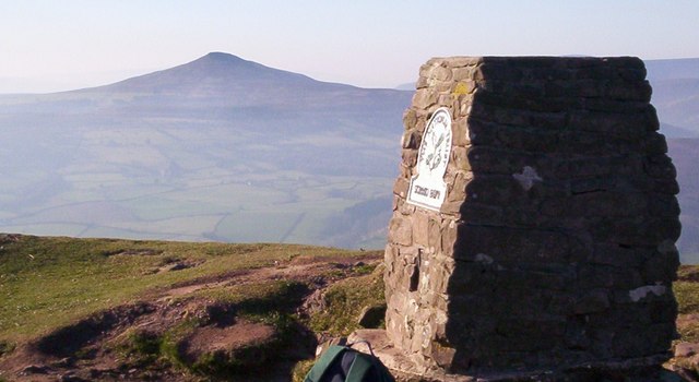
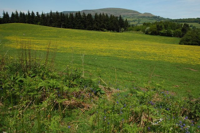
| Blorenge | 7.5 miles (12 km) | This challenging walk takes you around this prominent hill in the southeastern corner of the Brecon Beacons National Park. The hill is located near Abergavenny and rises to a height of 561 m (1,841 ft). This popular walk starts at the car park next to Keeper's pond and follows footpaths across the hill before climbing to the summit. There are fabulous views of the Usk Valley, Sugarloaf Mountain and Skirrid Fawr. You'll also pass through the Punchbowl on the eastern side of the hill. This delightful area has a large pond and woodland which attracts a wide variety wildlife. If you're interested in more hill climbing in the area then Sugarloaf Mountain and Skirrid Fawr are also easily reachable from Abergavenny. View Full Details>> | |
| Bodelwyddan Castle | 1.9 miles (3 km) | Explore the 260 acres of parkland and gardens surrounding this 19th century castle in Denbighshire, North Wales. There are a number of walking trails taking you around the large areas of formal garden and natural woodland. View Full Details>> | |
| Bodnant Garden | 1.9 miles (3 km) | These beautiful 80 acre gardens in Conwy have miles of footpaths, wonnderful floral displays and spectacular views across Snowdonia. View Full Details>> | |
| Breakwater Country Park | 4.3 miles (7 km) | Enjoy over 100 acres of coastal country park on this walking route in Holyhead, Anglesey. There are fabulous views of Holyhead Mountain, the Irish Sea and the Skerries - a group of offshore islands about 7 miles from the coast. The park includes a nature trail, various other footpaths, a visitor centre and good parking facilities. The Anglesey Coast Path runs through the park so there is scope for continuing your walk along the coast in either direction. Just along the coast you will come to the spectacular South Stack Lighthouse. Here you can descend the 400 steps to the island and enjoy fabulous views on the way. The area also includes the South Stack RSPB nature reserve where you can look out for puffins and porpoises. If you head in the other direction through Holyhead you will soon come to the lovely Penrhos Beach and Penrhos Coastal Park. View Full Details>> | |
| Brechfa Forest | 7.5 miles (12 km) | Enjoy miles of footpaths and mountain bike trails in this super forest in Carmarthenshire. There are three colour coded mountain bike trails of varying difficulty. The green/blue Derwen trail is great for novices looking for an introduction to the sport. The red Gorlech trail is a hard, fast, all weather surface suitable for the more experienced rider. The black Raven trail is a real test of your skills and is receiving great reviews from experienced enthusiasts of the sport. Walkers are catered for with a number of well laid out circular walks taking you through the peaceful forest and into the wider countryside. The forest is located near to Abergorlech, Brechfa, and Llanybydder. View Full Details>> | |
| Brecon Beacons Way | 98.2 miles (158 km) | Follow the Beacons Way through the centre of the stunning Brecon Beacons National Park. The walk begins at Abergavenny and follows the trail through the park to Llangadog. On the way you will pass some of the most breathtaking scenery in the UK with marvellous views of Sugarloaf Mountain, Skirrid Fawr, Llanthony Priory, The Black Mountains, Talybont Reservoir, Llyn y Fan Fach, Table Mountain, Pen Cerrig Calch and Pen Y Fan - the highest peak in South Wales and southern Britain. View Full Details>> | |
| Brenig Way | 31.1 miles (50 km) | Follow the Brenig Way way from Corwen, in the Dee Valley, to the beautiful Llyn Brenig, in the heart of the Denbigh Moors. The walk passes through Cynwyd, Maerdy and Betws Gwerfil Goch, before following the River Clwyd towards Clocaenog Forest where there are fabulous views of the Clwydian Range AONB. View Full Details>> | |
| Bridgend Circular Walk | 19.9 miles (32 km) | Starting at Ogmore Castle on the River Ogwr, follow this relativley flat route around the town of Bridgend, South Wales. View Full Details>> | |
| Bryngarw Country Park | 2.2 miles (3.6 km) | This 120 acre country park is situated on the River Garw just north of Bridgend. There are lovely woodland trails with mature sweet chestnuts, ancient oaks and towering beeches. View Full Details>> | |
| Bute Park | 2.5 miles (4 km) | Explore 130 acres of landscaped gardens and parkland in this beautiful park in Cardiff. The park consists of an arboretum, flower gardens, grassland, woodland and tree-lined avenues. The River Taff also runs through the park so there is a lovely waterside walking and cycling section to enjoy. The Taff Trail runs past the park so you could continue your cycle or walk along this excellent route. View Full Details>> | |
| Cadair Berwyn | 5 miles (8 km) | Climb to the highest point in the Berwyn Mountains range on this challenging walk in North East Wales. The walk starts from the car park at Tan-y-pistyll and takes you to the beautiful Pistyll Rhaeadr Waterfall. The falls are 240-foot (73 m) high and regarded as one of the Seven Wonders of Wales. You'll pass through attractive woodland and along the rushing waters of the Afon (River) Rhaeadr on this section of the walk. View Full Details>> | |
| Cadair Idris | 5 miles (8 km) | The epic circular walk to the 893 m (2,930 ft) summit of Cadair Idris is one of the most popular climbs in the Snowdonia National Park. This route follows the Minffordd Path and begins near the car park at Minffordd and the glacial Tal-y-llyn Lake. The area is part of a National Nature Reserve which includes woodland, streams, waterfalls and some wonderful geological formations such as the cliffs of Cwm Cau. The walk starts from the Dol Idris Car Park at the junction of the A487 & B4405 (postcode: LL36 9AJ). There's plenty of parking here with toilets facilities also. From here you can easily pick up the Minffordd Path which will guide you up to the summit. You begin the walk with a lovely woodland section with streams and waterfalls before ascending towards the stunning Llyn Cau. This beautiful lake is surrounded by huge cliffs and is a breathtaking sight, particularly when viewed from above. You continue around the lake towards Penygadair - the highest point on the mountain. From here there are magnificent views of the Barmouth estuary, the Cambrian Mountains, the Brecon Beacons, the Rhinogs and the rest of Snowdonia National Park. You continue east to Mynydd Moel and descend towards Moelfryn, crossing the Nant Cadair before returning to the car park through the woodland. After your hike you can enjoy refreshments at the splendid Ty Te Cadair Tea Room where there's outdoor seating with great views. View Full Details>> | |
| Caerphilly Mountain | 0.6 miles (1 km) | Enjoy a climb to the summit of Caerphilly Mountain and a walk across Caerphilly Common on this circular route in South Wales. You can park at the Caerphilly Mountain Snack Bar car park on Mountain Road to start your walk. From here you can pick up the tracks to take you to the 271 metres (889 ft) summit where there are fabulous views over the town and Caerphilly Castle. There are a few different paths to choose from. Most of them are good wide trails though they can get muddy in winter. After your walk you can enjoy refreshments at the snack bar. The Taff Ely Ridgeway Walk passes the common so you can pick up this long distance trail to continue your walk. The waymarked trail starts on the common and will take you to Garth Hill, the Ely Valley and the Taff Vale. The Glamorgan Ridgeway Walk also passes the mountain. It's a long distance ridge top walk which takes you to Llantrisant forest and Margam Country Park. View Full Details>> | |
| Caldicot Castle | 1.2 miles (2 km) | This medieval castle is surrounded by a beautiful 55 acre country park with woodland, grassland and several walking paths. View Full Details>> | |
| Canaston Woods | 5 miles (8 km) | Enjoy a walk or cycle around these pretty woodlands in Pembrokeshire. There's 420 acres to explore with a good mountain bike track running through the centre of the woods. It's a fairly easy path so it's suitable for families. There are also numerous footpaths to follow through the ancient mixed woodland. The route begins near Canaston Bridge next to Blackpool Mill. There is a lay-by immediately south of Canaston Bridge where you can park. You then pick up the Knight's Way into the forest and follow various waymarked paths around the heart of the woods. If you would like to continue your outing then you could head to the nearby Picton Castle Gardens and Slebech Park where you will find more excellent walking trails. View Full Details>> | |
| Cardiff | 15.5 miles (25 km) | Cardiff has some fine walks along the coast and great riverside trails along the River Taff. The Taff Trail and the beautiful Bute Park are great options in the city. If you go north of the city you can enjoy a climb to Garth Hill and pick up long distance trails including the Taff Ely Ridgeway Walk. This walk takes you along a section of the Wales Coast Path from Cardiff Docks to Barry Island via Penarth. The walk starts at Atlantic Wharf and follows paths around Penarth Flats and Cardiff Bay to Penarth. There's views of the River Ely, the attractive Penarth Marina and the Victorian Penarth Pier as you pass through the popular seaside resort. The town is located at the top of limestone cliffs that have a distinctive rock formation and are referred to as the Penarth Group of rocks. The route continues south to Lavernock Point with splendid views overlooking the Bristol Channel. Here you will find a lovely nature reserve with varied and colourful plants and several species of butterfly to look out for. The area is also noteworthy as the place where Guglielmo Marconi transmitted and received the first wireless signals over open sea between Lavernock Point and Flat Holmisland in the late 19th century. At Lavernock you have the option of taking a detour from the coast to the nearby Cosmeston Lakes Country Park. The lakes have a series of waterside trails with 200 acres of woodland, meadows and wetland habitats to enjoy. After exploring the park the route returns to the coast at Swanbridge Bay, where there are nice views towards Sully Island. The small tidal island is accessible on foot at low tide from the car park of the Captain's Wife public house. The pretty island is home to several unusual plants including bee orchid, the marine spleenwort and the adder's tongue fern. The next section takes you along Sully Bay to Barry. You'll pass Barry Docks before coming to the seaside resort of Barry Island. Here you'll find several beaches and the resurrected Barry Island Pleasure Park. View Full Details>> | |
| Carew Castle | 1.2 miles (2 km) | This fine castle in Pembrokeshire has a lovely one mile circular walking trail taking you around the pretty 23-acre Millpond. View Full Details>> | |
| Carmarthen | 0.9 miles (1.5 km) | This short walk takes you around the county town of Carmarthenshire, visiting some of the local highlights. The walk starts at the train station and crosses the River Towy on the footbridge to reach the northern side of the river. Here you can pick up a riverside footpath heading west to Carmarthen Park. There's some nice footpaths here with features including Wales's first velodrome (cycle track), one of the few early velodromes to survive in working condition. There's also nice wide lawns, an old bandstand and a tea room for refreshments. Near the footbridge you have the option of heading north east to visit Carmarthen Castle. Little remains of the original medieval castle at Carmarthen, but the old Gatehouse still dominates Nott Square. The motte is also accessible to the public. Castle House, within the old walls, is a museum and Tourist Information Centre. View Full Details>> | |
| Carneddau | 5.6 miles (9 km) | This walk explores the Carneddau mountain range in the Snowdonia National Park. You'll visit the peaks of Carnedd Llewellyn and Yr Elen with wonderful views of Tryfan, The Glyders and Llyn Ogwen as you go. The walk starts from Llyn Ogwen where there is roadside parking. You then follow a track north along the River Lloer to Bryn Mawr and Cwm Loer where you pass around the pretty lake of Ffynnon Lloer. The route then involves a scramble to Pen Yr Ole Wen before continuing to the peaks of Carnedd Fach and Carnedd Dafydd. You continue to the 1,064 m (3,491 ft) summit of Carnedd Llewelyn, the second highest peak in Wales after Snowdon. Just to the east of the peak you will find the highest lake in Wales, Llyn Llyffant. From Carnedd Llewelyn you can continue a short distance north west to the 962 m (3,156 ft) peak of Yr Elen. It's a very challenging walk with some scrambling but you will be rewarded with spectacular views of Snowdonia, Bangor, Anglesey and the Irish Sea. If you would like to continue your walking in the area then you could climb Tryfan or enjoy an easier walk around Llyn Ogwen. Also in the range is Foel Fras near the coast at LLanfairfechan. View Full Details>> | |
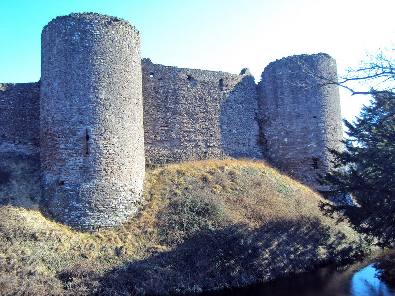
| Carreg Cennen Castle | 1.9 miles (3 km) | Enjoy a circular walk around this spectacularly positioned ruined castle in Carmarthenshire. The castle sits on an elevated limestone precipice with fabulous views over the lovely Brecon Beacons countryside. There are a series of good footpaths taking you around the grounds and an invigorating climb up to the castle itself. The castle includes a natural cave which leads deep into the hillside, six towers, a great twin-towered gatehouse and the fascinating King's Chamber dating from the 13th/14th century. The Brecon Beacons Way also runs past the castle so you can pick this up to continue your walking in the area. Carreg Cennen Castle is located about four miles south of Llandeilo on the western tip of the Brecon Beacons National Park. To continue your walking in the area head to Llandeilo and visit Dinefwr Park. View Full Details>> | |
| Castell Dinas Bran | 2.4 miles (3.8 km) | This walk visits the atmospheric ruins of a medieval castle from the attractive north Wales town of Llangollen. View Full Details>> | |
| Castle Coch | 3.1 miles (5 km) | Visit this 19th-century Gothic Revival in Tongwynlais and enjoy a walk or cycle in the adjacent Fforest Fawr. The route starts in Tongwynlais taking you around the castle and then into the peaceful woodland of Fforest Fawr which lies just to the east. The castle is located next to the Taff Trail so you could extend your cycle/walk by heading along the River Taff. View Full Details>> | |
| Cefn Bryn | 7.5 miles (12 km) | This super walk in the Gower AONB takes you along an elevated sandstone ridge known as the 'backbone of Gower'. With a high point of 188m/617 ft the walk is quite challenging but you are rewarded with wonderful views of the coastline and countryside of the Gower Peninsula. The walk starts in the little village of Penmaen where there is parking at the National Trust car park. You then pick up the good footpath along the ridge with wonderful views back to Oxwich Bay. You continue towards Cefn Bryn Common and to the neolithic burial ground of Arthur's Stone. Its name comes from a legend that the ancient British King Arthur threw a large stone from Llanelli which landed on this spot. Look out for Wild ponies and horses in this area. There is also the Broad Pool nature reserve consisting of a large pond which attracts wildlife such as dragonflys and wetland birds. At the summit point there is a handy toposcope detailing all the landmarks that can be seen from the hill top. This walk descends back to Penmaen from Arthur's Stone but you could continue along the ridge to Ryer's Down and Llanmadoc where you will find the splendid Whiteford Sands Nature Reserve. Here you will find woodland and sand dunes with nice coastal views to the lighthouse at Whiteford Point. The Three Cliffs Bay Walk also starts from Penmaen. View Full Details>> | |
| Cefn Onn Park | 1.2 miles (2 km) | This gem of a park is located on the northern outskirts of Cardiff. It has a large collection of specimen trees, rare plants and flowers with well surfaced, waymarked walking paths to follow. You'll also find rhododendron and azelea bushes, carpets of bluebells and buttercups, ponds and a gently trickling stream. If you'd like to continue your walk you could pick up the Rhymney Valley Ridgeway Walk which runs just to the north of the park and takes you through the countryside surrounding Caerphilly. View Full Details>> | |
| Cemlyn Bay | 1.6 miles (2.5 km) | Enjoy a stroll along Cemlyn Bay and lagoon on this delightful coastal walk on the Isle of Anglesey. The circular path starts at the car park at the north western corner of the reserve and runs along the coast next to Cemlyn Bay before heading inland and circling the lagoon. You can enjoy a stroll along the shingle beach and around the little rock pools before heading towards the nearby Wilfa Power Station. The countryside around the reserve is also very attractive with wildflowers, orchids and heather to enjoy in the summer months. It's a great place for wildlife spotting with various coastal birds to look out for. These include Ringed Plover, Arctic Terns, Oystercatcher and Shelduck. The colony of Sandwich terns is the third largest in the UK. The Anglesey Coast Path passes the reserve so you could pick this up to extend your walk. You could head east to visit Wylfa Head and Cemaes Bay where there's fine views over to the Isle of Man and the Lake District. The interesting Copper Trail also passes the bay and is another good option. View Full Details>> | |
| Cenarth Falls | 0.9 miles (1.5 km) | Visit these beautiful falls and enjoy a woodland stroll along the Afon Teifi on this walk in Carmarthenshire. It's a stunning sight when the river is in full flow with the water rushing over a cascade of waterfalls. The area is also well known for leaping salmon. You can see them jumping up the falls in the autumn months. View Full Details>> | |
| Ceredigion Coast Path | 62.1 miles (100 km) | This walk follows the beautiful coastline of Ceredigion from Cardigan to Borth. The walk is waymarked with a coast and sea logo. View Full Details>> | |
| Chepstow Park Wood | 4 miles (6.5 km) | This large area of woodland is located a few miles north west of Chepstow. It contains miles of trails and footpaths with the option of extending your walk in the adjacent Fedw Wood and New Wood. Parking is available off Devauden Road about 1.5 miles north of St Arvans. The Wye Valley Walk passes nearby St Arvans so you could pick this up and head through Wyndcliffe Woods to Tintern Abbey to extend your walk. View Full Details>> | |
| Chirk Castle | 2.5 miles (4 km) | Explore the gardens an wider estate surrounding this 13th century castle in Wrexham. View Full Details>> | |
| Claerwen Reservoir | 11.2 miles (18 km) | Enjoy a cycle or walk along this large reservoir in the Cambrian Mountains. There is a good track running along the northern shore of the lake which makes for a nice traffic free cycle or walk. It runs for about 6 miles starting at the Claerwen Dam car park. There are lovely views across the water to the surrounding hills and countryside. If you would like to extend your exercise in the area then you could visit the other reservoirs in the Elan Valley by heading south along the River Claerwen to Caban Coch Reservoir where you can pick up the climb to Drygarn Fawr and other cycling and walking trails. You could also try the Teifi Pools Walk which starts from the nearby Strata Florida Abbey near Pontrhydfendigaid. View Full Details>> | |
| Clwydian Way | 121.8 miles (196 km) | Explore the Clwydian Range of mountains on this circular walk through north east Wales. From the range there are splendid views of north Wales, Snowdonia, the Cheshire Plain and the Peak District. The walk starts at Prestatyn on the coast, taking you through some beautiful countryside and also visiting the historic towns of Ruthin, Llangollen, Corwen, and Denbigh. You'll also pass the small city of St Asaph where there are nice riverside paths along the River Elwy and a notable cathedral which dates from the 13th century. Just north of here is the town of Rhuddlan with a significant 13th century castle and footpaths along the River Clwyd. Also of interest are waterside sections along the beautiful Llyn Brenig, the River Alwen, the River Aled and the the River Dee. View Full Details>> | |
| Clyne Valley Country Park | 1.9 miles (3 km) | Explore 700 acres of wooded hillsides, steep gorges, meadows and wet valley floor in this country park near Swansea and Gowerton. The park is great for walking and cycling with the trackbed of the old London Midland Scottish Railway forming the park's main footpath and cycleway. View Full Details>> | |
| Cnicht | 3.4 miles (5.5 km) | Climb to the 'Matterhorn of Wales' on this challenging walk from the village of Croesor in Gwynedd. Although several thousand metres lower, Cnicht has a similar appearance to the famous mountain of the Alps. View Full Details>> | |
| Coed Morgannwg Way | 36 miles (58 km) | This walk runs from Merthyr Tydfil to Margam, through the four forests of Coed Morgannwg, the Cynon Valley and the Dare Valley. The walk starts at the Gethin Woodland Park in Merthyr Tydfil and heads west to Aberdare and the lovely Dare Valley Country Park with 500 acres of woodlands, pasture and moorland mountainside. View Full Details>> | |
| Coed Y Brenin Forest Park | 5 miles (8 km) | This large forest in Snowdonia is fantastic for both cycling and walking. For walkers there are 4 well devised, all ability trails taking place on wide well maintained paths. The trails take you along the Afon Eden on a sculpture lined riverside path and along a disused tramway to the old Copper processing mill. If you're looking for more strenuous walking then you can pick up one of the 3 difficult routes. The waterfall trail takes you to the confluence of the Afon Gain and Mawddach with their twin waterfalls. The mountain trail climbs to the Mynydd Penrhos ridge with spectacular views of the surrounding area. Cyclists can follow a National Cycle Network trail which runs through the park. There are also a number of graded mountain bike trails. Depending on your ability and experience you can follow the blue moderate trail for a good introduction to singletrack mountain biking. The red trails are more difficult while the black (severe) trails are for the experienced mountain biker. There are 7 trails in all plus an easy forest road trail that follows the Mawddach river valley. This one is good for families looking for a more relaxing ride! The circular route below starts near the visitor centre and takes you along the National Cycle Network trail and a riverside track. It's suitable for both walkers and cyclists. View Full Details>> | |
| Constitution Hill Aberystwyth | 3.4 miles (5.5 km) | This circular walk visits Constitution Hill and explores the area around the town of Aberystwyth in Ceredigion. It's a fantastic viewpoint with views over the town below, several of the Welsh Mountains and Cardigan Bay. At the hill summit you will find one of the world's largest camera obscuras, offering a bird's eye view of 1000 square miles of countryside and coast. The hill is a short climb from the centre of the town. After reaching the summit you continue to the woodland of Glanmor Fach before heading along the golf course and descending back into the town. The footpaths are generally good and there are really nice views for most of the way. On a clear day you can see the Pembroke Coast to the south and Snowdonia to the north. If you'd like to visit the hill without the climb then you could take the funicular electric cliff railway which is the longest in Britain. The Abercyclefest also organises a downhill mountain bike race on the hill. See the video below for details! To continue your walking in the Aberystwyth area catch the Vale of Rheidol Steam Railway to the spectacular Devil's Bridge Falls. You can also pick up a lovely section of the Ceredigion Coast Path on our Aberystwyth to Borth Walk. View Full Details>> | |
| Conwy Falls | 0.6 miles (1 km) | Follow the circular Conwy Falls Walk through this beautiful wooded gorge near Betws-y-Coed. The walk starts from the car park and cafe located just off the A5 where it meets the B4406. You then pick up the trail through the woodland to the River Conwy where you will find the lovely falls. Here the river drops 50 feet (15 m) into a deep pool. It's a short, easy walk with a number of good viewpoints. You can refresh yourself in the good sized cafe after your walk. To extend your walk you can pick up a footpath along the river to Fairy Glen. Here you will find little waterfalls, rapids and cascades chanelled into a narrow ravine on the River Conwy. It's a delightful place and is only about a mile up river from Conwy Falls. Also nearby are the wonderful Swallow Falls, the picturesque Miners Bridge and the ancient Capel Garmon Burial Chamber. View Full Details>> | |
| Corndon Hill | 2.5 miles (4 km) | Climb to this prominent hill in Powys and enjoy wonderful views over the Long Mynd and Stiperstones on this lovely walk on the Wales-England border. You can start the walk from a parking area just north of the hill, near the Mitchell's Fold stone circle. From here it is a short walk to the hill summit which stands at a height of 1,683 ft. The view from here is first class with the Shropshire Hills and Welsh Mountains stretching out in front of you for miles. On a clear day the Clee Hills, Severn Valley, Clwydian Hills, Cheshire Plain, Cadair Idris, the Rhinogs and the Black Mountains are all in focus. After taking in the view you can return the same way or turn it into a longer circular walk by descending south east and then south from the summit. The footpath then loops round to Lan Fawr near Priest Weston before returning to the car park. The walk to Mitchell's Fold Stone Circle starts from the same car park so you can easily visit the fascinating Bronze Age stones at the same time. Corndon Hill is located just a few miles west of the wonderful Stiperstones Nature Reserve. It's a great place to continue your walking with its craggy rock outcrops, gorgeous heather heathland and more wonderful views from the elevated position. The long distance Shropshire Way also runs nearby and is another great way to explore this beautiful area on foot. Also of interest is the Bishop's Castle Ring long distance footpath. It passes just to the west of the hill and will take you on a tour of the countryside and hills surrounding the Shropshire market town of Bishop's Castle. View Full Details>> | |
| Cors Caron | 0.9 miles (1.5 km) | This short walk explores the delightful Cors Caron National Nature Reserve in Ceredigion. There is a lovely boardwalk at the south eastern end of the reserve. It's a nice easy stroll with great views over the reserve's raised bogs with surrounding reedbeds, grasslands, woodland, rivers, streams and ponds. It's a peaceful place with views of the River Teifi and the surrounding hills and countryside. The area supports a wide variety of wildlife including badger, blackcap, buzzard, Dartford warbler, fallow deer, nightingale, nightjar and willow warbler. You can also look out for otters around the Teifi and the rare red kite in the air. The reserve is located just north of Tregaron with a car park just off the B4343 . The Ystwyth Trail Cycle Route also passes the reserve so if you are visiting by bike you can follow this route from nearby Tregaron or Aberystwyth. The trail follows a disused railway line so can be used to extend your walk too. View Full Details>> | |
| Cosmeston Lakes Country Park | 2.2 miles (3.5 km) | Explore over 200 acres of woodland, meadows and wetland habitats in this popular country park in Penarth. Cosmeston Lakes has a number of accessible gravel paths and wooden boardwalks taking you around and between the two large lakes which form the centrepiece of the park. Around the lakes are bird hides where you can look out for mute swans, mallards, herons, egrets and diving birds such as the great crested grebe. The reedbeds around the lake also support a great deal of wildlife - look out for dragonflies and the rare Bittern. Other walking paths take you through the peaceful woodland with oak, ash, elm, hawthorn and blackthorn trees. Look out for birdlife that includes woodpecker, tree creeper, nuthatch, tits and buzzards. The wildflower meadows are also beautiful with the Sully Brook running through and a wide variety of plantlife including cowslips, primrose and birdsfoot trefoil, bee orchid, pyramidal orchid, butterfly orchid and the pink willow herb. Look out for rabbits and foxes in this area of the park. Also in the park is a reconstructed 14th century medieval village where costumed guides show you around the period furnished buildings. View Full Details>> | |
| Craig-y-Nos Country Park | 2.2 miles (3.6 km) | This delightful 40-acre Victorian garden is perfect for a peaceful stroll. There are well laid out walking paths taking you through woodlands, meadows, wide lawns and along the River Tawe which runs through the park. Craig-y-Nos Country Park is located in the Brecon Beacons National Park so the surrounding scenery is spectacular. Within the park you will find the historic Craig-y-nos Castle surrounded by beautiful landscaped gardens and two pretty lakes which attract a wide variety of wildlife. There is also a visitor centre and tea room with benches and picnic areas. View Full Details>> | |
| Craig Cerrig-Gleisiad a Fan Frynych | 3.1 miles (5 km) | Enjoy a walk through this spectacular glacial National Nature Reserve and climb to the summit of Fan Frynych on this challenging walk in the Brecon Beacons. The reserve can be easily accessed from a lay-by on the A470 from which the walk starts. Soon you will be exploring this wonderful natural amphitheatre with imposing craggy cliffs created during the Ice Age, 20000 years ago. The reserve contains rare arctic-alpine plants such as purple saxifrage and mossy saxifrage. There is also an abundance of wildlife to look out for including Peregrine falcons, merlin, red kite and a variety of butterflies. The area also contains woodland, streams and an Iron Age Hillfort. From the 629 m (2,064 ft) summit of Fan Frynych there are splendid views over the national park. The Brecon Beacons Way also passes the reserve so you could pick this up to continue your walk. View Full Details>> | |
| Cwm Idwal | 2.5 miles (4 km) | Explore this wonderful hanging valley and enjoy some of the most spectacular mountainous scenery in the country on this fine circuit in Snowdonia. In a Radio Times poll in 2005, Cwm Idwal was ranked the 7th greatest natural wonder in Britain. This circular walk begins at the car park next to the western end of Lllyn Ogwen. You then pick up a footpath which ascends to the beautiful Llyn Idwal. It's a simply wonderful spot with the crystal clear lake and surrounding mountains forming a spectacular natural amphitheatre. The footpath runs along the edge of the lake to the Darwin Idwal Boulders and then to the Idwal Slabs. The slabs were used as a training ground for Mount Everest conqueror Edmund Hillary. As you pass the lake you close in on the impressive headwall of Cwm Idwal know as 'The Devil's Kitchen'. From here the route descends on the western side of Llyn Idwal to Llyn Ogwen and the finish point. If you would like to continue your walking in the area then you could climb the challenging Tryfan mountain. The route starts from the eastern end of Llyn Ogwen which is a great place to extend your walk. View Full Details>> | |
| Cwmcarn Forest | 6.2 miles (10 km) | This large country park has miles of fantastic walking and cycling trails to explore. There are 2 fabulous singletrack mountain bike trails with testing climbs, swooping descents and demanding technical sections. There are 6 walks of varying lengths and difficulty - more information can be found from the visitor centre. The route below starts at the visitor centre and follows a series of peaceful woodland trails through the park. View Full Details>> | |
| Dare Valley Country Park | 3.7 miles (6 km) | Enjoy a cycle or walk around this large country park in Aberdare, Rhondda Cynon Taf. There are 500 acres of woodlands, pasture and moorland mountainside to explore on a number of different waymarked trails. There's some climbing involved but you are rewarded with some truly fabulous views of the surrounding countryside and mountains. The Coed Morgannwg Way runs past the park so you could follow this trail if you'd like to continue your walk. View Full Details>> | |
| Devil's Bridge Falls Walk | 0.6 miles (1 km) | These spectacular falls near Aberystwyth have a lovely nature trail to try. The trail includes a visit to the imposing Jacob's Ladder. This steep series of stone steps is quite challenging so good footwear and a head for heights is required. The effort is well worthwhile with wonderful scenery and the gushing water of the falls to enjoy. There's several viewpoints along the way and a nearby hotel where you can stop for refreshments after your walk. There is car parking right next to the falls but you can also come by the Vale of Rheidol Steam Railway which departs from Aberystwyth. To extend your walk you can explore the Coed Rheidol National Nature Reserve. Here you will find woodland trails and more waterfalls. Just follow the footpaths north west from Devil's Bridge, taking you through the woods to the Afon Rheidol. There's also lots of interesting flora and fauna to look out for in the expansive reserve. For some nice woodland footpaths and challenging mountain bike trails head to the nearby Nant Y Arian. The large forest is located just a few miles north west of Devil's Bridge and a great place to extend your exercise. Also in the Ceredigion region is the lovely Cors Caron Nature Reserve. The pretty reserve includes reedbeds, grasslands, woodland, rivers, streams and ponds. In Aberystwyth you can enjoy a climb to Constitution Hill and pick up the long distance Ceredigion Coast Path. View Full Details>> | |
| Dewstow Gardens and Grottoes | 3.7 miles (6 km) | These splendid gardens in Monmouthshire were built around 1895 but then buried just after WW2. They were rediscovered in 2000 and since then they have been beautifully restored. There are rock gardens, herbaceous borders, pretty ponds and a wonderful labyrinth of underground grottoes, tunnels and sunken ferneries. The walk below takes you through the 7 acre gardens before heading into adjacent woodland where you can extend your walk along a variety of paths and tracks. View Full Details>> | |
| Dinas Head | 2.5 miles (4 km) | Enjoy stunning coastal views on this circular walk on the Pembrokeshire Coast. Dinas Island is actually a peninsula with a wonderful 466ft (142m) viewpoint at the high point known as Pen-y-fan. It's a steep climb but you are rewarded with wonderful views of Cardigan Bay, Fishguard Bay, Snowdonia and the Llyn Peninsula. View Full Details>> | |
| Dinefwr Park | 4 miles (6.5 km) | Explore the 12th-century Welsh castle, the historic house, the 18th-century landscaped park and the medieval deer park in this large park in Llandeilo. View Full Details>> | |
| Dolgoch Falls | 1.2 miles (2 km) | Travel on the marvellous Talyllyn Railway to Dolgoch and visit the beautiful Dolgoch Falls on this circular walk in the Snowdonia National Park. View Full Details>> | |
| Dorothea Quarry | 3.1 miles (5 km) | This walk in the Nantlle valley visits the 19th century Dorothea Quarry. The slate quarry is now flooded and is a popular place for scuba divers. View Full Details>> | |
| Dyfi Valley Way | 101.9 miles (164 km) | A walk through the beautiful Dyfi Valley taking you from Aberdovey (Aberdyfi) on the coast to Llanuwchllyn before returning along the river to Borth. There is a long wooded section through Dyfi Forest and waterside sections along the river to enjoy. You'll also pass through the noteworthy town of Machynlleth as you skirt the edge of the Snowdonia National Park. View Full Details>> | |
| Ebbw Valley Walk | 16.2 miles (26 km) | Travel through the beautiful Ebbw Valley on this walk from Festival Park in Ebbw Vale to the Sirhowy Valley Country Park, near Risca. View Full Details>> | |
| Elan Valley Reservoirs | 10.6 miles (17 km) | This waterside cycling and walking route takes you through the beautiful Elan Valley in Powys. View Full Details>> | |
| Elidir Fawr | 3.7 miles (6 km) | Climb to Elidir Fawr, the northernmost peak in the Glyderau range on this challenging walk in Snowdonia. The walk takes you to the 924 metre (3,031 ft) summit from the village of Nant Peris at the bottom of the Llanberis Pass. It's only about a 2 mile climb, but quite steep. The walk starts from the parking areas off the A4086 in Nant Peris. Cross the A4086 and then pick up a country lane heading north. A footpath then takes you the rest of the way to the summit, passing the Afon Dudodyn on the way. There are fabulous views over the peaks and reservoirs of the national park. You can extend the walk by continuing a short way on to the pretty Marchlyn Mawr reservoir. Following the path further will take you to Foel-Goch and then on to Y Garn. From the 947 m (3,107 ft) summit there are great views of Llyn Clyd and the Ogwen Valley. Also nearby are the climbs to Glyder Fawr and Glyder Fach and Tryfan. View Full Details>> | |
| Epynt Way | 39.8 miles (64 km) | A circular cycling and walking route on lanes and bridleways within the boundary of the MOD's busy Sennybridge Army Training Area. View Full Details>> | |
| Erddig Hall and Country Park | 2.2 miles (3.5 km) | Explore the 1,200-acre country park surrounding the 18th century Erddig Hall in Wrexham. You can enjoy a riverside stroll along the River Clywedog, visit the 13.5-acre walled garden with fruit trees and water features before exploring the huge parkland, rolling farmland and woodland areas. Cyclists can also enjoy the park with a particularly lovely trail running along the river. You can also tour the impressive Erddig Hall with its grand rooms, furniture and gallery. There are a number of interesting outbuildings with stables, a smithy, a joiners' shop and a sawmill too. View Full Details>> | |
| Fairy Glen Betws y Coed | 0.6 miles (1 km) | Visit this delightful glen in Betws y Coed and enjoy little waterfalls, rapids and cascades in a wooded gorge on the River Conwy. You can pick up the Fairy Glen footpath from the A470 north of the falls, next to the Fairy Glen Hotel. It is located just where the road crosses the river and runs for about half a mile through the glen. There are some steep steps to climb down so please take car when wet as they can be a bit slippery. The glen is a delightfully peaceful area with the rushing water surrounded by interesting vegetation and attractive woodland. If you enjoy this walk then you could head to the nearby Swallow Falls. These can be reached from Betws-y-Coed by following the Afon Llugwy to the falls. It's a lovely riverside walk, with woodland trails, the picturesque wooden Miners Bridge and a series of waterfalls to enjoy. Just south of Fairy Glen you will find Conwy Falls. It's about a mile down the river and consists of a short circular trail through the Conwy Forest Park. This takes you to the River Conwy where you will find the lovely 50 ft waterfall. View Full Details>> | |
| Fan Y Big and the Cribyn | 7.5 miles (12 km) | This walk makes use of the Brecon Beacons Way to take you to Fan Y Big and Cribyn mountains from the Blaen y Glyn Waterfalls. You start off in the Blaen y Glyn car park and climb to the 719 m (2,359 ft) summit of Fan Y Big. This section passes along the spectacular Craig Fan Ddu with wonderful views towards Fan Y Big. From the Fan Y Big summit you continue west along Craig Cwm Cymwyn to the 795 m (2,608 ft) summit of Cribyn. You can extend the walk by continuing west to the summit of Pen Y Fan. It's a spectacularly beautiful area with wide ranging views across the national park. Also look out for a wide variety of wildlife which includes red kites, sky larks, meadow pipits, peregrines and kestrels. View Full Details>> | |
| Fforest Fawr | 2.5 miles (4 km) | This large area of woodland has some lovely waymarked footpaths including the delightful Fforest Fawr sculpture trail. It's a lovely, peaceful area with well laid out paths, pretty streams, old mining caves and lots of woodland wildlife to look out for. In the spring months you can also see carpets of bluebells, wood anemone and wild garlic flowers. You can pick up the trails from the Castle Coch car park in Tongwynlais. There are several waymarked trails including the sculpture trail with a number of beautifully carved wooden pieces including a dragon, a wizard and other mythical creatures. After your walk you can enjoy refreshments at the tea room. The Taff Trail cycling and walking trail also passes through the forest so mountain bikers can pick up the trails too. To extend your walking in the area you can head a mile to the west and climb Garth Hill. From the summit you can enjoy fantastic views of Cardiff, the Bristol Channel and the Taff Valley. Also round here you can pick up the long distance Taff Ely Ridgeway Walk and visit the beautiful Ely Valley and Taff Vale. View Full Details>> | |
| Flint Castle and the Dee Estuary | 2.9 miles (4.6 km) | Explore the fascinating ruins of this 13th century castle and enjoy lovely views over the River Dee estuary on this interesting circular walk in North Wales. The castle was the first of a series of castles built during King Edward I's campaign to conquer Wales. It's a very picturesque area with the striking castle sat next to the pretty estuary. The views over the estuary to England and the Wirral are also splendid. There is a car park next to the castle or you could walk up from the nearby Flint railway station. There are good walking paths along the Wales Coast Path which runs past the site to Flint Marsh. You could extend your walk by continuing along this long distance path towards Holywell or Connah's Quay. Also nearby is the River Dee footpath into Chester in England. View Full Details>> | |
| Foel Cwmcerwyn | 3.7 miles (6 km) | Climb to the highest point in the Presili Hills on this challenging walk in Pembrokeshire. The hill stands at 1759 feet and commands wonderful views of the surrounding area. The walk starts at the Bwlch Gwynt car park on the B4329 and follows a woodland trail through the northern end of the Pantmeanog Forest before picking up a mountain track to the Foel Cwmcerwyn summit. Here you will find a trig point, a number of cairns and fabulous views. You can also reach the hill from the little village of Rosebush in the south-west. From the same car park you can also easily climb Foel Eryr. It's only about a half a mile climb from Bwlch Gwynt and makes a nice extension to the walk. Alternatively you could extend your walk by following the wonderful Preseli Hills Golden Road east to visit the Iron Age Hillfort at Foel Drygarn near Crymych. View Full Details>> | |
| Foel Fras | 9.3 miles (15 km) | Climb to the summit of Foel Fras on this challenging climb in the Carneddau mountain range in the Snowdonia National Park. The walk starts from the pretty seaside town of Llanfairfechan and climbs towards Garreg Fawr along the North Wales Coast Path. You continue to Pen Bryn Du before reaching the 770 m (2,526 ft) of Drum. From Drum you climb to Foel Fras with wonderful views down towards the pretty Llyn Anafon below. The summit of Foel Fras stands at 942 m (3,091 ft) making it one of the Welsh 3000s (mountains over 3000ft high). From the high pint there are wonderful views over Carneddau and the rest of Snowdonia. This route descends straight back to LLanfairfechan but you have other options if you'd like to extend your walk. You could continue south and climb to Carneddau Llewellyn, the second highest peak in Wales after Snowdon. This would take you past Garnedd Uchaf and Foel Grach. You could also descend back to Drum and head east to visit Pen Y Castell. As an alternative you can start the walk from the beautiful Aber Falls by heading left from the car park along the North Wales Coast Path towards Garreg Fawr. Then follow this route from there. View Full Details>> | |
| Forest Farm Country Park | 2.8 miles (4.5 km) | This lovely country park and nature reserve in Cardiff is a great place for a peaceful cycle or walk. There are 150 acres to explore with a section of the Taff Trail running through the park alongside the River Taff. View Full Details>> | |
| Four Valleys Path | 18.6 miles (30 km) | Explore the four former slate mining valleys of Nantlle, Gwyrfai, Padarn and Ogwen on this beautiful walk through Gwynedd. The walk runs from Penygroes to Bethesda passing along the edge of the Snowdonia National Park along the way. Highlights on the walk include the 13th century, Dolbadarn Castle which features one of the finest surviving examples of a Welsh round tower. You will also pass between Llyn Peris and Llyn Padarn in Snowdonia. View Full Details>> | |
| Four Waterfalls Walk | 5 miles (8 km) | This is a specatacular walk visiting four beautiful waterfalls near Ystradfellte in the Brecon Beacons. It is one of the best waterfall walks in Britain with delightful woodland gorges, riverside trails along the Afon Mellte and a series of roaring waterfalls. The popular trail starts at the Gwaun Hepste car park just south east of Ystradfellte. It's a good sized parking area which also includes a picnic area. From here you can pick up the trails to the Sgwd Clun-Gwyn, Sgwd Isaf Clun-Gwyn, Sgwd y Pannwr and Sgwd-yr-Eira waterfalls. Sgwd Isaf Clun-gwyn is a particularly impressive and powerful waterfall which will take your breath away. Sgwd yr Eira, is also noteworthy as probably the most photographed waterfall in the Brecon Beacons. You can actually walk behind the curtain of thundering water which is a great experience. There are also many other smaller waterfalls dotted around this area known as Waterfall Country. There are some challenging sections on the walk but the footpaths are well surfaced and maintained. View Full Details>> | |
| Garth Hill | 3.7 miles (6 km) | This challenging walk takes you to the summit of Garth Hill or Mountain near Cardiff. The hill is thought to be the inspiration for the fictional hill featured in the film 'The Englishman Who Went Up a Hill But Came Down a Mountain' starring Hugh Grant. The walk begins in the village of Taff's Well and follows the Taff Ely Ridgeway Walk to the 307 m (1,007 ft) summit. Here you can enjoy fantastic views of Cardiff, the Bristol Channel and the Taff Valley. You will also find a number of burial sites dating from the early to middle Bronze Age, around 2000 BC. You descend on country lanes, crossing the River Taff and finishing back in Taff's Well. To extend your walking in the area just head a mile to the east and visit Castle Coch and Fforest Fawr. View Full Details>> | |
| Glamorgan Ridgeway Walk | 32.9 miles (53 km) | Follow the Glamorgan Ridgeway from Margam Country Park, near Port Talbot, through beautiful upland and valley scenery, to Caerphilly Castle. There are fabulous panoramic views of the Brecon Beacons to the north, the Bristol Channel and Devon and Somerset to the south. The walk begins at the splendid Margam Country Park (video below). The attraction includes the magnificent Margam Castle, an 18th Century Orangery with ornamental gardens and the Deer Park, all set within 1000 acres of beautiful countryside. From Margam you begin by heading east to Bettws and Blackmill. You then pass through Llantrisant forest, Llantrisant, Garth Hill and Caerphilly Common. From Garth Hill there are fine views of Cardiff and the Taff valley. It is thought to be the inspiration for 'Ffynnon Garw', the fictional mountain (or hill) featured in the book, and film, The Englishman Who Went Up a Hill But Came Down a Mountain. The walk also passes near to Taff's Well - the only thermal spring in Wales located in Taff's Well park. You also climb Caerphilly Mountain with more tremendous views to enjoy as shown in the latter part of the video below. View Full Details>> | |
| Gloucestershire Way | 93.8 miles (151 km) | Travel from Chepstow in Wales to Tewkesbury in Gloucestshire and visit the Forest of Dean, the Severn Plain and the Cotswolds on this beautiful and varied walk. The recommended stages for the walk are: Chepstow to Parkend - 13.5 miles Parkend to May Hill - 14 miles May Hill to Gloucester - 13 miles Gloucester to Crickley - 12 miles Crickley to Salperton - 12 miles Salperton to Stow on the Wold - 11 miles View Full Details>> | |
| Glyder Fawr and Glyder Fach | 5 miles (8 km) | Explore the Glyderau mountain range on this spectacular walk in Snowdonia. The challenging walk visits the peaks of Glyder Fawr and Glyder Fach with incredible views towards Tryfan and over Llyn Ogwen and Llyn Idwal. You will also pass incredible rock formations in the form of the Cantilever Stone and Castell y Gwynt. The walk starts at Llyn Ogwen by Idwal Cottage where parking is available. You then climb towards the pretty Llyn Bochlywd and then on to Bwlch Tryfan. You continue to the peak of Glyder Fach, the second highest of the Glyderau range and the sixth highest in Wales. There is a challenging section over the spectacular Bristly Ridge where some scrambling is required. It's a stunning ridge with truly awe inspiring views over Nant Ffrancon and Cwm Idwal. At the summit of Glyder Fach you will find the precariously positioned Cantilever Stone. The climb then continues to the high point of the Glyderau range at the 1000m high Glyder Fawr. You will pass the magnificent Castell y Gwynt with its series of tall spiky rocks and enjoy views towards Snowdon on this section. The descent back to Llyn Ogwen passes the two pretty lakes of Llyn y Cwn and Llyn Idwal with wonderful views over the Ogwen Valley. If you'd like to continue your walking in this area then the Cwm Idwal and Tryfan walks are both nearby. The climb to Elidir Fawr can also be tackled from the nearby Nant Peris at the bottom of the Llanberis Pass. View Full Details>> | |
| Glyncorrwg Ponds | 3.1 miles (5 km) | Enjoy miles of cycling and walking trails in this country park set within the Afan Forest. The Glyncorrwg Ponds are a series of small, beatiful lakes set along a narrow valley. You can follow a number of way-marked walks which run past the ponds, along the River Corrwg and through the surrounding hills and woodland. The walks are of varying difficulty with some gentle waterside strolls and more strenuous hill climbing. With the latter you are rewarded with fabulous views of the Afan Valley, the Gower Peninsular, the Brecon Beacons and Somerset. Cyclists will find a world class centre for mountain bikers. There is a technical singletrack route to challenge you plus miles of comfortable family cycling trails. The circular route below takes you past the ponds and along the River Corrwg before returning to the start point through peaceful woodland trails. You can find more details about all the different walks and cycle rides at the visitor centre. If you would like to extend your outing you could head deeper into the fabulous Afan Forest Park Country Park where you will find more mountain bike tracks and walking trails. View Full Details>> | |
| Glynllifon Country Park | 2.9 miles (4.6 km) | Explore the woodland, gardens, parkland and riverside in this beautiful country park in Gwynedd. The park and gardens are Grade One listed and home to some of the rarest flora and fauna in the Wales. Glynllifon contains many lovely walking trails including one through woodland and along the River Llifon with follies and sculptures along the way. There is also a cafe and a maze and exhibits such as steam power pistons restored by Fred Dibnah. The park sits next to the Lon Eifion Cycle/Walk Route which runs along a disused railway line. If you'd like to extend your walking in the area then this is a good option. The surfaced path has great views of the Welsh Highland Railway and Snowdonia National Park. View Full Details>> | |
| Gnoll Estate Country Park | 2.5 miles (4 km) | Explore 240 acres of woodland and wide open spaces in this country park in Neath. There are miles of walking trails taking you to Mosshouse Wood Reservoir, Mosshouse Woods, two large duck ponds, two impressive 18th century cascades and the Gnoll House ruins. Gnoll Park was voted as the Best Picnic spot in Wales in the 2010 Warburtons National Picnic Awards. The park is located just a short walk from Neath town centre. There is a lovely waterside walking path running along the nearby Neath River and Neath Canal so this is a good option if you would like to continue your walk. You could also visit the delightful Aberdulais Falls located just north of the park. View Full Details>> | |
| Gower Way | 34.8 miles (56 km) | This walk takes you through the stunning Gower AONB from Penlle'r Castell in the north, to Rhossili on the Gower Peninsula, in the south. The route was inaugurated by the Prince of Wales in 1998 and takes you past a variety of impressive historical sites, including ancient cairns, standing stones and Norman chapels. The first section runs from Penlle'r Castell to Gowerton, passing the Lliw Reservoirs, before crossing the River Lliw a Gorseinon. The second section runs from Gowerton to Penmaen where you can enjoy splendid coastal views of Oxwich Bay. The final section runs from Penmaen to Rhossili, with a climb to the sandstone ridge of Cefn Bryn where there are more fabulous views of the Gower Peninsula. At Rhossili you can enjoy wonderful views over Rhossili Bay and Worm's Head. This unusual promontory, is shaped like a giant sea-serpent and marks the most westerly tip of Gower. It is possible to walk to Worm's Head but only when the tide is out so check tide times before if you intend to extend your walk here. The walk is waymarked with a black, green and yellow disc. View Full Details>> | |
| Great Orme Country Park | 2.8 miles (4.5 km) | Explore this limestone headland in Llandudno and enjoy spectacular views of the North Wales coast on this circular walk. From West Shore beach waymarked trails take you around the park where there are views of Liverpool Bay and the Irish Sea, the Carneddau mountains, the Menai Strait and Anglesey. You can also climb to the summit of the park or catch the Great Orme Victorian Tramway and Cable Car to get there. The area is geologically significant with limestone and dolomite rock formations dating from between 339 and 326 million years old. It's also great for flora and fauna with lots of lovely wildlfowers such as pyramidal orchid, common rockrose and wild thyme carpeting the grassland. Also look out for the Kashmiri goats grazing on the slopes of the headland. The 200 strong herd, has roamed the Orme since the middle of the 19th century. They're descended from a pair of goats that were presented by the Shah of Persia to Queen Victoria shortly after her coronation in 1837. View Full Details>> | |
| Greenfield Valley Country Park | 1.9 miles (3 km) | Explore 70 acres of woodlands, reservoirs, ancient monuments and industrial history near Holywell in North Wales. There is also a museum, maze, adventure treehouse, water play area and Victorian Farm House. The walk also passes the Grade I listed listed ruins of the 12th century Basingwerk Abbey. View Full Details>> | |
| Grwyne Fawr Reservoir | 5 miles (8 km) | This is a lovely waterside walk along the Grwyne Fawr to Grwyne Fawr Reservoir in the Brecon Beacons. You can start your walk from the Mynydd Du car park and follow the trails north to the reservoir. The rushing waters and the beautiful scenery of the Vale of Grwyney are a real delight. The route climbs to a height of over 1800ft so is quite challenging. You are rewarded with splendid views over the surrounding hillls of the Black Mountains. View Full Details>> | |
| Gwydyr Forest | 7 miles (11.2 km) | This large area of woodland encircles the popular village of Betws y Coed in the Snowdonia National Park. There's miles of footpaths and mountain bike trails with lots of pretty streams, rivers, waterfalls, hills and lakes to see. This long circular route takes you around the area immediately surrounding Betws-y-Coed, following a series of trails to Llyn Elsi, Rhiwddolion, Pentre Du, the Miners Bridge over the River Llugwy and the Clogwyn Cyrau Nature Reserve to the north of the village. The forest stretches for miles so there's huge scope for extending your exercise. Just off this route there is the option of visiting Swallow Falls and Fairy Glen. There's lovely waterside walking here with lots of pretty waterfalls to see. If you head to the northern end of the forest there's several beautiful reservoirs to visit including Llyn Cowlyd, Llyn Crafnant and Llyn Geirionydd. These reservoirs have some lovely circular walking trails with wonderful views of the Carneddau mountains. Near Llyn Geirionydd there's also the delightful Fairy Falls in the village of Trefriw. View Full Details>> | |
| Hafren Forest | 3.7 miles (6 km) | This large woodland area near Llanidloes has miles of walking paths and mountain bike trails to try. In the forest you will find the source of the River Severn, pretty waterfalls and a wide variety of wildlife. Look out for ospreys, buzzards, goshawks and red kites on your way through the woods. You can start your exercise from the Hafren Forest car park. Here you'll find an information point, toilets and a picnic area. It's located near the centre of the forest and gives direct access to the trails. The long distance Severn Way passes through the forest so you can pick this up to extend your walk. If you head north west along the path through the woods you will come to the start of the trail at the Source of the River Severn on the slopes of Plynlimon. If you follow the trail south east it will take you into Llanidloes. You could also head east and visit the nearby Llyn Clywedog. The large lake has nice cycling and walking trails including the long distance Glyndwr's Way which runs along the western side of the water. The lake can be found on the eastern fringe of the forest. View Full Details>> | |
| Hawarden Castle | 1.6 miles (2.5 km) | Explore the parkland and woodland surrounding this medieval castle near Hawarden in Flintshire. The ruins of the castle have an interesting history connected with the Welsh struggle for independence in the 13th century. After exploring the ruins you can stroll through Hawarden Park and Bilberry Wood with woodland trails, pretty streams, attractive parkland and a large fish pond. There are also great views of the surrounding countryside of the Cheshire plain. Also on the site is the new Hawarden Castle, a manor house which in 1852 became the home of the Prime Minister W E Gladstone. Also of interest is the The Parish Church of St. Deiniol (of 13th century origin) and the neo-Gothic Gladstone library containing about 30000 of Gladstone's books. If you would like to continue your walking in the area then the nearby Wepre Park in Connah's Quay is a good option. View Full Details>> | |
| Hay Bluff | 0.9 miles (1.5 km) | This is a popular climb to Hay Bluff hill in the Black Mountains. The hill straddles the border of Wales and England. Most of the area lies within Powys with the eastern flanks in Herefordshire. From the summit there are wonderful views over the Wye Valley and the Welsh Mountains. This walk starts from the Hay Bluff car park located just half a mile north west of the hill. However, you could also start the walk from Hay on Wye. Just follow the Offa's Dyke Path south from the town centre for about three miles and you will reach the hill. The path passes Cusop and Tack Wood before arriving at the car park and Stone Circle at the foot of the climb. The route to the 677 m (2,221 ft) passes Ffynnon y Parc on a good path. You can further explore the area as the entire hill is designated as open country so walkers have the freedom to roam at will. View Full Details>> | |
| Henrhyd Falls | 3.1 miles (5 km) | Visit the spectacular Henrhyd Falls and the rushing Nant Llech River on this splendid walk in the Brecon Beacons National Park. The falls are the highest in South Wales at 90 feet (27m). There's the additional bonus of being able to walk around the back of the falls and see it from a completely different perspective. The walk starts at the National Trust car park at Dol Henrhyd, Coelbren (postcode:SA10 9PH). From here you follow a footpath heading west to the falls and then along the Nant Llech River towards Ynyswen. On the way you will pass through a lovely wooded valley where you will see another small waterfall and a disused watermill before coming to the River Tawe. Return to the start point on the same path. The final scene of the film The Dark Knight Rises was filmed at Henrhyd Falls, where it doubled as the entrance for the Batcave. This has drawn extra visitors to the site so it can be busy at peak times in the summer holidays. View Full Details>> | |
| Hergest Ridge | 4 miles (6.5 km) | Cross the Hergest Ridge on this splendid walk on the England Wales border. The ridge runs between Kington in Herefordshire to the little village of Gladestry in Powys, Wales. It's an exhilirating and beautiful way to cross the border between the two countries. The route runs for about 4 miles along the Offa's Dyke Path reaching a height of 426 m (1,398 ft). There are fabulous panoramic views of the Welsh Hills and English countryside as you make your way across the ridge. The beautiful area inspired the 1974 album 'Hergest Ridge' by the English musician Mike Oldfield. You can start the walk in the centre of Kington, picking up the trail on Ridgebourne Road and following it west up to the ridge. The route then passes Yeld Wood and Hanter Hill before descending into Gladestry where you can enjoy refreshments. The route also passes a disused Victorian circular country racecourse, popular between 1825 and 1846. You can still see the markings about half way along the ridge. To extend your walk you can continue along the path towards Newchurch. The Mortimer Trail also passes through Kington so you can also pick up this path and explore the Herefordshire countryside north of the town. View Full Details>> | |
| Holyhead Mountain | 2.2 miles (3.5 km) | Climb to the summit of Holyhead Mountain on this walk on Holy Island, Anglesey. From the 722 feet (220 m) summit there are magnificent views towards the Isle of Man, the Skerries and the mountains of Ireland. The walk starts from the car park at the lovely Breakwater Country Park. The park covers 100 acres and includes a nature trail, a large pond and a visitor centre. You then follow the coast path to North Stack before ascending the mountain. The mountain is historically significant with a late Roman watchtower at the summit and an Iron Age stone circle settlement near its foot. The area is wonderful for wildlife watching with puffins, stonechats and oyster catchers to look out for. You may also see grey seals in the summer months. If you would like to extent your walk you could continue along the coast to South Stack Lighthouse. Here you can descend the 400 steps to the island and enjoy fabulous views on the way. The area also includes the South Stack RSPB nature reserve where you can look out for puffins and porpoises. View Full Details>> | |
| Horseshoe Falls Llangollen | 0.6 miles (1 km) | Enjoy a stroll along the River Dee to these lovely falls on this short walk in Denbighshire. It's a really beautiful spot with a 460 feet (140 m) long distinctively shaped weir surrounded by attractive woodland. You can park at the car park by the river and then follow a nice surfaced footpath to the falls. It's a short waterside walk along the river and canal, running for about half a mile. There's also the option of following the canal and riverside path from Llangollen to Horseshoe Falls. It's about a 2 mile walk from the town centre or train station. You can virtually explore the footpath leading from the car park to the falls using the google street view link below! To extend your walking in the area you could enjoy a waterside walk along the Llangollen Canal or explore the countryside around the town on the Llangollen Round. View Full Details>> | |
| Kerry Ridgeway | 14.9 miles (24 km) | This is an exceptionally beautiful walk or cycle through Powys and then into Shropshire. The route runs along a ridge top overlooking Wales on the one side and England on the other with spectacular views for the duration of the ride. It runs for about 15 miles with a gradual descent when going from west to east. You start at Cider House Farm near Kerry and head east to Bishop's Castle passing through Ceri Forest on the way. You will pass through heather moors, woodlands and bilberry rich heaths with fabulous views of the Welsh and Shropshire Hills. View Full Details>> | |
| Lake Vyrnwy | 11.2 miles (18 km) | Follow the lakeside cycle lanes around this lovely reservoir on this circular ride in Powys. The country lanes around the water are flat and well maintained so this is a farily easy waterside ride. It's a lovely area with the lake surrounded by hills and attractive woodland. You can hire bikes at Llandwddyn at the southern end of the water. This route starts from the visitor centre near the village of Llanwddyn and the impressive Vyrnwy Dam. You then follow the B4393 around the water for about 12 miles. The whole of this route is probably more suitable for cyclists but walkers can enjoy the reserve too. There's nice paths at the southern end of the water near the visitor centre, including a sculpture trail. There's also woodland trails on both the western and eastern side of the lake. At the northern end of the lake you will find the beautiful Rhiwargor Waterfall. There's a nice track running along the Afon Eiddew to the spectacular waterfall. At the southern end you can pick up the Glyndwr's Way long distance footpath. The waymarked trail can be used to explore the nearby Dyfnant Forest. View Full Details>> | |
| Landsker Borderlands Trail | 59 miles (95 km) | A super circular walk through the Pembrokeshire and Carmarthenshire countryside visting the River Cleddau estuary, the Ogham stones, the Norman castles at Llawhaden and Carew Castle as well as the prehistoric remains at Llawhaden. View Full Details>> | |
| Laugharne | 2.2 miles (3.5 km) | This lovely, coastal circular walk around Laugharne visits Laugharne Castle and the Dylan Thomas Boathouse. The delightful Carmarthenshire town lies on the estuary of the River Taf. It is well known for having been the home of the author Dylan Thomas from 1949 until his death in 1953. It is thought to have been the inspiration for the fictional town of Llareggub in his famous play 'Under Milk Wood'. You can start the walk from car park in the town. It is a short stroll from here to the castle, which is in a great position overlooking the estuary. The castle was originally established in 1116 and then rebuilt as a Norman stronghold in 1215. It later became a Tudor fortified manor house in the sixteenth century. The two robust round towers date from the rebuilding work done in the late thirteenth century, however. The site is a scheduled ancient monument and Grade I listed building, described as being 'amongst the most substantial castle remain in Wales'. After exploring the castle the route continues a short distance to the north where you will find the Dylan Thomas boathouse. The house is very photogenic, being set in a cliff overlooking the estuary. It was at this house that he wrote many major pieces including part of 'Under Milk Wood'. The house now serves as a museum which is open to the public for most of the year. It contains various memorabilia and some of the original furniture, including Dylan's father's desk. Items on show include a bust of Dylan Thomas, formerly owned by Richard Burton and Elizabeth Taylor, a letter from former US President Jimmy Carter, and a 1936 photograph of Thomas, notable for having been taken into space on board the Space Shuttle Columbia in 1998. Also close to the main house is a reconstruction of the 'writing shed' where Thomas spent much of his time. The route then continues along the coastal footpath where you can look out for a variety of wildlife on the estuary. The mud flats are rich in wildlife with all kinds of visiting wading birds, fish and seals and the occasional peregrine falcon. The route then returns to the town on an inland public footpath to create a circular walk. View Full Details>> | |
| Lawrenny Quay and the Daugleddau River | 3.1 miles (5 km) | Enjoy woodland trails and riverside paths on this walk in the heart of the Pembrokeshire Coast National Park. Although most of the park lies on or near the coast this area is unusual in that it lies several miles inland. The little village of Lawrenny lies on a peninsula of the Cleddau estuary. The walk starts from the pretty Lawrenny Quay where this is a yacht club, pub and the popular tea rooms. The walk then picks up the Landsker Borderlands Trail and passes through Lawrenny Wood with views of the Daugleddau River. There are also nice glimpses through the trees to Benton Castle on the other side of the river. You continue along the Daugleddau to Garron Pill where you can either head south to Lawrenny village or you can just return the same way. At the end of your walk you can reward yourself with food and drink at the splendid Lawrenny Quayside where you can sit outside and enjoy great views of the river. If you would like to continue your walk then you could head east along the Cresswell River to Cresswell Quay, using the Landsker Borderlands Trail. Carew Castle is also nearby, just a few miles south of Cresswell Quay. View Full Details>> | |
| Llanberis Waterfall | 0.9 miles (1.5 km) | Visit this spectacular waterfall on this short walk in Llanberis in the Snowdonia National Park. Also known as Ceunant Mawr Waterfall these lovely falls drop over a hundred feet into the Afon Arddu. It's a short walk to the falls from the centre of Llanberis. A footpath off Church Road leads to the falls where there is an observation point. You can continue your walk by following the riverside path along the Afon Arddu or visiting the woodland of Coed Victoria. To continue your walking in Llanberis you can visit the beautiful Padarn Country Park. View Full Details>> | |
| Llanddwyn Island | 3.7 miles (6 km) | This walk explores Llanddwyn Island (Ynys Llanddwyn) on the Isle of Anglesey. The small tidal island is a stunningly beautiful location with rolling dunes, rocky outcrops, sandy beaches, lovely bays and the atmospheric ruins of St Dwynwen's Church. You can park at the Newborough Warren car park just to the north east of the island. Then follow the woodland trails through Newborough Forest to reach the island. Footpaths then head south toward the Twr Mawr lighthouse which marks the western entrance to the Menai Strait. The noteworthy structure is similar in style to the Anglesey windmills and stands at a height of 33 feet (10 m). From here there are fabulous views to Snowdonia and the Lleyn Peninsula. The island is attached to Newborough Forest where you can extend your walk if you have time. The large coastal forest forms part of the Newborough Warrent Nature Reserve where you can look out for wildlife including oystercatchers, lapwings, curlew, skylarks and meadow pipits. The long distance Anglesey Coast Path also passes the island. You can follow the trail north and visit the lovely Malltraeth Sands and the Afon Cefni on the Lon Las Cefni Cycle Trail. Following the path east will take you along the Menai Strait to Menai Bridge. View Full Details>> | |
| Llandegfedd Reservoir | 6.2 miles (10 km) | Enjoy a long circular walk around this beautiful reservoir near Cwmbran and Newport. The complete trail runs for about 10km (6.2) miles through the countryside and woodland surrounding the reservoir. Please note that some parts of the trail are closed between October 1st to March 1st. The walk starts from the visitor centre car park at the southern end of the water. It then heads along the western side of the water towards Glascoed, before returning on the eastern side. There's some moderate climbing involved with the walk reaching a peak height of over 450ft. From the high points there are great views backs down to the reservoir. Along the way there are also a number of pleasant woodland trails, pretty streams and hay meadows where you can see wildflowers in the summer months. The reservoir is a great place for bird watching with a number of hides dotted along the route. Look out for birds including wigeon, teal, pochard, goldeneye and ruddy duck as you make your way around the site. Llandegfedd Reservoir is located just to the east of Pontypool. You can continue your walking here by picking up the Monmouthshire and Brecon Canal. View Full Details>> | |
| Llandegla Forest | 7.5 miles (12 km) | This large forest near Wrexham is a fantastic place for walking and cycling. There are 50km of graded, waymarked mountain bike trails. The trails range from nice easy family trails to more exhilarating downhill tracks. The Green Route is a leisurely ride around the pretty Pendinas Reservoir with views of the Clwydian Range. At the other end of the scale is the challenging Black Route with steep descents, large steps, gaps and drop-offs. The Blue route is a good one to try for people new to mountain bikers while the Red Route is for Intermediate riders. Walkers are also well catered for with a series of waymarked walks. Easy trail include one around the reservoir with views of Moel Famau. There's also a nice trail across the Ruabon moors where you can look out for the Black Grouse from the bird hides. The forest has an excellent visitor centre with bike hire and a cafe. The Offa's Dyke Path runs through the forest so you could pick this up to extend your exercise. If you follow the trail south for a couple of miles you will come to the lovely wooded gorge at World's End. View Full Details>> | |
| Llandudno | 6.8 miles (11 km) | Enjoy wonderful coastal views on this circular walk around the popular North Wales town of Llandudno. View Full Details>> | |
| Llangollen Canal | 49.1 miles (79 km) | Enjoy a waterside walk or cycle along the Llangollen Canal. The canal runs from Llangollen in Wales to Hurleston Reservoir near Nantwich in Cheshire. You can walk along the canal towpath from start to finish, while cyclists can enjoy the section from Llangollen to Chirk using National Cycle Network routes 85 and 84. This first section starts at the wonderful Horseshoe Falls just to the west of Llangollen. You then head through Llangollen to the wonderful Pontcysyllte Aqueduct where the canal is carried over the valley of the River Dee. The magnificent structure is the longest and highest aqueduct in Britain and a World Heritage Site. There are wonderful views of the Dee Valley and up to the medieval Castell Dinas Bran from this major highlight on the route. You can explore the Aqueduct by clicking on the google street view link below. You continue to Chirk where you will pass the National Trust owned Chirk Castle. The castle has award-winning gardens and a 460 acre estate to explore so is well worth the small detour from the canal. The next section runs to Ellesmere passing Hindford and the pretty Frankton Locks on the way. At Frankton Junction you can pick up the Montgomery Canal which runs to Newton. When you reach Ellesmere you will pass close to the lovely Ellesmere Lake where you can enjoy lakeside and woodland walks. You continue east to Whitchurch passing the delightful Colemere Country Park, the Ellesmere Canal and Bettisfield on the way. View Full Details>> | |
| Llangollen Round | 31.7 miles (51 km) | Explore the beautiful area around the town of Llangollen, in Denbighshire, on this circular walk, devised to raise funds for the Cancer Research UK charity. This is a challenging walk visiting every summit around the Vale of Llangollen with views of Snowdonia, the mid-Wales mountains, the River Dee Valley and the Shropshire Hills. Highlights on the walk include the Pontcysyllte Aqueduct (video below) - the longest and highest aqueduct in Britain. View Full Details>> | |
| Llangorse Lake | 3.7 miles (6 km) | Follow good footpaths around the western side of this beautiful lake in the Brecon Beacons National Park. Llangorse is the largest natural lake in Wales and a must see of the region. It is located near to the town of Brecon and the village of Llangors. The walk starts at the northern end of the lake where parking is available. You then follow waymarked public footpaths through the pretty countryside to a lakeside viewpoint at Llangasty. Here you'll also find a 19th century lakeside church. The lake is surrounded by some lovely scenery with green hills, fields and meadows. The area is also a nature reserve so look out for a variety of wildlife on your walk. These include otters, water voles, coots, swallows, swifts and geese. Also of interest is the Crannog - an ancient man-made island of oak, willow and hazel wood. If you would like to continue your walking in the area then the Taff Trail is located nearby. You can pick it up in Talybont On Usk where you can also enjoy a riverside walk along the Usk Valley Walk. Running just to the south east of the site is the Brecon Beacons Way. The epic long distance trail is a great way of exploring the national park on foot. View Full Details>> | |
| Lliw Reservoir | 1.9 miles (3 km) | This is a nice walk between Lower Lliw Reservoir and Upper Lliw Reservoir, using a section of the Gower Way long distance trail. It's about a 2 mile walk between the reservoirs, so 4 miles there and back. It's a resonably flat road with a moderate climb towards the end as you approach the upper reservoir. Please take care on the road between the reservoirs as it is often used by vehicles from Welsh Water employees, residents and deliveries. The reservoirs are in a delightfully quiet spot with lovely views of the surrounding hills and countryside. Look out for wildlife including Canadian geese on the water. The walk starts of from the Lower Lliw Reservoir car park. There's also a visitor centre and cafe which sells a variety of cakes and snacks at reasonable prices. After leaving the car park you follow the trail north along the eastern side of the lower reservoir. It then continues along the Afon Lliw (River Lliw) to the upper reservoir. If you would like to extend your walk you can continue north along the Gower Way through the woodland at the upper reservoir to Penlle'r Castell where the trail actually starts/finishes. Here it links with St Illtyd's Walk which you can use to further explore the area. The site is located a few miles north of Swansea. View Full Details>> | |
| Llwybr Ceiriog Trail | 23 miles (37 km) | A circular walk or cycle through the beautiful Ceiriog Valley. The trail visits the pretty villages of Bronygarth and Pandy and contains some challenging climbs. View Full Details>> | |
| Llyn Alaw | 1.2 miles (2 km) | Enjoy a stroll along this large reservoir on the Isle of Anglesey. The lake cover 770 acres and has a number of walking trails along the water. There are also wildflowers, butterflies and bird hides where you can look out for the wide variety of birds that visit the lake. View Full Details>> | |
| Llyn Brenig | 9.3 miles (15 km) | A long circular walk around the beautiful Llyn Brenig, in the heart of the Denbigh Moors. There's nice woodland trails, views of the River Brenig and great views across the water to the surrounding hills. The northern end of the lake is also a nature reserve so there's lots of wildlife to see too. Look out for deer, otters, red squirrels, badgers, grouse and buzzards. The walk also includes lovely views of heather moorland and a stretch along the impressive dam towards the end. You can start the walk from the car park and visitor centre at the south western end of the lake. You can easily pick up the trails from here. After your exercise you can enjoy refreshments in the lakeside cafe. To continue your reservoir walking in the area, head west and visit Alwen Reservoir. The Brenig Way also starts at the lake. The long distance trail can be followed through the Dee Valley to Carrog and Corwen.< The Clwydian Way also passes along the western side of the lake. It will take you through the Clwydian Range of mountains with splendid views of north Wales, Snowdonia, the Cheshire Plain and the Peak District. The reservoir sits on the western edge of the expansive Clocaenog Forest. View Full Details>> | |
| Llyn Brianne | 13.7 miles (22 km) | Enjoy a walk or cycle along this beautiful reservoir in central Wales. The reservoir sits at the head of the River Towy with a dam 299 feet high and 951 feet long. There's a lovely country lane running along the eastern side of the water. It climbs high above the reservoir with wonderful views over the water to the surrounding countryside and hills. The lane is ideal for a quiet cycle ride in beautiful surroundings. The route starts from the car park at the southern end of the water and follows the track through the Tywi Forest before finishing at the bridge at the northern end of the reservoir. Look out for red squirrels as you pass through the forest. You can view the scenery and follow the route using the google street view link below. To extend your walking in the area you could head to the Gwenffrwd-dinas RSPB Nature Reserve which is just to the south of the reservoir. Here you can enjoy great views of the River Towy and look out for red kites and a variety of butterflies. Just to the north west of the lake you will find Soar y mynydd a Calvinist Methodist Church sitting in the valley of the river Camddwr in the Cambrian Mountains. It's claim to fame is that it is the remotest chapel in all Wales. To the north east of the lake you will find the village of Abergwesyn, Vicarage Meadows and the pretty Nant Irfon National Nature Reserve. There's some nice woodland trails here with lots of bluebells in the spring. View Full Details>> | |
| Llyn Clywedog | 4.3 miles (7 km) | The scenery surrounding this large reservoir near Llanidloes is truly wonderful. This walk takes you along the western side of the reservoir along the Glyndwr's Way long distance footpath. You start at the car park at south western end of the water with views of the Afon Clywedog. You then head past the spectacular dam which is the tallest concrete dam in the UK, with a height of 72 metres and a length of 230 metres. The walk continues to the north western edge of the reservoir with a mixture of lakeside sections and woodland trails. It's a splendid area for bird watching too. Look out for ospreys, red kites, buzzards and ravens on your walk. The whole of this route is designed for walkers but cyclists can enjoy the second half of the route where there is a splendid trail along the lakeside. For the first half you can follow country lanes to the west of the lake. If you would like to continue your walking in the area you could continue along the Glyndwr's Way or the Sabrina Way into the adjacent Hafren Forest. View Full Details>> | |
| Llyn Coastal Path | 80.8 miles (130 km) | Follow the Llyn Peninsula from Caernarfon to Porthmadog on this stunning coastal walk. The route is often completed in 7 sections: Caernarfon to Trefor Trefor to Morfa Nefyn Morfa Nefyn to Llangwnnadl Llangwnnadl to Aberdaron via the fine beaches and viewpoints at Whistling Sands and Porth Iago Aberdaron to Abersoch Abersoch to Pwllheli Pwllheli to Porthmadog As well as the stunning scenery you can look out for bottle-nosed dolphins and Atlantic grey seals as these are often seen off the coast. Near Trefor you can enjoy wonderful views of the three peaks of Yr Eifl and the fascinating hill fort at Tre'r Ceiri. There's also a visit to the historically significant castle in Criccieth. View Full Details>> | |
| Llyn Cowlyd | 8.7 miles (14 km) | Visit the deepest lake in north Wales on this walk in the Carneddau range. The walk starts from the car park at Capel Curig and follows a footpath north to the reservoir. This section passes along the Afon Llugwy before climbing to the lake which is positioned 1,164 feet (355 m) above sea level. There are great views over the Ogwen Valley. The trail then runs along the lake with splendid views over the water towards the surrounding mountains of Tryfan, Y Garn, Foel Goch and Pen-Yr-Ole-Wen. It's a good footpath which runs for about 2 miles along the north-western shore of the lake. Other walk highlights include views of the pretty Afon Ddu stream which flows from the lake, and views of the 45ft (14m) high dam at the north-eastern end of the water. View Full Details>> | |
| Llyn Cwm Bychan | 1.2 miles (2 km) | Enjoy a short walk or cycle along this pretty lake in the Rhinogs. The lake is one of the sources of the River Artro which flows south westwards through Llanbedr and onwards to the sea. There is a car park at the eastern end of the lake where you can pick up the lakeside trail. It's a good surfaced track, ideal for an easy walk or cycle. The lake is surrounded by hills, rocky outscrops and interesting flora and fauna. If you would like to continue your walking in the area then you could climb Rhinog Fawr for great views over Snowdonia. View Full Details>> | |
| Llyn Cwm Llwch | 3.1 miles (5 km) | Llyn Cwm Llwch is the best preserved glacial lake in South Wales. There are many legends about the lake and the fairies that live on an invisible island in the lake. This walk takes you through the Cwm Llwch valley to this popular beauty spot in the Brecon Beacons National Park. The walk starts at the car park near the lake and involves a steep climb along the Cwm Llwch river to the beautiful lake. The surrounding scenery of the Brecon mountains is simply stunning. View Full Details>> | |
| Llyn Dinas | 2.5 miles (4 km) | Enjoy a nice circular walk around this beautiful lake in the Snowdonia National Park. You can start the walk from the Llyn Dinas car park at the western end of the lake, off the A498. It's about 1.5 miles east of Beddgelert. From the car park pick up the public footpaths heading above the south eastern side of the water. There's some moderate climbing as you head through the woodland above the reservoir. The path eventually takes you to the end of the reservoir where you can cross the Afon Glaslyn and return along the road to the car park. Alternatively you can return the same way through the woods and avoid the road. To continue your walking in the area you could visit the beautiful Aberglaslyn Pass on the circular Fishermans Walk which passes the lake. Also nearby are miles of cycling and walking trails in Beddgelert Forest. Along the Afon Glaslyn you will find Llyn Gwynant which has some nice footpaths along the water and through the surrounding woodland. The Snowdon Watkin Path also starts from the nearby Nant Gwynant car park. View Full Details>> | |
| Llyn Gwynant | 2.5 miles (4 km) | Enjoy a circular walk around this beautiful lake in Snowdonia. The lake has nice paths along the water and through the surrounding woodland, with great views towards the mountains of Snowdonia. The lake links with Llyn Dinas where there are more nice trails to try. The Snowdon Watkin Path also starts from the nearby Nant Gwynant car park so you could try this challenging climb to extend your walk. If you don't feel like climbing all the way to the summit then you could try the start of the path which is very pretty. It takes you through woodland to the Afon Cwm Llan where there are some lovely waterfalls. If you head north along the Afon Glaslyn you could also visit Llyn Llydaw, one of the most visited lakes in the country. View Full Details>> | |
| Llyn Llech Owain | 1.6 miles (2.5 km) | Enjoy waterside paths and woodland trails in this 158-acre country park in Carmarthenshire. View Full Details>> | |
| Llyn Ogwen | 3.1 miles (5 km) | This circular walk takes you around Llyn Ogwen in the Snowdonia. You'll also visit the beautiful Ogwen waterfall at the western end of the lake. There's great views over the lake to the surrounding hills and mountains. The views of Tryfan are particularly good as it is located just to the south of the lake. You can start the walk from the Tryfan car park on the southern side of the lake. You then follow the lakeside pavement to the waterfall before picking up footpaths above the lake on the northern side. It's easy to extend your walking in this beautiful area. You can head up to the hanging valley at Cwm Idwal and visit Llyn Idwal on the way. View Full Details>> | |
| Llyn y Fan Fach | 5 miles (8 km) | This is a super waterside walk through a particularly beautiful section of the Brecon Beacons. The walk starts at a parking area north of the lake and takes you along the Afon Sawddle to the lovely Llyn y Fan Fach. It's a good track that climbs steadily towards the lake where you will first reach the Dam before climbing to Bannau Sir Gaer on the western side of the water. From here there a truly wonderful views over the lake and surrounding mountains. The lake is a great place for bird spotting. Look out for red kite, common buzzard, kestrel, carrion crow, common raven and skylark as you make your way around the water. The Brecon Beacons Way runs past the lake so you could pick this up and head east to Llyn y Fan Fawr to continue your walk. Heading north would take you to Llanddeusant with wonderful views over the Black Mountains. View Full Details>> | |
| Llynnau Mymbyr | 1.9 miles (3 km) | Enjoy a short walk along this picturesque lake in the Dyffryn Mymbyr valley area of the Snowdonia National Park. The walk starts from the car park at Capel Curig and follows a track to the lake. There are footpaths on either side of the lake with the ones on the southern side passing the woodland of Coed Bryn-Engan. There are lovely views across the water to the surrounding mountains. It is a particularly good spot to get a photo of the Snowdon Horseshoe across the water. View Full Details>> | |
| Llys y Fran Reservoir Country Park | 5.6 miles (9 km) | This 350 acre country park contains a beautiful 212 acre reservoir with a waterside cycling and walking path. The park includes grassland and woodland with cycle hire available in the park. As well as the 6.5 mile reservoir perimeter track, there is also a 1.5 mile trail suitable for families. In 2020 the site has been extensivley redeveloped with a new visitor centre refurbishment, new outdoor activity centre and waterside cabin, bike pump skills area and new cycle tracks offering over 14km of trails to explore. Check the link below for opening times. View Full Details>> | |
| Loggerheads Country Park | 3.1 miles (5 km) | Explore the beautiful Clwydian Range and Dee Valley in this stunning country park in Mold. Dramatic limestone cliffs, wooded gorges and secluded grasslands dominate the scenery while the River Alyn also runs through the park. Highlights include the walkway over the Devil's Gorge - a popular spot for abseilers. There are also several caves to explore, a restored water mill and the pretty riverside tea gardens. View Full Details>> | |
| Lon Eifion | 11.2 miles (18 km) | This splendid cycling and walking trail runs along a disused railway path from Caernarfon to Bryncir on the edge of the Snowdonia. It's a good surfaced traffic free path making it ideal for a safe family cycle or a leisurely walk. There are lovely views of the surrounding Welsh Countryside and mountains such as Yr Eifl (or the Rivals) and Snowdon. The route runs alongside the Welsh Highland Railway so you should also see some wonderful steam trains as you go. The route starts at Caernarfon at the impressive Caernarfon Castle, and heads south through the town, crossing the River Seiont on the way. You continue to Llanwnda and Groeslon where you pass the lovely Glynllifon Country Park. It's well worth taking a short detour from the path and visiting the park with its woodland, gardens, parkland and river. There is also a cafe, a maze and exhibits such as steam power pistons restored by Fred Dibnah. The route continues through Penygroes before the final stretch takes you to the finish point at the little village of Bryncir. View Full Details>> | |
| Lon Las Cefni | 9 miles (14.5 km) | This cycle trail explores a lovely part of the Isle of Anglesey. The route runs for about 9 miles with some pleasant riverside trails, traffic free sections and a beautiful lake at the end of the ride. View Full Details>> | |
| Lord Hereford's Knob (Twmpa) | 1.2 miles (2 km) | This is a short climb to Lord Hereford's Knob or Twmpa in the Black Mountains. The scenery is stunning with magnificent views over the Brecon Beacons National Park on one side and the Herefordshire countryside on the other. You can park at the Gospel Pass car park about 1 mile to the east of the hill. From here you can pick up the footpath to the 690 m (2,260 ft) summit. View Full Details>> | |
| Maelor Way | 23.6 miles (38 km) | This splendid walk takes you from the Shropshire/Cheshire border into Wales. The path starts at Grindley Brook near Whitchurch and heads west to Penley in Wales, passing around the pretty Hanmer Mere on the way. You continue to Overton and then Erbistock where you join the River Dee and then the River Ceiriog to Chirk before the final waterside section leads to the finish point at Bronygarth. This is a beautiful walk through some fabulous English and Welsh countryside. It also has several waterside streches along the two rivers with a stroll along the Llangollen Canal near Chirk to enjoy also. View Full Details>> | |
| Manorbier Castle | 1.9 miles (3 km) | This Norman castle near Tenby is well worth a visit. It includes pretty gardens and sits next to the coast so you can easily extend your walk to the nearby Manorbier Bay. View Full Details>> | |
| Margam Country Park | 3.1 miles (5 km) | This large country park includes the magnificent Margam Castle, an 18th Century Orangery with ornamental gardens and a Deer Park, all set within 1000 acres of beautiful countryside. The park is excellent for cycling with miles of tarmac roads and rough tracks. A section of the National Cycle Network known as the Celtic Trail Route 4 runs through the northern end of the park. The only place that you are not allowed to cycle is the Orangery Gardens. There is also a splendid, 5 mile mountain Bike Trail. It is waymarked with yellow markers and takes place on tracks, paths and rough ground. The Margam Activity Centre offers guided rides for families. Margam is also great for walking with several different colour coded waymarked trails taking you to the different sections of the park. View Full Details>> | |
| Marloes Sands | 1.9 miles (3 km) | This short circular walk visits the beautiful Marloes Peninsula on the Pembrokeshire Coast. The National Trust managed area also includes Marloes Mere and the lovely beaches of Marloes Sands. There's great views towards Gateholme Island and Skomer Island with attractive coastal vegetation including heather and gorse. There's also lots of interesting wildlife with Welsh Mountain ponies, various sea birds and seal pups to look out for. The walk starts from the National Trust car park just to the west of Marloes village. From here you can pick up the footpath heading west past the pretty mere, where you can look out for various birds from the hide. The path continues to the coast where you pick up the coast path to Marloes Sands. After passing along the sands you can pick up another path to take you back through the countryside to the car park. The sands are on the Pembrokeshire Coast Path so you can easily extend your walk by picking up the trail. Heading north west will take you past a series of pretty bays to Martin's Haven. Here you can catch a boat to Skomer Island where you can look out for a huge variety of wildlife including Puffins, Manx Shearwaters, Dolphins, Harbour Porpoises, Razorbills, Gannets and Fulmars. Head a short distance to the east and you will soon come to the lovely Dale Peninsula where you can visit St Ann's lighthouse and Dale Fort. View Full Details>> | |
| Martin's Haven | 1.2 miles (2 km) | Explore the beautiful Marloes Peninsula on this circular coastal walk in the Pembrokeshire Coast National Park. It's a wonderful area with great views towards the nearby Skomer Island, spectacular cliff tops and fields with pink wildflowers and heather in the summer. The walk starts at the Martin's Haven car park near the excellent Lockley Lodge Visitor Centre. You then head towards the coastguard hut and Wooltack Point for great views across St Bride's Bay. You continue along the coast with more splendid views towards Skokholm and Grassholm islands. The area is wonderful for wildlife with wild ponies, gannets and seals to look out for in the autumn months. To continue your walking in the area you can catch the boat from Martin's Haven to the wonderful Skomer Island from April to October. If you head east you can visit the lovely Marloes Sands and Marloes Mere. Here you'll find a bird hide where you can look out for a variety of birds visting the little lake. Near here you can also visit the lovely Dale Peninsula where you can visit St Ann's lighthouse and Dale Fort. View Full Details>> | |
| Mawddach Trail | 8.7 miles (14 km) | This splendid cycling and walking trail takes you along the old Ruabon to Barmouth railway line on excellent paths. The route runs for about 9 miles from the coastal town of Barmouth to Dolgellau, through the Snowdonia National Park. You start by crossing the Barmouth Bridge over the lovely River Mawddach estuary on the coast of Cardigan Bay. The route then runs right alongside the estuary to Penmaenpool Bridge where you can stop for some riverside refreshments. The final stretch continues along the river to the historic town of Dolgellau. It's a beautiful trail with lots of bird watching opportunities around the estuary. The nearby Cadair Idris makes for a wonderful backdrop for the whole of the route. It's also a very flat trail so it's perfect for people of all abilities. Highlights on the route include the little village of Arthog where you could take a small detour to visit the Arthog Waterfalls. The series of pretty falls run along a stream to the south east of the trail, just before you cross the estuary into Barmouth. To extend your walking in the Barmouth area try the Panorama Walk. View Full Details>> | |
| Melincourt Falls | 1.2 miles (2 km) | Enjoy a short walk to these pretty falls from the little village of Resolven in the heart of the Vale of Neath. It's about a one mile walk from the car park in the village to the spectacular 80 feet high waterfall. The route follows the St Illtyd's Walk long distance footpath through some attractive oak woodland. It's a lovely spot with carpets of bluebells in the spring and the rushing waters of the Melincourt Brook. There's also the added advantage of being able to go behind the falls and experience the rushing waters from close up. The Neath Canal runs past Craig Nedd near the start point for this walk. To extend your walking in the area you can pick up the towpath and enjoy a waterside walk to Glynneath. There's also miles of trails in Rheola Forest to the east of Resolven. View Full Details>> | |
| Merthyr Mawr Sand Dunes Walk | 1.9 miles (3.1 km) | This walk visits the lovely Merthyr Mawr Warren National Nature Reserve on the South Wales coast. The reserve includes miles of wonderful sand dunes including the 'Big Dipper', the highest dune in Wales. There's also some areas of woodland, saltmarsh, grassland with great coastal views to enjoy from the high points. The walk starts from the car park at Candleston Castle just a few miles south west of Bridgend. The ruined 14th-century castle sits right on the edge of the reserve. Wildfowl, butterflies, moths, autumn gentian, violets and orchids can be seen in the area around the castle. From the Candleston car park you can pick up several waymarked trails of varying length. Highlights on the routes include views of the River Ogmore and a visit to the unusual limestone spring at Burrows Well. The 'Big Dipper Walk' will take you to the top of the huge dune. It's quite a challenging climb but when you get to the top there's splendid views over the reserve and the coast. The area is great for flora and fauna with wildflowers attracting lots of butterflies including grizzled skippers, dark green fritillaries and small blues. Repltiles seen on the Warren include adders, common lizards, grass snakes and slow worms. View Full Details>> | |
| Millennium Coastal Park Llanelli | 13.7 miles (22 km) | This fabulous country park in Carmarthenshire has miles of coastal cycling and walking paths to enjoy. You can follow National Cycle Route 4 along a super traffic free path which passes along the beautiful Loughor Estuary and the Gower peninsula. The route takes you past Llanelli beach and Tywyn beach to Burry Port where you will find a pretty harbour, beach and the newest marina in Wales. You then head back east passing Sandy Water Park and Machynys beach before coming to the National Wetlands Centre where you can look out for a variety of birdlife. Look out for flocks of dunlin, ringed plover, sanderling and redshank along the coast whilst shelduck, oystercatcher and curlew can be seen further out on the mudflats. Other highlights in the park include the excellent Discovery Centre where you will find a wealth of information about the area in a fabulous modern building. If you would like to continue your outing you could head west along the coast to the fabulous Pembrey Country Park where you will find more lovely coastal scenery, woodland wildlife trails and bike hire from the Ski Pembrey centre. View Full Details>> | |
| Moel Arthur | 1.6 miles (2.5 km) | This short climb follows the Offa's Dyke Path from the Clywd Forest to Moel Arthur in the Clwydian Range AONB. You can start the walk from the car park at the eastern end of the Clywd Forest, about a mile north west of Moel Arthur. You then follow good footpaths to the summit where there are lovely views over the Vale of Clywd and the other mountains on the Clwydian Range. In the autumn months the hill slopes are a lovely site, covered in pretty heather. The area also has an interesting history with an Iron Age Hillfort and some of the largest banks and ditches in the area. If you would like to extend your walking in the area then you could continue south along the Offa's Dyke Path to the nearby Moel Famau Country Park. View Full Details>> | |
| Moel Eilio | 8.1 miles (13 km) | This circular walk climbs to Moel Eilio from Llanberis in the Snowdonia National Park. It's a challenging climb with the option of continuing up to the peak of Snowdon Llanberis Path after reaching the Moel Eilio peak. Start your walk in Llanberis and head past the quarries to Bwlch y Groes. Here you can ascend to the summit on the north ridge of Moel Eilio, passing Bryn Mawr on the way. From the 726 m (2,382 ft) summit there are splendid views towards Snowdon and the surrounding mountains. After taking in the views you descend to the subsidiary summits of Foel Gron and Foel Goch. The path then descends past Cefn Drum and the Llanberis Waterfall before returning to the town. An alternative route is to start from the Snowdon Ranger Path car park and head to the summit via Foel Gron and Foel Groch. See the video below for details of this route and to give you an idea of the scenery you can expect to see on this walk. To extend your walking in the area you can climb to the Snowdon Peak on the Snowdon Llanberis Path or visit the beautiful Padarn Country Park. View Full Details>> | |
| Moel Famau Country Park | 3.4 miles (5.5 km) | Climb to the top of Moel Famau mountain on this circular walk through the stunning Moel Famau Country Park. The walk starts at the car park at Bwlch Penbarra and immediately picks up the Offa's Dyke Path to take you to the 1818 feet high peak. Part of the Clwydian Range the mountain peak proffers wonderful views of the Wirral, Merseyside, Snowdonia, the Dee Valley and the coast. At the summit you will also find the 19th century Jubilee Tower constructed in 1810 to commemorate the Golden Jubilee of King George III. The climb from the car park is not too strenuous so would suit reasonably fit walkers. It also takes place on a good path. From the summit the trails then descend through the Clwyd Forest before returning you to the car park.
For the shortest/easiest route to the summit please see the Moel Famau Easy Route page. This is more suitable if you would like to park very close to the summit and get to the views and the tower quickly! If you'd like to continue your walking in this beautiful area then you could visit the nearby Loggerheads Country Park. Located just a few miles to the east it contains dramatic limestone cliffs, wooded gorges and secluded grasslands next to the River Alyn. Also of interest is the Iron Age Hillfort at Moel Arthur just to the north of the park. View Full Details>> | |
| Moel Hebog | 1.9 miles (3 km) | This challenging walk climbs Moel Hebog from Beddgelert in the Snowdonia National Park. There's great views of the Welsh coastline and several peaks including Snowdon, Moel Siabod and the Nantlle Ridge. Please note that while this is a great walk the path is not always well defined and there is a degree of scrambling involved. The walk starts from the picturesque village of Beddgelert with its fine bridge crossing the River Colwyn and a number of good pubs for refreshment. You then follow footpaths out of the village and through a woodland section before ascending the mountain path. At the 783 m (2,569 ft) summit you will find a trig point where you can enjoy some stunning views of the surrounding peaks. The walk can be extended by continuing to the peaks of Moel yr Ogof and Moel Lefn . The area is great for wildlife spotting. Look out for Buzzards, Red Kites and Perigrine Falcons as you make your way up the mountain. If you'd like to continue your walking in the area then you could follow the Fishermans Walk along the stunning Aberglaslyn Pass. You could also visit the nearby Beddgelert Forest where you'll find miles of walking paths and mountain bike trails. View Full Details>> | |
| Moel Siabod | 5 miles (8 km) | Climb to the summit of Moel Siabod on this challenging walk in Snowdonia. The mountain reaches a peak of 872m making it the highest peak in the Moelwynion mountain range. The views from the summit are particularly special. On a clear day the you can see Snowdonia, Glyderrau and the Carneddau ranges. The start point at the village of Pont Cyfyng is delightful, with views of the Afon (river) Llugwy and the Llugwy waterfalls. You then ascend to the summit passing a small lake, a quarry and the lovely Llyn-y-Foel on the way. There's also the spectacular Deaer Ddu south east ridge which requires some scrambling before you reach the summit. This is a challenging walk with some scrambling required. You are rewarded with wonderful views throughout. View Full Details>> | |
| Monmouthshire and Brecon Canal | 37.3 miles (60 km) | Follow the Monmouthshire and Brecon Canal from Brecon to Newport on this super waterside walking and cycling route. Walkers can enjoy the whole route along canal towpaths while cyclists can follow National Cycle Network routes 4, 47 and 49 from Newport to Pontypool. The cycle path is wide and well surfaced so it's a lovely, safe ride. The cycle section runs for about 12 miles. The whole route runs from Brecon to Newport passing through the beautiful and dramatic scenery of the Brecon Beacons National Park. The first section runs from Brecon to Talybont-On-Usk via Pencelli. It's a 6.5 mile walk with views of the River Usk and the pretty Brynich Lock. The canal continues to the delightful Llangynidr locks and then on to Crickhowell and Abergavenny. There's an opportunity here to visit Abergavenny Castle Meadows and Linda Vista Gardens with a small detour from the canal. The next section runs from Abergavenny to Pontypool, passing the noteworthy Goytre Wharf, with its historic limekilns, boat hire, informative heritage centre and on site cafe. The final section runs from Pontypool to Newport via Cwmbran. This section is open to cyclists. On the way you'll pass the noteworthy Fourteen Locks. The impressive flight of locks date from the 18th century and includes an excellent visitor centre with a wealth of information about the area. The route finishes shortly after in Newport near the castle. View Full Details>> | |
| Montgomery Canal | 34.8 miles (56 km) | Enjoy easy waterside cycling and walking along the Montgomery Canal through Powys and Shropshire. The whole of the route can be walked while cyclists can enjoy the section from Newtown to Welshpool along National Cycle Network route 81. It's a great ride and suitable for families and people of all abilities. Starting in Newtown you follow the River Severn towards Llanllwchaiarn and the start of the canal. You then follow the towpath north passing the Pwll Penarth Nature Reserve and a series of pretty villages including Abermule and Berriew where the canal is carried over the River Rhiw aqueduct. The route continues to Welshpool passing Powis Castle and the Llyn Coed y Dinas Nature Reserve. It's a super section of the canal with wildlife such as otters and water voles to look out for. From Welshpool you continue north to Arddleen and Four Crosses where you cross the Vyrnwy Aqueduct. It's a highlight of the route with splendid views of the River Vyrnwy to enjoy. The route continues through Pant and Maesbury Marsh before finishing at Frankton Locks in Shropshire. Here you can pick up the Llangollen Canal and enjoy more waterside walking. View Full Details>> | |
| Mumbles Circular | 3.4 miles (5.5 km) | This circular walk takes you around the Mumbles headland on the western edge of Swansea Bay, just south of Swansea. It starts by the bus station and information centre near Oystermouth Castle. It's well worth exploring the ruins of the 12 century Norman Castle before starting the coastal walk. There are lovely views over the bay from the castle grounds. You head along the coast to Mumbles Head where there is a lifeboat station and a nice long pier to stroll out on. From here there are great views out to Mumbles Head and the lighthouse. You continue along the coast, passing Bracelet Bay and Limeslade Bay before heading to the lovely Langland Bay. There's a nice beach here and great views down the Gower coast. If you'd like to extend your walk you could continue along the Gower coast on our Mumbles to Langland and Caswell Bay Walk where you'll visit a lovely beach popular with tourists and surgers. Just beyond Caswell Bay there's the delightful Bishopston Valley and the beautiful secluded beach at Pwll Du Bay. View Full Details>> | |
| Mynydd Du Forest | 8.1 miles (13 km) | This large area of woodland in the Black Mountains has miles of forest tracks suitable for walking and mountain biking. The waters of the Grwyne Fawr run through the woods so there is the option of a waterside walk to the nearby Grwyne Fawr Reservoir along the river. You can start your exercise from the Mynydd Du car park at the northern end of the woods, a few miles west of the splendid Llanthony Priory. It's situated in a nice spot at the end of a country lane just next to the river. From here you can pick up the forest trails through the western side of the woods before crossing the river at Pont Cadgwan and returning on the eastern side of the river. There's lots of attractive trees and plants and some steep climbs with great views of the surrounding hills. The riverside sections are lovely too with lots of pretty waterfalls to enjoy. View Full Details>> | |
| Mynydd Illtud Common | 1.9 miles (3 km) | Starting at the Brecon Beacons Visitor Centre, enjoy a stroll across the pretty Mynydd Illtud Common on this easy circular walk. From the common there are great views towards Pen Y Fan and Corn Du, the Black Mountains and the river Usk. It's a good spot for wildlife too - look out for red kites, larks and butterflies. View Full Details>> | |
| Mynydd Mawr | 5 miles (8 km) | Climb to the 698 m (2,290 ft) summit Mynydd Mawr on this challenging climb in the Snowdonia National Park. On the walk you will enjoy stunning views of Llyn Cwellyn and the surrounding mountains. The walk starts from the village of Rhyd Ddu and follows woodland trails through Beddgelert Forest before climbing above Llyn Cwellyn to Foel Rudd and then on to the Mynydd Mawr summit. There are interesting geological formations, rocky outcrops and breathtakingly beautiful views to enjoy. It's also a fairly quiet walk with most people heading to Snowdon from Rhyd Ddu. If you'd like to continue your climbing in the area then the Snowdon Rhyd Ddu Path starts from the village too. You could also head along the wonderful Nantlle Ridge. View Full Details>> | |
| Nant Y Arian | 2.8 miles (4.5 km) | This large forest near Aberystwyth has a series of good mountain bike trails and miles of good footpaths for walkers. The forest has a good sized car park and visitor centre just off the A44 between Goginan and Ponterwyd. From here you can pick up the mtb trails heading north into the forest. There's two red grade and two black grade trails of varying lengths. These include technical singletrack descents and long climbs with more details on the open street map link and more information link below. If you're on foot then there's nice paths around the two ponds located just to the east of the car park. There's also miles of bridleways and footpaths to the north of the car park. Some of the trails are quite challenging with a climb to Mynydd March in the northern section. From the high points there are stunning views to the Welsh Mountains. There's also a number of large ponds which are in really lovely remote spots. The forest has a number of bird hides and is well known as a great place to watch red kites. There's also a nice cafe where you can refresh yourself after your exercise. To extend your walking in the area you could head to the nearby Devil's Bridge Falls. The spectacular falls include the imposing Jacob's Ladder stone steps and some wonderful scenery. A few miles north you'll find Nant-y-moch Reservoir where there's a nice waterside trail to try. View Full Details>> | |
| Nantlle Ridge | 8.7 miles (14 km) | This popular circular walk explores the Nantlle Ridge range of mountains in the Snowdonia National Park. View Full Details>> | |
| Nash Point | 4 miles (6.5 km) | This coastal circular walk in the Vale of Glamorgan visits Nash Point Lighthouse on the Monknash Coast. The stretch of coast is popular with hikers with cliff top views, nice beaches and a visit to the Grade II listed lighthouse, which dates from 1831-32. You can park at the Nash Point car park, just south of Marcross. From here it is a short walk to the coastal path and the lighthouse. You follow the path east to St Donat's Point, with nice views of St Donat's Bay, Tresilian Bay and the Bristol Channel. The route then heads inland, towards the medieval castle of St Donat's. After rounding the castle, you follow public footpaths through the countryside towards Marcross where you pick up the Marcross Brook to take you back to the car park. Another popular way of visiting the lighthouse is to follow a strech of the Glamorgan Heritage Coast from Funraven Bay at Southerndown. Our coastal walk will take you along the cliffs to the lighthouse on a good footpath. You can extend the walk by heading east towards Llantwit Major beach. View Full Details>> | |
| Neath Canal | 3.1 miles (5 km) | This section of the Neath Canal makes for a lovely waterside cycle or walk. It runs along the National Cycle Network route from the parking area at Craig Nedd, Resolven to Glynneath. You'll pass pretty locks and bridges with views of the River Neath along the way. St Illtyd's Walk runs through Resolven so you could pick this up and head to the nearby Melincourt Falls to extend your walk. View Full Details>> | |
| Newborough Forest | 8.1 miles (13 km) | Explore this fabulous coastal forest in Anglesey on this walking route in Wales. There are miles of cycling and walking trails through the peaceful woodland leading you to the stunning Llanddwyn Bay and Newborough Warren Nature Reserve. This large dune, mudflat, saltmarsh and beach system attracts a large lumber of coastal birds including oystercatchers, lapwings, curlew, skylarks and meadow pipits. This circular walk starts from the Newborough Warren car park near to the coast (postcode for sat navs:LL61 6SG). It runs for about 8 miles on a series of good footpaths. The forest is attached to the wonderful Llanddwyn Island. The island has nice footpaths leading to the ruins of St Dwynwen's Church and the Twr Mawr lighthouse. From the island there are wonderful views of the Menai Strait to Snowdonia and the Lleyn Peninsula. Most of this route is designed for walkers but there are plenty of cycle tracks in the area to try as well. The Anglesey Coast Path runs past the site so you could pick this trail up and continue your exercise. Heading east will take you along the Menai Strait to Menai Bridge. View Full Details>> | |
| Newport Wetlands | 2.5 miles (4 km) | This circular walk takes you around the beautiful Gwent Levels near Newport. The reserve covers 1,080 acres of the Caldicot Levels attracting a wide variety of wildlife. These include Cetti's warblers, Bearded Tits, Little Egrets and Little Grebes. View Full Details>> | |
| North Berwyn Way | 14.9 miles (24 km) | This challenging walk explores the North Berwyn Mountains, to the south of the River Dee, in Denbighshire. View Full Details>> | |
| North Wales Path | 59.7 miles (96 km) | Explore hills, coast, valleys, mountains and the beautiful coast on this stunning walk through North Wales. The walk starts at Bangor (Gwynedd) in the west and heads to Prestatyn (Denbighshire) in the east. The first section runs between the seaside towns of Bangor and Conwy passing through the Carneddau mountain range in the Snowdonia National Park on the way. You will also pass the 120 ft Aber Falls in the foothills of the Carneddau range before coming to Conwy Mountain. The mountain overlooks the sea of Conwy Bay and is topped by Neolithic hut circles and the hillfort of Castell Caer Seion. The next section runs along the coast from Conwy to Colwyn Bay via Llandudno. There are fabulous views of Conwy Sands, Ormes Bay and Penrhyn Bay as you follow this beautiful section of coastline. Also of interest is Llandudno Pier in the seaside resort of Llandudno. At 2,295 ft the pier is the longest in Wales. Near the town you will also pass the wonderful limestone headlands of Great Orme and Little Orme. There's more splendid views and lots of sea birds to look out for here. The final section runs from Colwyn Bay to Prestatyn. There are more lovely, long coastal sections as you pass Abergele before arriving at the popular seaside town of Rhyl. You then head inland along the River Clwyd to Rhuddlan where you can visit the historic ruins of the 13th century Rhuddlan Castle. The route then continues to Dyserth before finishing at Prestatyn. View Full Details>> | |
| Ogwr Ridgeway Walk | 13 miles (21 km) | Enjoy spectacular views of the Ogwr Fach, Garw and Llynfi valleys on this walk from Mynydd Maendy to Margam Country Park near Port Talbot. The walk passes through the village of Blackmill, located at the confluence of the Ogwr Fach and Ogmore rivers. You finish at the splendid Margam Country Park. View Full Details>> | |
| Oxwich Bay Circular | 4 miles (6.5 km) | This circular walk explores the area surrounding Oxwich Bay on the Gower Peninsula. The Travel Magazine named Oxwich beach the most beautiful in Britain. You start at the car park in Oxwich and head along the coast through Oxwich Wood before continuing to Oxwich point where there are splendid coastal views. On the way you will pass the fascinating St Illtud's Church. Founded in the 6th century the church has an interesting stone font and tranquil grounds. From Oxwich point you continue around the southern part of the headland with views over Port-Eynon Bay. Footpaths through the countryside then take you back to Oxwich via the fine ruins of Oxwich Castle. The route then heads through the lovely sand dunes of Oxwich Burrows Nature Reserve where you can look out for a variety of flora and fauna. These include more than 600 species of plants such as Bee Orchids and Early Marsh-orchids. The area also includes a freshwater lake, salt marsh and the pretty stream of Nicholaston Pill. Look out for birds including Cetti's Warblers, Sedge Warblers and Bittern. If you'd like to continue your exercise then you could try the Three Cliffs Bay Walk which visits Nicholaston Burrows and Penmaen Burrows. The video below shows a walk from Oxwich to Three Cliffs also. The atmospheric ruins of the 12th century Pennard Castle are near here and well worth a visit too. View Full Details>> | |
| Padarn Country Park | 2.5 miles (4 km) | This country park in Snowdonia has a number of splendid way-marked walking trails to follow. There are 800 acres to explore through oak woodland and along lakeside paths. The beautiful Llyn Padarn is the centrepiece of the park. You can stroll along the lakeside or catch the Llanberis Lake Railway which runs along the easten edge of the lake. It's a splendid 1 hour ride with views of the 13th century Dolbadarn Castle and the twin lakes of Llyn Padarn and Llyn Peris. Mount Snowdon, the highest peak in England and Wales makes a wonderful backdrop. To continue your walking in the area you could visit the spectacular Llanberis Waterfall. It is located just to the south of the country park and has a nice footpath running to the 100ft high falls. For splendid views of the area you could try the climb to Moel Eilio from Llanberis. View Full Details>> | |
| Parc Bryn Bach | 2.2 miles (3.5 km) | Enjoy waterside cycling and walking in this lovely country park in Tredegar. In the park you can enjoy a 2.2km scenic lakeside cycle/walking trail, a 2km single woodland cycle track and a National Standard BMX Track. Cycle hire is available within the park. View Full Details>> | |
| Parc Cwm Darran | 3.1 miles (5 km) | This cycling and walking route takes you along an abandoned rail track and under a number of historic bridges used to transport coal from nearby collieries dotted around the surrounding countryside. You then head through the delightful Parc Cwm Darran. This country park was built on the site of the former Ogilvie Colliery. It features one of Wales' last remaining Powder Stores and an interactive learning centre which tells the story of the area's great industrial past. In the park you will find peaceful woodland trails, lakeside paths and sunny wildflower meadows in the Cwmllwydrew Meadows Local Nature Reserve. At the end of your exercise you can refresh yourself in the Lakeside Coffee Shop. The Rhymney Valley Ridgeway Walk runs past the park so you could pick up this long distance trail if you wanted to extend your walk. View Full Details>> | |
| Parc Penallta | 3.7 miles (6 km) | Explore three way-marked trails in this country park created on a former colliery site. There's a delightful wetlands area with boardwalks, peaceful woodland trails, pretty lakes and open grassland. You can climb the High Point Observatory for spectacular views across the county and admire the park's sculptures which include the 'Sultan' pit pony - one of the UK’s largest figurative earth sculptures. For cyclists National Cycle Route 47 runs through the park. You could pick this up and head east to the lovely Sirhowy Valley Country Park on the safe off road track. The Rhymney Valley Ridgeway Walk also runs through the park so this is a good way of extending your walk. The park is located close to Ystrad Mynach rail station and not far from Hengoed. View Full Details>> | |
| Parys Mountain | 5 miles (8 km) | This circular walk on the Isle of Anglesey visits the fascinating disused copper mines of Parys Mountain. The mountain was mined for copper ore in the early Bronze Age and dominated the world's copper market during the 1780s, when the mine was the largest in Europe. The mines are an extraordinary sight, rich with various ores and minerals. The striking mixture of colours and shadows from the undulating hills are very picturesque. From the elevated position there are wonderful views of the Anglesey coast and countryside. There is also an old windmill and a number of pools/ponds. Cyclists can reach the mountain by following the wonderful Copper Trail Cycle Route which is named after the mountain. View Full Details>> | |
| Pembrey Country Park | 7.5 miles (12 km) | With stunning views of the Gower Peninsula and Carmarthen Bay this coastal country park is one of the most popular in the UK. It is perfect for a long cycle or walk with numerous well laid trails, National Cycle Network route 4 and St Illtyd's Walk all running through the park and the adjacent Pembrey Forest. Highlights include the gorgeous Cefn Sidan beach with 8 miles of golden sand and extensive dunes. There are also 8 Wildlife trails, the beautiful Corsican pine forest and a Conservation pond with bird hides. The off road cycle trail is perfect for a family cycle ride - you can bring your own bike or hire one from the Ski Pembrey centre. Here you could also hire some skis and try the dry sky slope in the park! It's a top class facility with an Alpine Ski Lodge, Cafe and a floodlit 130m main slope. There's also a fantastic toboggan run, crazy golf and pony trekking on offer. If you'd like to continue your walk/cycle then you could head further into the adjacent Pembrey Forest - it covers nearly 2500 acres with several lovely woodland trails and interesting wildlife including sparrowhawk and goshawk. You could also follow National Cycle Route 4 along the coast to Llanelli where you will find the splendid Millennium Coastal Park or follow St Illtyd's Walk to the lovely Swiss Valley Reservoirs. View Full Details>> | |
| Pembroke Castle | 1.9 miles (3 km) | This is a short walk around the fascinating medieval Pembroke Castle. It's an attractive area with the castle surrounded by a large Mill Pond. View Full Details>> | |
| Pen Y Fan | 5 miles (8 km) | Climb the highest peak in South Wales and southern Britain on this stunning walk in the Brecon Beacons National Park. This is a challenging climb to the 2906 feet (886m) summit but the footpaths are generally very good for most of the walk. You start at the car park at Storey Arms about 10 miles north of Merthyr Tydfil. There is an alternative car park at Pont ar Daf just to the south if you prefer. The first stage passes through woodland and crosses Blaen Taf Fawr before ascending toward Bwlch Duwynt. You continue to Corn Du where there are fabulous views of the Neuadd Valley, Cantref Reservoir, Beacons Reservoir and Llwyn-on Reservoir. Shortly after you reach the summit of Pen Y Fan where you will find a former Bronze Age burial chamber. The views are fantastic with Sugar Loaf, the Bristol Channel , Carmarthen Bay, Swansea Bay, the Gower Peninsula, the Black Mountains, the Cambrian Mountains and Exmoor all visible on a clear day. From the summit you descend to Corn Du and then on to the heather covered Y Gyrn. You soon come to a woodland area and the finish point at the car park. View Full Details>> | |
| Penllergare Valley Woods | 1.2 miles (2 km) | Penllergare Valley Woods in Swansea is a wonderful place for walkers with miles of woodland trails, lakes, and beautiful waterfalls. Once the estate of botanist and pioneer photographer John Dillwyn Llewelyn, the woods have recently been restored by the Penllergare Trust. It's an enchanting place with terraces, waterfalls and cascades and the beautiful stone arched Llewelyn Bridge. There's good walking paths taking you along the river, around the upper and lower lake and through woodland and parkland. There are also good facilities with car parking and a coffee shop. View Full Details>> | |
| Penmon Point | 0.9 miles (1.5 km) | This walk on Penmon Point visits the Trwyn Du Lighthouse where you can enjoy lovely views towards Puffin Island, Great Orme and Snowdon. It's a splendid section of the Anglesey Coast with nice pebble beaches, interesting rock formations and some nice coastal countryside. It's also great for wildlife watching with seals and dolphins to look out for. You can park at the car park next to the excellent Pilot House cafe and pick up a good walking trail to the lighthouse on Black Point. Then explore the area on more coastal paths. The village of Penmon is also well worth exploring. It has a fascinating history with the 12th century Pemon Priory. Here you can explore the ancients hermits well, the magnificent dove house and the ancients church. View Full Details>> | |
| Pennard Castle | 3.7 miles (6 km) | Visit this ruined 12th century castle and explore the beautiful Pennard Burrows on this circular walk on the Gower Peninsula. It's a stunning area with a wooded valley and the fresh water river of Pennard Pill. The walk starts from the large parking area at West Cliff and heads along the coast to Shire Combe with wonderful views over Three Cliffs Bay (you can actually explore this section of the coast path on the google street view link below). There are nice wide grassy footpaths through fields surrounded by gorse bushes on this section. You then head through Pennard Burrows to Pennard Castle, crossing the delightful Pennard Pill on the way. The walk continues to the ruins on sandy paths. The castle is a grade II listed building and a scheduled ancient monument with a fascinating history stretching back several centuries. There's great phot opportunities with the beautiful coast making a splendid backdrop to the atmospheric ruins. If you would like to extend your walking in the area then you could try the Three Cliffs Bay Walk for more fabulous views. You could also pick up the Gower Way long distance walk or climb the sandstone ridge of Cefn Bryn for magnificent views over the area. Just a mile to the east is the lovely Bishopston Valley with a pretty river running through a wooded valley to Pwll Du Bay. View Full Details>> | |
| Penrhos Coastal Park | 2.2 miles (3.5 km) | This lovely coastal park consists of woodland trails and nice coastal views. The area is a country park and nature reserve with waymarked nature trails and lots of wildlife to look out for. Highlights are the resident red squirrels, badgers and various wildfowl around the two large ponds. You can also enjoy a stroll to Penrhos beach. Here you can enjoy splendid views across the bay and study some interesting rock formations. Cyclists can visit the reserve by following National Cycle Route 8 from Holyhead. It's a lovely ride passing Penrhos beach before arriving at the park. This route starts at the car park at Penrhos beach and follows a cycling and walking trail through the park to Beddmanarch Bay. The Anglesey Coast Path runs through the park so you can pick this up to extend your walk. If you follow it along the coast you will come to Breakwater Country Park where you can climb Holyhead Mountain for wonderful views over Anglesey, the Isle of Man, the Skerries and the mountains of Ireland. View Full Details>> | |
| Penrhyn Castle | 1.2 miles (2 km) | Explore 60 acres of woodland and parkland surrounding this large 19th-century neo-Norman castle near Bangor, Gwynedd. View Full Details>> | |
| Penrhys Pilgrimage | 20.5 miles (33 km) | This long distance walk runs from Llandaff in Cardiff to the village of Penrhys in Rhondda Cynon Taf. View Full Details>> | |
| Pentre Ifan | 1.9 miles (3 km) | Visit the largest and most well preserved neolithic dolmen in Wales on this fascinating walk in Pembrokeshire. The walk starts from the Pentre Ifan car park and follows footpaths and country lanes to the burial chamber. It's an impressive sight with 7 principal stones including a 5 metre long capstone. Built around 3,500 B.C it is classed as a Scheduled Ancient Monument. View Full Details>> | |
| Pererindod Melangell | 14.9 miles (24 km) | Travel from Pont Llogel to Llangynog and enjoy fabulous views of Lake Vyrnwy on this challenging walk. There are also wonderful views of the Cambrian and Berwyn Mountains and the Vyrnwy and Tanat Valleys. View Full Details>> | |
| Picton Castle Gardens | 1.2 miles (2 km) | Explore the stunning gardens surrounding this 13th century stately home in Pembrokeshire. There's well laid out footpaths taking you through 40 acres of gardens with some woodland trails to try too. Highlights include rhododendrons, peaceful woodlands, an exotic jungle garden and a pretty walled garden. There also two nice ponds with fish, frogs, eels and dragonflies to look out for. It's great for families with an adventure playground, jungle boardwalk and maze. If you feel like extending your walk you could visit the nearby Slebech Park Estate where you will find miles of woodland trails. Canaston Woods is also nearby and has miles of good cycling and walking trails to try. View Full Details>> | |
| Pistyll Rhaeadr | 1.9 miles (3 km) | This circular walk visits a spectacular 240-foot (73 m) waterfall regarded as one of the Seven Wonders of Wales. The walk begins at the car park at the foot of the waterfall and takes you past the falls and then along a footpath running next to the Afon/River Rhaeadr. You return to the start point along a country lane. The falls are surrounded by some beautiful countryside so there's ample opportunity to continue your walk. There is a B&B and a cafe near the falls so you can also refresh yourself after the walk. The challenging climb to Cadair Berwyn also starts from Pistyll Rhaeadr so you could head north along this footpath for great views of the area. View Full Details>> | |
| Plas yn Rhiw | 2.2 miles (3.5 km) | This walk takes you to this National Trust owned 17th century manor house in Rhiw, Gwynedd. View Full Details>> | |
| Plynlimon | 5 miles (8 km) | Climb to the highest point in the Cambrian Mountains on this challenging circular walk in Ceredigion. There are wonderful views of the reservoirs, countryside and forests of mid-wales to enjoy. The walk starts from the parking area on the A44 at Esteddfa Gurig. You then pass a farm and then through a gate marked 'All Walks' before beginning the ascent. The path takes you to the summit of Pen Pumlumon Fawr which stands at a height of 752 metres (2,467 ft). Here you will find a trig point and magnificent views in all directions. You can then descend the same way or via Pen Y Drawsallt, to the west. View Full Details>> | |
| Point of Ayr | 0.6 miles (1 km) | This beautiful coastal Nature Reserve on the Dee Estuary is a great place for a walk with splendid views and an abundance of wildlife. There are nice sandy paths through the dunes with thousands of feeding birds to look out for. These include Curlew, Peregrine and Oystercatcher. Also look out for natterjack toads. You can also enjoy a walk along the lovely Talacre beach and visit the 18th century Point of Ayr lighthouse providing it is not high tide! Talacre beach has miles of golden sand with great views over the Irish Sea. View Full Details>> | |
| Pontsticill Reservoir | 6.5 miles (10.5 km) | This circular walk takes you around the beautiful Pontsticill Reservoir in the Brecon Beacons National Park. The reservoir is located a few miles north of Merthyr Tydfil on the Taff Trail. You can catch the splendid Brecon Mountain Railway to Pontsticill station next to the reservoir. The railway runs from Pant near Merthyr Tydfil along the full length of the Pontsticill Reservoir to Torpantau high in the Brecon Beacons. The walk starts near the Dam and Pontsticill station and heads along the Taff Trail through a woodland area on the western side of the reservoir. You return on the eastern side, climbing towards Cwm Criban for splendid views of Pontsticill and the surrounding countryside. You then descend towards the dam and the finish point. The route runs for just under 7 miles and includes a moderate climb on the way. View Full Details>> | |
| Porthdinllaen | 2.5 miles (4 km) | Enjoy stunning coastal views and delightful coastal villages on this walk on the Llyn Peninsula. There are also fine sandy beaches, interesting rock pools and great views to the mountains of Yr Eifl and Snowdonia to enjoy on this bracing walk. The walk starts from the car park at the little village of Morfa Nefyn. You then walk along the attractive headland to the fishing village of Porthdinllaen where you will find the well known Ty Coch Inn. The distinctive pub is considered one of the best in Wales with its wonderful views over the Irish Sea to The Rivals. You continue around the headland passing the lifeboat station and heading through the local golf course before returning to the car park. The area is wonderful for wildlife. Look out for a variety of sea birds including oystercatchers, sand martins and cormorants. Grey seals can also be seen around the coast. View Full Details>> | |
| Porthkerry Country Park | 4 miles (6.5 km) | Explore 220 acres of woodland, meadows and coast in this super country park near Barry in the Vale of Glamorgan. View Full Details>> | |
| Portmeirion | 3.1 miles (5 km) | Enjoy a walk around this popular tourist attraction built in the style of an Italian village. The village is located on the estuary of the River Dwyryd, about 2 miles east of Porthmadog. View Full Details>> | |
| Powis Castle | 4.3 miles (7 km) | Explore the world-class gardens surrounding this historic castle in Welshpool. View Full Details>> | |
| Preseli Hills Golden Road | 6.8 miles (11 km) | This splendid walking trail runs right along the spine of the Preseli Hills giving wonderful views of the area. On a clear day you can see Cardigan Bay, Snowdonia and even Ireland. You will also pass two quarries which are believed to have provided the stones for Stonehenge. The road is thought to date back to Neolithic times. It's a 7 mile linear route but you could turn it into a circular walk by following the country lane at the end of the route south east towards Rosebush and then turning north through the Pantmaenog Forest to return to the start point. The walk starts at the Bwlch Gwynt car park on the B4329 and heads east following the trail past the northern end of the Pantmeanog Forest. Here you have the option to take a short detour south to Foel Cwmcerwyn, the highest point in the Presili Hills. View Full Details>> | |
| Radnor Forest Ride | 62.1 miles (100 km) | A long distance shared walking and cycle path that runs from Llanfair Waterdine on the English-Welsh border to the Brecon Beacons Visitor Centre. It will take you through the expansive area of the Radnor Forest located to the north of the Black Mountains and to the east of the Cambrian Mountains. The forest is noted for its photogenic geology and a wide variety of interesting flora and fauna. The path follows a series of bridleways and minor country roads through some wonderful scenery including the beautiful Wye Valley and the spectacular Brecon Beacons. View Full Details>> | |
| Ramsey Island | 3.7 miles (6 km) | Explore this beautiful island and RSPB Nature Reserve on this circular walk off the Pembrokeshire Coast. View Full Details>> | |
| Raven Walk | 11.8 miles (19 km) | This circular route has some challenging climbs but with some truly tremendous views of the Sirhowy Valley and Ebbw Valley as the reward. The walk starts at the Cwmcarn Visitor Centre and heads to Mynydd Islwyn, Ynys Hywel and Glenside before returning to Cwmcarn where you can explore the expansive Cwmcarn Forest and enjoy a climb to Twmbarlwm Iron Age Hillfort. View Full Details>> | |
| Red Wharf Bay | 8.1 miles (13 km) | This walk uses part of the Anglesey Coast Path to explore this expansive sandy bay located on the east coast of Anglesey. The area is an area of outstanding natural beauty with fabulous coastal views and some lovely countryside. There's also lots of pretty pools and eroded rock formations to look out for. This walk starts at the car park at the village of Red Wharf Bay and picks up the coast path to take you around the bay. It's a good path which runs along the beach with the option of climbing into the forest around Mynydd Llwdyiarth. National Cycle Route 5 runs through the village of Pentraeth which is just south of the bay. You can cycle to the village and then head along Lon y traeth to take you down to the bay. To extend your walk you can continue along the coast path to the village of Benllech. This will take you through St David's Park. Here you can try the Benllech to Moelfre Coastal Path which takes you north along a beautiful stretch of coast. If you continue east along the coast you will soon come to Penmon Point. View Full Details>> | |
| Rhinog Fawr | 4.3 miles (7 km) | Visit the Rhinogs range of mountains in the Snowdonia National Park and climb Rhinog Fawr on this challenging walk. You'll pass heathery slopes, little streams, rocky outcrops and two small lakes on your way to the top. The walk begins from the Llyn Cwm Bychan car park a couple of miles north of Rhinog Fawr. You then follow the footpaths through a woodland area before climbing the Roman Steps. You'll pass the two pretty lakes of Llyn Morwynion and Llyn Du before coming to the 720 m (2,360 ft) summit of Rhinog Fawr. From here there are fabulous views over the surrounding peaks and lakes. The area is also a National Nature Reserve so look out for interesting flora and fauna including purple heather and wild goats. View Full Details>> | |
| Rhiwargor Waterfall | 0.9 miles (1.5 km) | Visit these beautiful falls near Lake Vyrnwy on this short walk in Powys. The Rhiwargor Trail takes you along the Afon Eiddew to a series of pretty waterfalls. You can park at the Rhiwargor Waterfall car park at the northern end of the lake. From here you get direct access to the footpaths along the river to the falls. It's a lovely area with the rushing river surrounded by attractive woodland and the steep hills of the Afon Eiddew Valley. There's picnic areas by the water, nice grassy paths and a stream crossing on some stepping stones. You can extend your walk by strolling along the lovely Lake Vyrnwy. The area is also a RSPB nature reserve so you can look out for a variety of birds including great crested grebes, dippers and buzzards. There's bike hire at the southern end of the lake so you could hire a bike and cycle to the falls from Llanwddyn. View Full Details>> | |
| Rhossili | 2.5 miles (4 km) | This circular walk takes you around the Rhossili headland on the beautiful Gower Peninsula. The walk start from the car park in the village of Rhossili. Here there is a National Trust shop in one of the former coastguard cottages. You then follow a good surfaced footpath along the headland with wonderful views of the beautiful Rhossili Bay and beach. You continue towards Kitchen Corner where there are splendid views of Worm's Head. This unusual promontory, is shaped like a giant sea-serpent and marks the most westerly tip of Gower. It is possible to walk to Worm's Head but only when the tide is out so check tide times before if you intend to extend your walk here. The route continues along the coast to Tears Point with views of the lovely Fall Bay. The final section takes you through the countryside back to the car park. If you would like to continue your walking in the area then you could climb to the high point of the Gower at Rhossili Down on our Rhossili Bay Walk. The Gower Way long distance walk starts in Rhossili so you could follow the trail inland and visit the wonderful Cefn Bryn, an elevated sandstone ridge known as the 'backbone of Gower'. You could also pick up the Wales Coast Path and follow it north along Rhossili Bay to Llangennith. Using the google street view link below you can virtually explore area! View Full Details>> | |
| Rhymney Valley Ridgeway Walk | 28 miles (45 km) | Explore the beautiful river Rhymney Valley on this circular walk through the county borough of Caerphilly. The route starts at the pretty Penallta Community Park and visits Caerphilly, Bedwas, Hengoed, Rudry and Machen. Here you will climb Machen Mountain (the highest point on the walk) where there are spectacular views of the Rhymney Valley, Cardiff and the Bristol Channel. The route also visits the 17th century Ruperra Castle ruins in Lower Machen and the peaceful woodland at the pretty Llwyn Celyn Forest. In this area you can pick up the Iron Bridge Circular Walk to explore the area further. Also of note is the delightful Parc Cwm Darran where you can enjoy peaceful woodland trails, lakeside paths and sunny wildflower meadows. You'll also pass near Cefn Onn Park which is also well worth a visit. The walk is waymarked with a green and white disc. View Full Details>> | |
| Ruthin Castle | 1.1 miles (1.8 km) | Enjoy a stroll around the grounds of this medieval castle in the town of Ruthin, North Wales. View Full Details>> | |
| Sarn Sabrina Walk | 24.9 miles (40 km) | This stunning circular walk explores the area around the town of Llanidloes in Powys. You begin at Llanidloes and pass along the beautiful Llyn Clywedog with its large dam, before climbing into the Cambrian mountains, where you will arrive at the highest point of the range at Plynlimon. Here you will find the source of the River Severn - the longest river in Britain, marked with a post in both English and Welsh. The route then returns to Llanidloes, passing through Hafren Forest, before joining the River Severn for a long waterside section that leads you to the finish point of the walk. The walk is named after the Celtic myth of Sabrina, a water nymph said to inhabit the waters of the River Severn. View Full Details>> | |
| Scolton Manor Country Park | 1.2 miles (2 km) | Explore 60 acres of country park surrounding this Victorian manor house in Haverfordwest. View Full Details>> | |
| Severn Way | 223.7 miles (360 km) | Follow the River Severn from its source at Plynlimon in Powys, to Bristol, the mouth of the river. You start the walk at Plynlimon in upland Mid Wales, before descending into Llanidloes, Newtown, Powys, and Welshpool. The route then follows the towpath of the Montgomery Canal passing The Wrekin and continuing on through Shrewsbury, the Severn Gorge, and the historic town of Ironbridge. You then cross into Worcestershire passing Bewdley, Stourport-on-Severn, Worcester and Upton-upon-Severn in the Malvern Hills. The next section passes through Gloucestershire and includes a section along the Gloucester and Sharpness Canal which takes you past the fascinating abandoned ships at Purton Hulks. You'll also visit Tewkesbury, Gloucester, the 12th century Berkeley Castle before heading to the Severn Estuary and the mouth of the Severn near Oldbury on Severn. View Full Details>> | |
| Singleton Park | 1.9 miles (3 km) | Enjoy a peaceful stroll through the beautiful botanical gardens in this large park in Swansea. The gardens feature Herbaceous borders, a Rock garden, Ornamental gardens, a Japanese bridge, Glasshouses and a Herb garden. There's also a boating lake with pedal boats available for hire. To extend your walk continue south along the Wales Coast Path and visit Clyne Valley Country Park. View Full Details>> | |
| Sirhowy Valley Country Park | 2.5 miles (4 km) | Explore 1000 acres of woodland and meadows in this beautiful country park in Risca. You can follow the waterside path along the Sirhowy River and climb to Graig Goch Woods for wonderful views of the surrounding countryside. For cyclists National Cycle Route 47 runs through the park. You could pick this up and head west to Parc Penallta. If you're on foot you could extend your walk along the Rhymney Valley Ridgeway Walk or the Sirhowy Valley Ridgeway Walk which run past the park. View Full Details>> | |
| Sirhowy Valley Ridgeway Walk | 26.1 miles (42 km) | This walk runs through the beautiful Sirhowy Valley in south Wales. The trail starts at the delightful Tredegar House Country Park near Newport. Here you will find a 17th-century mansion surrounded by 90 acres of beautiful gardens and parkland. The trail then heads north towards Risca and Blackwood before finishing at Tredegar. Highlights on the walk include waterside sections along the Monmouthshire and Brecon Canal near Newport and along the Sirhowy river through Blackwood. You also visit the pretty Sirhowy Valley Country Park at Risca. View Full Details>> | |
| Skirrid Fawr | 9 miles (14.5 km) | Climb this 486m (1594 feet) mountain in the Brecon Beacons on this challenging walk. Skirrid Fawr (or Ysgyryd Fawr) forms part of the Black Mountains range. The walk starts in Abergavenny, next to the tourist information centre and follows the Marches Way long distance trail to the summit. Here you will find the ruins of an iron–age hill fort and St Michael's medieval Roman Catholic church. There are splendid views across the Brecon Beacons, Black Mountains, Abergavenny and the surrounding countryside. The walk descends through woodland areas before rejoining the Marches Way and returning to Abergavenny. If you'd like to climb another Black mountain then the iconic Sugarloaf is also near Abergavenny. The Brecon Beacons Way also runs through the area so you could pick this up to continue your walk. View Full Details>> | |
| Skomer Island | 3.7 miles (6 km) | Visit this beautiful Island on the Pembrokeshire Coast and enjoy wonderful coastal views and thousands of breeding seabirds. The island has lovely walking trails along the coast and down the centre of the island. You can visit the island from April to October by catching a boat from Martin's Haven near Marloes village (Click here for information on sailing times). The island is fantastic for wildlife watching with Puffins, Manx Shearwaters, Dolphins, Harbour Porpoises, Razorbills, Gannets and Fulmars to look out for. In April you can see the Atlantic Grey Seal as they gather to moult at North Haven. The island itself is lovely with fields, cliff tops and interesting coastal rock formations. In the spring and summer months it is covered with pretty flowers such as Bluebells and Campion. Look out for the Skomer Vole and the multitude of Rabbits as you make your way across the reserve. It's a special place and a must see if you are visiting the Pembrokeshire Coast National Park. To continue your walking in the area you could explore the wonderful Marloes Peninsula on the Martin's Haven Walk. Also nearby is Marloes Sands and Marloes Mere. Here you'll find a bird hide where you can look out for a variety of birds visting the little lake. Near here you can also visit the lovely Dale Peninsula where you can visit St Ann's lighthouse and Dale Fort. View Full Details>> | |
| Slebech Park | 1.9 miles (3 km) | This 600 acre estate is covered with miles of footpaths making it an excellent location for walkers. It sits on the Dau cleddau river Estuary and consists of Bluebell covered Beech wood, wildflower meadows and riverside paths. This circular walk starts from the car park and follows a very good path around the estate passing woodland and ponds. You finish with a riverside stretch along the Dau cleddau river. If you'd like to continue your walking in the area then you could head a mile or so west to the wonderful Picton Castle Gardens. Canaston Woods is also nearby and has miles of good cycling and walking trails to try. Slebech Park is located a few miles east of Haverfordwest. View Full Details>> | |
| Snowdon Horseshoe | 7.5 miles (12 km) | This classic circular walk to the Snowdon summit is a favourite for many. The 7 mile challenge is considered one of the finest ridge walks in the country. It is a very challenging circuit with knife edge sections along Crib Goch, where great care should be taken, particularly on windy days. The walk starts from the Pen-y-pass car park at the top of the Llanberis Pass off the A4086 road. From here you pick up the Snowdon Pyg Track and head west towards Bwlch Y Moch. You continue west to the exhilarating section along Crib Goch. The high point stands at 923 metres (3,028 ft) above sea level. It involves a fair degree of scrambling and a challenging knife edge ridge so take your time! After tackling three rock-pinnacles you will arrive at the grassy col at Bwlch Coch. From here there are great views to Llyn Glas, Y Lliwedd's twin peaks and the Snowdon peak. The next section climbs to Garnedd Ugain mountain, the second highest peak in Wales, lying just under one kilometre north of the summit of Snowdon itself. The route continues to the Finger Stone on Bwlch Glas, marking the top of the Pyg Track and Miners Track. Soon after you reach the summit of Snowdon where you can enjoy views as far as the Isle of Man, the Peak District, the Lake District and Ireland. A brass plaque shows all the surrounding mountains of Snowdonia you can see. The route then steeply descends to Bwlch Cileau and Y Lliwedd using part of the Watkin Path. You continue the descent to Lliwedd Bach and then on to Llyn Llydaw. There are nice views here back to Crib Goch where you can see walkers tackling the same challenging ridge you have already completed! Then next section passes along the shores of the pretty lake before following part of the Snowdon Miners Track to the much smaller Llyn Teyrn. From here it is a short stroll back to the car park and the end of the route. There are lots of other routes up to the mountain summit to try. These include the Snowdon Llanberis Path, Miners Track, Pyg Track, Ranger Path and the Rhyd Ddu Path. View Full Details>> | |
| Snowdon Llanberis Path | 9 miles (14.5 km) | Climb to the summit of the highest mountain in Wales on this challenging walk. The Llanberis Path is the longest of the six routes to the top of Snowdon but because of it's gradual elevation it is generally considered the easiest route to the summit. It's very popular with leisure walkers as it runs parallel with the Snowdon Mountain railway which starts at Llanberis. As such you can use the railway to take you up (or down) part of the route. The path starts in Llanberis near to the Royal Victoria Hotel and climbs towards Hebron Station with great views back towards Dinorwig Slate Quarry and Elidir Fawr. You continue to Halfway House, with wonderful views of Moel Cynghorion, Foel Goch, Foel Gron, Moel Eilio and the Cwm Brwynog valley. At Halfway House you can purchase refreshments in the summer months. The next stage ascends towards Cwm Glas Bach with views of the Llyn Du'r Arddu lake. The final section takes you from Bwlch Glas to the summit where there are magnificent views over Snowdonia, Ireland, the Isle of Man, the Peak District and the Lake District. If you're looking for more challenging climbs to the summit you could try the Snowdon Miners Track or the Snowdon Pyg Track. The peak can also be reached by following a longer trail to Moel Eilio Foel Gron and Foel Goch. For an exhilarating circular ridge walk, taking in the Crib Goch ridge, try the Snowdon Horseshoe. View Full Details>> | |
| Snowdon Miners Track | 8.1 miles (13 km) | This route follows the Miners Track to the summit of the highest mountain in Wales. It is a slightly longer route than the alternative Pyg Track but has the advantage of waterside sections alongside the mountain's three beautiful lakes of Llyn Teyrn, Llyn Llydaw and Glaslyn. The walk begins in the Pen y Pass car park and ascends to the pretty Llyn Teyrn before coming to the much larger Llyn Llydaw. The path crosses the lake and then runs right along it's northern edge, making for a lovely waterside section. At the lake you'll also pass the ruins of the old Britannia Copper Mine crushing mill. You continue along a steep section to Llyn Glaslyn and then Bwlch Glas where you can see the tracks of the Snowdon Mountain Railway. The final section takes you from Bwlch Glas to the Snowdon summit where there are magnificent views over Snowdonia, Ireland, the Isle of Man, the Peak District and the Lake District. The Pyg Track starts from the same car park. It is a shorter route but has more challenging rocky sections. For an exhilarating circular ridge walk, taking in the Crib Goch ridge, try the Snowdon Horseshoe. View Full Details>> | |
| Snowdon Pyg Track | 6.8 miles (11 km) | Climb to the summit of Snowdon on this challenging walk in the Snowdonia National Park. Snowdon is the highest mountain in Wales, standing at a height of 1,085 metres (3,560 ft). The Pyg Track is one of six paths to the Snowdon summit. It is generally regarded as the most challenging as it crosses some rough and rocky terrain. The walk begins in the Pen y Pass car park and ascends to Bwlch y Moch. You continue past the beautiful glacial lakes of Llyn Llydaw and Glaslyn on your way to Bwlch Glas where you can see the tracks of the Snowdon Mountain Railway. The final section takes you from Bwlch Glas to the summit where there are magnificent views over Snowdonia, Ireland, the Isle of Man, the Peak District and the Lake District. The Snowdon Miners Track also starts from the same car park and has the advantage of waterside sections along the mountain's three beautiful lakes of Llyn Teyrn, Llyn Llydaw and Glaslyn. There's also the Snowdon Ranger Path,Snowdon Llanberis Path and the Snowdon Rhyd Ddu Path to try. For an exhilarating circular ridge walk, taking in the Crib Goch ridge, try the Snowdon Horseshoe. View Full Details>> | |
| Snowdon Ranger Path | 8.1 miles (13 km) | Climb to the summit of Snowdon on the ranger path on this challenging walk in the Snowdonia National Park. You can start your walk from the National Park car park next to Llyn Cwellyn and the Snowdon Ranger railway station. From here you can pick up the path, heading east away from the lake. It's generally a good track with rockier sections as you approach the summit. It runs for nearly 4 miles with wonderful views over the surrounding mountains and the numerous beautiful lakes. The route actually passes very close to Llyn Ffynnon-y-gwas and Llyn Du r Arddu as you approach the summit. You will also pass Clogwyn Du'r Arddu, considered to be one of the best climbing cliffs in Britain. Here there are magnificent views of the Llechog ridge and Cwm Clogwyn with the lakes of Llyn Glas, Llyn Coch and Llyn Nadroedd. (Blue Lake, Red Lake and Snakes' Lake). From the Snowdon summit the views are also impressive with 18 lakes and 14 peaks visible. On a clear day you can see as far as Ireland, the Isle of Man and the Lake District.
The ranger path is one of several routes to the summit. You can also try the Llanberis Path, Miners Track, Pyg Track and the Rhyd Ddu Path. For an exhilarating circular ridge walk, taking in the Crib Goch ridge, try the Snowdon Horseshoe. View Full Details>> | |
| Snowdon Rhyd Ddu Path | 7.5 miles (12 km) | The Rhyd Ddu Path is one of the six main routes to the summit of the highest mountain in Wales. It is considered to be one of the quietest and most beautiful, though there are some challenging sections where care should be taken. The path begins in the car park in the village of Rhyd Ddu and ascends to Pen ar Lon, Rhos Boeth and Llechog, before reaching the 1,085 metres (3,560 ft) summit. On the asent you will enjoy magnificent views of Llyn y Gadair and Llyn Cwellyn lakes, and the summits of Moel Hebog, Moel yr Ogof, Moel Lefn, Mynydd Drws y Coed and Mynydd Mawr. From the Snowdon summit there are views over Snowdonia, Ireland, the Isle of Man, the Peak District and the Lake District. For an exhilarating circular ridge walk, taking in the Crib Goch ridge, try the Snowdon Horseshoe. View Full Details>> | |
| Snowdon Watkin Path | 7.5 miles (12 km) | The Watkin Path to the Snowdon summit is considered to be the most challenging of the available routes as it starts from the lowest elevation. It is, however, very pretty with attractive woodland and waterfalls near the start. You can start your walk from the good sized Nant Gwynant car park off the A498. Then if you head south over the Afon Glaslyn you will soon come to the start of the Watkin path on your right. You head north along the path, passing through woodland before a waterside stretch along the Afon Cwm Llan. You'll pass some lovely waterfalls before coming to the Gladstone Rock. The rock is dedicated to the Prime Minister William Gladstone, who opened the path in 1892. The path continues north from the rock with great views over the Glaslyn estuary and Llyn Glaslyn lake below. The next section from Bwlch y Saethau is quite challenging with a very steep incline and loose stones. Shortly after you reach the summit where you are rewarded with magnificent views towards Ireland, the Isle of Man and the Lake District. There's several other routes across Snowdon to try. If you would like to do a circular walk then the Snowdon Horseshoe is a good option. For a longer but less demanding climb try the Llanberis Path. The beautiful Llyn Gwynant and Llyn Dinas are also very close to the start of this route. You could visit these two lovely lakes from the same car park. You can virtually climb to the summit using the google street view link below! View Full Details>> | |
| Solva Harbour | 1.9 miles (3 km) | Enjoy a walk around the beautiful Solva Harbour on the Pembrokeshire Coast. There are good walking trails on the east and west side of the harbour with the rocky headland of the Gribin giving wonderful views of the coast and St Bride's Bay. There are also great views of the River Solva and of the pretty Solva beach. This walk starts from the car park and follows good footpaths to the Gribin on the eastern side of the harbour. At the Gribin summit you will find an Iron Age fort and really wonderful views of the harbour and the coast. You can descend to the pebble beach at Gwadn where you may see breeding chough. After returning to the village you could stop for refreshments at the lovely Harbour Inn which has outdoor tables overlooking the river. The walk then continues along the western side of the harbour where there is more lovely scenery. View Full Details>> | |
| South of the Landsker Trail | 62.1 miles (100 km) | This circular walk explores the Pembrokeshire Coast National Park around Pembroke. View Full Details>> | |
| South Stack Lighthouse | 0.6 miles (1 km) | Visit this spectacularly positioned lighthouse and the wonderful South Stack Cliffs RSPB nature reserve on this walk in Holyhead, Anglesey. The walk starts from the car park a short distance from the lighthouse. You then descend 400 steps on to the island. It's a short but wonderful path with craggy cliffs and wonderful coastal views to enjoy as you descend. On a clear day you can see to the Isle of Man and the mountains of Ireland. After climbing back up the steps you can explore the South Stack Cliffs nature reserve on more splendid coastal paths. The reserve consists of heathland with wildflowers and an abundance of wildlife. Look out for coastal birds including Chough, Guillemot and Puffins. You may also see porpoises in the water below. Please note that although this is a short walk the climb back up the steps is quite challenging so you need to be in reasonable shape! To extend your walk you can easily pick up the Anglesey Coast Path and follow it along South Stack Road to Penrhosfeilw. In the other direction you will find Holyhead Mountain and Breakwater Country Park. Here you can enjoy a nature trail and wonderful views of the Irish Sea and the Skerries. The google street view link below will give you a great panoramic view of the area from the car park. View Full Details>> | |
| St David's Head | 3.4 miles (5.5 km) | Widely considered to be the most spectacular coastal headland on the Pembrokeshire Coast, this stunning area is a must see when visiting the National Park. This circular walk makes use of the Pembrokeshire Coast Path and other public footpaths to take you on a tour of the St David's Peninsula. You'll enjoy great views over the beautiful Whitesands Bay towards the nearby Ramsey Island. The area is also geologically fascinating. You will pass Carn Llidi, a huge jagged tor, towering above the coast. You can climb the tor for stunning views to the east. The route also passes the Neolithic burial chamber of Coetan Arthur which dates from about 4000BC. View Full Details>> | |
| St Donat's Castle and Coast Circular Walk | 8.7 miles (14 km) | A 9 mile circular walk along the beautiful Glamorgan Heritage Coastline. View Full Details>> | |
| St Govan's Chapel | 3.7 miles (6 km) | This fascinating 13th century chapel is situated by the side of a spectacular limestone cliff on the Pembrokeshire Coast. This circular walk takes you from the delightful village of Bosherton to the coastal chapel, passing through the beautiful Stackpole Estate on the way. The walk starts in Bosherton with its fine pub, pretty cottages and 13th century Norman church. You then follow a nice country lane through the countryside to the coast where you can climb down the 52 stone steps to the little chapel. There's a doorway into the chapel on the north side, where you will find low stone benches and an empty bell-cote in a single chamber. The view out of the window towards the sea is wonderful. After leaving the chapel and climbing back up the steps you continue to St Govan's Head for more great coastal views. Look out for a variety of seabirds, including guillemots, razorbills and kittiwakes. The next section takes you from St Govan's Head to the sand dunes at Broad Haven. You then pass along the lovely Stackpole Lily Ponds where you can look out for waterlilies in the summer and wildlife which includes the resident otters. The final waterside section along the ponds leads you back into Bosherton. View Full Details>> | |
| St Illtyd's Walk | 59.7 miles (96 km) | A religous walk from Pembrey Country Park (Carmarthenshire) to Margam Country Park (Neath). The path runs through Hendry, Pontardawe and Bryn.
You will visit Penlle'r Castell ruin on the summit of Mynydd y Betws (with fabulous views), the spectacular Melincourt Falls on the Neath River and the Vale of Neath. There are also splendid views of the Black Mountains and peaceful wooded sections near Abercregan. The two splendid country parks at either end of the walk are also real highlights on this challenging walk. Near Swansea the route also skirts the edge of the wonderful Cwm Clydach National Nature Reserve. View Full Details>> | |
| Stackpole Estate | 6.2 miles (10 km) | Explore the wonderful National Trust owned Stackpole Estate on this circular walk in the Pembrokeshire National Park. In the estate you'll find miles of coastal footpaths, woodland trails and waterside sections along the beautiful, large lake. View Full Details>> | |
| Strumble Head | 1.9 miles (3 km) | This circular walk takes you to this wonderful rocky headland on the Pembrokeshire coast. Strumble Head is a great place for wildlife watching with porpoises and seals regular visitors to the seas below. It's a lovely area with the well known Strumble Head Lighthouse and a beautiful coastline with views towards Dinas Head and Cardigan Bay. This walk starts off at the Strumble Head car park and takes you along the Pembrokeshire Coast Path to Porthsychan before returning through the countryside on a country lane. The final stretch back to the car park has great views of the lighthouse for most of the way. If you'd like to extend your walk you could head south along the Pembrokeshire Coast Path to the rocky volcanic outcrop Garn Fawr where you will find an Iron Age Hillfort and spectacular views of the surrounding area. View Full Details>> | |
| Sugarloaf Mountain | 5 miles (8 km) | Climb to the summit of this iconic mountain on this challenging circular walk in Monmouthshire, Wales. Sugarloaf is part of the Black Mountains range and stands at a height of 1,955 feet (596 metres). The walk starts at the car park to the south of the summit near the town of Abergavenny. You head towards the lovely oak woodland of St Mary's Vale where you will pass pretty streams and a variety of woodland wildlife. You continue on to the summit where there are fabulous views of the Severn Estuary, the Cotswolds to the east, as far as the Brecon Beacons including Pen y Fan and Corn Du to the west and the Bristol Channel to the south. There are also great views over the nearby Usk River Valley and Abergavenny. On a clear day you could also see the Shropshire Hills and Somerset. You descend towards Mynydd Llanwenarth, passing ancient medieval ditches before returning to the finish point, back at the car park. If you'd like to continue your climbing in the area then the Skirrid Fawr walk also starts in Abergavenny. You could also pick up the splendid Brecon Beacons Way which runs through the area. To start the hike from the town see our alternative Abergavenny Sugarloaf Walk which starts from the bus station in the town centre and uses an alternative path to climb to the summit. View Full Details>> | |
| Swallow Falls | 2.5 miles (4 km) | This walk follows the Afon Llugwy from Betws-y-Coed to the beautiful Swallow Falls in the Snowdonia National Park. This is a popular riverside walk, passing along woodland trails with a series of waterfalls to enjoy. The walk starts in the delightful village of Betws-y-Coed in the Conwy valley. The area is popular with walkers as it is surrounded by some wonderful woodland trails, the Clogwyn Cyrrau Nature Reserve, the Llyn Elsi, and the rivers Conwy, Llugwy and Lledr. This walk takes you along the Llugwy passing the wooden Miners Bridge and several smaller waterfalls before coming to Swallow Falls. The falls are charming and are best enjoyed after wet weather. You can enjoy refreshments at the nearby Swallow Falls Hotel. View Full Details>> | |
| Swansea | 9.9 miles (16 km) | Swansea has some great coastal walking with other nice trails to be found in the woods, country parks, reservoirs and canals nearby. It's proximity to the Afan Forest, the Brecon Beacons National Park and the wonderful Gower AONB also make it a great base for walkers. View Full Details>> | |
| Swansea Canal | 3.5 miles (5.7 km) | Enjoy an easy waterside cycle or walk along the Swansea Canal and River Tawe. The route runs from Clydach to Pontardawe along National Cycle Route 43. The route uses the canal towpath and a riverside trail, passing locks and bridges on the way. Look out for a variety of wildlife including otters, kingfishers, dippers, ducks, moths, butterflies and beetles. To extend the walk head into the lovely Cwm Clydach National Nature Reserve in Clydach. There's some lovely riverside trails through a beautiful gorge here. View Full Details>> | |
| Table Mountain | 3.7 miles (6 km) | Enjoy wonderful views over the Brecon Beacons on this moderate climb to the 451m peak of Table Mountain (Crug Hywel). The walk starts from the pretty town of Crickhowell with its ruined Norman castle and 18th century 13-arched bridge across the river Usk. You then follow the Table Mountain footpath which starts at the northern end of the town. It passes through fields and woodland to the unusual flat top of the mountain. At the top you will find an Iron Age Hill Fort and wonderful views in all directions. If you would like to extend the walk then you could continue north along the Cambrian Way to the summit of Pen Cerrig Calch, a subsidiary summit of Waun Fach, standing at a height of 701 metres. You could also pick up the Usk Valley Walk which runs past Crickhowell. The long distance Brecon Beacons Way also passes Table Mountain so you can easily pick this up too. View Full Details>> | |
| Taf Fechan Forest | 5.6 miles (9 km) | Enjoy a series of beautiful waterfalls and delightful woodland trails on this walk in the Brecon Beacons National Park. The walk begins at the Taf Fechan Forest car park near the northern end of Pentwyn Reservoir. You then head to Lower and Upper Neuadd Reservoirs on peaceful woodland trails. You'll pass along the Taf Fechan River which is dotted with a number of picturesque waterfalls. The trail then passes along the lovely Lower and Upper Neuadd Reservoirs with the imposing Pen Y Fan making a wonderful backdrop. The route returns to the car park on alternative woodland trails. The whole of this route is designed for walkers but the eastern leg takes place on a super track which is suitable for walkers and cyclists. The route can be extended by following the Taff Trail to the nearby Blaen y Glyn Waterfalls. View Full Details>> | |
| Taff Ely Ridgeway Walk | 16.2 miles (26 km) | Follow the Taff Ely Ridgeway Walk/Ffordd y Bryniau through the Ely Valley and Taff Vale on this walk in South Wales. The trail starts near Glynogwr and heads through Llantrisant forest, Llantrisant and Garth Hill before finishing on Caerphilly Common. From Garth Hill there are fine views of Cardiff and the Taff valley. It is thought to be the inspiration for 'Ffynnon Garw', the fictional mountain (or hill) featured in the book, and film, The Englishman Who Went Up a Hill But Came Down a Mountain. The walk also passes near to Taff's Well - the only thermal spring in Wales located in Taff's Well park. The walk finishes on Caerphilly Mountain. View Full Details>> | |
| Taff Trail | 54.7 miles (88 km) | Follow the River Taff, from Cardiff to Brecon, on this fantastic waterside cycling and walking route. You start on the River Taff in Cardiff and head along the river northwards passing the Millennium Stadium and Cardiff Castle. There are also views of the attractive riverside Bute Park and the Weir on the Taff near Maindy as you leave the centre of Cardiff. You soon come to Radyr where you will pass the splendid Forest Farm Country Park and Castle Coch (the red castle) before passing through the village of Nantgarw. The route continues along the river through Glyntaff and on to Pontypridd where you join the trackbed of a disused railway to Merthyr Tydfil. The final section runs from Merthyr to Brecon passing the beautiful Pontsticill, Pentwyn and Talybont Reservoirs. You'll also pass the beautiful Blaen y Glyn Waterfalls before joining the Monmouthshire and Brecon Canal taking you into Brecon. View Full Details>> | |
| Taith Ardudwy Way | 24.2 miles (39 km) | This walk takes you through the Snowdonia National Park from Barmouth, on the Mawddach Estuary, to Llandecwyn. The route is divided into three sections:
Southern: Barmouth to Tal y Bont (8 miles) Central: Tal y Bont to Harlech(13 miles) Northern: Harlech to Llandecwyn (12 miles). Highlights on the walk include the lovely views of the Mawddach Estuary at Barmouth (video below), fabulous views of the Rhinogydd range of mountains in Snowdonia and the Bryn Cader Faner Bronze Age round cairn towards the end of the route. Also look out for buzzards and red kites as these are regularly seen on the trail. There are challenging climbs on the walk but you will be rewarded with some of the best coastal/mountain views in Wales. The walk is waymarked with a Buzzard logo. In Barmouth the route links with the Mawddach Trail. A splendid cycling and walking trail which takes you along the Mawddach Estuary. View Full Details>> | |
| Tal-y-llyn Lake | 2.5 miles (4 km) | Enjoy a waterside walk around this stunning glacial lake in the Snowdonia National Park. Also known as Llyn Mwyngil, the lake is situated at the foot of the imposing Cadair Idris the second highest mountain in Wales. There is a lovely walking trail along the northern end of the lake which will take you from Tal-y-llyn to Dol-ffanog. At the south western end of the lake you will find a lakeside hotel where you can get a Welsh cream tea and other refreshments. To extend your lakeside walking try the climb to the stunning Llyn Cau. View Full Details>> | |
| Talybont Reservoir | 6.2 miles (10 km) | This circular cycling and walking route takes you around the lovely Talybont Reservoir in the Brecon Beacons National Park. The route makes use of National Cycle Route 8 and the Taff Trail to take you around the 318 acres (1.29 km2) reservoir. You start off at the northern end of the reservoir, near the dam, where roadside parking is available. You then climb through the woodland area on the eastern side of the water, along the Taff Trail. There are splendid views over the water to the surrounding hills and beautiful waterfalls near Abercynafon at the southern end of the reservoir. The return leg follows a country lane along the western side of the water and Talybont Forest. View Full Details>> | |
| Teifi Pools | 9.3 miles (15 km) | This splendid circular walk in the Cambrian Mountains takes you around a series of beautiful lakes. The lakes of Llyn Teifi, Llyn Hir, Llyn Gorlan, and Llyn Egnant are collectively known as the Teifi Pools. A footpath starts from the car park at the Strata Florida Abbey near Tregaron and Pontrhydfendigaid in the county of Ceredigion. The former Cistercian abbey was originally founded in 1164. You can explore the ruins which include a largely in tact main entrance archway. The 9 mile walk then follows country lanes and footpaths to the lakes. It is quite a challenging walk as you must climb up to the lakes which are in a elevated position of about 1400ft. You'll climb to Cwm Teifi before heading around and between the lakes. The route then descends past Graig Wen and Nant Egnant to the abbey car park. It's a challenging route but you are rewarded with wonderful views over the Cambrian Mountains and the lovely countryside of the River Teifi Valley. You can see the route start point of the abbey ruins and car park on the google street view link below! If you enjoy this walk then you could head to the nearby Claerwen Reservoir and follow the waterside cycle and walking track along the lake. View Full Details>> | |
| Tenby to Saundersfoot Walk | 5 miles (8 km) | A popular walk along the Pembrokeshire Coast Path from Tenby to the neighbouring village of Saundersfoot. There's much to enjoy with exhilarating cliff top paths, beautiful beaches, woodland sections and fabulous coastal views. It's about a 5 mile walk on an undulating path, so a reasonable level of fitness is required. The walk starts on the front in Tenby and takes you past Paragon Beach, Castle Beach and St Catherine's Island. The island is reachable at low tide and contains St Catherine's Fort, a Grade II listed 19th century Palmerston Fort. There's lovely views across to the island on the opening section of the walk. The coastal path then takes you past the medieval Tenby Castle. The ruined fortification dates from the 13th century and includes a circular walk following the line of the original curtain walls. It is also home to Tenby Museum & Art Gallery. After exploring the castle the route heads north along the coast path to Monkstone Beach, passing Lodge Valley woodland on the way. You can visit the secluded beach on some steep steps. It's a peaceful place to escape the crowds. After rounding Monkstone Point the walk continues north through Rhode Wood before coming into Saundersfoot. The village is a very popular destination with its lovely harbour and wide blue flag beach. The train station is a little way out of the town. You can follow a country lane to the station and catch a train directly back to Tenby if you like. There's also regular buses from the village. If you would like to extend the walk you can continue along the coast path to Amroth. Here you can visit the National Trust's Amroth and Colby Woodland Garden. You can pick up the long distance Knights Way in Amroth and follow it north to the gardens. If you head in the other direction you can visit the beautiful Lydstep Haven on the Tenby to Lydstep Walk. View Full Details>> | |
| The Kymin | 1.9 miles (3 km) | Climb to the 245m (800ft) summit of Kymin Hill and enjoy wonderful views down the Wye Valley, up into the Brecon Beacons and across to the Malvern Hills. The National Trust owned site also has nice woodland trails and the Grade II listed Round House built in the late 18th century. There is also a Naval Temple built in 1800 to commemorate the second anniversary of the British naval victory at the Battle of the Nile in 1798. In the early 19th century Vice Admiral Horatio Nelson visited the Naval Temple and the Roundhouse on Kymin Hill, where he enjoyed the magnificent views. On a clear day you can see Abergavenny with Blorenge, Sugarloaf Mountain, Skirrid, Pen-y-fan and Corn Du. The Kymin Dash takes place on the hill every year. The course covers about 7 miles, circling the town and both ascending and descending the Kymin by forest tracks, field paths and minor roads. It's easy to extend your walk in this lovely area. You can pick up the Wye Valley Walk and head along the river to the mysterious King Arthur's Cave and Symonds Yat Rock where you can enjoy more great views and a number of waymarked walking trails. You can virtually explore the Kymin by using the google street view link below! View Full Details>> | |
| Three Castles Walk | 19.9 miles (32 km) | Visit the three Norman fortresses of Skenfrith, White Castle and Grosmont on this beautiful circular walk through Monmouthshire. View Full Details>> | |
| Three Cliffs Bay | 3.7 miles (6 km) | This circular walk visits the stunning Three Cliffs Bay on the Gower Peninsula before exploring the adjacent woodland of Nicholaston Burrows. It's an exceptionally beautiful area with the view over Three Cliffs Bay nominated for 'Britain's Best View' in a recent television programme. The area includes sand dunes, salt marsh and the signature three limestone cliffs. The lovely stream of Pennard Pill also flows into the middle of the bay. You can continue your walk along the cliff top to the pretty Nicholaston Burrows where you will find woodland trails and interesting flora such as bloody cranesbill, pyramidal orchids and a number of lichen species.
This circular walk starts in the little village of Penmaen and descends to Penmaen Burrows where you will find the remains of a Neolithic burial chamber and a medieval church. You then head west to Nicholaston Burrows, passing the Nicholaston Pill stream and enjoying great views over Oxwich Bay. If you would like to continue your walking in the area then you could pick up the Gower Way long distance walk or climb the sandstone ridge of Cefn Bryn for magnificent views over the area. The Pennard Castle Walk will take you to the nearby ruins of a 12th century grade II listed building and scheduled ancient monument with a fascinating history stretching back several centuries. View Full Details>> | |
| Tintern Abbey | 5.9 miles (9.5 km) | Visit the fascinating ruins of this 12th century monastery and then explore the surrounding area on this walk on the England-Wales border. This route makes use of the Wye Valley Walk and Offa's Dyke Path to visit local woodlands, countryside and viewpoints. It's a beautiful area with the atmospheric ruins and the river flanked by the attractive woodland of the Forest of Dean. The walk starts at the abbey car park and heads west along the river to the pretty village of Brockweir. Here you cross the river and head through Caswell Woods where you will find a variety of interesting flora and fauna. The path then climbs to the Devil's Pulpit where you can enjoy fabulous views back towards the abbey and over the Wye Valley. More woodland trails then take you back to the village and the car park. It's a great area for wildlife spotting with heron, kingfisher, otter to look out for on the river. Also look out for Kestrels around the limestone rocks in Caswell Wood. View Full Details>> | |
| Tintern Old Station | 1.6 miles (2.5 km) | This park is situated in the Wye Valley Area of Outstanding Natural Beauty (AONB) near Chepstow. It was voted the UK's favourite park in the 2011 People's Choice Green Flag Award public poll. The station was originally opened in 1876 and closed in 1959. It now serves as a popular tourist attraction with three old carriages used as a gift shop and museum with old railway memorabilia. There is a one mile circular walk around the park with a section along the River Wye. You could follow the river further along the Wye Valley Walk if you wanted to continue your walk. View Full Details>> | |
| Tredegar House Country Park | 1.9 miles (3 km) | This striking 17th-century mansion in Newport is surrounded by 90 acres of beautiful gardens and parkland. Highlights include the large lake which has a lovely waterside walking path. There are also three delightful formal gardens - The Orchard Garden, the Cedar Garden and the Orangery Garden. The Sirhowy Valley Ridgeway Walk starts at Tredegar so you could continue your walk along this lovely waymarked trail towards Machen. If you were to head north from the park on the trail it would take you to the wonderful Fourteen Locks on the Monmouthshire and Brecon Canal. There's nice waterside paths here and an excellent visitor centre with a wealth of information on the area. Also near Newport is the splendid Newport Wetlands nature reserve where there's lots of nice trails and wildlife spotting opportunites. View Full Details>> | |
| Treginnis Peninsula | 5.9 miles (9.5 km) | This circular walk explores the beautiful coastline and fascinating geological features of the Treginnis Peninsula in the Pembrokeshire National Park. You will pass the oldest volcanic rocks in Wales, formed over 600 million years ago. It's a particularly beautiful stretch of coast with wonderful views over to the nearby Ramsey Island. It's also a great area for wildlife watching. Look out for birds including Peregrine, Oystercatcher, Kittiwake and Shag. You may also see porpoises in the water below and deer on Ramsey Island. The walk starts at the Porth Clais car park and follows country lanes towards Treginnis Lodge where there are super views towards Skomer Island and St Bride's Bay. Just past Treginnis Lodge you turn right off the country lane at the sign for Pencnwc Farm, and head north towards Porthstinian/St Justinian. At St Justinian you will pass the RNLI station, the Grade I listed ruined chapel and the small harbour where you can catch boats to Ramsey Island. At St Justinian you pick up the Pembrokeshire Coast Path and head south passing the Iron Age hillfort of Castell Heinif and Seal Bay where you can look out for seal pups in late summer and early autumn. You then head east along the coast passing Porthlysgi Bay with views of Skomer Island, Midland Isle and the Marloes Peninsula in the distance. View Full Details>> | |
| Tryfan | 2.2 miles (3.6 km) | This is a very popular and very challenging climb to the top of Tryfan in Snowdonia. Tryfan has a distinctive pointed shape with rugged crags making it stand it out amongst the other peaks in the area. This route takes you to the 917.5 m (3,010 ft) summit via the north ridge. The path is difficult in many places so scrambling with both hands is required. The walk starts from the car parking area next to Llyn Ogwen and ascends to Milestone Buttress and then onto the eye catching Canon Stone. This splinter of rock protrudes from the mountain at a 45 degree angle. The route continues to the north ridge where you will scramble over several boulders before reaching the summit. At the summit you will see the striking boulders of Adam and Eve. It is said that if you jump between the rocks on the 'Leap of Faith' you will be rewarded the Freedom of Tryfan. The descent takes you to Bwlch Tryfan and then onto the pretty Llyn Bochlwyd. You continue with lovely views of the lake to Bochlwyd Buttress and then back to the shores of Lyn Ogwen. If you would like to continue your walking in the area then you could head to the nearby Cwm Idwal for more stunning mountainous scenery. The route starts from the eastern end of Llyn Ogwen. You could also tackle the nearby Glyder Fawr and Glyder Fach or the slightly quieter Carneddau Range. The climb to Elidir Fawr can be tackled from the nearby Nant Peris at the bottom of the Llanberis Pass. View Full Details>> | |
| Ty Mawr Country Park | 1.9 miles (3 km) | Enjoy a peaceful riverside walk in the Clwydian Range and Dee Valley Way Area of Outstanding Natural Beauty. The walk starts at the Pontcycyllte Aqueduct which is now a UNESCO World Heritage Site (video below). The Aqueduct carries the
Shropshire Union canal high above the Dee Valley and is nicknamed 'the stream in the sky'. It's a beautiful spot and offers fabulous views of the area. The walk then follows the River Dee to Ty Mawr - a 35 acre country park which is also a working farm with donkeys, pigs, goats, llamas and chickens. The river attracts many different birds including herons, kingfishers, swans, ducks and goosanders. Also look out for otters and jumping salmon! If you would like to continue your walk you could follow the Offa's Dyke Path and the Shropshire Union Canal which run just past the park. View Full Details>> | |
| Upper Ceiriog Valley Walk | 13.7 miles (22 km) | This is a circular cycling or walking trail through the countryside around Llanarmon Dyffryn Ceiriog near Wrexham. View Full Details>> | |
| Usk Reservoir | 5 miles (8 km) | Follow the circular cycling and walking trail around the beautiful Usk Reservoir on this route in the Brecon Beacons National Park. View Full Details>> | |
| Usk Valley Walk | 47.8 miles (77 km) | This super waterside walk follows the River Usk, the Monmouthshire and Brecon Canal and the Brecon and Newport Canal from Caerleon to Brecon. The walk passes through Abergavenny and Usk and is enclosed by beautiful hills for the whole of its length. View Full Details>> | |
| Valeways Millennium Heritage Trail | 65.2 miles (105 km) | Follow the Valeways Millennium Heritage Trail on this long circular walk through the Vale of Glamorgan. The epic route includes a splendid coastal section along the Glamorgan Heritage Coast and visits a series of lovely Welsh towns and villages. The route runs through Peterston-super-Ely, Barry, Cowbridge, Llantwit Major, St Brides Major and Llanharry, Ewenny Priory and St. Fagans. It includes a waterside section along the River Ely as you pass the through the beautiful Ely Valley. You will also pass through the lovely Porthkerry Country Park near Barry, while visiting the historic castles at Boverton and St Donat's. This section runs along the beautiful Glamorgan Heritage Coast and passes the lighthouse at the picturesque Nash Point and Rhoose Point, the most southerly point of mainland Wales. View Full Details>> | |
| Wat's Dyke Way Heritage Trail | 61.5 miles (99 km) | A new walking route running through the pastoral countryside near the Welsh-English border. The trail runs from Llanymynech in Powys to Holywell in Flintshire following Wat's Dyke - a 40-mile earthwork. On the route: Montgomery Canal - the walk follows the canal from the start at Llanymynech to Maesbury (video below). Oswestry - the next stage takes you to this interesting town with a Celtic Hill Fort. Erbistock - you will cross the River Dee at this pretty village. Wrexham - the walk then heads to the largest town in north Wales, passing the National Trust Property of Erddig Hall just before. Alyn Waters Country Park - the next stage takes you through this lovely park and the villages of Hope and Caergwrle. View Full Details>> | |
| Waun-y-llyn Country Park | 1.9 miles (3 km) | Climb to the top of Hope Mountain on this walk through Waun-y-llyn Country Park in Hope, Flintshire. View Full Details>> | |
| Waun Fach | 7.5 miles (12 km) | Climb to the highest mountain in the Black Mountains on this challenging walk in the Brecon Beacons. The walk starts from Castell Dinas just of the A479. View Full Details>> | |
| Wepre Park | 3.1 miles (5 km) | Follow a series of walking trails through the ancient woodland of this pretty country park in Connah's Quay in Flintshire. There are 160 acres to explore with highlights including the river, waterfall and the 12th century ruins of Ewloe Castle. If you would like to extend your walking then the 13th century ruins of Hawarden Castle and its surrounding woodland and parkland are well worth exploring. You could also pick up the River Dee and follow the riverside path into Chester. Also nearby is the fascinating ruins of Flint Castle with views over the Dee Estuary. View Full Details>> | |
| Whiteford Lighthouse Walk | 5.5 miles (8.8 km) | This beautiful nature reserve on the North Gower coast has lovely walking trails through woodland and sand dunes with nice coastal views. View Full Details>> | |
| World's End Llangollen | 1.9 miles (3 km) | Explore this beautiful narrow vale on this popular circular walk near Llangollen. View Full Details>> | |
| Wye Valley Walk | 137.9 miles (222 km) | This walk takes you through the beautiful Wye Valley in Gloucestershire, Herefordshire and Wales.
The walk begins on the mouth of the River Wye at Chepstow Castle in Monmouthshire and follows the River Wye north to Monmouth, passing the fascinating ruins of Tintern Abbey on the way. You continue through Ross on Wye to Hereford and then onto Hay on Wye. You then return to Wales and head to Builth Wells, Newbridge and Rhayader before the final stretch takes you towards the source of the Wye on the slopes of Plynlimon mountain in the Cambrian Mountains of Powys. View Full Details>> | |
| Wysis Way | 54.7 miles (88 km) | The Wysis Way runs for 55 miles from Monmouth in Wales to Kemble, in Gloucestershire. The way links the Offa's Dyke Path and Thames Path national trails. Starting from the Wye Bridge in Monmouth the Wysis Way heads eastwards up to The Kymin and on into the Forest of Dean. Continuing east the trail goes through Hillersland before continuing through the Forest, passing through Nailsbridge, Harrow Hill and Mitcheldean on its way to the top of May Hill where there are fabulous views of the River Severn. From May Hill, it continues eastward through Glasshouse, Taynton, Tibberton and the edge of Highnam before reaching Gloucester. At Gloucester, the trail heads south east to Robinswood Hill, before continuing southeasterly through Painswick, Bisley and Oakridge Lynch before reaching its end in Kemble, where it meets the Thames Path. View Full Details>> | |
| Y Garn | 4.3 miles (7 km) | Enjoy breathtaking views over the Snowdonia National Park on this challenging circular walk to the 947 m (3,107 ft) summit of Y Garn. The walk starts at the car park at the western end of Llyn Ogwen and climbs to the wonderful natural amphitheatre of Cwm Idwal. In a Radio Times poll in 2005, Cwm Idwal was ranked the 7th greatest natural wonder in Britain. You pass along the beautiful clear waters of Llyn Idwal before climbing towards Pinnacle Crag. You continue to the summit with views Llyn Clyd and the Ogwen Valley. The route then descends towards the Devil's Kitchen and Cwm Idwal before returning to the car park. If you'd like to continue your walking in the area then you could try the challenging Tryfan mountain. If you continue north from the peak you can visit Foel-Goch, the Marchlyn Mawr reservoir and the summit of Elidir Fawr. View Full Details>> | |
| Yr Eifl | 3.7 miles (6 km) | Climb the Yr Eifl mountain group on this challenging circular walk on the Llyn Peninsula. The three summits are collectivley known as 'The Rivals' offering wonderful views over the Llyn Peninsula coastline, the Isle of Man, the mountains of Ireland and the Lake District, as well as the entire sweep of Cardigan Bay. The route visits the peak of Tre'r Ceiri where you will find Britain's best preserved Iron Age hill fort. The walk starts from the Porth-y-Nant upper car park just off the B4417 north of Llithfaen. You then ascend past the Graig Ddu cliffs where you can look down and see the abandoned village of Borth y Nant. You continue to Bwlch yr Eifl where you turn east towards the 561 m (1,841 ft) summit of Yr Eifl. It's a stunning spot. Take a while to soak in the magnificent views of the coast and mountains of Snowdonia. The footpath then descends to Tre'r Ceiri where you can explore the interesting Iron Age stone hut circles before descending the mountain. If you would like to continue your walking in the area then you could pick up the Llyn Peninsula Coastal Path which runs past the mountain. View Full Details>> |