Burbage Common Walks
![]()
![]() Explore 200 acres of semi-natural woodland, wildflower meadows and unspoilt grassland in this country park in Hinckley. There are a number of well maintained walking paths and a bridleway suitable for cyclists. There is also a visitor centre with displays explaining the management of the common and woods.
Explore 200 acres of semi-natural woodland, wildflower meadows and unspoilt grassland in this country park in Hinckley. There are a number of well maintained walking paths and a bridleway suitable for cyclists. There is also a visitor centre with displays explaining the management of the common and woods.
The park is located about a mile east of Hinckley town centre. The Leicestershire Round walking route runs through the park so you could extend your walk if you wish.
Postcode
LE10 3DD - Please note: Postcode may be approximate for some rural locationsBurbage Common Ordnance Survey Map  - view and print off detailed OS map
Burbage Common Open Street Map  - view and print off detailed map
Burbage Common OS Map  - Mobile GPS OS Map with Location tracking
Burbage Common Open Street Map  - Mobile GPS Map with Location tracking
Pubs/Cafes
A popular spot for post walk refreshments is the conveniently located Mays cafe. It's a friendly place where you can get a nice bacon sandwich and cup of tea after your exercise. You can find the cafe on the edge of the common at a postcode of LE10 3DD for your sat navs.
There's also Acorns Coffee Shop near to the car park. They have a good range of meals and snacks with a good outdoor seating area for warmer days.
Dog Walking
The woods are a great place for a dog walk and you will probably see other owners on a fine day. The two commonside cafes mentioned above are also very dog friendly.
Further Information and Other Local Ideas
The Hinckley Circular Walk uses a section of the Ashby Canal and the waymarked Nuneaton Circular Walk to explore the area around the town.
Head a few miles to the east and there's the Croft Hill and Quarry Walk to try. There's fine views over the countryside and to the significant geological site from the Croft Hill viewpoint. This area additionally includes Stoney Cove, a flooded quarry now home to the UK’s National Diving Centre where you can enjoy scuba diving and other activities.
For more walking ideas in the area see the Leicestershire Walks page.
Cycle Routes and Walking Routes Nearby
Photos
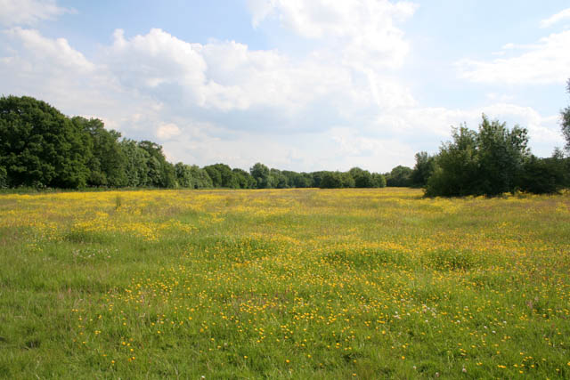
Photo of the common in the summer of 2008. Burbage Common is a 200-acre Country Park and SSSI popular with birdwatchers, walkers and horseriders. It is one of the few areas of unimproved acid grassland to the south west of Leicester as a result of it being used as common grazing land since the eighteenth century Enclosure Acts.
View over the fields on the common. The land is managed by Hinkley and Bosworth Borough Council as Spring or Summer meadows, with either a silage or hay crop being taken. The open areas, with their regularly mown bridleways and footpaths, are bounded by ancient oak, ash and maple woodland. Its history as a grazing area dates back to at least the Domesday Book of 1086.


