Cotswold Way
![]()
![]() This trail takes you through some of the most beautiful countryside in England.
This trail takes you through some of the most beautiful countryside in England.
It runs for just over 100 miles from Chipping Campden in Gloucestershire to the historic city of Bath in Somerset.
As well as proffering wonderful views of the Cotswold Hills Area of Outstanding Beauty, you can also see the River Severn, the Black Mountains of Wales and the Forest of Dean from the route.
You will pass through or near a series of attractive market towns such as Chipping Sodbury, Wooton-under-Edge, Stroud and Cheltenham before arriving at the splendid Roman city of Bath at the end of the trail.
Highlights on the route include the lovely National Trust owned Woodchester Park and the magnificent Sudeley Castle.
You'll also visit the highest point in the Cotswolds at Cleeve Hill where you will also find the fascinating Belas Knap chambered long barrow.
Cotswold Way Ordnance Survey Map  - view and print off detailed OS map
Cotswold Way Open Street Map  - view and print off detailed map
Cotswold Way OS Map  - Mobile GPS OS Map with Location tracking
Cotswold Way Open Street Map  - Mobile GPS Map with Location tracking
Pubs/Cafes
The Air Balloon is located on the route close to Crickley Hill near Gloucester. It is housed in an attractive Cotswold stone building, dating from the 18th century. Outside there's a nice beer garden to relax in on warmer days. There's a good menu and a decent selection of ales too. You can find it at postcode GL4 8JY right next to the park. There's usually quite a few walkers in there who have just climbed the adjacent hill so it's a nice place to stop at on the walk.
In the village of Broadway you could stop off for a bite to eat at The Broadway Hotel. The hotel is in a lovely spot on the quaint village green, alongside beautiful boutiques and honey-coloured cottages. It includes a brasserie and a racing themed bar, inspired by the nearby Cheltenham Racecourse and its famous Gold Cup. The Broadway dates all the way back to 1575 and also has a fine garden area to relax in on warmer days. It also provides good quality accommodation and can be easily found on the High Street in the village at a postcode of WR12 7AA.
In Dursley head to the noteworthy Old Spot Inn. The inn dates back to 1776 and includes a charming interior with low ceilings and comfortable connecting bar-rooms which are adorned with interesting "breweriana" from times gone by. The inn is also a CAMRA National Pub of the Year with a fine range of ales to choose from. Outside there's a lovely garden area where you can relax on warmer days. You can find the pub at 2 Hill Road with a postcode of GL11 4JQ.
The Old Crown in the pretty village of Kelston is well worth consideration. The pub serves fine food has a fabulous large garden to relax in on warmer days. The lovely open space won the Bath in Bloom and South West in Bloom awards in 2018. The pub also has some history having been a coaching inn back in the 17th century. You can find them in the village with a postcode of BA1 9AQ for your sat navs.
Mount Inn - Stanton. The attractive 17th century pub sits in an elevated position on a mount at the end of the village. You can sit outside in the garden area and enjoy views across the Vale of Evesham towards the Malvern Hills & even the Black Welsh mountains beyond.
They have a great food menu and a good selection of drinks.
The ancient building has an interesting history having originally been a farmhouse. Sometime later it became a "cobbler shop", a tea room and then an off-licence.
You can find the inn on the High Street at postcode WR12 7NE for your sat navs. The pub is dog friendly.
Stanton is also well worth exploring with a number of ancient houses built from the honey coloured limestone quarried from the nearby Shenberrow Hill. It's generally considered to be one of the loveliest settlements in the Cotswolds.
Cycle Routes and Walking Routes Nearby
Photos
Cotswold Way at Battle of Lansdown. The battle was part of the First English Civil War and fought on 5 July 1643, near Bath. The Royalists under Lord Hopton forced the Parliamentarians under Sir William Waller to retreat from their hilltop position but suffered many casualties themselves. The site of the battle is marked by a monument to Sir Bevil Grenville, who died after the battle in Cold Ashton Rectory.
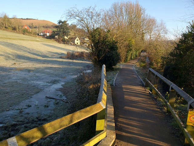
The grounds of Salterley Grange (formerly the first municipal sanatorium to be opened in the country) are on the left as the Way follows a restricted byway towards Leckhampton Hill.
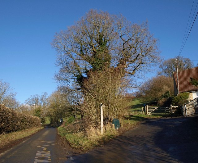
Horton Hill. The Way leaves the lane to Horton Court, beside the primary school (right) - the signpost and oak tree can be seen on the left of that image. The route has been shifted from that shown on the maps, which is along the lane on the left.
Video
Route Highlights
Chipping CampdenThis lovely market town is a splendid start point for the trail with its attractive Cotswold stone high street and 17th century Market Arch (right). |
Dyrham ParkWith its deer park and baroque mansion the 17th century, National Trust owned Dyrham Park is well worth stopping for. |
StroudConveniently located near the trail the town of Stroud makes an ideal overnight stop. |
Tyndale MonumentBuilt in 1866 in honour of William Tyndale who translated the new testament, the tower can be climbed for a small fee. |
City of BathWith it's Roman Baths and fine architecture, the city of Bath marks the end of the trail. |
Broadway TowerLocated at the second highest point on the Cotswold escarpment the Saxon Broadway Tower, is a must see on the trail. Enter the tower for exhibitions about the tower's history and some fabulous views of the surrounding area. |
Sudeley CastleDating from the 15th century, Sudeley Castle with its beautiful, award winning gardens and lovely chapel, is a real highlight on the trail. |
Hailes AbbeyStop here to explore the National Trust owned Hailes Abbey with its 13th century ruins and excellent museum. |
Stanway HouseThis splendid Jacobean manor house is right on the trail and open to the public. There are also beautiful gardens and a 300ft high fountain which is the tallest gravity fountain in the world. |
Cleeve HillHighest point both in the Cotswolds and in the county of Gloucestershire, at 1,083 feet (330 m). Includes the lovely Cleeve Common where there is an abundance of wildlife including roe deer. |
Dowdeswell ReservoirThere's plenty of wildlife to enjoy at this picturesque reservoir in Gloucestershire. Birds include Moorhen, Coot, Mallard, Little Grebe and Great Crested Grebes. The nearby Dowdeswell Wood makes a lovely backdrop. |
Devil's ChimneySituated in Leckhampton, this unusual limestone rock formation is shaped like a crooked chimney. Legend holds that the Devil's Chimney is the chimney of the Devil's dwelling deep beneath the ground. Visitors to the Devil's Chimney would leave a coin on top of the rock as payment to the Devil in exchange for his staying in his underground home. |
Coopers Hill Cheese-RollingThis annual event held on the Spring Bank Holiday involves locals chasing a large round cheese down a near-vertical grass slope |
Coaley PeakSuper picnic site and viewpoint with views over the Severn Vale and the Forest of Dean. |
Cam Long DownThis humpbacked ridge of oolitic limestone makes a great viewpoint |
DursleyThe trail passes right through this pretty market town that sits on the edge of the Cotswold escarpment at the point where it drops off towards the Severn Vale and the River Severn. The town is surrounded by beautiful woodland and countryside and has plenty of amenities and accommodation. It also includes the splendid nature reserve at Cam Peak Dursley, the impressive Iron Age Hillfort at Uley Bury and the Tudor Manor house at nearby Owlpen. |
Wotton-under-EdgeThe trail passes through this market town which is surrounded by some typically beautiful rolling Cotswold countryside. |
Somerset MonumentLocated near Hawkesbury this monument was erected in 1846 to commemorate General Lord Edward Somerset, who had served with distinction at Waterloo. |
Horton CourtStone-built manor house Owned by the National Trust |
Belas KnapFascinating neolithic, chambered long barrow, situated on Cleeve Hill. |
BirdlipNear this little village you'll pass the noteworthy Great Witcombe Roman Villa and the pretty Witcombe Reservoirs. The English Heritage villa was built about AD 250, and lived in until the 5th century. The remains include a bathhouse complex and mosaic pavements. There is also a fine viewpoint at Barrow Wake just to the north of the village, with a car park. It's a nice place to start a walk to the nearby Witcombe Wood and the site of the villa on the trail. |
Kelston RoundhillThere is a popular circular walk to this ancient barrow starting from Kelston village. From the summit there are wonderful views to the Wiltshire Downs, the Mendip Hills and the Black Mountains of Wales. There's also a fine 17th century pub to visit in the village afterwards. |
Hawkesbury UptonThis village near Chipping Sodbury is home to a 400 year old pub and the Somerset Monument. The monument commemorates Lord Robert Somerset and sits in an elevated position just to the north west of the settlement. Near here the trail also passes the National Trust's Horton Court. The Grade I listed manor house dates back to the 16th century and includes a 12th century Norman Tower. The house is surrounded by some lovely gardens and grounds which includes a pretty lake. |


