Pennine Bridleway
![]()
![]() This fabulous 120 mile long trail runs through the beautiful Derbyshire Peak District, through Lancashire and on into Yorkshire.
This fabulous 120 mile long trail runs through the beautiful Derbyshire Peak District, through Lancashire and on into Yorkshire.
It is suitable for mountain bikers, horse riders and walkers taking you on a tour through some of the most beautiful parts of the country.
The trail generally runs along dismantled railway lines, tracks and quiet roads passing through moorland, open fields and purple heather moors with the Pennine Hills providing a splendid backdrop.
Highlights on the route include several picturesque reservoirs and the eye catching 1300 ft Stoodley Pike Hill in Yorkshire.
For more information on this route, including accomodation and holiday ideas please click here.
Pennine Bridleway Ordnance Survey Map  - view and print off detailed OS map
Pennine Bridleway Open Street Map  - view and print off detailed map
Pennine Bridleway OS Map  - Mobile GPS OS Map with Location tracking
Pennine Bridleway Open Street Map  - Mobile GPS Map with Location tracking
Pubs/Cafes
Stop in the village of Greenfield on the way and enjoy refreshments at the King William IV Hotel on Chew Valley Rd, OL3 7DD. There's a great menu and a lovely beer garden to sit out and relax in when the weather is fine.
In Hayfield you could try the Lantern Pike Inn. The interesting old pub dates from 1792, and has a very good menu. There's also a nice outdoor seating area where you can relax outside and enjoy views of the surrounding hills. You can find the pub in the village on 45 Glossop Rd, Little Hayfield with postcode SK222NG for your sat navs. The pub is dog friendly and also does accommodation so you can stay over here if you need to.
In Hebden Bridge there's the excellent Rim Nam Thai Restaurant. It's located in a wonderful spot right on the canal side just a short distance from The Hebden Bridge Picture House. It's a great place to enjoy a fine meal with a lovely scenic view. You can find it at Butlers Wharf at postcode HX7 8AF. A little to the west of the town centre there's also the noteworthy Fox & Goose Inn. The pub is the first community-owned pub in West Yorkshire. The friendly place is well worth some investigation with its cosy interior with a roaring fire and an exhibition space for local artists to display their work. Outside there's a lovely hillside beer garden which is great on warmer days. The place is also very dog friendly and will provide water bowls and free biscuits. You can find the pub at 7 Heptonstall Road with a postcode of HX7 6AZ for your sat navs.
Just above the National Trust's Hardcastle Crags you'll find the noteworthy Pack Horse Inn. This interesting historic pub is located in a very remote position and dates from the 17th century. Inside there's a cosy bar with fires, window seats cut into the partly panelled stripped-stone walls (from where you can take in the beautiful views), sturdy furnishings and some horse related mementoes. There are also seats outside in the cobblestoned beer garden which has attractive hanging baskets. They have a good selection of ales, a decent menu and are also dog friendly. You can find the pub on the Widdop Road just as you pass Gorple Reservoir and Widdop Reservoir. Postcode for sat navs is HX7 7AT.
Slightly off the trail in Derbyshire there's the worthy village of Brassington where you'll find the Olde Gate Inn. The historic inn dates back to the 17th century and is Grade II listed. Bonnie Prince Charlie’s soldiers were billeted at the inn on their march to London, and some of the oak beams came from ships of the Spanish Armada. It's been named Britain’s cosiest pub by The Times with its charming interior and roaring fires. Outside there's a lovely large garden area with fine views. They serve high quality gastro food and have a good selection of ales. You can find them on Well Street with a postcode of DE4 4HJ for your sat navs. The attractive village is a pleasant place for a stroll too, with several centuries old limestone cottages, a church dating from the Norman period and a notable Tudor house built in 1615.
In Chelmorton there's the Church Inn. The fine stone pub dates back to 1742 and sits opposite the village church which dates from the 11th century. There's roaring open fires in the winter, a beautiful sun trap of a beer garden and patio for summer al fresco dining. You can find them at postcode SK17 9SL for your sat navs.
Further Information and Other Local Ideas
Near Todmorden you could take a small detour to visit Gaddings Dam. The small reservoir is notable for having the highest beach in Britain.
Cycle Routes and Walking Routes Nearby
Photos
Walkerwood Reservoir near Stalybridge.
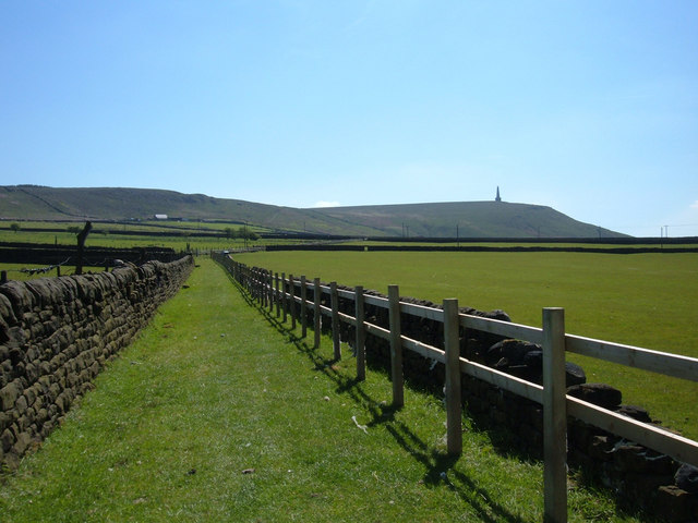
Above Lumbutts. Looking northeast along the bridleway. In about one hundred metres the bridleway joins Lumbutts Road, one of the few road sections on the Mary Towneley Loop part of the National Trail. Stoodley Pike can be seen on the skyline.
Mountain biker near Summit. The start of the descent back into the valley where the National Trail crosses the Rochdale Canal at Summit, the highest point on the canal's route from Manchester to Sowerby Bridge. The canal can be seen left of shot.
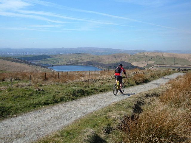
Bent Heath. This is the start of the long descent into the Piethorne Valley having just crossed the A672, Ripponden Road. Piethorne Reservoir can be seen in the middle distance whilst further in the distance is the town of Rochdale.
Erringden. On the agricultural shelf above Hebden Bridge in the Calder Valley. Looking south towards Stoodley Pike (an iconic waypoint on the Pennine Way) on this newly constructed section of the PBW national trail. The route no longer uses Kilnshaw Lane which was interim only pending construction of this off-road section.
Above Cowpe Reservoir. The cyclist is crossing Cowpe Moss on the gradual descent from Top of Leach heading towards Waterfoot.
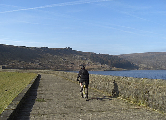
Widdop Reservoir. Riding along the dam wall with Cludders Slack rocks on the skyline. A stiff climb to the summit of Black Moor awaits.
Video
Route Highlights
Middleton-by-WirksworthThe village of Middleton-by-Wirksworth is near the start of the trail. |
Peak ForestSmall village in the Peak District with a church dedicated to 'Charles, King & Martyr' (King Charles I of England, executed in 1649.) |
HayfieldThe route passes right through this pretty village which has plenty of fine pubs, cafes and guest houses. |
Lantern PikeLantern Pike is a hill located just outside Hayfield measuring 373 metres in height. The views from the trail are fabulous. |
GlossopOften called 'the gateway to the Peak District National Park' this market town is slightly off the route but ideal for overnight stays. |
Bottoms Reservoir, HadfieldThis man-made lake in Longdendale in north Derbyshire sits just outside of Hadfield which doubled as the fictional town of Royston Vasey in the television show League of Gentlemen. |
Piethorne ReservoirThe largest of several reservoirs in the Piethorne Valley above Milnrow, in the Metropolitan Borough of Rochdale, Greater Manchester, England. It was built in 1866. |
Cowm ReservoirLocated near Whitworth, Lancashire, just north of the route. There is a nice circular walk around the reservoir. |
Healey DellThis attractive reserve sits in the Spodden Valley and right on the route. It is a real trail highlight with water mills, wildlife, picnic areas and the 1867 Healey Dell Viaduct. |
Gorple ReservoirThe trail path runs right alongside this Yorkshire Reservoir. |
Stoodley PikeStoodley Pike is a 1,300ft hill including the Stoodley Pike Monument at the summit. It was built in 1856 when peace was declared at the end of the Crimean War. |
BuxtonLovely spa town with the highest elevation of any market town in England. Buxton is described as 'the gateway to the Peak District National Park' with plenty of excellent choices for overnight stay. |
Dovestone ReservoirReservoir situated in a valley above the village of Greenfield, in Saddleworth, Greater Manchester. Dovestones is a major tourist attraction, offering several walks amongst picturesque landscapes. |
Hollingworth LakeThis beautiful lake and country park is a popular tourist attraction offering watersports and scenic views. There is also a caravan park on site. Right next to the lake is the splendid Wine Press. This contemporary British Restaurant includes a lovely outdoor seating area where you can enjoy fine views over the lake with your lunch. There's also an attractive modern interior for cooler days. The pub is also dog friendly and a nice place to stop on the route. |
Rochdale CanalThe trail crosses the Rochdale Canal near the village of Calderbrook in Yorkshire. |
Watergrove ReservoirThe trail runs right alongside this large reservoir near Wardle. |
Hebden BridgeThe lovely Yorkshire Town of Hebden Bridge lies at the confluence of the River Calder and the River Hebden (Hebden Water). It is an ideal place for a stopover with plenty of good guest houses, pubs and restaurants to enjoy. |


