Catbells Circular Walk from Hawes End
![]()
![]() Catbells is one of the most popular climbs in the Lake District. At 451 metres (1,480 ft) it is not particularly high so attracts lakeland walkers of all abilities. Alfred Wainwright said of Catbells: 'It is one of the great favourites, a family fell where grandmothers and infants can climb the heights together, a place beloved. Its popularity is well deserved, its shapely topknott attracts the eye offering a steep but obviously simple scramble.' The fell is located on the western side of Derwent Water near to the popular town of Keswick.
Catbells is one of the most popular climbs in the Lake District. At 451 metres (1,480 ft) it is not particularly high so attracts lakeland walkers of all abilities. Alfred Wainwright said of Catbells: 'It is one of the great favourites, a family fell where grandmothers and infants can climb the heights together, a place beloved. Its popularity is well deserved, its shapely topknott attracts the eye offering a steep but obviously simple scramble.' The fell is located on the western side of Derwent Water near to the popular town of Keswick.
This circular walk starts at the car park at Hawes End and climbs to Skelgil Bank and on to the summit on a good but steep path with minimal scrambling. From the summit there are fabulous views of Derwent Water, Bassenthwaite Lake, the Newlands Valley, Skiddaw and Keswick to the north, while the view south has a fine vista of Borrowdale. You descend towards Manesty where you pick up the Allerdale Ramble waymarked walking trail which will take you back to the finish point at the car park.
If you enjoy this climb you could try other popular nearby fells including Castle Crag and Latrigg. As stated the Allerdale Ramble walking trail runs past Catbells so this another option if you'd like to continue your walk. You could potentially follow it all the way to Keswick or head south into Borrowdale.
Just to the north is the village of Braithwaite where you can climb to Grisedale Pike. It's a popular and challenging climb with wonderful views to the Cumbrian coast, the Vale of Keswick, the Pennines and the head of Derwentwater. On a very clear day you can even see the Belfast Hills and the Southern Uplands of Scotland.
If you would like to climb the hill from Keswick then it's about a 3.5 mile hike to the summit. See the Catbells from Keswick Walk for full details.
Just to the west of the fell top you can visit Little Town and explore the beautiful Newlands Valley on our circular walk.
Catbells Ordnance Survey Map  - view and print off detailed OS map
Catbells Open Street Map  - view and print off detailed map
Catbells OS Map  - Mobile GPS OS Map with Location tracking
Catbells Open Street Map  - Mobile GPS Map with Location tracking
Pubs/Cafes
There's a few good refreshment options at Hawes End at the start of the walk. Just to the north there's the delightful Lingholm Kitchen. This splendid cafe also includes the kitchen gardens which Beatrix Potter credited as her inspiration for Mr McGregor’s garden in The Tale of Peter Rabbit. The Victorian style garden has herbaceous borders while it’s central areas are for vegetable production that is then served fresh daily in the Kitchen. Within the walled garden there is the splendid bonus of an outdoor gallery dedicated to Beatrix Potter’s work in the Derwentwater area, much of it undertaken whilst she stayed at Lingholm. The gallery takes a journey through her years at Lingholm and the Northern Lakes and how she wrote and illustrated some of her best known stories here. From the kitchen there are tremendous views towards the surrounding mountains. It's a lovely place to get a bite to eat and then enjoy a little stroll around the gardens afterwards.
Also on the estate is an Alpaca Farm where you can take part in feeding time and ask the keepers all about these beautiful animals.
Dog Walking
The hill is a fantastic place for a dog walk and you will likely see plenty of other owners with their pets on a fine day. Lingholm Kitchen mentioned above is also dog friendly.
Further Information and Other Local Ideas
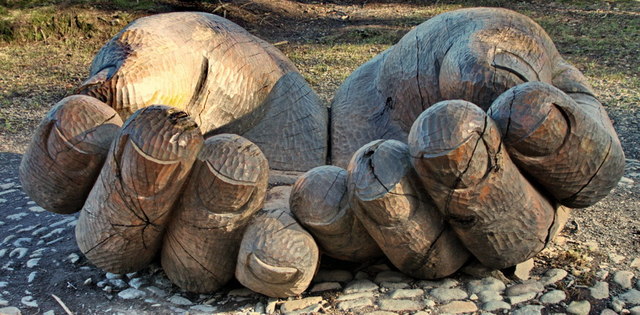
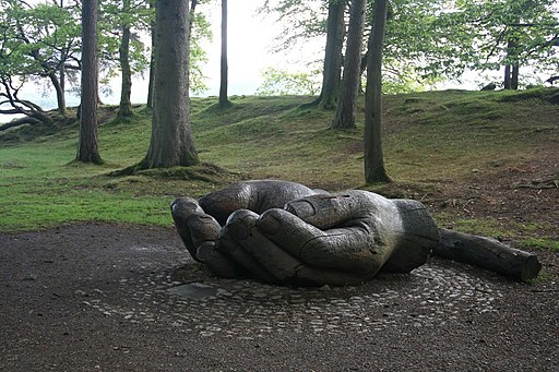
Just to the east of the hill is another highlight of the area at Brandlehow Park. The lakeside park has some interesting wooden sculptures including the cupped hands (below) which commemorates the centenary of the National Trust's first ever land purchase, 108 acres of the Brandlehow estate. Octavia Hill, one of the founders of the Trust, planted a tree at the official opening of Brandelhow to the public in October 1902. It's another very pleasant place for a stroll, with peaceful woodland paths and lots of interesting flora and fauna. Look out for kingfishers, woodpeckers, nuthatches, roe deer, red squirrels and, if you're very lucky, perhaps even an otter.


Above: The wooden sculptures in Brandlehow Park. You will often see children climbing on them!
The Coledale Horseshoe can be picked up to the west of the hill. The popular circular walk explores the wonderful hanging valley, climbing to several of the significant local peaks.
Cycle Routes and Walking Routes Nearby
Photos
Ascending Catbells. The fell's lower slopes are adorned with bracken, heather, and grasses typical of upland areas, providing essential cover for small mammals such as voles and field mice. Wildflowers like tormentil, heath bedstraw, and harebells bloom during the summer months, adding splashes of colour to the rugged landscape. As you ascend, the vegetation becomes more sparse due to exposure to wind and grazing. On higher ground, you may encounter hardy species like bilberry and crowberry, which thrive in the acidic soils. Lichens and mosses cling to rocks and boulders, demonstrating their adaptability to the harsh conditions
Catbells descending to its subsidiary peak Skelgill Pike on the right. Below the fell is Derwentwater with, in the foreground, the river Derwent approaching it.
Birds of prey such as kestrels and buzzards are often seen soaring above the ridges, while skylarks and meadow pipits are common on the open slopes. Red squirrels inhabit nearby woodlands and may occasionally be spotted on the fringes of the walk. The shores of Derwentwater, visible from the route, attract waterfowl such as mallards, grebes, and cormorants. The surrounding fells and valleys support roe deer, foxes, and badgers, though they are more active during dawn and dusk. Amphibians like frogs and newts can sometimes be found in the wetter areas around the base of Catbells.
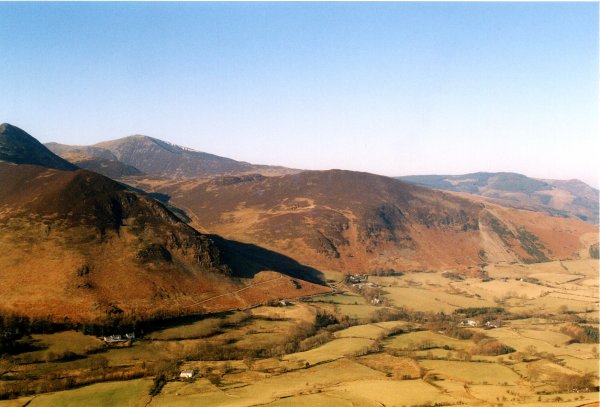
Barrow from Catbells. Strong colours showing the ruggedness of the fells. The geology of the area, characterised by Borrowdale volcanic rock, adds to the interest, forming rugged outcrops and steep ridges. Historical features, including remnants of old mining activity in the nearby Newlands Valley, offer a glimpse into the region’s industrial past.


