South West Coast Path OS Map and GPX Download
630.1 miles (1014 km)
This incredible 600 mile walk follows the coast from Minehead in Somerset, through Devon and Cornwall and onto the finish point at Poole in Dorset. You will pass some of the most spectacular scenery in the country with beautiful beaches, stunning cliffs and a series of charming coastal villages just some of the highlights along the way.
Scroll to the bottom of the page to download the full gpx file for the whole route.
Photos

Cove Cottage, Porthgwarra. The dwelling in the centre of this photo is appropriately called Cove Cottage, as it sits above the cove at Porthgwarra. Just beyond it, to the right, is the top of the�tunnel down to the beach at Porthgwarra cove. The headland beyond the cottage is Carn Scathe. The wooden fingerpost on the left points out the route of the southwest coast path.

Coast path around Bass Point. The building of Lloyd's signal station dominates this headland, the coast path winds its way around the point. The hottentot fig plant is invading the cliffs here,
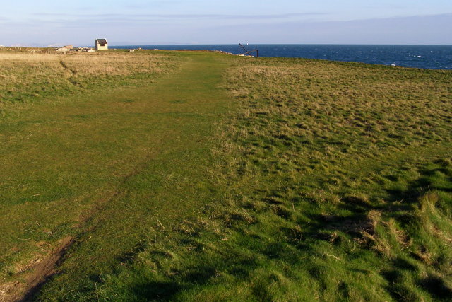
Coastal lawn, Broad Ope. The coast to the east of Portland Bill is known as Broad Ope. This grassy lawn is on the clifftop between Butts Quarries and Cave Hole. The small building on the left is next to a small disused quarry. The land surface slopes gently downhill to the cliff edge, with the topsoil of the slope lying above the raised beach deposits. The coastal path follows the well-worn route across the grass.

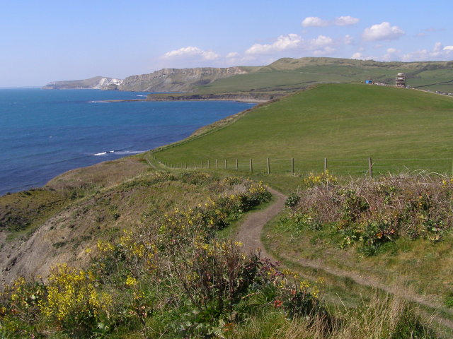
Coast path approaching Blackstone Point from the west The coast path follows the cliff-top to Blackstone Point (the headland on the right). Just beyond is the old oil shale (blackstone) mining area of Clavell's Hard, then the path rises up to Rope Lake Head. St Aldhelm's Head can be seen in the far distance.

Remains of tramway near Clavell's Hard. A short section of the tramway that served bituminous shale workings on the cliffs in this area can be found protruding over the edge.

Slipping clifftop, Bran Point. The coast path from Osmington Mills to Ringstead follows the cliff-top, and this section has fairly recently slipped. It is possible to walk along the shore between Osmington Mills and Ringstead if tide and weather allows. The left turn up ahead is at Bran Point.

View from Emmetts Hill over Pier Bottom to St Aldhelm's Head. A steep sided dry valley separates the two high points. The coast path goes straight down and up; a diagonal path can be traced on the opposite hillside. In the 18th century there was a jetty at the bottom of the valley for the export of stone, hence the name.
Coast path east from Cuddle. The coast path leads along the crumbling cliff-top. Underfoot is the high ground of Cuddle. A seam of blackstone (oil shale) outcrops in the cliff below (off to the left) and on the left of this photo is a cutting that once carried the 1848 tramway of the Bituminous Shale Co. The tramway was connected to the workings north of D Plantation (off to the right), and from there it ran down towards a wooden pier that stood off the old sea-wall beside Maple Ledge in Kimmeridge Bay.
 Ordnance Survey Map
 OpenStreetMap


