Chatelherault Walk Map
![]()
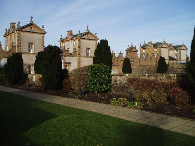
![]() Enjoy a cycle or walk around this large country park located between Motherwell and Hamilton. The park lies along the River Avon gorge with ancient woodland and riverside trails to enjoy. Highlights of the park include the Hunting Lodge and Summer House built in 1732 for the Dukes of Hamilton. In the buildings you will find the visitor centre, the Banqueting Hall and Duke and Duchess Apartments, an Exhibition Gallery with displays, the Gift Shop and Cafe. There's also a wide variety of wildlife including roe deer, otter, badger and various woodland birds.
Enjoy a cycle or walk around this large country park located between Motherwell and Hamilton. The park lies along the River Avon gorge with ancient woodland and riverside trails to enjoy. Highlights of the park include the Hunting Lodge and Summer House built in 1732 for the Dukes of Hamilton. In the buildings you will find the visitor centre, the Banqueting Hall and Duke and Duchess Apartments, an Exhibition Gallery with displays, the Gift Shop and Cafe. There's also a wide variety of wildlife including roe deer, otter, badger and various woodland birds.
If you would like to continue your walk/cycle you could follow the River Avon north to the nearby Strathclyde Country Park.
Postcode
ML3 7UE - Please note: Postcode may be approximate for some rural locationsChatelherault Country Park Ordnance Survey Map  - view and print off detailed OS map
Chatelherault Country Park Open Street Map  - view and print off detailed map
*New* - Walks and Cycle Routes Near Me Map - Waymarked Routes and Mountain Bike Trails>>
Chatelherault Country Park OS Map  - Mobile GPS OS Map with Location tracking
Chatelherault Country Park Open Street Map  - Mobile GPS Map with Location tracking
Pubs/Cafes
The park has a visitor centre and cafe where you can enjoy some refreshments after your exercise. In the Oaks Cafe you can purchase a delicious range of sandwiches, toasties, paninis, baguettes, bagels, ciabattas and focaccias.
Dog Walking
The park is great for dog walking with miles of trails through woodland, parkland and along the river. You will probably see plenty of other owners on a fine day.
Further Information and Other Local Ideas
The waymarked Avon Walkway runs through the park so you can extend your outing on this trail. If you were to follow it north you would soon meet with the Clyde Walkway. This trail runs along the River Clyde passing the photogenic ruins of the 13th century Bothwell Castle. Just east of the park there's the Barons Haugh Nature Reserve where there are more riverside trails and lots of wildlife spotting opportunites.
A few miles west in East Kilbride there's the delightful Calderglen Country Park. There's more river paths here along the Calder River with pretty waterfalls to see on the way.
Head south along the river and you could visit Morgan Glen where you can see the impressive Larkhall Viaduct and some pretty waterfalls.
Cycle Routes and Walking Routes Nearby
Photos
April 2016. The former hunting lodge of the now demolished Hamilton Palace, designed by William Adam and completed in 1734.
Lush green countryside by the estate. As viewed from the road, this path leads into the network of paths in Chatelherault Park.
The vista from Chatelherault in October 2005. The Duke of Hamilton built a hunting lodge at Chatelherault, just outside Hamilton. This vista, looking north, has been irrevocably changed due to extensive sand quarrying, which has lowered the ground level just in front of the lodge by around 60 feet. The explanatory plaque shows the changed ground profile. His avenue of trees has been replanted, but needs a few years of growth yet.The Duke's mausoleum (red sandstone, domed roof) can be seen in the distance above the plaque.
A mountain bike rests on the bridge. This is the White Bridge that spans the River Avon in Chatelherault Park.
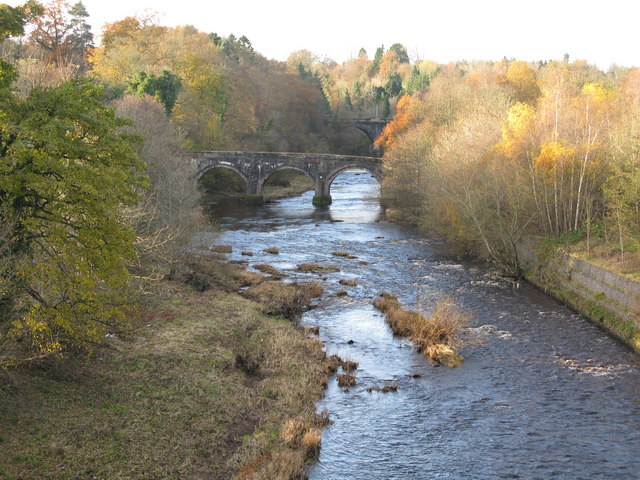
The Avon Water (near Chatelherault) Looking up river from the road bridge which carries the A72 (the main south road the A74 until the late 1960's). The bridge in the foreground is the old Avon Bridge and the bridge in the background carries the recently reopened railway line from Hamilton to Larkhall.


