Dams to Darnley Country Park
![]()
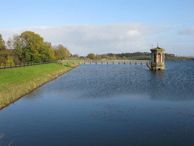
![]() Enjoy cycling and walking in this large country park near Glasgow. There are 1350 acres to explore including wetland, burn, woodland, grassland and scrub. The main attractions in the park are the beautiful Barrhead Dams with miles of waterside trails alongside a series of connected reservoirs. These include the large Balgray Reservoir and the smaller Ryat Linn and Waulkmill Reservoirs. The dams are excellent for birdwatching - look out for lapwing, ringed plover, redshank, common sandpiper and common gull.
Enjoy cycling and walking in this large country park near Glasgow. There are 1350 acres to explore including wetland, burn, woodland, grassland and scrub. The main attractions in the park are the beautiful Barrhead Dams with miles of waterside trails alongside a series of connected reservoirs. These include the large Balgray Reservoir and the smaller Ryat Linn and Waulkmill Reservoirs. The dams are excellent for birdwatching - look out for lapwing, ringed plover, redshank, common sandpiper and common gull.
The park is located a few miles south west of Glasgow city centre at Barrhead.
If you wanted to extend your outing you could head to the nearby Rouken Glen Park where you will find miles of walking paths.
Postcode
G53 7ZE - Please note: Postcode may be approximate for some rural locationsPlease click here for more information
Dams to Darnley Country Park Ordnance Survey Map  - view and print off detailed OS map
Dams to Darnley Country Park Open Street Map  - view and print off detailed map
Dams to Darnley Country Park OS Map  - Mobile GPS OS Map with Location tracking
Dams to Darnley Country Park Open Street Map  - Mobile GPS Map with Location tracking
Dog Walking
The park is a good place for dog walking with lots of paths to choose from. You'll probably see other dogs with their owners on most days.
Further Information and Other Local Ideas
A few miles to the north east there's the popular Pollok Country Park to explore. One of the highlights of the area Pollok was named the best park in Britain in 2006 and in 2008, was named the best park in Europe. In the park you'll find a riverside section along the pretty White Cart River, a beautiful walled garden with glasshouses, a delightful woodland garden and the very grand Pollok House - Scotland’s answer to Downton Abbey.
Cycle Routes and Walking Routes Nearby
Photos
Steps into Darnley Mill Country Park From Waulkglen Road. Looking to the bridge over the Brock Burn which appears in the First Geograph image in this square. It was designated as a country park in 2000 making it one of the newest country parks in the country.


