Barlaston Downs Banks Walks
![]()
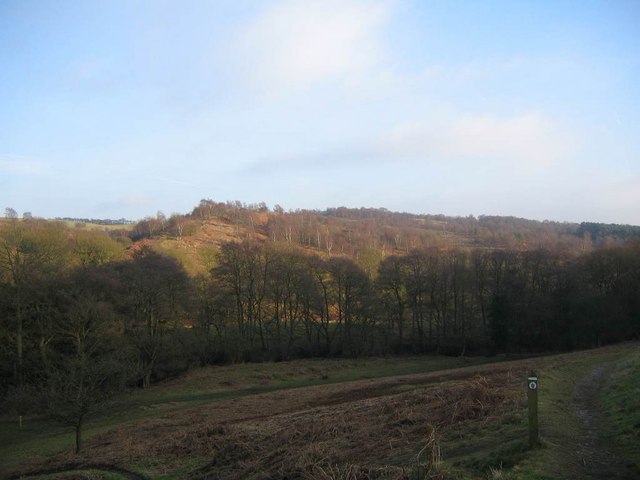
![]() Enjoy a circular walk around this pretty area of woodland and heathland near Stone, in Staffordshire. The area is also known as Barlaston Downs and is run by the National Trust so there is a car park and good walking trails to follow through the area. There is some climbing on the walk but you are rewarded with splendid views over the Staffordshire countryside from the Millennium Viewpoint. There is also a pretty stream with marshland and wildflowers next to it. The route below is designed for walkers but cyclists can follow a waymarked bridleway through the site.
Enjoy a circular walk around this pretty area of woodland and heathland near Stone, in Staffordshire. The area is also known as Barlaston Downs and is run by the National Trust so there is a car park and good walking trails to follow through the area. There is some climbing on the walk but you are rewarded with splendid views over the Staffordshire countryside from the Millennium Viewpoint. There is also a pretty stream with marshland and wildflowers next to it. The route below is designed for walkers but cyclists can follow a waymarked bridleway through the site.
If you feel like continuing your walk then you could pick up the Trent and Mersey Canal which runs through Barlaston.
You could follow it towards Trentham and visit the lovely Trentham Gardens.
Postcode
ST15 8UU - Please note: Postcode may be approximate for some rural locationsPlease click here for more information
Downs Banks Ordnance Survey Map  - view and print off detailed OS map
Downs Banks Open Street Map  - view and print off detailed map
Downs Banks OS Map  - Mobile GPS OS Map with Location tracking
Downs Banks Open Street Map  - Mobile GPS Map with Location tracking
Pubs/Cafes
There's no on site cafe but there a number of lovely picnic spots. One nice idea is to head into nearby Stone and visit the canalside Star Stone. You can sit outside in the lovely garden area and watch the boats go by with your refreshments. They have a good menu and decent selection of real ales too. You can find the pub at 21 Stafford Street with a postcode of ST15 8QW for your sat navs.
Dog Walking
The woodland trails are ideal for dog walking so you'll probably see plenty of other dogs on your visit. You can let them off the lead and they'll enjoy the bubbling brook.
Further Information and Other Local Ideas
The Stone Walk passes along the canal towpath just to the west of the woods. You could pick it up and follow it north to visit Trentham.
Just to the south west is the worthy town of Eccleshall. The town has a particularly interesting high street with a number of Georgian buildings to admire. There's also a noteworthy 12th century church and a 13th century castle. You can walk from the town to the nearby Cop Mere where there are some nice waterside paths to try.
For more walking ideas in the area see the Staffordshire Walks page.


