Joydens Wood
![]()
![]() Explore these ancient woods near Bexleyheath on this easy walk on the border of London and Kent. The area is historically and archeologically significant with remains found from Roman times. This is represented with a series of impressive wooden sculptures. Look out for the Saxon Warrior and Roman Soldier pieces in particular. There's lots of wildlife to see also. Look out for bats, woodpecker, owl and dormouse all of which are represented by a sculpture.
Explore these ancient woods near Bexleyheath on this easy walk on the border of London and Kent. The area is historically and archeologically significant with remains found from Roman times. This is represented with a series of impressive wooden sculptures. Look out for the Saxon Warrior and Roman Soldier pieces in particular. There's lots of wildlife to see also. Look out for bats, woodpecker, owl and dormouse all of which are represented by a sculpture.
The wood has lots of good waymarked footpaths and nice wide bridleways for cyclists to follow. It's a peaceful place for walkers to visit on the outskirts of the city. With over 136 hectares (325 acres) to explore on miles of paths there's plenty to keep walkers and mountain bikers busy.
You can start your walk from Bexley train station just to the north of the woods. Then follows paths south to the site. As well as the extensive woodland there's an area of open heathland with ponds and picnic tables. Look out for pretty plants and flowers including bluebells, lily-of-the-valley, honeysuckle and wood sage.
The London Loop passes close to the woods so it's to extend your walking in the area. You can follow it to a number of parks and nature reserves close to the wood.
At Foots Cray Meadows nature reserve you can enjoy a waterside walk along the River Cray while at Scadbury Park you can explore the ruins of Scadbury Manor. The popular trails at Petts Wood Circular and Jubilee Country Park are also close by.
Postcode
DA5 2EE - Please note: Postcode may be approximate for some rural locationsJoydens Wood Ordnance Survey Map  - view and print off detailed OS map
Joydens Wood Open Street Map  - view and print off detailed map
Joydens Wood OS Map  - Mobile GPS OS Map with Location tracking
Joydens Wood Open Street Map  - Mobile GPS Map with Location tracking
Dog Walking
The expansive woods are ideal for dog walking so you're likely to bump into a few other owners on your visit.
Further Information and Other Local Ideas
Our circular Bexley Walk starts from the nearby Bexley Train Station. It follows the London Loop to Footscray Meadows before heading to Joyden's Wood and the splendid Hall Place where there's a historic house surrounded by beautiful gardens. The 7 mile route is a good way to see some of the highlights of the Bexley area.
Cycle Routes and Walking Routes Nearby
Photos
Wooden sculpture of a fighter aircraft in Joyden's Wood, commemorating the Royal Air Force fighters shot down over the woodland during the Battle of Britain
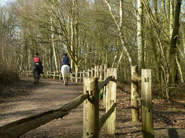
Bridleway and horse. This bridleway leads from Parsonnage Lane into the wood. There are several dismounting steps (steps on left) on the various ways in the wood.


