Llyn Trawsfynydd Circular Walk and Cycle
![]()
![]() Enjoy a long circular walk or cycle around this large lake in in Gwynedd, North Wales. With a total surface area of 4.8 km² (1,180 acres) the reservoir is slightly bigger than Wales's largest natural lake, Llyn Tegid (Bala Lake). It's a beautiful spot with lots of wildlife to look out for including Otters, Osprey and rare birds in the woodland sections. Most of the route is suitable for both cyclists and walkers. If you are on a bike please go around the footbridge on the roads though.
Enjoy a long circular walk or cycle around this large lake in in Gwynedd, North Wales. With a total surface area of 4.8 km² (1,180 acres) the reservoir is slightly bigger than Wales's largest natural lake, Llyn Tegid (Bala Lake). It's a beautiful spot with lots of wildlife to look out for including Otters, Osprey and rare birds in the woodland sections. Most of the route is suitable for both cyclists and walkers. If you are on a bike please go around the footbridge on the roads though.
This trail uses a mixture of footpaths, country lanes and road-side pavements to take you on a tour of the lake and its surrounding countryside.
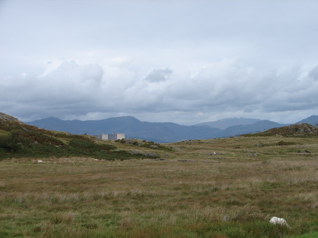
The route starts in the village of Trawsfynydd and heads west to the water where you cross the lake on the footbridge. There's great views in all directions as you cross the narrow bridge. The path then climbs through the woodland and countryside on the western side of the water. This section is quite challenging with the path reaching a height of almost 1000ft (300m). From the high points there are great views over the water to the surrounding hills and mountains of Snowdonia.
You then pass along the northern section of the lake, passing the pumping station and the visitor centre. Here you can enjoy refreshments at the cafe which overlooks the water.
The final section takes you along the eastern side of the lake on footpaths and pavement during the roadside section along the A470. If you would like to do a shorter route which avoids the roadside section then start from the visitor centre and head west to the dam and then south along the paths on the western side of the water. This is a shared walking and cycle path with bike hire available at the visitor centre.
If you would like to continue your walking in the area you could head west and climb to the fascinating stone circle at Bryn Cader Faner or the nearby Foel Penolau in the Rhinogydd range. The Taith Ardudwy Way long distance trail can be picked up near here too.
Postcode
LL41 4UD - Please note: Postcode may be approximate for some rural locationsPlease click here for more information
Llyn Trawsfynydd Ordnance Survey Map  - view and print off detailed OS map
Llyn Trawsfynydd Open Street Map  - view and print off detailed map
*New* - Walks and Cycle Routes Near Me Map - Waymarked Routes and Mountain Bike Trails>>
Llyn Trawsfynydd OS Map  - Mobile GPS OS Map with Location tracking
Llyn Trawsfynydd Open Street Map  - Mobile GPS Map with Location tracking
Further Information and Other Local Ideas
If you have time you could pay a visit to the historic Tomen y Mur. This ancient Roman Fort is located just a quarter of a mile to the north east of the visitor centre. The fort was originally constructed in AD 78, and abandoned around AD 140. A millennium later, in the Norman period, the site was reoccupied and refortified with a motte within the old walls. You can still see these walls today. Informative plaques detail the history of the site and the views from the top of the motte are also excellent. To visit the site just follow a footpath north east from the visitor centre.
Just north of the lake the village of Maentwrog is well worth seeing. Here you'll find the beautiful Plas Tan y Bwlch Gardens at the Snowdonia National Park environmental studies centre. It's a fine place for a walk with the picturesque Llyn Mair to see as well.


