Loch Oich
![]()
![]() Enjoy a circular cycle or walk around Loch Oich in the Scottish Highlands. On the western side of the loch you can follow challenging woodland trails through the forest above the loch in Invergarry. On the eastern side you can follow a flatter, waterside trail along the Great Glen Way. Good start points for the route are at the villages of Invergarry or Aberchalder. You could also start from the Forestry Commission car park at the southern end of the loch.
Enjoy a circular cycle or walk around Loch Oich in the Scottish Highlands. On the western side of the loch you can follow challenging woodland trails through the forest above the loch in Invergarry. On the eastern side you can follow a flatter, waterside trail along the Great Glen Way. Good start points for the route are at the villages of Invergarry or Aberchalder. You could also start from the Forestry Commission car park at the southern end of the loch.
Along the route you will pass the River Garry and the ruins of the 17th century Invergarry Castle. There's also attractive woodland and great views of the surrounding hills.
You can extend the route by continuing along the Great Glen Way and the Caledonian Canal to the nearby Loch Lochy. Here you'll find a great traffic free cycle and walking trail running along the huge loch.
Postcode
PH34 4EB - Please note: Postcode may be approximate for some rural locationsLoch Oich Ordnance Survey Map  - view and print off detailed OS map
Loch Oich Open Street Map  - view and print off detailed map
Loch Oich OS Map  - Mobile GPS OS Map with Location tracking
Loch Oich Open Street Map  - Mobile GPS Map with Location tracking
Explore the Area with Google Street View 
Further Information and Other Local Ideas
Head east and there's another lovely lochside walking and cycling trail along the expansive Loch Ericht. The path starts at Dalwhinnie train station and provides splendid views of Ben Alder. Loch Rannoch with its expansive forest is also located in this area.
Head west and there's a viewpoint car park and nice trails along Loch Garry.
Also to the east is Loch Laggan and the Ardverikie Estate. The loch includes the largest freshwater beach in Britain. The expansive estate was also used for the BBC series Monarch of the Glen. On the northern side of the loch there's also the Creag Meagaidh Nature Reserve. The area includes a wide variety of interesting flora and fauna with several nationally important plant species. There's also a circular waymarked trail which will take you to a fine viewpoint.
For more walking ideas in the area see the Scottish Highlands Walks page.
Cycle Routes and Walking Routes Nearby
Photos
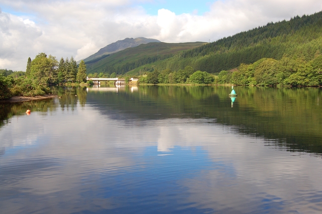
The south end of the loch, looking towards the Laggan swing bridge. The loch is the highest and shallowest of the Great Glen's four enclosed lochs.
Looking south-west over the loch towards Invergarry. A navigation channel had to be dredged through this loch, the shallowest on the Caledonian Canal.
A nor'easterly view along the loch. That's the crannog of Eilean Drynachan to port and in the distance you can see the red hull of the "Fruitful Bough", a trawler en route from the west coast grounds to the eastern fishing grounds. The swing bridge of Aberchalder is also visible in the mid distance.
Sailing through the loch. Two-masted yacht heading south on Loch Oich towards Laggan Swing Bridge. In the background is ruined Invergarry Castle. The castle was the seat of the Chiefs of the Clan MacDonell of Glengarry, a powerful branch of the Clan Donald. Its position overlooking Loch Oich on Creagan an Fhithich – the Raven's Rock – in the Great Glen, was a strategic one in the days of clan warfare.


