Pilgrims Way
![]()
![]() Follow the Pilgrims Way cycle route from Rochester to Canterbury, through the beautiful North Downs. The route runs for about 47 miles on a mixture of quiet roads and traffic free paths. There's some fairly challenging climbs along the way so to complete in one day is for the more experienced rider.
Follow the Pilgrims Way cycle route from Rochester to Canterbury, through the beautiful North Downs. The route runs for about 47 miles on a mixture of quiet roads and traffic free paths. There's some fairly challenging climbs along the way so to complete in one day is for the more experienced rider.
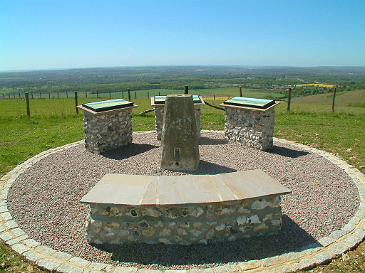
The route starts off in Rochester next to the Medway River and Rochester Castle. You head south west along the river before turning south for a woodland section through Monk Wood. The route then passes the splendid viewpoint at Blue Bell Hill where you can enjoy views over the Kent North Downs. Near here you will also pass the interesting Medway Megaliths. This series of Early Neolithic chambered long barrows and megalithic monuments were constructed circa 4000 BCE, during the Early Neolithic period of British prehistory, surviving today in a ruined state.
The route then turns to the south east to head through the countryside around Boxley, Detling Hill, Thurnham, Hollingbourne, Harietsham, Charing and Westwell. This section takes you through some very pretty Kent villages with highlights including the picturesque water mill and windmill at Charing.
The route continues to Ashford where you turn north towards Wye, running parallel to the River Stour. A woodland section then takes you through Eggringe Wood and Denge Wood to Chartham. The final section runs along the Great Stour to take you to the finish point at Canterbury with its historic cathderal.
To continue your riding in Canterbury pick up the popular Crab and Winkle Way. The traffic free path will take you all the way to Whitstable on the Kent coast.
Pilgrims Way Ordnance Survey Map  - view and print off detailed OS map
Pilgrims Way Open Street Map  - view and print off detailed map
Pilgrims Way OS Map  - Mobile GPS OS Map with Location tracking
Pilgrims Way Open Street Map  - Mobile GPS Map with Location tracking
Pubs/Cafes
In the village of Hollingbourne make a pit stop at the splendidly named Dirty Habit. It's a pub of some note with a history dating back to the 11th century when it began life as a monk’s ale and cider house. The pilgrims who passed on their way to Canterbury would refresh themselves and perhaps stay the night. It is also said that James II stayed here whilst escaping the country to France.
They serve high quality dishes and have a lovely garden area to sit out in on warmer days. You can find them on Upper Street at postcode ME17 1UW.
Further Information and Other Local Ideas
For the longer walk which runs from Winchester to Canterbury please see the Pilgrims Way Walk page.
Just east of Canterbury you can visit the Stodmarsh National Nature Reserve which boasts the largest reedbeeds in the South East of England. This area also includes the lovely Grove Ferry Walk which starts at the eastern end of the reserve. There's a car park, picnic area, boat trips and a fine riverside pub here. At the western end of the reserve you'll also find the Westbere Marshes and the noteworthy town of Fordwich. Fordwich is notable as Britain's smallest town and also has a great pub with a dining terrace overlooking the Stour.


