Silverdale Country Park
![]()
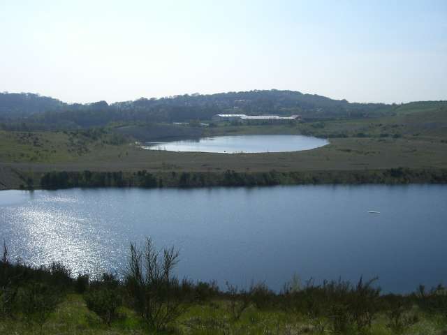
![]() This pretty country park is located in Newcastle Under Lyme, Staffordshire. It has safe, family cycle paths and well maintained walking trails taking you around the open grassland landscape. There is a large pond which attracts great crested newts, a plateau with lovely views of the surrounding countryside, farm meadows, wilidlife conservation areas and woodland areas.
This pretty country park is located in Newcastle Under Lyme, Staffordshire. It has safe, family cycle paths and well maintained walking trails taking you around the open grassland landscape. There is a large pond which attracts great crested newts, a plateau with lovely views of the surrounding countryside, farm meadows, wilidlife conservation areas and woodland areas.
The Newcastle Way walk runs past the park so you could continue your walk along this long distance path. The adjacent Apedale Country Park is also a good option if you would like to continue your outing.
Postcode
ST7 8BS - Please note: Postcode may be approximate for some rural locationsPlease click here for more information
Silverdale Country Park Ordnance Survey Map  - view and print off detailed OS map
Silverdale Country Park Open Street Map  - view and print off detailed map
Silverdale Country Park OS Map  - Mobile GPS OS Map with Location tracking
Silverdale Country Park Open Street Map  - Mobile GPS Map with Location tracking
Dog Walking
It's a popular place with dog walkers so you'll probably bump into other owners on your visit.
Further Information and Other Local Ideas
A few miles south of the park you'll find the village of Keele. Here you can explore the lovely campus of Keele University which includes an arboretum, lakes and gardens. It's well laid out with several colour coded footpaths to try.
For more walking ideas in the area see the Staffordshire Walks page.
Cycle Routes and Walking Routes Nearby
Photos
Lakes near Black Bank. A couple of quite deep lakes/pools in the Silverdale Void or more correctly High Lane Void, Silverdale, the site of old opencast coal workings associated with Silverdale Colliery. Silverdale was closed in 1998, the last colliery in this area to go.


