Aberystwyth to Borth Walk
![]()
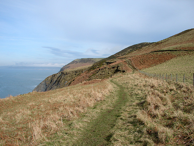
![]() This is a lovely coastal walk from the town of Aberystwyth to the village of Borth along a section of the Ceredigion Coast Path. Borth is located about 5 miles north of the town with a nice footpath taking you along the beaches and cliffs. There's some moderate climbs along the way so a reasonable level of fitness is required. From the cliff tops there are fantastic views down to Aberystwyth and along the coast.
This is a lovely coastal walk from the town of Aberystwyth to the village of Borth along a section of the Ceredigion Coast Path. Borth is located about 5 miles north of the town with a nice footpath taking you along the beaches and cliffs. There's some moderate climbs along the way so a reasonable level of fitness is required. From the cliff tops there are fantastic views down to Aberystwyth and along the coast.
The walk starts by the pier on the sea front of Aberystwyth, near to the train station. You then head north past Constitution Hill, a wonderful viewpoint with a large Camera Obscura giving a bird's eye view of 1000 square miles of countryside and coast.
The route continues along the cliff top path to Clarach Bay, where you can stop for refreshments at the cafe. Here you'll also find a lovely beach and views of the Afon Clarach which runs into the bay.
The path then climbs above Clarach Bay to Wallog where you will pass an attractive shingle spit named Sarn Gynfelyn.
The final section takes you past the cliffs of Craig y Delyn before descending into the pretty resort of Borth. Features in the village include a nice sandy beach and an ancient submerged forest visible at low tide along the beach. There's also a train station so you can return to Aberystwyth very easily.
To extend the walk continue north along the coast path to the Dyfi National Nature Reserve. The reserve includes lovely beaches, lots of wildlife, views of the Afon Leri and a visitor centre.
Aberystwyth to Borth Walk Ordnance Survey Map  - view and print off detailed OS map
Aberystwyth to Borth Walk Open Street Map  - view and print off detailed map
Aberystwyth to Borth Walk OS Map  - Mobile GPS OS Map with Location tracking
Aberystwyth to Borth Walk Open Street Map  - Mobile GPS Map with Location tracking
Pubs/Cafes
After your exercise head to The Glengower in Aberystwyth for some post walk refreshments. The hotel is in a great location on the sea front with nice views and an outdoor seating area for the warmer months. You can find it at 3 Victoria Terrace, Aberystwyth SY23 2DH.
Further Information and Other Local Ideas
The Borth to Ynyslas Coastal Path will take you north along Borth Sands to visit Ynyslas and the Dyfi National Nature Reserve. There's some splendid high sand dunes to explore in the wildlife rich reserve. You can also enjoy lovely views over the Dyfi Estuary to Aberdovey on the opposite side.


