Ballydavid Cliff Walk
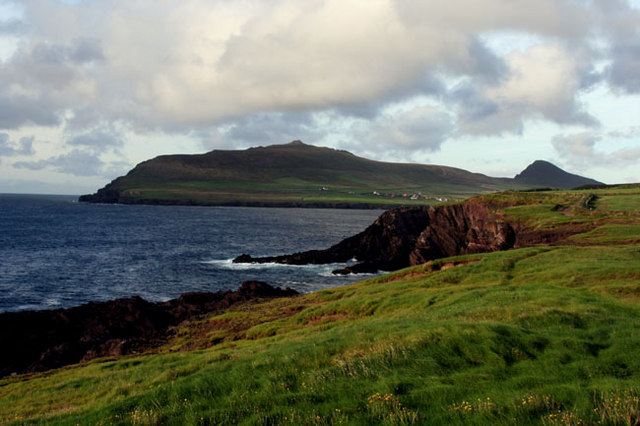
![]() This popular coastal walk takes you along the cliff top path in Ballydavid on the Dingle Peninsula of County Kerry.
This popular coastal walk takes you along the cliff top path in Ballydavid on the Dingle Peninsula of County Kerry.
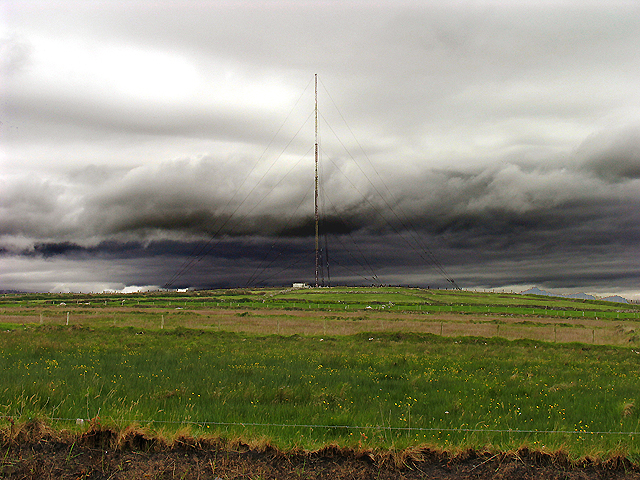
The walk runs for about 5km heading north along a section of the Dingle Way, a circular waymarked footpath running through the area. You can start off at the car park in Ballydavid and then follow the trail along the fairly flat coastal path to the Radio Masts. Along the way there are some wonderful views over the Atlantic Ocean and the surrounding hills and countryside.
You can extend your walk by continuing along the circular Dingle Way in either direction. If you were to head east for example you could visit Annascaul Lake. The picturesque lake sits in a wonderful remote spot surrounded by mountains and a beautiful river valley.
Ballydavid Cliff Walk Open Street Map  - view and print off detailed map
Ireland Walking Map - View All the Routes in the Country>>
Ballydavid Cliff Walk Open Street Map  - Mobile GPS Map with Location tracking
Pubs/Cafes
After your walk you could enjoy some refreshment at Tigh TP. The pub is in a great location next to the beach and the pier in the village. You can sit outside and enjoy a wonderful view with your meal.
Further Information and Other Local Ideas
Head south along the Dingle Way and you could visit Slea Head. There are some interesting ancient huts, the pretty Coumeenoole Beach and Dunmore Head to visit here. The scenic headland is notable as the westernmost point of Ireland and provides great views to Blasket Island.


