Barton Hills
![]()
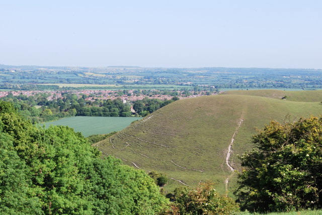
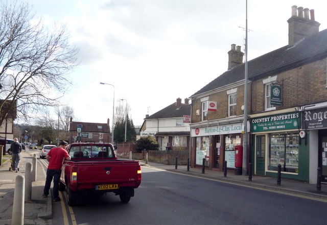
![]() Visit the Barton Hills National Nature Reserve and enjoy peaceful walking trails in the Chilterns. A series of footpaths take you to the attractive downland, chalk grassland, natural springs and beech woodland. It's delightful in the summer months with a variety of wildflowers attracting butterflies such as marbled white and dark green fritillary. Look out for vegetation including wild thyme, horseshoe vetch, marjoram and orchids as you make your way along the paths. It's a great area for wildlife too with lots of different birds and mammals such as ponies, stoats, weasels and hares. You can start your walk from the little town of Barton-le-Clay which lies just to the north of the reserve. Follow the John Bunyan Trail through the town and south to the reserve.
Visit the Barton Hills National Nature Reserve and enjoy peaceful walking trails in the Chilterns. A series of footpaths take you to the attractive downland, chalk grassland, natural springs and beech woodland. It's delightful in the summer months with a variety of wildflowers attracting butterflies such as marbled white and dark green fritillary. Look out for vegetation including wild thyme, horseshoe vetch, marjoram and orchids as you make your way along the paths. It's a great area for wildlife too with lots of different birds and mammals such as ponies, stoats, weasels and hares. You can start your walk from the little town of Barton-le-Clay which lies just to the north of the reserve. Follow the John Bunyan Trail through the town and south to the reserve.
To extend your walking in the area you can follow the John Bunyan Trail and the Icknield Way Path through the surrounding Bedfordshire countryside. The trails can take you east towards Hexton, Pegsdon and Pirton or south towards Luton. The video below shows an exploration of the Barton and Pegsdon Hills from Hexton. From there you can enjoy a climb with wonderful views over the surrounding area.
Also nearby is the village of Streatley and Sundon Hills Country Park near Toddington. This includes the climb to Sharpenhoe Clappers where there is an Iron Age Hillfort and more great views to enjoy.
Postcode
SG5 3JN - Please note: Postcode may be approximate for some rural locationsBarton Hills Ordnance Survey Map  - view and print off detailed OS map
Barton Hills Open Street Map  - view and print off detailed map
Barton Hills OS Map  - Mobile GPS OS Map with Location tracking
Barton Hills Open Street Map  - Mobile GPS Map with Location tracking
Pubs/Cafes
The 19th century Royal Oak in Barton-Le-Clay is a good place for some post walk refreshments. They have good facilites with a car park and a lovely garden area to relax in on warmer days. There's also a good menu and fine selection of real ales. Highly recommended are their delicious pizzas! You can find the pub on the Bedford Road with postcode of MK45 4JX for your sat navs.
Dog Walking
The reserve is an excellent place for a dog walk so you'll probably bump into plenty of other owners on a fine day. There's on lead and off lead areas with the natural springs and streams an ideal place for your dog to splash around. The Royal Oak mentioned above is also dog friendly.
Further Information and Other Local Ideas
The circular Luton Walk visits the reserve from the town. It takes you along a section of the River Lea and also heads to Sharpenhoe Clappers using some of the waymarked trails running through the area. It's a nice way of visiting the reserve from the town's train station.
To the north there's the town of Shefford where there are several local woods to explore including Rowney Warren Wood.
Just to the north there's Silsoe where you can enjoy easy trails around Wrest Park. There's 92 acres of landscaped early eighteenth-century gardens to explore here. You can also enjoy a pleasant stroll around Silsoe village where there are a number of historic properties associated with the park estate.
For more walking ideas in the area see the Bedfordshire Walks and Chilterns Walks pages.
Cycle Routes and Walking Routes Nearby
Photos
Barton Hills, near to Barton-le-Clay, Bedfordshire, Great Britain. View of Barton Hills and Leet Wood


