Bawdsey Walks
![]()
![]() This little village is located in a lovely spot in on the River Deben Peninsula in the Suffolk Coast and Heaths Area of Outstanding Natural Beauty. It includes a pretty quay, a little beach and many pretty old cottages associated with the nearby Bawdsey Manor.
This little village is located in a lovely spot in on the River Deben Peninsula in the Suffolk Coast and Heaths Area of Outstanding Natural Beauty. It includes a pretty quay, a little beach and many pretty old cottages associated with the nearby Bawdsey Manor.
This walk from the village takes you along the Suffolk Coast Path to the nearby resort of Felixstowe. On the way you'll pass the noteworthy Bawdsey Manor where radar research took place early in World War II. Many of the old cottages in the village were built by the Quilter family of Bawdsey Manor in the late nineteenth and early twentieth century as model cottages for their workers.
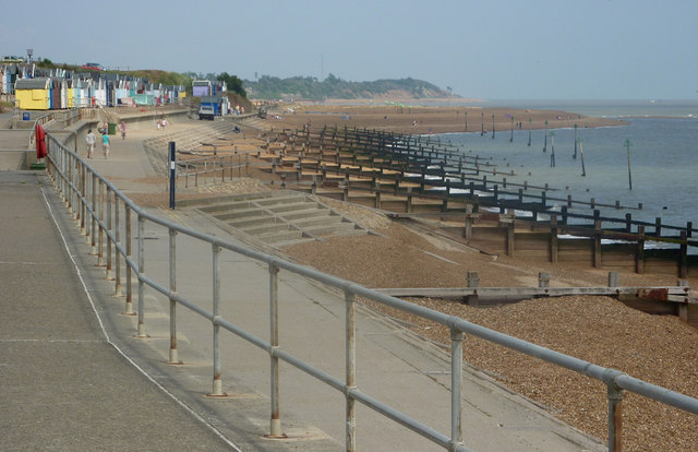
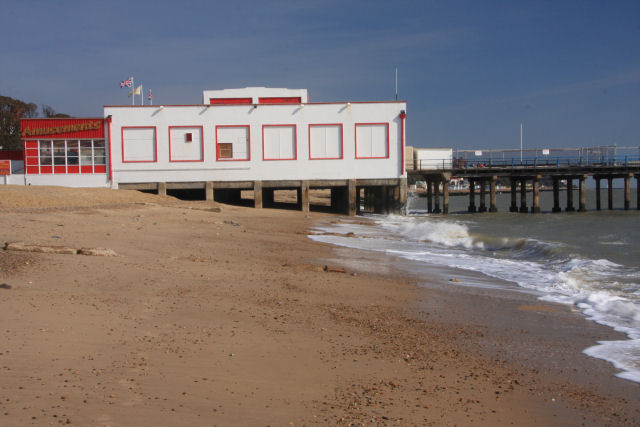
The walk starts from car park just to the east of the village. From here it is a short stroll to the waymarked coastal path which you can follow south west along Bawdsey Beach to Bawdsey Manor. Near here you can catch the Ferry over Woodbridge Haven to Felixstowe Ferry on the other side of the water. The path then heads along the coast at Felixstowe before finishing at the pier.
Bawdsey Ordnance Survey Map  - view and print off detailed OS map
Bawdsey Open Street Map  - view and print off detailed map
Bawdsey OS Map  - Mobile GPS OS Map with Location tracking
Bawdsey Open Street Map  - Mobile GPS Map with Location tracking
Pubs/Cafes
On the route you could stop off at the Ferry Boat Inn at Felixstowe Ferry. It's a historic pub of some note, dating all the way back to 1465. The interior is full of character and includes low beams and a huge wood burner to keep you warm on those winter days. They do very good food and also have a nice beer garden to sit out in on warmer days. You can find the pub at a postcode of IP11 9RZ for your sat navs. The pub is also dog friendly if you have your canine friend with you.
Further Information and Other Local Ideas
Head north along the river and you will soon come to the village of Waldringfield. The village is located right next to the river and includes a 14th century church and a very fine quayside pub.
Just to the north west you can pick up the Ramsholt Walk. This will take you along the eastern side of the river to Methersgate Quay. In Ramsholt there's a pretty quay, a beach and another splendid riverside pub in what is a delightful remote, unspoilt spot. Near the northern end of the walk there's also the National Trust's Sutton Hoo where you can explore a fascinating Anglo-Saxon burial site.
To the north east there's some fine views over Hollesley Bay and Orford Haven on the Shingle Street Walk. The Hollesley and Boyton Marshes Walk can also be picked up in this area.
For more walking ideas in the area see the Suffolk Coast and Heaths Walks and the Suffolk Walks pages.
Cycle Routes and Walking Routes Nearby
Photos
Houses at Bawdsey. These houses are on the east side of the River Deben close to its mouth into the north sea.
Bawdsey Manor. A view from the reinforced sea wall. Built in 1886, it was enlarged in 1895 as the principal residence of Sir William Cuthbert Quilter. The manor is now used for PGL holidays and courses, and has a small museum in the Radar Transmitter Block. It's also notable as the place where radar research took place early in World War II. The manor is located in a fine position at the mouth of the River Deben near Felixstowe Ferry.
Bawdsey Beach. Standing on the shingle spit, Bawdsey Beach and Bawdsey Manor can be seen in the background.
Pulhamite Cliff Walk at Bawdsey Manor. The Cliff Walk at Bawdsey Manor is a 110 metre long artificial cliff built from sand, shale and cement backed by brick. The name comes from the Pulham factory. The Manor's website states that, "at 10 metres high in places it's the biggest sculpture in Suffolk".


