Beaulieu to Bucklers Hard Circular Walk
![]()
![]() Enjoy a waterside walk along the Beaulieu River on this circular walk in the New Forest. The walk first runs from the pretty village of Beaulieu to the little hamlet of Buckler's Hard along a section of the Solent Way long distance footpath.
Enjoy a waterside walk along the Beaulieu River on this circular walk in the New Forest. The walk first runs from the pretty village of Beaulieu to the little hamlet of Buckler's Hard along a section of the Solent Way long distance footpath.
There is a car parking area in Beaulieu where you can start the circular walk. The first section uses flat, waymarked paths and runs for about 2 miles to the hamlet. It's a decent path so is also suitable for a cycle. There are long woodland sections and a delightful end to the walk at the hamlet of Buckler's Hard. It's a special place with a number of pretty Georgian cottages running down to the river and marina. There's also a fascinating Maritime Museum where you can find out all about this 18th century shipbuilding village and the vessels built for Nelson's Navy.
The area is great for birdwatching so look out for the boardwalks leading to the bird hides as you approach Buckler's Hard. There's great views over the marshes and the sea lavender with a wide variety of coastal birds to see.
The route then continues along the Solent Way south and then west before picking up a lovely country lane to East Boldre. From here you follow footpaths north east to return to the car park.
Postcode
SO42 7ZN - Please note: Postcode may be approximate for some rural locationsBeaulieu to Bucklers Hard Circular Walk Ordnance Survey Map  - view and print off detailed OS map
Beaulieu to Bucklers Hard Circular Walk Open Street Map  - view and print off detailed map
*New* - Walks and Cycle Routes Near Me Map - Waymarked Routes and Mountain Bike Trails>>
Beaulieu to Bucklers Hard Circular Walk OS Map  - Mobile GPS OS Map with Location tracking
Beaulieu to Bucklers Hard Circular Walk Open Street Map  - Mobile GPS Map with Location tracking
Pubs/Cafes
At the end of the walk reward yourself with some refreshments at The Master Builder's. The main draw here is the Riverview Restaurant terrace where you can sit outside and enjoy views of over the river and countryside. The hotel also has an interesting maritime history dating back to 1729 when it was built. The most famous tenant was Henry Adams, the Master Builder of ships for Nelson’s Navy, including three of the ships which fought at the Battle of Trafalgar in 1805. Inside there's an olde worlde feel with oak beams and big open fireplaces. You can find them in the village at a postcode of SO42 7XB for your sat navs.
Dog Walking
The river and woodland trails make for a pleasant walk with your dog. The Master Builder's mentioned above is also dog friendly.
Further Information and Other Local Ideas
If you'd like to continue your waterside walking in the area then you could head to the nearby Hatchet Pond. The pretty pond is located just to the west of the village on Beaulieu Heath.
On the opposite side of the river from Buckler's Hard you will find the splendid Exbury Gardens. There's 200 acres of parkland with a wonderful collection of rhododendrons, azaleas, camellias, rare trees and plants.
Continuing west along the Solent Way will take you to the nearby Pylewell Estate where there are some lovely walks along the coast.
For more walking ideas in the area see the New Forest Walks page.
Cycle Routes and Walking Routes Nearby
Photos
Restored mill gutted by fire, Palace Lane, Beaulieu. On 16 March 2006 the restored mill on Palace Lane was gutted by fire. The 16th century mill had undergone five years of restoration and was due to be opened as a tourist attraction. Beaulieu village has its own fire station and engine, situated just behind the mill, but seven engines attended the blaze which is being treated as arson.
The name "Beaulieu" is derived from the French phrase beau lieu, meaning "beautiful place." This name traces back to Beaulieu Abbey, which was founded in the early 13th century by monks from the French abbey of Cîteaux, the mother house of the Cistercian order. The medieval Latin name for the abbey was Bellus Locus Regis, translating to "the beautiful place of the king," highlighting its royal patronage.
During World War II, the Beaulieu Estate in the New Forest, owned by Lord Montagu, became an important site for training Special Operations Executive (SOE) agents. Between 1941 and 1945, group B schools for secret agents operated here, training individuals for covert operations. Among the notable figures involved was Kim Philby, who was later revealed to be a Soviet spy. Today, a special exhibition at the estate commemorates this history, featuring photographs and recordings of former SOE agents and trainers.
The village of Beaulieu remains relatively untouched by modern industrialisation, making it a popular tourist destination. It is also a favourite for birdwatchers, with species like the Dartford warbler, European honey buzzard, and Eurasian hobby frequently spotted in the area.
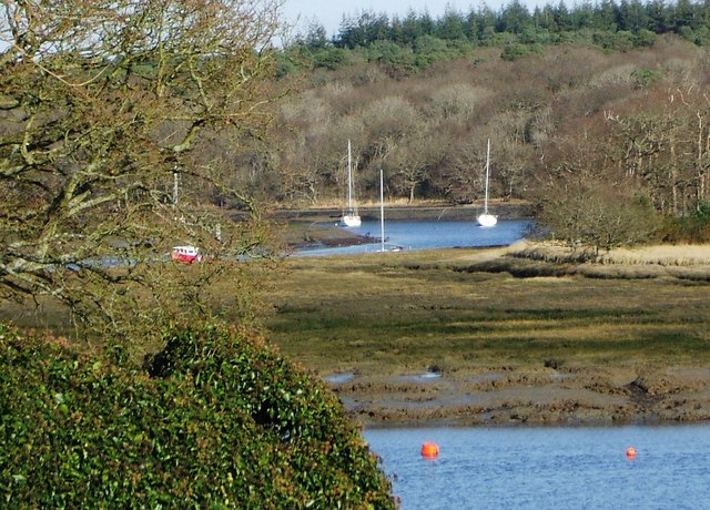
Inlet on the River Beaulieu Estuary. Here seen at high tide, this inlet is formed by a stream running into the Beaulieu River at Jarvis's Copse.
The Beaulieu River originates near Lyndhurst in the New Forest, a region characterised by a landscape of scattered trees and sandy heath soil. The upper reaches of the river are fed by a network of small streams, which form a dendritic drainage basin due to the area's lack of long-standing organic deposits. These streams converge and flow southeast towards the village of Beaulieu, where the river becomes tidal. Historically, the tidal forces powered a tide mill in Beaulieu, which remained operational until 1942.
Below the village, the river is navigable for small craft and flows through Buckler's Hard, once a major shipbuilding hub where ships like Nelson's HMS Agamemnon were constructed. The river eventually meets the Solent at Needs Ore, where its estuary is separated from the sea by Gull Island, a raised salt marsh. Since 2000, the river’s navigable entrance has been marked by the Millennium Lighthouse, also called the Beaulieu River Beacon.
Sea Lavender on the Beaulieu River bank. Looking up river towards the village with Keeping Copse on the left.
River Beaulieu from Bucklers Hard. Standing by the hotel this is the view of the river as it meanders inland.
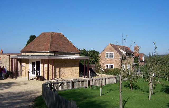
Maritime Museum Building-Bucklers Hard. Here you can find out all about the village's shipbuilding past. You can view models of the Buckler’s Hard ships which took part in the Battle of Trafalgar and Nelson artefacts, including his baby clothes.
Buckler's Hard, originally known as Montagu Town, was established in the early 18th century by the second Duke of Montagu. It was intended to serve as a free port for trade with the West Indies. However, the location's suitability for shipbuilding soon took precedence, as it had access to a sheltered waterway and an abundance of timber from the nearby New Forest.
Crane on the quay at Bucklers Hard. This is here for the tourists to look at - all the modern boat action goes on a little further west at the marina and boatyard. Bucklers Hard was last really active during the preparations for D-day in the Second World War.
Shipbuilding at Buckler's Hard began with James Wyatt, a timber merchant, who secured contracts to build naval vessels, including HMS Surprise and HMS Scorpion, around 1744. Henry Adams, a master shipwright, was sent to oversee the construction, and under his leadership, the shipyard became a prominent builder of Royal Navy ships. Over the following decades, 43 Royal Navy ships were constructed at Buckler's Hard, three of which—HMS Euryalus, HMS Swiftsure, and HMS Agamemnon—participated in the Battle of Trafalgar in 1805.
In the 19th century, shipbuilding at Buckler's Hard waned, but during World War II, the village played a role in the construction of motor torpedo boats and served as a base for landing craft used in the Normandy invasion. Today, Buckler's Hard is a popular tourist destination, featuring a maritime museum and a yachting marina. It also holds significance as the starting and finishing point of Sir Francis Chichester's solo voyage around the world on the Gipsy Moth IV.


