Belvoir Park Forest
![]() This large park in Belfast has some nice woodland trails and views of the River Lagan which runs right through the forest. It is unusual to find a working forest within a city so the area is well worth a visit. The woods have a number of waymarked trails to try with lots of woodland wildlife to look out for. There are also interesting historic sites including the 12th century Norman motte and Ice House.
This large park in Belfast has some nice woodland trails and views of the River Lagan which runs right through the forest. It is unusual to find a working forest within a city so the area is well worth a visit. The woods have a number of waymarked trails to try with lots of woodland wildlife to look out for. There are also interesting historic sites including the 12th century Norman motte and Ice House.
You can start your walk from the forest car park, off Belvoir Drive. From here you can directly pick up the trails through the woodland, meadows and along the river.
To extend your walk simply follow the Ulster Way and the Lagan Towpath along the Lagan to the nearby Lagan Valley Regional Park. The Lagan Towpath will take you through the Lagan Valley to Lisburn.
You're also very close to the splendid Lady Dixon Park which includes more nice footpaths taking you to the arboretum, the Azalea Walk, fountains, a walled garden and a delightful a Japanese-style garden with pretty water features.
Postcode
BT8 7QT - Please note: Postcode may be approximate for some rural locationsBelvoir Park Forest Open Street Map  - view and print off detailed map
Belvoir Park Forest Open Street Map  - Mobile GPS Map with Location tracking
Further Information and Other Local Ideas
For more walking ideas in the area see the Northern Ireland Walks page.
Cycle Routes and Walking Routes Nearby
Photos
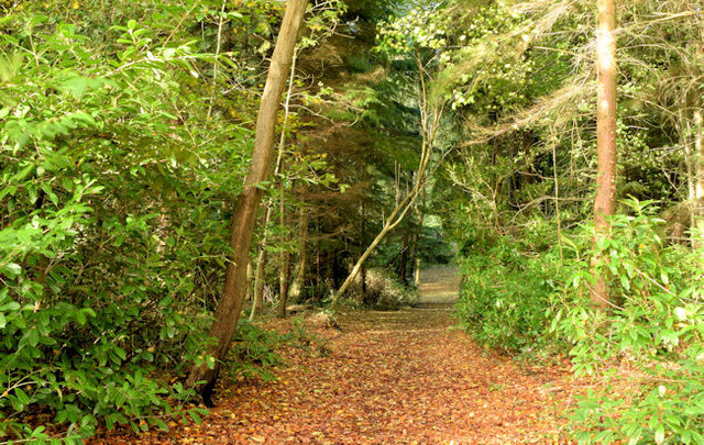
Belvoir forest, Belfast. Belvoir forest is some 185 acres of woodland, in south/south east Belfast, between the Lagan and Newtownbreda. It opened in 1961. The plans for a motorway through it seem to have been abandoned. In this view the path is quite high above the Lagan (well hidden in the valley to the right), close to the entrance from the towpath near the Red Bridge.


