Benthall Hall Walks
![]()
![]() This circular walk near Ironbridge visits the Shropshire village of Benthall and the historic Benthall Hall.
This circular walk near Ironbridge visits the Shropshire village of Benthall and the historic Benthall Hall.
Start the walk from Benthall village where you can pick up footpaths heading north west to the National Trust's Hall. The fine 16th century house is surrounded by parkland and pretty gardens. On the site you'll find a restored plantsman's garden, an old kitchen garden and interesting Restoration church. You can also tour the fine house and learn all about the family history which dates back to the doomsday book.
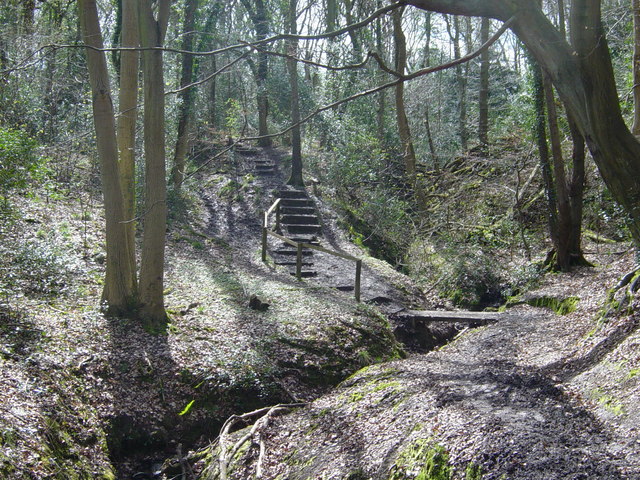
After exploring the hall head north west to enter Benthall Edge Wood where you can pick up Severn Way. Follow the waymarked trail east along the River Severn and it will take you to the famous Ironbridge over the river. At the bridge you turn south to follow country lanes and footpaths back to Benthall.
Postcode
TF12 5RX - Please note: Postcode may be approximate for some rural locationsPlease click here for more information
Benthall Hall Ordnance Survey Map  - view and print off detailed OS map
Benthall Hall Open Street Map  - view and print off detailed map
Benthall Hall OS Map  - Mobile GPS OS Map with Location tracking
Benthall Hall Open Street Map  - Mobile GPS Map with Location tracking
Pubs/Cafes
There's a nice tea room on site where you can enjoy refreshments after your walk.
Further Information and Other Local Ideas
To continue your walking in the area try the Coalbrookdale and Ironbridge Gorge Walk. This visits the fascinating Coalbrookdale Museum which details the history of the area and features stunning exhibits, exquisite art castings and functional cookware all made from iron.
The Shifnal Walk visits the nearby market town before a climb to Lodge Hill for fine views over the Shropshire Hills.
The hall is also close to Telford so you can easily pick up the Telford Walk. The route uses the Silkin Way and the Ironbridge Way to create a circular walk around the town on good waymarked footpaths. Also nearby is the lovely Granville Country Park where there more nice trails to try.
The Wellington Walk starts from the historic market town which lies just north west of Telford. It visits The Wrekin and The Ercall Nature Reserve where there are some striking geological features to admire. The walk start from close to the town's bus station and train station making the area accessible by public transport. The town is also well worth exploring with its historic market and the splendid Victorian house and garden at the National Trust's Sunnycroft to see.
For more walks in the area see the Shropshire Hills Walks page.
Cycle Routes and Walking Routes Nearby
Photos
Benthall Hall, near to Wyke, Shropshire. This fine stone house is situated on a plateau above the gorge of the river Severn.


