Bethesda and Penrhyn Quarry Walk
![]()
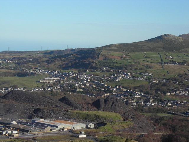
![]() This former slate quarrying village sits in a dramatic location on the edge of the Snowdonia National Park in the valley of the River Ogwen.
This former slate quarrying village sits in a dramatic location on the edge of the Snowdonia National Park in the valley of the River Ogwen.
This circular walk explores the old Penrhyn Quarries. The quarries are located just to the south of the village and include some fine views over the village from the high points. It's a photogenic area with the dramatic steep quarry faces and unusually coloured lakes formed from old gravel pits.
The quarry is of some historical significance as at the end of the nineteenth century it was the world's largest slate quarry. On the walk there are also some nice riverside trails along the River Ogwen which runs through the area.
The quarry is home to Zip World where you can enjoy an exhilarating ride on the fastest zip line in the world. Here you can fly 500m above the bright blue quarry lake and learn all about the history of the quarry on the Penrhyn Quarry Tour.
You can extend the walk by picking up the Snowdonia Slate Trail. This circular long distance trail takes you through the Snowdonia National Park visiting more of the heritage mining sites in the area. Follow the trail south for a few miles would take you to Padarn Country Park where you can explore the Dinorwic Quarry and climb the splendid zig zag path at Llyn Peris.
Bethesda Ordnance Survey Map  - view and print off detailed OS map
Bethesda Open Street Map  - view and print off detailed map
Bethesda OS Map  - Mobile GPS OS Map with Location tracking
Bethesda Open Street Map  - Mobile GPS Map with Location tracking
Pubs/Cafes
The Blondin Restaurant is located at the zip world attraction at the quarry. You can enjoy a fine range of meals with wonderful views over the quarry.
Further Information and Other Local Ideas
The Lon Las Ogwen cycle route passes through the area. The off road trail will take you north to the coast at Bangor or south to the glacial valley of Nant Ffrancon and Llyn Ogwen with its stunning waterfall. It runs mostly along old railway paths and the River Ogwen. The route is also suitable for walkers.
For more walking ideas in the area see the Snowdonia Walks page.
Cycle Routes and Walking Routes Nearby
Photos
View from Penybryn Road, Bethesda, Gwynedd, toward Arafa Don in the High Street. Arafa Don was built in 1840 as the Congregational Capel Bethesda, replacing a less ornate building of 1823. the town is named after the chapel. The chapel is now an apartment building.


