Beverley Beck
![]()
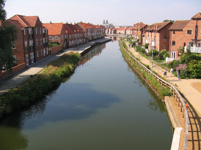
![]() Enjoy a short stroll along the Beverley Beck on this easy walk in the Yorkshire town. There's a nice footpath running along the pretty beck which you can pick up just to the east of the Minster and train station. The path runs for just under a mile until it joins with the River Hull. Here you can extend the walk by following riverside paths south toward Woodmansey or north to Tickton. See our River Hull Walk for more details on this.
Enjoy a short stroll along the Beverley Beck on this easy walk in the Yorkshire town. There's a nice footpath running along the pretty beck which you can pick up just to the east of the Minster and train station. The path runs for just under a mile until it joins with the River Hull. Here you can extend the walk by following riverside paths south toward Woodmansey or north to Tickton. See our River Hull Walk for more details on this.
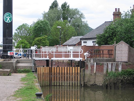
On the way you'll enjoy the tranquil waters of the beck, flanked by attractive woodland and new housing. At the eastern end you'll come to the lock gates near its junction with the River Hull. The lock gates and pumping station were restored in early 2007 and make for a nice photo.
At the end of the beck the route heads back towards the town centre on the same paths.
To continue your walking in the area pick up the Beverley Twenty long distance circular walk and explore the countryside surrounding the town.
Beverley Beck Ordnance Survey Map  - view and print off detailed OS map
Beverley Beck Open Street Map  - view and print off detailed map
Beverley Beck OS Map  - Mobile GPS OS Map with Location tracking
Beverley Beck Open Street Map  - Mobile GPS Map with Location tracking
Further Information and Other Local Ideas
Head south west and you could visit the neighbouring village of Skidby. The main attraction here is the Grade II listed Skidby Mill which dates back to 1821. The working mill includes an interesting museum and a fine restaurant with a landscaped garden.
A few miles north of Beverley there's the lovely Tophill Low Nature Reserve to explore. The reserve includes two pretty reservoirs and easy footpaths along the River Hull. It's a great place for birdwatching with several hides dotted around the site. Near here is also the worthy vlllage of Brandesburton with its medieval church and historic 16th century pub
For more walking ideas in the area see the Yorkshire Wolds Walks page.
Cycle Routes and Walking Routes Nearby
Photos
The inner lock gates at the eastern end of Beverley Beck near its junction with the River Hull. The lock gates and pumping station were restored in early 2007. Beverley Beck was improved into a navigable canal to allow barges and other shipping to travel into the centre of Beverley.


