Bishop's Castle Ring Circular Walk
![]()
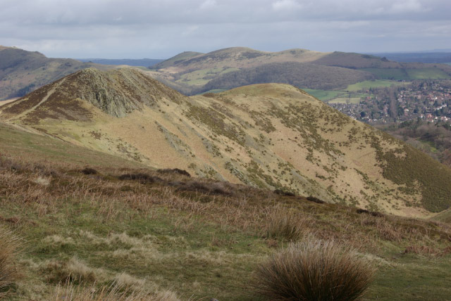
![]() This long circular walk encircles the historic market town of Bishop's Castle in Shropshire. The walk first heads to Clun with it’s Norman castle, church and interesting houses. You continue to Aston-on-Clun and then to the spectacular Long Mynd (video below). This heathland plateau forms part of the Shropshire Hills Area of Outstanding Natural Beauty and is owned by the National Trust. The views are spectacular, making this section one of the walk highlights.
This long circular walk encircles the historic market town of Bishop's Castle in Shropshire. The walk first heads to Clun with it’s Norman castle, church and interesting houses. You continue to Aston-on-Clun and then to the spectacular Long Mynd (video below). This heathland plateau forms part of the Shropshire Hills Area of Outstanding Natural Beauty and is owned by the National Trust. The views are spectacular, making this section one of the walk highlights.
The next section takes you to the rocky Stiperstones and The Bog lead mines, which are of great historical interest. The final section runs through Stapeley Common to the ancient stones of Mitchell's Fold before heading through Saddlers Little Wood and returning to Bishop’s Castle. This section also passes the eye catching Corndon Hill which sits on the border between England and Wales.
The walk is waymarked with a green and yellow disc.
Bishop's Castle Ring Ordnance Survey Map  - view and print off detailed OS map
Bishop's Castle Ring Open Street Map  - view and print off detailed map
Bishop's Castle Ring OS Map  - Mobile GPS OS Map with Location tracking
Bishop's Castle Ring Open Street Map  - Mobile GPS Map with Location tracking
Pubs/Cafes
In Bishops' Castle there's the characterful Three Tuns Inn. It's a historic pub of some note, dating all the way back to 1642. The associated brewery is possibly the oldest in the country, with records showing that King Charles 1st issued the first brewing licences in that year to raise funds to pay for his army fighting the civil war. It's a cosy place with an excellent selection of real ales. You can find the pub at Salop Street with a postcode of SY9 5BW. The pub is also dog friendly.
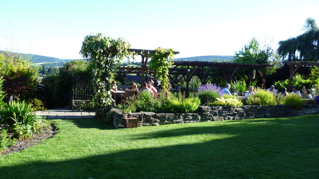
In Clun you could stop off at The White Horse Inn for some refreshments on your walk. The 16th century inn has a lovely garden area where you can relax and enjoy a meal on a sunny day. You can find the inn on The Square at a postcode of SY7 8JA for your sat navs. It's also dog friendly if you have your canine friend in tow. The Sun Inn on the High Street is another good option, dating all the way back to the 15th century. It has a real old world feel and also has a nice garden area.
Just east of Hopton Castle there's the lovely Wood 'n' Ribbon cafe. The cafe serves delicious sandwiches and cakes in their tempting afternoon tea. There's also a lovely outdoor area with animals including goats, hens and ponies. The eclectic site provides accommodation in the shape of quality glamping pods too. You can find them at Oakheath, station yard, Hoptonheath SY7 0QD.
In this area you can also visit the ruins of the mediaeval Hopton Castle which was besieged in a battle of the English Civil War during 1644.
Further Information and Other Local Ideas
The wonderful Kerry Ridgeway starts/finishes in the town and is another great walking option. It will take you west to Powys along a ridge top overlooking Wales on the one side and England on the other.
For more walking ideas in the area see the Shropshire Walks page.
Cycle Routes and Walking Routes Nearby
Photos
Elevation Profile


