Blakey Topping
![]()
![]() This circular walk climbs to the Blakey Topping standing stones and hill top in the North York Moors.
This circular walk climbs to the Blakey Topping standing stones and hill top in the North York Moors.
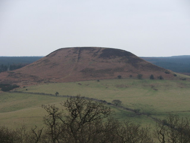
The walk starts from the Crosscliff car park and view point on the northern edge of Dalby Forest. There's nice views from here towards the hill which lies a couple of miles to the north west. From the car park head north west through Crosscliff Wood to the Old Keeper's House with views of the Crosscliff Beck on the way. You then head across Thompson's Rigg before climbing to the ancient standing stones and then on to the hill top which stands at a height of 267 metres. From here there are great views over the hills and countryside of the National Park.
The route then descends to Newgate Foot before turning south east along Newgate Moor. A final woodland section through Crosscliff Brow returns you to the car park.
Postcode
YO18 7LR - Please note: Postcode may be approximate for some rural locationsBlakey Topping Ordnance Survey Map  - view and print off detailed OS map
Blakey Topping Open Street Map  - view and print off detailed map
Blakey Topping OS Map  - Mobile GPS OS Map with Location tracking
Blakey Topping Open Street Map  - Mobile GPS Map with Location tracking
Further Information and Other Local Ideas
Just to the west of the car park you can visit another local highlight at the Bridestones. The wonderful Hole of Horcum is also located nearby.
For more walking ideas in the area see the North York Moors Walks page.
Cycle Routes and Walking Routes Nearby
Photos
Blakey Topping. When the giant, Wade, scooped out the Hole of Horcum and threw the contents (at his wife?) they landed a mile and a half away and are now known as Blakey Topping.


