Bolton le Sands Walks
![]()
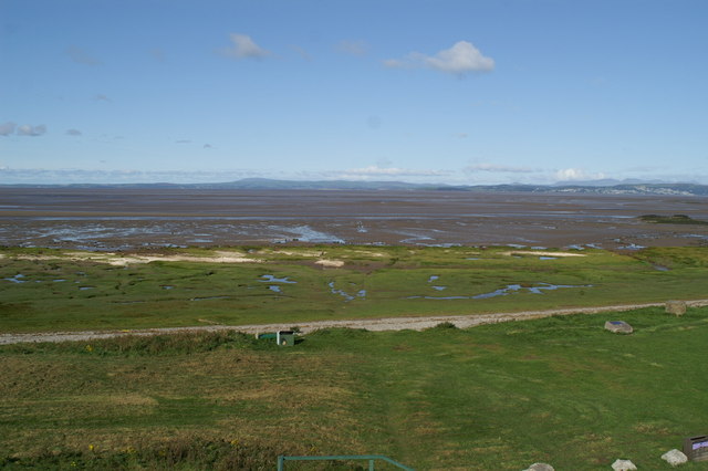
![]() This pleasant Lancashire based village is a fine place to visit and start a walk from. There's canalside paths and some lovely coastline where you can look out for birds such as Cormorants, Curlews, Lapwings and Oystercatchers. There's also a number of nice pubs and a noteworthy church dating back to 1500.
This pleasant Lancashire based village is a fine place to visit and start a walk from. There's canalside paths and some lovely coastline where you can look out for birds such as Cormorants, Curlews, Lapwings and Oystercatchers. There's also a number of nice pubs and a noteworthy church dating back to 1500.
This route from the village uses sections of the Lancaster Canal and the Lancashire Coastal Way to create a circular walk around the settlement.
The walk starts on the canal in the village and heads south along the towpath towards Bolton Town End and Hest Bank. Here you leave the canal to head towards the coast at the Morecambe Bay National Nature Reserve where there's a large variety of wildlife to look out for. The Lancashire Coastal Way will then take you north to Red Bank, Wild Duck Hall and The Old Mill where you follow a lane back into the village.
Postcode
LA5 8DQ - Please note: Postcode may be approximate for some rural locationsBolton le Sands Ordnance Survey Map  - view and print off detailed OS map
Bolton le Sands Open Street Map  - view and print off detailed map
Bolton le Sands OS Map  - Mobile GPS OS Map with Location tracking
Bolton le Sands Open Street Map  - Mobile GPS Map with Location tracking
Walks near Bolton le Sands
- Lancaster Canal - Follow the Lancaster Canal from Preston, in Lancashire, to Kendal, in Cumbria, on this splendid waterside walk or cycle
- Lancashire Coastal Way - Travel along the beautiful Lancashire coast from Silverdale to Freckleton on this fairly easy walk.
You start off at Silverdale and head south to Morecambe Bay passing Warton and Bolton le Sands - Morecambe Bay - Enjoy a visit to the Morecambe Bay Nature Reserve and a stroll along the Lancaster Canal on this circular cycle or walk in Lancashire
- Lancaster Circular Walk - This 10 mile circular walk makes use of three of the long distance trails which run through the area surrounding the city
- Lancaster to Caton - This easy short ride or walk follows the River Lune and National Cycle route 69 from Lancaster to Caton
- Lune Estuary Footpath - Explore the beautiful River Lune Estuary on this waterside walk near Lancaster
- Lune Valley Ramble - This lovely easy walk follows the River Lune from Lancaster to Kirkby Lonsdale in Cumbria
Pubs/Cafes
The Royal Hotel is a good choice for some post walk refreshments. The inn is located in a fine spot next to the canal so you can enjoy your meal in the nice garden area by the water. They serve good quality food and can be found at postcode LA5 8DQ for your sat navs.
Dog Walking
The canal and coast on the route make for a fine dog walk. The Royal Hotel mentioned above is also dog friendly.
Further Information and Other Local Ideas
If you head north along the coast path or the canal you will soon come to the neighbouring town of Carnforth.
To the south are the towns of Morecambe and Heysham where you can visit the delightful Sunderland Point. It's a lovely place for a walk with coastal views, salt marsh, beach, mud flats, farmland and lots of wildlife to look out for. There's also a series of attractive Georgian houses by the quay.
For more walking ideas in the area see the Lancashire Walks page.


