Brightlingsea Walk
![]()
![]() This attractive coastal town is located in the Tendring district of Essex. There's some lovely walking trails along the Colne Estuary to enjoy here.
This attractive coastal town is located in the Tendring district of Essex. There's some lovely walking trails along the Colne Estuary to enjoy here.
This circular walk takes you along the River Colne before exploring the countryside to the north west of the town. The route runs for just under 7 miles on a series of flat footpaths. There's long waterside sections along the river with plenty of water loving wildlife to look out for on the way.
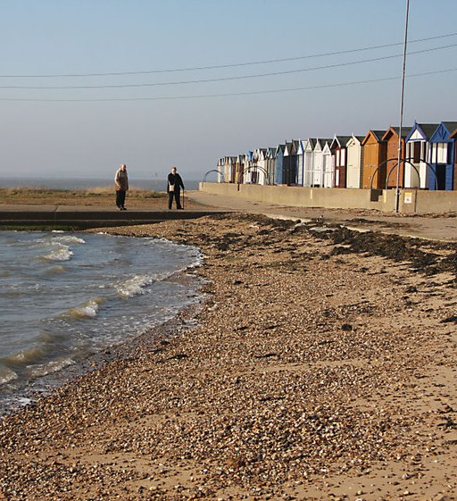
The walk starts from the public car park next to the river at Bateman's Tower. The 19th century tower is located at the entrance to Brightlingsea Creek at Westmarsh Point. Here you'll also find a beach, lined with a number of beach huts. You can then pick up a footpath running north west along the river. There are fine views over Brightlingsea Marsh where you can look out for a wide variety of birdlife. Information boards on the path will tell you all about the marsh and the associated Colne Estuary National Nature Reserve.
The trail eventually comes to Alresford Creek then loops back through the countryside before passing through the town. You can then enjoy a stroll along the pretty Brightlingsea Creek before passing the Boating Lake and returning to the car park. At Alresford Creek you have the option of crossing the creek and continuing north to visit the little village of Alresford. There is a train station here if you would like to visit the area by public transport.
Brightlingsea Ordnance Survey Map  - view and print off detailed OS map
Brightlingsea Open Street Map  - view and print off detailed map
Brightlingsea OS Map  - Mobile GPS OS Map with Location tracking
Brightlingsea Open Street Map  - Mobile GPS Map with Location tracking
Pubs/Cafes
The Rosebud Pub & Seafood Restaurant is a good choice for some post walk refreshments. They do great food and also have an outdoor seating area with sea views. It's a fine place to relax in if the weather is good. You can find it at 66 Hurst Green with a postcode of CO7 0EH for your sat navs.
Dog Walking
The sea wall is a fine place for a bracing walk with your dog. The Rosebud Pub mentioned above allows dogs in the garden area.
Further Information and Other Local Ideas
The Wivenhoe to Brightlingsea Walk starts/finishes in the town. It will take you north along the Colne to the pretty Alresford Creek and the neighbouring town of Wivenhoe. Here you can pick up the Wivenhoe Trail and follow it into Colchester. The noteworthy Fingringhoe Wick Essex WT reserve is also located in this area. The site is one of the finest nature reserves in the country and the first to be taken under the care of Essex Wildlife Trust. There's some lovely trails taking you around the marshland, lakes and heathland at the reserve. It's a great area for bird watching with many different species to observe.
On the other side of the river there are also nice walks on Mersea Island which includes the lovely Cudmore Grove Country Park.
Cycle Routes and Walking Routes Nearby
Photos
Built in 1883 by John Bateman as a folly for his daughter to recuperate from consumption. The tower is sited on Westmarsh point at the entrance to Brightlingsea Creek on the River Colne. In 2005 restored and now used for sailing race administration.
Boating Lake, Brightlingsea. Dug out of the salt marsh in the 1930s, the lake is about a metre deep. It is topped up with sea water at high tide from sluices direct from the beach. The lack of fresh water has led swans and some ducks to walk their chicks away from the lake in search of other fresh water ponds.
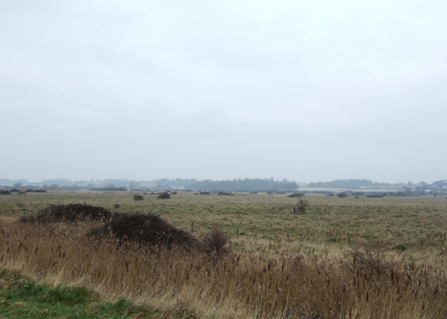
West Marsh. Looking inland from the path along the sea wall towards the Great Divide on a particularly raw and dark spring morning. The reserve is mainly wet grassland, with areas of scrub and reedbed and is supports a high population of wading birds.


