GPS Cycle and Walking Routes

Broch of Gurness

0.62 miles (1 km)

Visit this Iron Age broch village on Mainland Orkney and learn about its fascinating history stretching back over 2000 years.
There are also wonderful coastal views over the Eynhallow Sound to enjoy from this photogenic spot.
You can start the walk from the public car park at the Point at Hellia.

Postcode

KW17 2NH - Please note: Postcode may be approximate for some rural locations

Broch of Gurness OS Map - Mobile GPS OS Map with Location tracking

Broch of Gurness Open Street Map - Mobile GPS Map with Location tracking

Photos

Broch of Gurness - geograph.org.uk - 231945

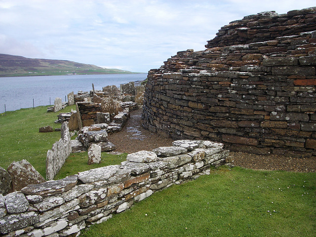
Broch of Gurness. Looking northwest towards Rousay.

Broch of Gurness - geograph.org.uk - 33183

Broch of Gurness

Broch of Gurness - geograph.org.uk - 181835

Showing the thickness of the main broch wall.

Pictish Village, Broch of Gurness - geograph.org.uk - 488652

Pictish Village, Broch of Gurness Drystane walls, cupboards, walls, etc abut the neolithic broch which was inhabited by both Picts and Vikings. The stone huts coalesce into an amorphous mass around the broch.

Video

GPS Files

GPX File

Broch of Gurness.gpx (On Desktop:Right Click>Save As. On Ipad/Iphone:Click and hold>Download Linked File)

Memory Map Route

Broch of Gurness.mmo (On Desktop:Right Click>Save As. On Ipad/Iphone:Click and hold >Download Linked File)