Buckfastleigh and Buckfast Abbey
![]()
![]() This short walk from the town of Buckfastleigh takes you through the countryside to Buckfast Abbey. It's about a 1.5 mile walk passing the remains of the old chapel and phreatic maze cave system of Bakers Pit. You'll follow a mixture of quiet country lanes and public footpaths to the historic abbey. The site includes attractive grounds with a series of lovely gardens and an old water mill.
This short walk from the town of Buckfastleigh takes you through the countryside to Buckfast Abbey. It's about a 1.5 mile walk passing the remains of the old chapel and phreatic maze cave system of Bakers Pit. You'll follow a mixture of quiet country lanes and public footpaths to the historic abbey. The site includes attractive grounds with a series of lovely gardens and an old water mill.
At the abbey you can enjoy a peaceful stroll through the Lavender garden, Physic garden and Sensory garden. There's also a lovely restaurant with outdoor seating and views of the abbey.
This walk starts in the centre of Buckfastleigh but you could also start from the railway station which is on the South Devon Railway. The splendid heritage railway can be picked up in Totnes and runs for about 6 miles with nice views over the River Dart.
After exploring the fascinating old abbey the route returns to Buckfastleigh on the same paths.
The abbey is the start point for the Abbot's Way long distance trail which will take you through the Dartmoor National Park to the ruins of Tavistock Abbey 22 miles to the west.
The abbey sits on the fringes of Hembury Woods which is a great place to extend your walk. The site includes Hembury Castle Iron Age Hillfort and a series of shady woodland trails.
The long distance Dartmoor Way passes just to the east of the abbey grounds. The trail will take you north to Ashburton where you can enjoy nice riverside paths along the River Ashburm. Heading west will take you to the village of Scoriton.
Please click here for more information
Buckfastleigh and Buckfast Abbey Ordnance Survey Map  - view and print off detailed OS map
Buckfastleigh and Buckfast Abbey Open Street Map  - view and print off detailed map
Buckfastleigh and Buckfast Abbey OS Map  - Mobile GPS OS Map with Location tracking
Buckfastleigh and Buckfast Abbey Open Street Map  - Mobile GPS Map with Location tracking
Further Information and Other Local Ideas
Enjoy a ride on the South Devon Railway as an extension to your outing. The heritage railway can be picked up at Buckfastleigh Station and runs for about 6 miles with nice views over the river valley. It was initially known as the Dart Valley Railway and stretches from Totnes (Riverside) to Buckfastleigh. For most of its route, the line runs to the east or north of the River Dart. This means that the river views are best seen to the left of the train when facing Buckfastleigh and to the right of the train when facing Totnes. For steam train enthusiasts the rolling stock preserved on the line include many examples of steam locomotives typical of the Great Western Railway. These include GWR 1400 Class number 1420. There are also other types of steam locomotives and a number of diesel locomotives.


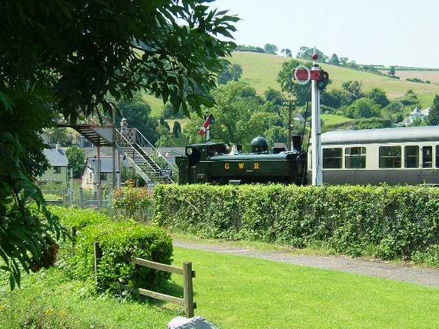
Pictured above the South Devon Railway at Buckfastleigh. On the right former Great Western Railway locomotive No. 5786 and train awaiting departure for Totnes in an idyllic rural setting on a warm Sunday afternoon. It's a fine way to relax and enjoy the beautiful scenery of the area.
Just a few miles north west of the town there's a bit of a hidden gem at Venford Reservoir. The pretty little reservoir has a nice circular walking trail and a secluded waterfall.
To the west there's the impressive Avon Dam Reservoir. Here you'll find a fine walk running along the River Avon up to the lake where there's a photogenic dam and some excellent views. The circular South Brent Walk visits the site from the neighbouring village to the south west. It will take you along the River Avon to the dam before returning along the old tramway to the west. The walk is a good option if you would like a longer route through the area. Historic South Brent is also worth exploring with a Norman church and a fine local pub dating back to medieval times.
For more walking ideas in the area see the Dartmoor Walks and Devon Walks pages.


