Burlingham Woods
![]()
![]() These pretty woods are located just east of Norwich near the villages of Acle and Brundall.
These pretty woods are located just east of Norwich near the villages of Acle and Brundall.
The peaceful site is a lovely place for an easy stroll with carpets of snowdrops in Ferbruary and lots of bluebells in the spring months.
You can start your walk at the car park close to St Andrew's church in the village of North Burlingham. Then follow the footpaths north towards Burlingham Green and the Millennium Wood. Head east from here and there's more trails through the Belt Plantation where there's a small pond.
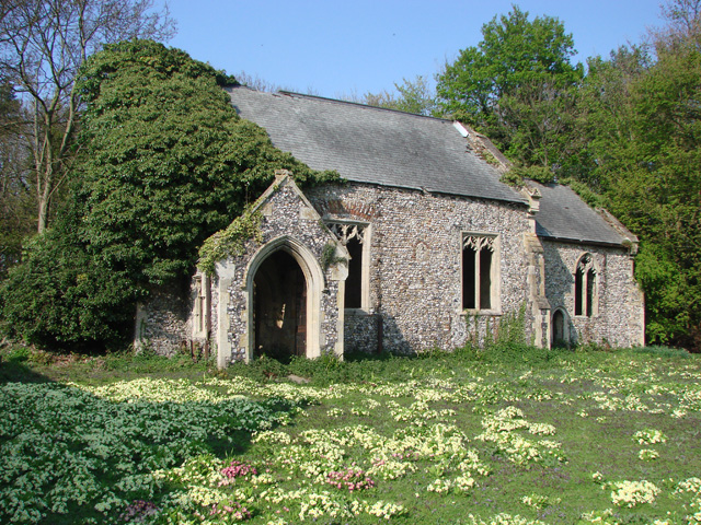
Just to the east of the car park there's also the ancient ruined church of St Peter to see. You can explore the interesting medieval ruins which date back to the 14th century.
Postcode
NR13 4TA - Please note: Postcode may be approximate for some rural locationsBurlingham Woods Ordnance Survey Map  - view and print off detailed OS map
Burlingham Woods Open Street Map  - view and print off detailed map
Burlingham Woods OS Map  - Mobile GPS OS Map with Location tracking
Burlingham Woods Open Street Map  - Mobile GPS Map with Location tracking
Dog Walking
The woods are ideal for a dog walk and many people take their four legged friend for a stroll here.
Further Information and Other Local Ideas
Just to the south you can explore Strumpshaw Fen. The RSPB reserve has some lovely trails and lots of wildlife to see.


