Burnham Beeches Cycling and Walk Map
![]()
![]() This hugely popular National Nature Reserve and woods has miles of good walking trails to try. The area consists mostly of beech woodland with lots of peaceful footpaths to follow. There's also ponds, streams, grassland and heathland with over 500 acres to explore.
This hugely popular National Nature Reserve and woods has miles of good walking trails to try. The area consists mostly of beech woodland with lots of peaceful footpaths to follow. There's also ponds, streams, grassland and heathland with over 500 acres to explore.
The reserve is great for wildlife too. Look out for Exmoor Ponies, Berkshire Pigs, Jacob Sheep and grazing cattle. Facilities are very good with a car park off Lord Mayors Drive and a nice cafe.
Burnham Beeches proximity to London and the beauty of the area attracts over half a million visitors per year. It has been used as a film location for Robin Hood, Prince of Thieves and Harry Potter and the Deathly Hallows - Part 1.
Please note this circular route is devised for walkers but cyclists can enjoy a network of tarmac surfaced roads, the majority of which are closed to cars. Please note off road cycling is not permitted in the reserve.
If you'd like to extend your outing then you can pick up the Beeches Way which runs through the reserve. If you head east you'll come to Farnham Common and Stoke Common where you'll find attractive Gorse and Heather heathland. If you follow the trail west it will take you to Cookham and the delightful Cliveden House. The Italianate mansion is surrounded by beautiful parkland and gardens with miles of walking trails and views of the River Thames.
Postcode
SLSL2 3LB - Please note: Postcode may be approximate for some rural locationsBurnham Beeches Ordnance Survey Map  - view and print off detailed OS map
Burnham Beeches Open Street Map  - view and print off detailed map
*New* - Walks and Cycle Routes Near Me Map - Waymarked Routes and Mountain Bike Trails>>
Burnham Beeches OS Map  - Mobile GPS OS Map with Location tracking
Burnham Beeches Open Street Map  - Mobile GPS Map with Location tracking
Pubs/Cafes
At the visitor centre there's a lovely tea room where you can sit outside in a wooded glade. There's light bites, nice cakes and ice cream to refresh yourself here after your exercise.
If you would like to sample one of the local pubs we recommend the splendid Blackwood Arms Country Pub. There's great food, a cosy fire indoors, and a delightful garden area with nice views of the countryside. It's perfect for relaxing in on warmer days. You can find the pub at address Common Lane, Littleworth Common, with a postcode of SL1 8PP for your sat navs.
Dog Walking
The reserve is a great place to walk your dog with miles of wide tracks and some off lead areas. The on site cafe mentioned above is also dog friendly with water bowls provided.
Further Information and Other Local Ideas
Just a few miles to the east there's three more highlights of the area at Langley Park Country Park, Stoke Poges Common and Black Park Country Park. Langley Park's rhododendron gardens and Arboretum are particularly lovely.
If you follow the Beeches Way north west you could visit the village of Wooburn Green. There's a pleasant large green here with a number of historic properties including a 16th century public house. There's also a pretty local park with walks along the River Wye and peaceful adjacent woodland.
Cyclists can pick up National Cycle Route 461 in nearby Farnham Common. The signed Sustrans route will take you south to Windsor via Slough, Eton and the Jubilee River.
Cycle Routes and Walking Routes Nearby
Photos
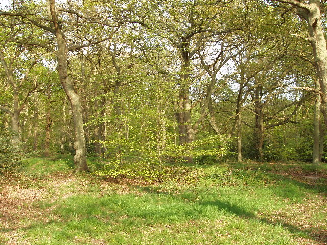
Burnham Beeches Woodland. The site is dominated by ancient pollarded beech and oak trees, some of which are over 400 years old. These trees provide habitats for rare fungi, mosses, lichens, and insects, including saproxylic beetles that depend on decaying wood. In spring, carpets of bluebells, wood anemones, and wild garlic bloom, while the autumn brings a stunning display of changing leaves alongside an array of mushrooms and toadstools, some of which are rare and protected species. Other plants include holly, hawthorn, and bracken, which form dense undergrowth in parts of the wood.
Middle Pond. This pond and the Upper Pond are both man-made having been created by damming across a small stream that flows south-westwards out of the woodland of Burnham Beeches.
The ponds and wetlands attract dragonflies, damselflies, and amphibians like common frogs and newts, while butterflies such as the white admiral and purple hairstreak add to the vibrant summer scene.
The area also supports mammals such as foxes, badgers, and bats, including the noctule and soprano pipistrelle. Birdwatchers can spot nuthatches, treecreepers, and woodpeckers among the trees, as well as sparrowhawks hunting above the canopy.
The Druids Oak. This is considered to be the oldest living tree in Burnham Beeches, a pollarded oak that is probably at least 800 hundred years old. It was probably named during the penchant for naming things in Victorian times and old photographs from this era reveal that its overall shape has not changed greatly in the last hundred years or more. It can be found on the south-east side of the Lord Mayors Drive, so named because the City of London own and manage the woodland.
This massive old tree stump is about 12 feet high and must be the remains of an old tree that thrived here several hundreds of years ago. It can be found just to the east of Middle Pond.


