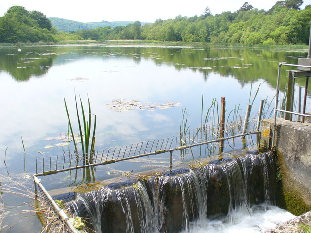
Burton Mill Pond
![]()
![]() This walk visits Burton Mill Pond and Chingford Pond near Duncton in West Sussex.
This walk visits Burton Mill Pond and Chingford Pond near Duncton in West Sussex.
The two adjacent ponds include some pleasant waterside walking trails. There's a car park at the northern end of the site at Burton Mill Pond where you can start the circular walk.
Keep your eyes peeled for a variety of wildlife around the ponds. Birdlife includes bitterns, warblers, and various wildfowl.
The Serpent Trail runs between the two ponds. You could pick up this waymarked walk and follow it west to visit Graffham Common and Lavington Common.
Burton Mill Pond Ordnance Survey Map  - view and print off detailed OS map
Burton Mill Pond Open Street Map  - view and print off detailed map
Burton Mill Pond OS Map  - Mobile GPS OS Map with Location tracking
Burton Mill Pond Open Street Map  - Mobile GPS Map with Location tracking
Further Information and Other Local Ideas
More Information about the site:
The pond is part of the larger Burton Park Site of Special Scientific Interest (SSSI), nationally recognised for its diverse wetland habitats, rare flora, rich birdlife, and thriving invertebrate communities. Chingford Pond, in close proximity, holds the status of a Site of Nature Conservation Importance (SNCI).
This tranquil body of water is adorned with floating yellow water lilies and surrounded by dense reedbeds. These reeds provide shelter for wintering bitterns and are a nesting ground for Reed Warblers. Burton Mill Pond is a notable Sussex location for spotting Cowbane, an uncommon member of the carrot plant family.
The pond is also flanked by carr woodland, an environment characterised by waterlogged conditions ideal for alder and willow trees. This unique habitat supports the breeding of Woodcock, and attracts various birds like Gadwall, Teal, Great Crested and Little Grebes, and Kingfishers, drawn to the blend of open water and rich surrounding habitats.
During the Elizabethan era, this region was renowned for its extensive iron-making industry. Local blast furnaces produced brittle cast iron, which was then transformed into a more robust material. To achieve this, the streams at Burton were dammed to create a 'hammer pond', which supplied the necessary water power to operate a forge's water wheel. This water wheel was essential for powering bellows and large mechanical hammers. These hammers, delivering up to 150 blows per minute, forged the iron into short, thick bars known as anconies.
By the 1780s, the pond underwent a significant shift in usage. The water power, previously harnessed for iron forging, was repurposed for grinding corn in a water mill. This mill, now a private residence, still stands and is a visible reminder of the area's rich industrial past.


