Burwash Walks
![]()
![]() This picturesque East Sussex based village is surrounded by some lovely High Weald countryside.
This picturesque East Sussex based village is surrounded by some lovely High Weald countryside.
This circular walk from the village visits the National Trust's Bateman's, just to the south west of the settlement. The fine 17th century Jacobean house was the home of author Rudyard Kipling during the early part of the 20th century. You can explore the house and the surrounding gardens with views of the High Weald countryside to enjoy on the way.
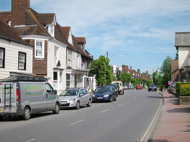
The walk starts at the car park in the village centre and heads east along the High Street before turning south along Bateman's Lane. This will lead you to the fine country house which you can explore for a fee.
The route then heads east towards Dudwell Farm which is located close to the Dudwell River. You then turns north to return to the village.
Postcode
TN19 7EA - Please note: Postcode may be approximate for some rural locationsBurwash Ordnance Survey Map  - view and print off detailed OS map
Burwash Open Street Map  - view and print off detailed map
Burwash OS Map  - Mobile GPS OS Map with Location tracking
Burwash Open Street Map  - Mobile GPS Map with Location tracking
Walks near Burwash
- Darwell Reservoir - Explore Darwell Reservoir and Darwell Wood on this walk near Mountfield in East Sussex
- Bewl Water - This is a walking and cycling route around the beautiful Bewl Water reservoir near Lamberhurst
- Bodiam Castle - This 14th century moated castle in Sussex is one of the National Trust's most visited properties
- Scotney Castle - Explore the 770 acres of woodland and parkland surrounding this 14th century moated castle near Tunbridge Wells
- Wadhurst - This East Sussex town is in a good location for exploring the High Weald AONB on foot
- Bedgebury Forest - Bedgebury is a great place for cyclists with miles of family cycle tracks and a more challenging mountain bike trail
- Heathfield - This East Sussex market town is in a good location for exploring the woods and countryside of the High Weald
- Cranbrook - This pretty Kent based town is surrounded by some lovely High Weald countryside and several large areas of woodland
- Goudhurst - This pretty Kent based village is located in a fine spot in the Weald
- Crowborough - The town of Crowborough is nicely positioned for exploring the expansive Ashdown Forest and the High Weald AONB
- Brede High Woods - This large area of ancient woodland consists of hundreds of acres of walking trails, a variety of wildlife and the pretty Powdermill Reservoir
- Eridge Rocks - This fascinating nature reserve in Tunbridge Wells contains a series of large boulders and mixed woodland
- Lamberhurst - This Kent based village has some nice walking trails through the valley of the River Teise and two noteworthy historic ruins to visit nearby
Pubs/Cafes
Back in the village head to the Rose and Crown for some post walk refreshment. The attractive pub has a very good menu and a nice garden area to sit out in. You can find them on Ham Lane with postcode TN19 7ER.
Dog Walking
The walk is a nice one to do with your dog. You are asked to keep them on short leads if you enter the Bateman's gardens though there are other areas on the estate where you can let them off lead. The Rose and Crown mentioned above is also dog friendly.
Further Information and Other Local Ideas
A few miles south east of the village there's some nice waterside walks along Darwell Reservoir. The popular Bewl Water lies just to the north and has some fine cycling and walking trails to try.
For more walking ideas in the area see the High Weald Walks page.
Photos
High Street, Burwash. It is a small village with one road and a Norman Church surrounded by lovely countryside.The village sign depicts the old iron industry of the area


