Cardigan to St Dogmaels and Poppit Sands Walk
![]()
![]() The town of Cardigan is located in a lovely spot on the Teifi Estuary. There's great walks along the Pembrokeshire coast with some beautiful beaches and wonderful scenery.
The town of Cardigan is located in a lovely spot on the Teifi Estuary. There's great walks along the Pembrokeshire coast with some beautiful beaches and wonderful scenery.
This walk from the town takes you along the coastal path to St Dogmaels, Poppit Sands and Cemaes Head. There's lovely views of the River Teifi estuary and the bay along the way. The destination headland is also a nature reserve so bring your binoculars!
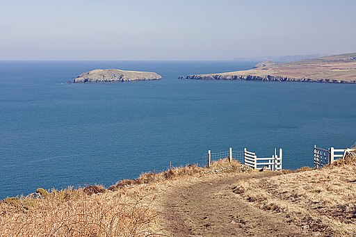
The walk starts on the bridge in Cardigan close to the historic castle. From here you can follow a footpath along the River Teifi towards the village of St Dogmaels where you could stop to explore the ruins of the 12th century abbey. The route continues north along the Pembrokeshire Coast Path to Poppit Sands where there's a lovely sandy beach. You continue to Cemaes Head where there are fine views over the bay to Cardigan Island. The area a nature reserve with birds such as choughs, kestrels and buzzards commonly seen. The high sea cliffs provide nesting sites for shags, fulmars, cormorants, razorbills, herring gulls and guillemots.
Cardigan Ordnance Survey Map  - view and print off detailed OS map
Cardigan Open Street Map  - view and print off detailed map
*New* - Walks and Cycle Routes Near Me Map - Waymarked Routes and Mountain Bike Trails>>
Cardigan OS Map  - Mobile GPS OS Map with Location tracking
Cardigan Open Street Map  - Mobile GPS Map with Location tracking
Pubs/Cafes
On the route the Ferry Inn is a great place to stop for some refreshments. The pub is located in an excellent spot right next to the river in the village of St. Dogmaels. You can sit outside on the decking area and enjoy wonderful views with your meal. You can find them on Poppit Road with a postcode of SA43 3LF for your sat navs.
Dog Walking
The bracing coastal path is a good one to do with your dog. The Ferry Inn mentioned above is also dog friendly.
Further Information and Other Local Ideas
To continue your coastal walking you could pick up the Ceredigion Coast Path which starts in the town. The epic route will take you north east to National Trust owned Mwnt and the coastal village of Aberporth where there is a blue flag beach. The area is also great for wildlife with a variety of seabirds and dolphins to look out for. Just north of Aberporth there's the worthy village of Llangrannog. Here you'll find another excellent blue flag beach and a wonderful headland area with fine views over Cardigan Bay. There's also an elevated hill fort and views of the River Hawen's waterfall in centre of the village. In the village you can pick up the Llangrannog to Cwmtydu Walk and continue north to the beautiful secluded cove at Cwmtydu. The beach is a great place to look out for seals during September and October.
Pentre Ifan is located a few miles south west. The noteworthy site includes the largest and most well preserved neolithic dolmen in Wales.
Just to the south there's Cilgerran where you can visit the fascinating remains of the 13th century castle and enjoy a stroll along the River Teifi.
If you head east there's the wonderful Cenarth Falls where you can see the leaping salmon in the autumn months. The historic town of Newcastle Emlyn with and its ruined Norman castle, can also be visited in this area.
For more walking ideas in the area see the Pembrokeshire Coast Walks page.
Cycle Routes and Walking Routes Nearby
Photos
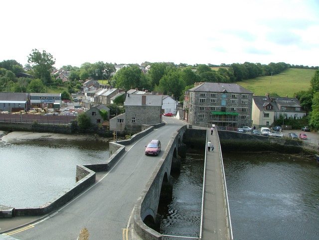
View of Bridgend, Cardigan. View across the River Teifi from Cardigan Castle showing the road bridge and pedestrian walkway and the Heritage Centre. The five-arched stone bridge probably dates back to the early 1700s; the pedestrian walkway was added not so long ago. The castle dates from the late 11th-century, though was rebuilt in 1244. It is a Grade I listed building.
Afon Teifi, Cardigan.
Two boys are attempting to fish in the fast flowing tidal water, watched by a third.
The bridge in the background used to carry the A487 over the river, but the Aberystwyth - Fishguard trunk route now by-passes the town and a new bridge has been built a short distance upstream.
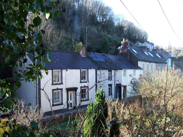
Cottages, Llandudoch/St Dogmaels. Much of the village clings to the steep sides of the Cwm Degwel ravine with C19 workers' cottages and terraces closely packed in along small street and alleys. In 1994 there was a serious landslip that destroyed houses and necessitated major drainage and stabilization work. The post-glacial soil structure of the area is the reason for the instability.
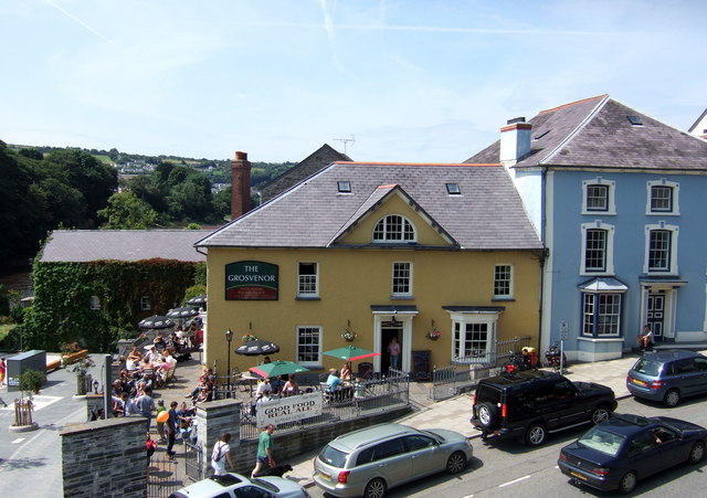
Bridge Street, Cardigan. Looking westwards from the castle, immediately across Bridge Street, is the late C19/early C19 Grosvenor Hotel above the recently opened riverfront area, and next to it Castle Chambers. These two attractive stucco buildings once constituted Bridge House which belonged to one of the main merchant families who operated their business over the river.
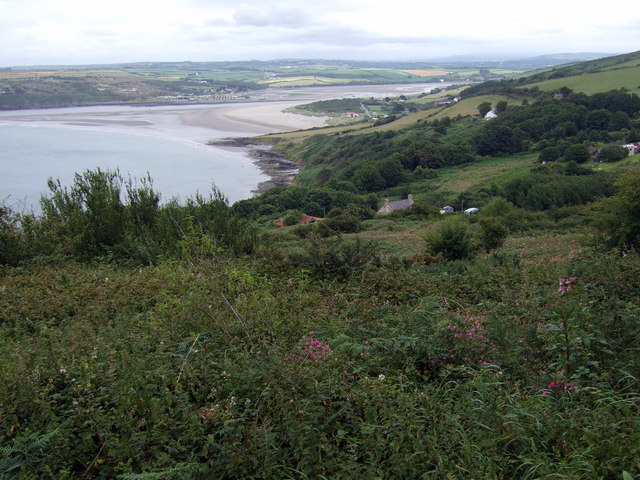
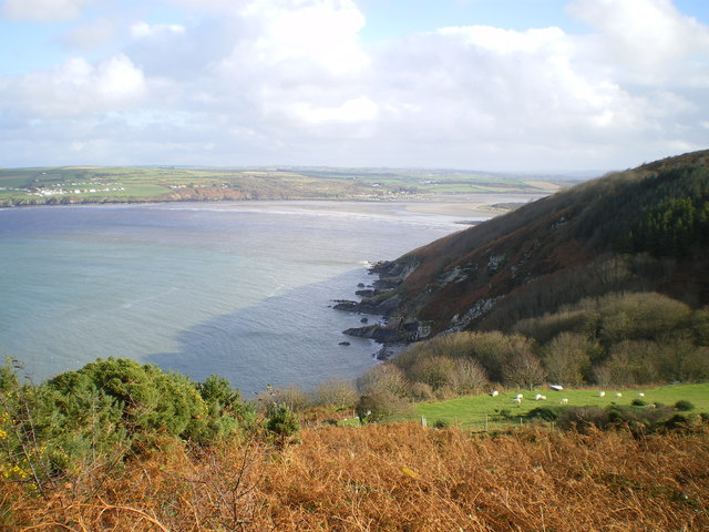
Penrhyn and the Teifi estuary. Looking down from Brynawelon cottage towards Penrhyn where the first coastguard station was established. Beyond is the Teifi estuary and Poppit Sands with Cardigan Bar visible across the mouth of the estuary. There is a footpath marked on the map as running past here to the coast, but it is not discernible on the ground. Penrhyn Castle is on the left of the picture but obscured.
