Castle Drogo to Fingle Bridge Circular Walk
![]()
![]() Explore the delightful gardens and wider estate surrounding this country house in Drewsteignton, Devon.
This is one of the classic circular walks in Dartmoor taking you from Castle Drogo to Fingle Bridge along the wonderful Hunters Path. There are fabulous views down the Teign gorge and across Dartmoor on this elevated path. At Fingle Bridge you cross a 16th/17th century packhorse bridge and pick up the River Teign Walk following a splendid waterside path through oak woodland. Lots of little beaches give you the opportunity for a waterside picnic or a little paddle. It's great for wildlife too- look out for salmon and brown trout jumping up the weirs when the river is in spate (high water). Kingfishers and woodpeckers are other visitors to this beautiful area.
Explore the delightful gardens and wider estate surrounding this country house in Drewsteignton, Devon.
This is one of the classic circular walks in Dartmoor taking you from Castle Drogo to Fingle Bridge along the wonderful Hunters Path. There are fabulous views down the Teign gorge and across Dartmoor on this elevated path. At Fingle Bridge you cross a 16th/17th century packhorse bridge and pick up the River Teign Walk following a splendid waterside path through oak woodland. Lots of little beaches give you the opportunity for a waterside picnic or a little paddle. It's great for wildlife too- look out for salmon and brown trout jumping up the weirs when the river is in spate (high water). Kingfishers and woodpeckers are other visitors to this beautiful area.
Other features on the walk include Hunter's Tor, Sharp Tor, Piddledown Common and Drewston Woods.
The area is managed by the National Trust and the route makes use of the Dartmoor Way so the footpaths are generally good.
If you head east from Fingle Bridge you can explore the extensive Fingle Woods. It consists of 420 acres of woodland with waymarked trails and the Iron Age Hillfort of Wooston Castle.
Postcode
EX6 6PB - Please note: Postcode may be approximate for some rural locationsCastle Drogo Ordnance Survey Map  - view and print off detailed OS map
Castle Drogo Open Street Map  - view and print off detailed map
*New* - Walks and Cycle Routes Near Me Map - Waymarked Routes and Mountain Bike Trails>>
Castle Drogo OS Map  - Mobile GPS OS Map with Location tracking
Castle Drogo Open Street Map  - Mobile GPS Map with Location tracking
Explore the Area with Google Street View 
Pubs/Cafes
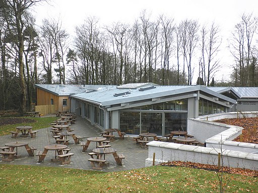
The Castle has a great National Trust visitor centre with a nice cafe. There's plenty of tables outside with great views of the grounds. It's a nice place to relax with a snack on a fine day.
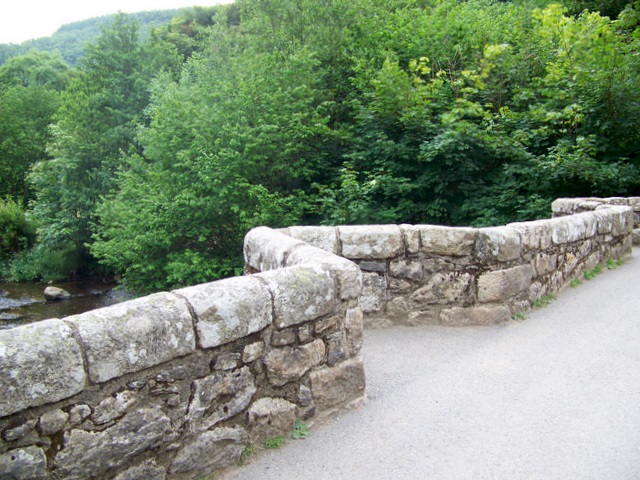
The Fingle Bridge Inn is in a great location right next to the river. You can sit outside in the large garden area which overlooks the woods and the river, which is just a few feet away from the tables. On a fine day it's the perfect place to relax with a cream tea after your exercise. Inside there's a cosy interior with a stone hearth and wood ceiling beams. You can find the inn right next to the old bridge at postcode EX6 6PW for your sat navs. Fingle Bridge is one of the highlights on the walk dating from between the 16th and 17th century. The bridge is Grade II listed.
Further Information and Other Local Ideas
Just half a mile west of the castle is the delightful Stone Lane Gardens. Here you'll find botanical gardens and an arboretum with many different types of trees and a series of lovely wooden sculptures. It's a tranquil place to go for a stroll and another of the area's worthy attractions. You can find the gardens about 1 mile due west of Drewseignton or about half a mile north west of the castle. The postcode is TQ13 8JU for your sat navs.
Cycle Routes and Walking Routes Nearby
Photos
Castle Drogo. Sometimes referred to as "the last castle built in England", it was constructed for Julius Drewe, the founder of that once famous high street chain of Home and Colonial Stores. The building is now managed by the National trust and unfortunately some of the construction of the Sir Edwards Lutyens design is now in need of repair, hence the tent and temporary building to the right of the picture.
Granite steps lead down to a courtyard on the southwest side of the castle. The 20th-century castle was designed by Edwin Lutyens. It is notable as the last castle built in England, blending modern architectural techniques with traditional styles. The surrounding landscape has been carefully managed by the National Trust to preserve its natural and cultural heritage.
Shed at Castle Drogo. Recent works at the National Trust property meant that the car park buildings were out of action until recently, so temporary buildings were erected across the lawn from the castle to act as shop, information centre and plant sales centre. This is one of them.
On the Hunter's Path. The Hunter's Path runs along the northern crest of the Teign gorge between Castle Drogo (in fact, to its west) to Fingle Bridge. Here it is following Drewsteignton Bridleway 13.
In the woodland sections, particularly along the Hunter’s Path and the descent to Fingle Bridge, you’ll encounter species typical of temperate woodlands. Trees such as oak, beech, and hazel dominate, with their understories supporting plants like wood sorrel, bluebells (in spring), ferns, and mosses. Lichens and fungi, including bracket fungi and puffballs, thrive in the moist conditions, indicating the health and age of these woods.
One of the walk's highlights is the stunning view of the Teign Gorge from the Hunter’s Path. This elevated path offers panoramic views of the valley and surrounding woodland, showcasing Dartmoor’s rugged beauty.
Drewsteignton, Hunter's Path. Looking north-north-west on a bridleway on the National Trust’s Castle Drogo estate, near Hunter’s Tor.
The heathland areas closer to Castle Drogo are home to heathers and gorse, which provide colour and nectar for pollinators like bumblebees and butterflies. In these more open spaces, you might also encounter birds of prey such as buzzards and kestrels, often seen soaring above the valley. Red deer and roe deer occasionally graze in the area, and the woods are home to foxes, badgers, and bats.
Fingle Bridge is a narrow road bridge over the River Teign. It dates from between the 16th and 17th century. The bridge is Grade II listed.
The River Teign, which you follow for part of the route, is an important habitat for aquatic species. Look out for dippers and grey wagtails along the riverbanks, and if you're lucky, you might spot an otter or its tracks. Fish species such as trout are common, supported by the clean, oxygen-rich waters.


