Cat's Back Walk
![]()
![]() This circular walk climbs to the Cat's Back, a wonderful ridge on Black Hill in the Black Mountains region of the Brecon Beacons.
This circular walk climbs to the Cat's Back, a wonderful ridge on Black Hill in the Black Mountains region of the Brecon Beacons.
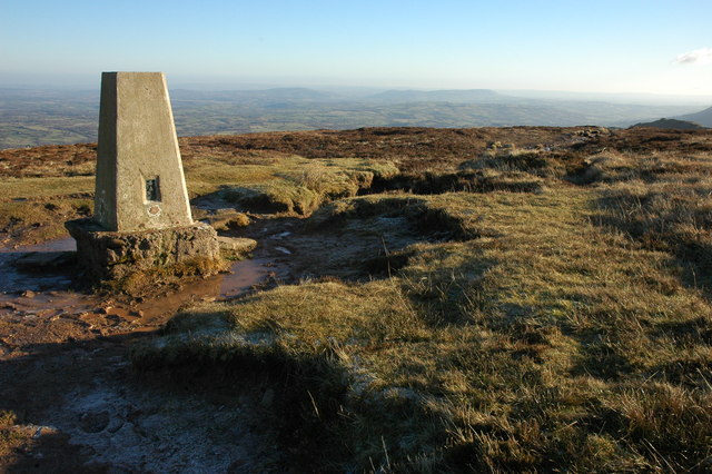
The walk starts from the Black Hill car park in the Olchon Valley, just west of Michaelchurch Escley. From here you can pick up a walking trail heading up on to the ridge. Follow the trail north west and it will take you up onto Black Hill which stands at a height of 640 metres or 2100 feet. The rocky knife-edge ridge gives excellent views into Wales on one side, and England on the other.
The route then descends to the north west, passing Crib y Garth before linking up with the Offa's Dyke Path National Trail. Follow the waymarked footpath south east before turning east to cross the Olchon Brook and return to the car park.
Additionally, the area is excellent for wildlife spotting with Red Kites and the lovely Welsh Mountain pony commonly spotted around the ridge. Also keep your eyes peeled for common buzzard, kestrel, carrion crow, common raven and skylark as you make your way along the ridge.
For a shorter circular walk through the area see the Olchon Valley Walk.
Postcode
HR2 0PL - Please note: Postcode may be approximate for some rural locationsCats Back Ordnance Survey Map  - view and print off detailed OS map
Cats Back Open Street Map  - view and print off detailed map
Cats Back OS Map  - Mobile GPS OS Map with Location tracking
Cats Back Open Street Map  - Mobile GPS Map with Location tracking
Pubs/Cafes
The little village of Craswell is located just a mile north of the hill summit. Here you can pay a visit to the White Haywood Farm Restaurant. The restaurant is set in a converted 400 year old stone barn at the foot of the Black Hill. It's a splendid place, serving high quality food with home grown and local produce. You can find them at postcode HR2 0PL.
You could also head into nearby Michaelchurch and visit the Bridge Inn. The friendly inn is situated in a lovely spot in the village, next to the Escley Brook. You can sit outside in the pretty garden and enjoy your meal with views of the stream. They have a varied menu and a particularly good selection of ciders as well. You can find them about 2 miles east of the car park at postcode HR2 0JW for your sat navs. The Michaelchurch Escley Walk visits the ridge from the village if you prefer to start from there.
Dog Walking
The hill makes for a bracing walk for fit dogs but it is a narrow elevated ridge so care must be taken. The Bridge Inn mentioned above is dog friendly.
Further Information and Other Local Ideas
Just a few miles west of the hill there's another popular climb to be found at Lord Hereford's Knob (Twmpa).
Hay Bluff is another local option. You could slightly extend this walk by climbing to the summit which is located just to the north west of the northern tip of this route.
Garway Hill is also not far and visible from the summit on this walk.
For more walking ideas in the area see the Brecon Beacons Walks and the Black Mountains Walks pages.
Cycle Routes and Walking Routes Nearby
Photos
Notice board at the car park and picnic site which provides access to the Black Hill. The board gives you a bit of information about the area before your climb.
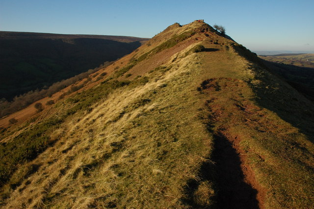
View down the ridge near the summit. Cat's Back Ridge is Herefordshire's own Striding Edge, the ridge rises to the Black Hill. This ridge is unusual for the Black Mountains in that it is narrow, elsewhere the tops are broad whatebacks.
The Ridge provides a wonderful route to ascend the Black Hill with the upper Olchon Valley on the left and Herefordshire stretched out below on the right.


