Coln St Aldwyns Walks
![]()
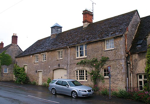
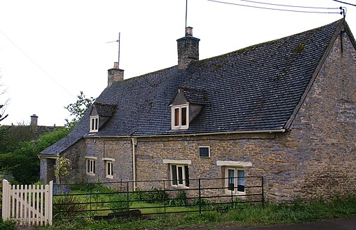
![]() This pretty Cotswolds village is located in a pleasant spot on the River Coln. There's also a noteworthy Norman Church and an 16th century inn to visit in the settlement.
This pretty Cotswolds village is located in a pleasant spot on the River Coln. There's also a noteworthy Norman Church and an 16th century inn to visit in the settlement.
This circular walk takes you around the village, visiting the Old Mill House, the River Coln and the neighbouring village of Quenington. There's nice views of the river and some lovely Cotswolds countryside to enjoy on the way.
Coln St Aldwyns Ordnance Survey Map  - view and print off detailed OS map
Coln St Aldwyns Open Street Map  - view and print off detailed map
Coln St Aldwyns OS Map  - Mobile GPS OS Map with Location tracking
Coln St Aldwyns Open Street Map  - Mobile GPS Map with Location tracking
Walks near Coln St Aldwyns
- Bibury-River Coln-Arlington Row - This circular walk takes you around the delightful village of Bibury and the surrounding countryside
- Eastleach - This Gloucestershire village includes the settlements of Eastleach Turville and Eastleach Martin which sit either side of the River Leach.
- Chedworth Roman Villa - This circular walk around the village of Chedworth visits the fascinating Chedworth Roman Villa and Chedworth Woods.
The walk starts in Chedworth and follows the Macmillan Way long distance trail to the National Trust owned villa - Lechlade River Circular Walk - This lovely circular walk takes you along the River Thames and through the countryside surrounding this pretty town in Gloucestershire
- Cricklade Circular Walk - Enjoy an easy stroll around the pretty Wiltshire town of Cricklade, on this circular walk in the Thames Valley
- Buscot Park - Explore the delightful grounds and gardens surrounding this fine 18th-century house near Faringdon in Oxfordshire
- Cotswold Canals - Follow a series of delightful waterways from Framilode to Lechlade on this waterside walk through Gloucestershire.
The walk starts at Framilode, next to the River Severn and follows the Stroudwater Canal and the River Frome to the market town of Stroud - Faringdon Circular Walk - This circular walk around the Oxfordshire town of Faringdon, visits Faringdon Folly and the village of Littlelworth
- Fairford - The Gloucestershire town of Fairford is ideally located for exploring the Cotswolds Hills on foot
- Carterton - This modern Oxfordshire based town is located in the western part of the county near Witney.
- Southrop - This Gloucestershire village lies just to the south of Eastleach on the eastern edge of the Cotswolds.
- Lechlade To Kelmscott - This walk takes you along a lovely section of the Thames Path from Lechlade to Kelmscott.
- Quenington - This delightful Gloucestershire village is located on the River Coln in the Cotswolds
Pubs/Cafes
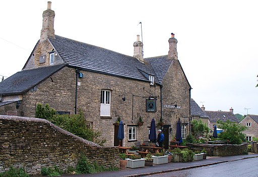
Head to the New Inn for some post walk refreshment. The 16th-century coaching inn serves quality food and can be found at postcode GL7 5AN for your sat navs.
Further Information and Other Local Ideas
Head north west along the river and you can visit Bibury and Arlington Row. These picturesque 14th century stone cottages are one of the most photographed Cotswold scenes. See the video below for a walk to the village.
Just to the west there's the villages of Ampney Crucis and Ampney St Peter where you can visit a series of noteworthy ancient churches.
To the east there's Eastleach where you can enjoy two noteworthy Norman churches and an ancient stone slab clapper footbridge over the River Leach. It's another picture postcard place known for its numerous historic buildings and a colourful display of daffodils in the spring. Lovely Southrop can also be visited in this area.
For more walking ideas in the area see the Cotswolds Walks and the Gloucestershire Walks page.
Photos
St John the Baptist parish church. View from the east, showing the parish war memorial, south tower and church clock.


