Croagh Patrick Walk
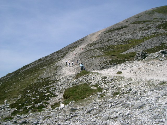
![]() This walk follows the Croagh Patrick Pilgrimage Trail to the summit of Croagh Patrick Mountain in County Mayo.
This walk follows the Croagh Patrick Pilgrimage Trail to the summit of Croagh Patrick Mountain in County Mayo.
The historic mountain is climbed by thousands of pilgrims every year on Reek Sunday, the last Sunday in July, a custom which goes back to at least the Middle Ages.
It's 3.5km walk to the top so about 7km there and back. It should take between 3 to 4 hours to complete the route. The path is qute a challenging one making trekking poles advisable due to the loose rocks and steep incline.
You can start the walk from the small village of Murrisk which lies just to the north east of the mountain. From here you can pick up the trail and follow it south towards Lugnademon. Here you bend round to the west to reach the 764 m (2,507 ft) high summit of Croagh Patrick.
From the top there are glorious views over Westport Bay, Clew Bay and the Mayo mountains.
Croagh Patrick Open Street Map  - view and print off detailed map
Ireland Walking Map - View All the Routes in the Country>>
Croagh Patrick Open Street Map  - Mobile GPS Map with Location tracking
Further Information and Other Local Ideas
To the north you can pick up the Great Western Greenway, a popular cycling and walking trail running along a disused railway line from Achill to Westport in County Mayo.
About an hours drive to the south there's the ruins of Clifden Castle to explore. The grounds of the striking Gothic Revival house include fine views of Clifden Bay. There's also the scenic Sky Road to pick up in this area.
Near Clifden there's more local historic interest at the 19th century Kylemore Abbey. The popular estate includes loughside trails, a Victorian walled garden, woodland paths and views of the surrounding Twelve Bens Mountains. Near here there's also the stunning Killary Fjord. There's some wonderful scenery here with the fjord flanked by the mountains of Mweelrea and Ben Gorm.
To the north east is Castlebar where there's a lovely waterside circular trail around Lough Lannagh. The long distance Great Western Greenway can also be picked up here.
To the south west there's Cleggan where you can catch the ferry to the beautiful Inishbofin island. There's a waymarked circular loop walk here passing rugged cliffs, a photogenic ruined fort, pretty lakes and stone beaches. Near here there's also Clare Island which you can reach from Roonagh Pier near the small town of Louisburgh. The island has strong associations with the notorious Grace O'Malley, the 'pirate queen' of the 16th century.
Cycle Routes and Walking Routes Nearby
Photos
The holy mountain has a pyramid-shaped peak and overlooks Clew Bay. It has long been seen as a holy mountain. The mountain is associated with Saint Patrick, who is said to have spent forty days fasting on the summit.
Rules of Pilgrimage at Croagh Patrick. Croagh Patrick is climbed by thousands of pilgrims every year on Reek Sunday, the last Sunday in July, a custom which goes back to at least the Middle Ages.


