Denham Country Park
![]()
![]() Enjoy waterside walking in this delightful park in Uxbridge. The rivers Colne and Misbourne and the Grand Union Canal pass through the park. There is a variety of wildlife, including herons, kingfishers and dragonflies.
Enjoy waterside walking in this delightful park in Uxbridge. The rivers Colne and Misbourne and the Grand Union Canal pass through the park. There is a variety of wildlife, including herons, kingfishers and dragonflies.
You will also find the useful Colne Valley Park Visitor Centre and cafe in the park.
The route below starts and ends at the parking facility in the park but Denham rail station is less than a mile away so makes for a good access point.
The excellent Colne Valley Trail also passes through the park so you could pick up this waymarked trail to extend your walking.
Postcode
UB9 5PG - Please note: Postcode may be approximate for some rural locationsPlease click here for more information
Denham Country Park Ordnance Survey Map  - view and print off detailed OS map
Denham Country Park Open Street Map  - view and print off detailed map
Denham Country Park OS Map  - Mobile GPS OS Map with Location tracking
Denham Country Park Open Street Map  - Mobile GPS Map with Location tracking
Walks near Denham
- Grand Union Canal Walk - Follow the towpath of Britain's longest canal from London to Birmingham on this fabulous waterside walk
- Colne Valley Trail - Follow the Colne Valley Trail from Uxbridge to Rickmansworth and enjoy riverside and canalside walking or cycling.
The trails follows the Grand Union Canal and the River Colne while also passing a series of pretty Lakes including Lynsters, Stocker's and Batchworth Lake - Rickmansworth - The town of Rickmansworth is ideally situated for some lovely waterside walking
- Black Park Country Park - With over 10 miles of well signed cycling and walking tracks, Black Park is the ideal place for a great day out in the country
- Langley Park Country Park - Langley Park has a variety of beautiful trails suitable for cycling and walking
- Bayhurst Wood Country Park and Ruislip Woods - Bayhurst Wood Country Park and Ruislip Woods are located in the London Borough of Hillingdon and contain numerous walking and cycling trails
Pubs/Cafes
In Denham village there's the Swan Inn for post walk refreshments. The pub serves good quality food and has a nice heated garden room. You can find them at postcode UB9 5BH. The village is a fine place for a stroll too with the 16th century Southlands Manor, a 14th century bakery and a church with Norman features to see.
Uxbridge has an interesting history as the site of the attempted negotiations between King Charles I and the Parliamentary Army during the English Civil War. The public house at the centre of those events, since renamed the Crown & Treaty, still stands and is worthy of some investigation. The pub is Grade II* listed, and dates from 1576. There is even an album named after the pub by mercury prize nominated band Sweet Billy Pilgrim. The pub does very good food and also has a fine outdoor bar for the summer months.
You can find the historic inn on Oxford Road at postcode UB8 1LU for your sat navs.
Dog Walking
The trails in the park are great for dog walking so you'll probably see other owners on a fine day.
Further Information and Other Local Ideas
The excellent Colne Valley Trail also passes through the park so you could pick up this waymarked trail to extend your walking. If you follow the trail north it will take you along a series of lakes towards Rickmansworth and Batchworth.
Head south west and you will find two other fine parks in the shape of Black Park Country Park and Langley Park Country Park. There's miles of good cycling and walking trails through the woodland in these parks.
The Celandine Route runs just to the east of the park. It will take you along the River Pinn from Pinner to Cowley.
For more walking ideas in the area see the Buckinghamshire Walks and London Walks pages.
Photos
Heron sculpture, Denham Country Park. In the grounds of the Colne Valley Visitor Centre in Denham Country Park. The heron is the symbol of the Colne Valley Regional Park. The sculpture, unveiled in 2005, is six metres high.
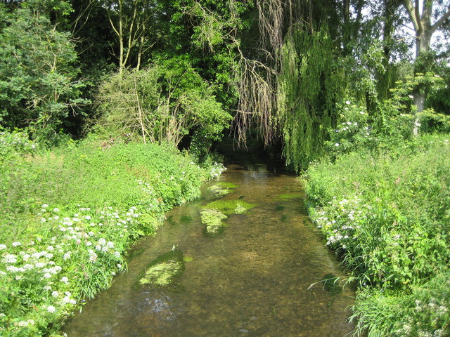
River Misbourne in Denham Country Park. The Misbourne is a chalk stream that rises northwest of Great Missenden in SP8902 and runs for about 23 kilometres, as the crow flies, before ending where it joins the River Colne in TQ0585. Here, only about 1 kilometre upstream of the confluence with the Colne, it is still very shallow. This view was taken from the Denham Court Drive bridge.


