Dolgarrog Pipeline Walk
![]()
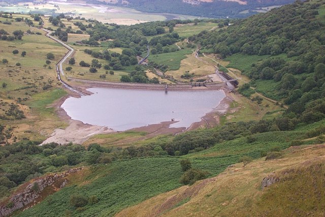
![]() This walk explores the area around the village of Dolgarrog in Conwy County Borough on the edge of the Snowdonia National Park. You'll visit the impressive Dolgarrog Pipeline and the picturesque Coedty Reservoir on the route. From the elevated position of the pipeline there are excellent views to the surrounding hills and mountains. The village is also notable as the site of the Dam disaster of 1925 wher the failure of two dams caused a flood that swamped the village, killing 16 people.
This walk explores the area around the village of Dolgarrog in Conwy County Borough on the edge of the Snowdonia National Park. You'll visit the impressive Dolgarrog Pipeline and the picturesque Coedty Reservoir on the route. From the elevated position of the pipeline there are excellent views to the surrounding hills and mountains. The village is also notable as the site of the Dam disaster of 1925 wher the failure of two dams caused a flood that swamped the village, killing 16 people.
The walk starts in the village and then follows woodland west, passing the old locomotive shed of the Cowlyd Tramway. The route then circles Pennarda where there's the remains of a medieval township. At the western end of the walk you skirt the edges of Moel Eilio before coming out at the pretty Coedty Reservoir. The final section heads past Pont Newydd before returning you to Dolgarrog.
To extend the walk head west to visit Llyn Eigiau where you can see the breached dam wall which lead to the disaster. There's a lovely waterside trail here with old slate quarries to explore and the possibility of spotting Carneddau ponies on the hills.
Dolgarrog Pipeline Walk Ordnance Survey Map  - view and print off detailed OS map
Dolgarrog Pipeline Walk Open Street Map  - view and print off detailed map
Dolgarrog Pipeline Walk OS Map  - Mobile GPS OS Map with Location tracking
Dolgarrog Pipeline Walk Open Street Map  - Mobile GPS Map with Location tracking
Further Information and Other Local Ideas
Just over a mile to the east is the climb to Cadair Ifan Goch, a National Trust owned area. From the summit of the hills there are excellent views over the River Conwy Valley to the Carneddau mountains.
Head further east to the nearby village of Llanfair Talhaiarn and you could explore the lovely River Elwy Valley and enjoy a climb to the splendid viewpoint at Mynydd Bodran. The historic Bodelwyddan Castle is also near here and well worth a visit.
Just to the north is the delightful village of Rowen. The village is considered one of the prettiest villages in Wales and a real hidden gem. The climb to Tal Y Fan, in the Carneddau mountains, is often started from here.
Cycle Routes and Walking Routes Nearby
Photos
The locomotive shed of the Cowlyd Tramway. The railway to Llyn Cowlyd from the head of the Dolgarrog incline, which survives as this track, was last used in the late sixties. The incline winding house and the locomotive shed remain today. One steam locomotive (Eigiau) and a small Simplex diesel (Dolgarrog) survive from this system. Eigiau is now in retirement in Kent, while Dolgarrog is at work on the Welsh Highland Railway reconstruction.
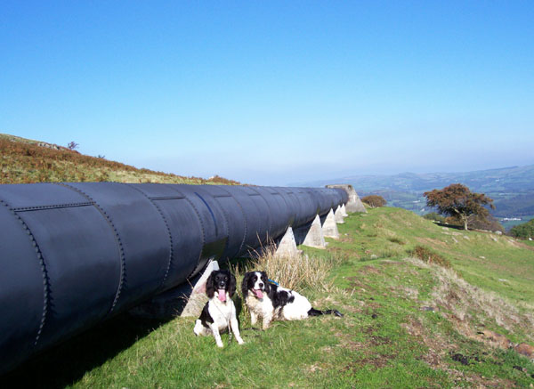
Two dogs relax in the sun by the Cowlyd pipeline. Water is taken from Llyn Cowlyd to the Hydro-electric power station at Dolgarrog in this pipeline. It is called the high-head supply as it is sourced at a higher elevation (350m) than the original supply through Coedty Reservoir at 270m.
Railway bridge. This lightweight steel bridge was built to carry a private siding from the Conwy Valley railway line at Dolgarrog Station to the Aluminium Works. It is still used for a nominally private road which runs along the course of the line and gives foot-access across the river, which is important since the nearest bridges are some miles away.
The Ardda Leat. This leat, which is partly in tunnel, brings water from the Afon Ddu to Coedty Reservoir. You can see how it is designed to intercept the normal drainage at this water supply takeoff.
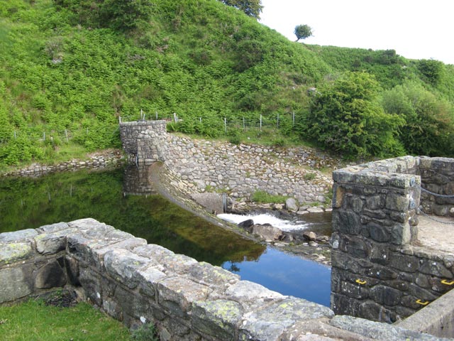
Tafolog weir. As part of the Dolgarrog hydro-electric power scheme, water is passed from the Afon Tafolog to Coedty reservoir along a tunnel and leat. This is the weir that impounds water at the tunnel level, and passes it through control valves in the structure in the right of the image. Compensation water issues from a pipe low in the wall of the weir, and floods will pass straight over the wide crest. At times of low flow, there is hardly any water to be seen, but recent rain has filled the basin to crest level.


