Dorothea Quarry
![]()
![]() This walk in the Nantlle valley visits the 19th century Dorothea Quarry. The slate quarry is now flooded and is a popular place for scuba divers.
This walk in the Nantlle valley visits the 19th century Dorothea Quarry. The slate quarry is now flooded and is a popular place for scuba divers.
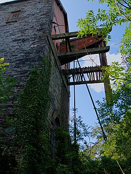
The area is also good for walking with a footpath taking you from the village of Nantlle to Talysarn via the quarry. You'll pass the old pump house and the Cornish Beam Engine installed in 1904 to pump the pits. It's an interesting place with nice countryside views to enjoy as well.
If you'd like to continue your walking in the area then you could stroll down to Llyn Nantlle Uchaf from the village. There's a nice footpath along the southern side of the lake with good views across the water to the surrounding hills.
Postcode
LL54 6AE - Please note: Postcode may be approximate for some rural locationsDorothea Quarry Ordnance Survey Map  - view and print off detailed OS map
Dorothea Quarry Open Street Map  - view and print off detailed map
Dorothea Quarry OS Map  - Mobile GPS OS Map with Location tracking
Dorothea Quarry Open Street Map  - Mobile GPS Map with Location tracking
Dog Walking
The quarry is a popular place for dog walkers so you'll probably see other owners on your visit.
Further Information and Other Local Ideas
You can continue your walking in the area by heading east to climb to the wonderful viewpoint at Mynydd Mawr. The picturesque Llyn Cwellyn can also be found in this area.
The quarry is one of the significant sites on the Snowdonia Slate Trail which runs through the area. The circular long distance trail can be used to visit several of the other historic mining areas located in the World Heritage Site. Heading north along the trail would take you to Dinorwic Quarry which was at one time the second largest slate quarry in the world. The quarry is located on the edge of Padarn Country Park where there are some lovely waterside trails along Llyn Padarn and Llyn Peris.
For more walking ideas in the area see the Snowdonia Walks page.
Cycle Routes and Walking Routes Nearby
Photos
Dorothea pumping engine and Penyrorsedd Quarries. The view shows the apparently precarious situation of the engine house between two of the quarry pits. The Penyrorsedd workings can be seen away into the distance. As can be seen in the following photograph nature is reclaiming this industrialised area and the view in this 1976 picture would be difficult to replicate today.
A view of the flooded Quarry, looking East and taken close by the Cornish beam engine house. The flooded quarry is used for diving, and is accessed via the landing stage to the left of the picture.


