Earlswood Lakes
![]()
![]() Enjoy a stroll along these three reservoirs and into the adjacent woodland on this lovely walk in Solihull. There's a good footpath running along the lakes which includes a visit to Terry's Pool. This wildlife reserve, has a rich variety of plant and animal life including otters and turtles. Along the shore you'll see lots of pretty willow trees and plants such as great willowherb, betony, gipsywort and yellow flag iris. The walk also takes you into the delightful Clowes Wood. Here you will find heathland, woodland, wildflowers and wet meadow. Look out for a variety of birdlife including jay, chiff chaff, nuthatch and treecreeper, woodcock and three types of woodpeckers.
Enjoy a stroll along these three reservoirs and into the adjacent woodland on this lovely walk in Solihull. There's a good footpath running along the lakes which includes a visit to Terry's Pool. This wildlife reserve, has a rich variety of plant and animal life including otters and turtles. Along the shore you'll see lots of pretty willow trees and plants such as great willowherb, betony, gipsywort and yellow flag iris. The walk also takes you into the delightful Clowes Wood. Here you will find heathland, woodland, wildflowers and wet meadow. Look out for a variety of birdlife including jay, chiff chaff, nuthatch and treecreeper, woodcock and three types of woodpeckers.
Postcode
B94 5JH - Please note: Postcode may be approximate for some rural locationsEarlswood Lakes Ordnance Survey Map  - view and print off detailed OS map
Earlswood Lakes Open Street Map  - view and print off detailed map
Earlswood Lakes OS Map  - Mobile GPS OS Map with Location tracking
Earlswood Lakes Open Street Map  - Mobile GPS Map with Location tracking
Explore the Area with Google Street View 
Pubs/Cafes
The Red Lion is located a short stroll north from the car park. It's a large country pub serving traditional pub meals. There's a good sized garden area as well so you can enjoy your meal outside if the weather is fine. The pub has an interesting history dating back to the 18th century, when they offered "pony and traps to hire along with good stabling". You can find it on Lady Lane at postcode B94 6AQ for your sat navs.
Dog Walking
The lakes are a popular place for dog walkers so you'll probably bump into plenty of other owners on a fine day. The Red Lion pub mentioned above is also dog friendly and have water and treats available for your thirsty/hungry friend.
Further Information and Other Local Ideas
If you'd like to continue your walking in the area then you could pick up the Solihull Way which starts at the lakes. The Stratford Upon Avon Canal is also nearby so this is another place where you can enjoy more waterside walks. The circular Solihull Walk visits the lakes and the Grand Union Canal.
Just a few miles to the east of the lake you will find the National Trust owned Packwood House. There's grounds of the 16th century house include a pretty lake, herbaceous borders, wildflower meadows, splendid topiary and a beautiful orchard.
The Reigate and Banstead Millennium Trail also passes the park. You could pick up and follow it south to visit the town of Horley next to Gatwick Airport.
Just to the south there's the neighbouring village of Tanworth-in-Arden. Here you can enjoy a circular walk around the grounds of the 17th century Umberslade Hall. The village itself is also worth exploring with its picturesque village green and 14th century church.
The circular walk from neighbouring Bletchingley visits the lakes. It also visits the Moors Nature Reserve and Mercers Country Park to the north east. There's some pleasant lakeside trails and lots of wildlife to see in this area. Bletchingley is also worth exploring with a conservation area including several historic medieval properties.
For more walking ideas in the area see the Warwickshire Walks page.
Cycle Routes and Walking Routes Nearby
Photos
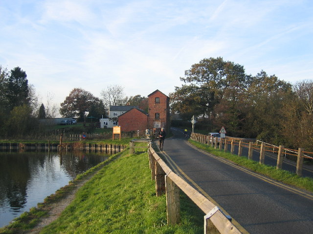
The causeway that carries the road over and divides Windmill Pool to the left and Engine Pool to the right.
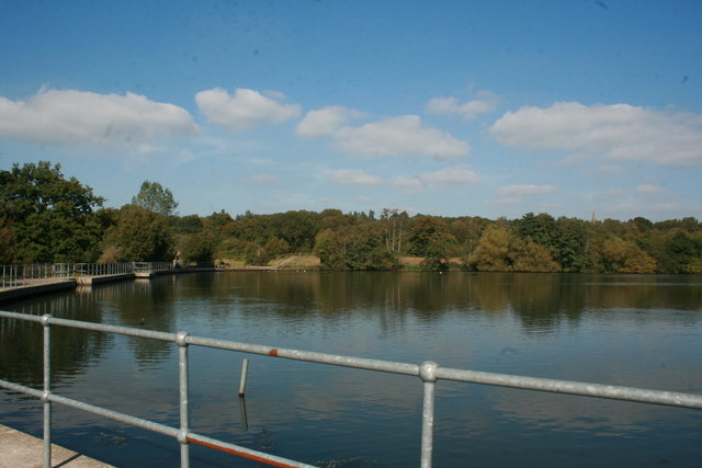
This is the top lake of the two lakes on a nice clear sunny day. The lake itself is not very deep and has an abundance of wildlife. It is a very quiet, relaxing spot, where you can either take in the views or go for walk around the lakes. The walks takes you through the woods where there are more hidden surprises. Bursting with wild life, you may catch a glimpse of a rare species, a migrant bird. An ideal nature reserve, easily accessed from either the M25 or M23, good free parking, with refreshment available.
Terry's Pool. Looking south across Terry's pool in the watery November afternoon light towards the far shore in the adjacent square.
Engine House. Earlswood Lakes were built to provide water for the Stratford-upon-Avon Canal. This view is looking NW along to the dam towards the old engine house at the point at which the canal feeder leaves the lakes. The lakes are divided into three pools and the one seen here is known as Engine Pool.


