Eltham Walks
![]()
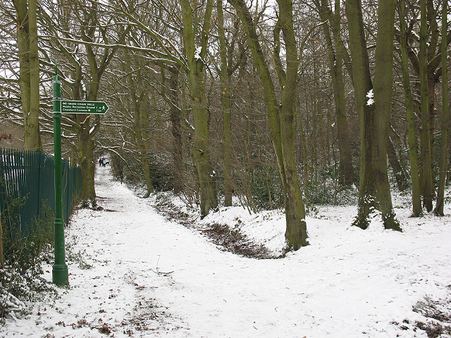
![]() This circular walk from Eltham uses part of the Green Chain Walk to take you to Eltham Palace, Beckenham Place Park and Elmstead Woods. The route runs for about 10 miles and includes a few small climbs on the way.
This circular walk from Eltham uses part of the Green Chain Walk to take you to Eltham Palace, Beckenham Place Park and Elmstead Woods. The route runs for about 10 miles and includes a few small climbs on the way.
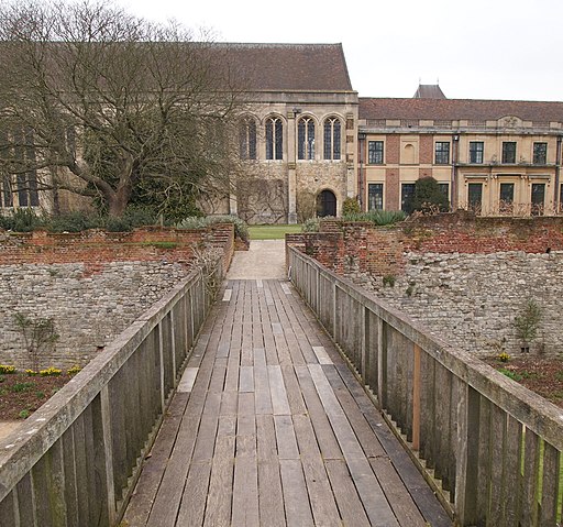
The walk starts at Eltham Palace where you can pick up the Green Chain Walk in the park. The fine 1930s house is surrounded by 19 acres of award-winning gardens and a moat. The English Heritage run site also includes a medieval palace with a glorious hammer-beam roof built for Edward IV five hundred years ago. You can follow the waymarked path south from the palace and it will take you past Mottingham to Elmstead Woods.
After exploring the woods the path heads west to Sundridge and Plaistow before coming to Beckenham Place Park. In the park you'll find 96 hectares (237 acres) of parkland including river trails along the Ravensbourne River, ancient woodland, a sensory garden and a Grade II listed mansion.
From the park you head east, crossing the Ravensbourne River before passing through Downham. The final section runs past Catford and Grove Park where you cross the Quaggy River at Mottingham. Shortly after you pass Mottingham Farm and return to Eltham Palace where the route finishes.
Postcode
SE9 5QE - Please note: Postcode may be approximate for some rural locationsEltham Ordnance Survey Map  - view and print off detailed OS map
Eltham Open Street Map  - view and print off detailed map
*New* - Walks and Cycle Routes Near Me Map - Waymarked Routes and Mountain Bike Trails>>
Eltham OS Map  - Mobile GPS OS Map with Location tracking
Eltham Open Street Map  - Mobile GPS Map with Location tracking
Walks near Eltham
- Green Chain Walk - The Green Chain Walk visits a number of London's prettiest parks and open spaces while also passing through some interesting urban areas
- Beckenham Place Park - This circular walk explores Beckenham Place Park in the London Borough of Lewisham
- Elmstead Woods - Enjoy a short stroll through Elmstead and Marvel Woods on this easy walk in the London Borough of Bromley
- Three Commons - This short circular walk in Bromley takes you on a tour of Hayes Common, Keston Common and West Wickham common
- Petts Wood Circular - A short circular walk that takes you through Petts Wood and Jubilee Country Park in Bromley
- Limehouse Cut - Follow the Limehouse Cut canal on this waterside walk or cycle in East London
- Keston Common - This area of common land in Bromley covers 55 hectares and includes some nice footpaths
- Bromley - This London town is part of the London Borough of Bromley, the southeasternmost of the 32 London boroughs that make up Greater London
- Ravensbourne River Walk - This walk takes you along the Ravensbourne Greenway on the eastern side of Beckenham Place Park on the border of the London Boroughs of Lewisham and Bromley.
Pubs/Cafes
The lovely glasshouse café at Eltham Palace is a fine place to enjoy some refreshments on the walk.
Further Information and Other Local Ideas
To continue your walking in the area you could try our Circular Walk around Bromley which visits some of the highlights of the London Borough.
Photos
Eltham Palace. Completed in 1936, this grand mansion stands in beautiful gardens which make a feature of the moat. The palace was built adjoining the Great Hall of the original Eltham Palace, built in the 1470s - it is the part mainly hidden in this picture by the foliage far left
Great Hall, Eltham Palace The magnificent Great Hall at Eltham Palace dates back to the 1470s when it was constructed for King Edward IV and designed by his chief mason, Thomas Jordan and his chief carpenter, Edmund Graveley. It measures 101' x 36' and is 55' tall (30.8 x 10.9 x 16.8 m) comparable to the Great Hall at Hampton Court built 50 years later and surpassed only in size by Westminster Palace Great Hall for surviving mediæval great halls.
Eltham Palace - Main Entrance. The curved columned façade seen centre image here is the grand main entrance to the Courtauld's 1930s redesigned palace at Eltham. The new 'palace' incorporated buildings dating back to the C15th, some effectively hidden within the body of the new building. Other parts, such as the Great Hall, part of which can be seen to the right in this image, retained their external appearance but were attached to the newer range.
Hall of Eltham Palace from rose garden. The sunken rose garden was created by Stephen and Virginia Courtauld when they owned Eltham Palace in the 1930s.


