Gelt Woods
![]()
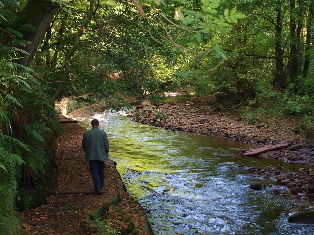
![]() Follow the River Gelt through Gelt Woods Nature Reserve, on this delightful walk near Brampton, Cumbria. There's pretty bluebells in the spring, the running waters of the river and lots of wildlife to look out for in the shady woods.
Follow the River Gelt through Gelt Woods Nature Reserve, on this delightful walk near Brampton, Cumbria. There's pretty bluebells in the spring, the running waters of the river and lots of wildlife to look out for in the shady woods.
You can start your walk from the car park at Low Gelt Bridge and then head south along the river to Middle Gelt Bridge and High Gelt Bridge. It's just under 3 miles to High Gelt so about 6 miles there and back.
As you make your way through the first section of the woods, look out for the rock with an inscription carved by a Roman soldier in the early part of the 3rd Century.
The woods are located just a mile to the west of Talkin Tarn Country Park. This is a great place to extend your walk with nice footpaths to follow around the large glacial tarn.
Postcode
CA8 1SY - Please note: Postcode may be approximate for some rural locationsGelt Woods Ordnance Survey Map  - view and print off detailed OS map
Gelt Woods Open Street Map  - view and print off detailed map
Gelt Woods OS Map  - Mobile GPS OS Map with Location tracking
Gelt Woods Open Street Map  - Mobile GPS Map with Location tracking
Pubs/Cafes
Head east into Talkin Tarn Country Park and you'll find a splendid tea room at the northern end of the lake.
To the west there's The Stone Inn in the little village of Hayton. The 19th century pub serves good quality food and traditionally brewed cask ales. You can find them at postcode CA8 9HR for your sat navs.
Dog Walking
The woods are a fine place for a dog walk so you'll probably see other owners on your visit. The Stone Inn mentioned above is also dog friendly.
Further Information and Other Local Ideas
Head a couple of miles south east of the woods and you can visit the picturesque Castle Carrock Reservoir. It's a lovely and peaceful area with the associated village of Castle Carrock also worth seeing.
The circular Brampton Walk visits the woods from the train station located just to the north east in Milton. It also visits Talkin Tarn and the surrounding countryside.
A few miles to the south west you'll find the worthy village of Wetheral where you can visit a historic ruined priory, the River Eden and the National Trust's Wetheral Woods. Near here there's also the Wreay Woods Nature Reserve where you can look out for otters by the River Petteril.
A few miles to the east there's the Geltsdale Walk to try. Here you'll find a rugged RSPB nature reserve with becks, hills, old quarries, a pretty tarn and lots of wildlife to see.
Just a couple of miles to the north east of Brampton there's Miltonrigg Woods to explore. There's more peaceful woodland trails here with pretty bluebells in the spring and lots wildlife to see. Lanercost Priory is also located in this area. The English heritage run site was originally founded in 1169 as an Augustinian monastery. Today the substantial priory ruins are well worth a visit for the fascinating history and architecure.
For more walking ideas in the area see the North Pennines Walks and Cumbria Walks pages.


