Godrevy Head
![]()
![]() Explore Godrevy Head and enjoy wonderful views of St Ives Bay and the Cornish coast on this splendid coastal walk. The area is managed by the National Trust so there's good footpaths and facilities along this stretch of coast. Along the way there's pretty beaches, attractive countryside, heathland and a wide variety of wildlife to look out for. Keep your eyes peeled for dolphins, seals and basking sharks in the water below.
Explore Godrevy Head and enjoy wonderful views of St Ives Bay and the Cornish coast on this splendid coastal walk. The area is managed by the National Trust so there's good footpaths and facilities along this stretch of coast. Along the way there's pretty beaches, attractive countryside, heathland and a wide variety of wildlife to look out for. Keep your eyes peeled for dolphins, seals and basking sharks in the water below.
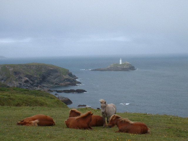
You can start the walk from the Godrevy National Trust car park off Churchtown Road, near Gwithian Bridge. You then head north along the coast path towards Godrevy Point where there are splendid views towards Godrevy Island and its lighthouse. The path continues along the headland to Navrax Point, passing Kynance Cove on the way. The route then turns south passing the lovely heathland of The Knavocks where you should look out for ponies grazing. The final section passes Castle Giver Cove and Higher Pencobben before finishing at Hell's Mouth where you can watch hundreds of seabirds around the cliffs.
There is a cafe at Hell's Mouth where you can rest and take on some refreshment before heading back to the car park on the same path.
You can extend your walk by continuing along the coast path to Portreath Walk. The path passes Reskajeage Downs, Carvannel Downs and Tehidy Country Park. The park is located just a few miles east of Hell's Mouth and contains 250 acres of woodland and lakes. There's nice cycling and walking trails and lots more wildlife to look out for around the lake.
Postcode
TR27 5ED - Please note: Postcode may be approximate for some rural locationsGodrevy Head Ordnance Survey Map  - view and print off detailed OS map
Godrevy Head Open Street Map  - view and print off detailed map
Godrevy Head OS Map  - Mobile GPS OS Map with Location tracking
Godrevy Head Open Street Map  - Mobile GPS Map with Location tracking
Pubs/Cafes
Near the start of the walk at Gwithian Bridge there's the Rock Pool for some post walk refreshment. The relaxed café restaurant is in a fine location, standing in the dunes of Gwithian and Godrevy. They serve delicious fresh seafood with a wonderful view from the outdoor seating area. You can find them at postcode TR27 5ED for your sat navs.
In the warmer months there's also an ice cream van at the car park.
Dog Walking
The coastal path makes for a nice bracing walk with your dog. The Rock Pool mentioned above is also dog friendly.
Further Information and Other Local Ideas
The Portreath Walk passes the headland as it makes its way along the coast to visit the stunning Hayle Estuary.
The circular Gwithian Walk starts from the same car park. It will take you south west along the Gwithian Towans beach with sand dunes, wild grass, rock pools and Atlantic seals to look out for.
For more walking ideas in the area see the Cornwall Walks page.
Cycle Routes and Walking Routes Nearby
Photos
Lighthouse, Godrevy Island. The Lighthouse pictured at low tide. It was built in 1858–1859. The Lighthouse marks the Stones reef, which has been a hazard to shipping for centuries. It is said to be the inspiration for Virginia Woolf's novel To the Lighthouse.
Ponies on the Knavocks. The National Trust have brought in ponies to graze on the land around Godrevy Point.


