Grassington to Conistone Walk
![]()
![]() This walk takes you from Grassington to the nearby village of Conistone. On the way you'll visit the rocky outcrop of Conistone Pie and Conistone Dib, an interesting dry valley in a limestone gorge.
This walk takes you from Grassington to the nearby village of Conistone. On the way you'll visit the rocky outcrop of Conistone Pie and Conistone Dib, an interesting dry valley in a limestone gorge.
The walk starts in Grassington where you can pick up the Dales Way long distance trail. Follow the waymarked path north from the town to Lea Green and Conistone Pie. Here you will find an unusual rock outcrop which is said to resemble an apple pie. From the elevated position of the pie there are splendid views over Wharfdale and Swineber Scar.
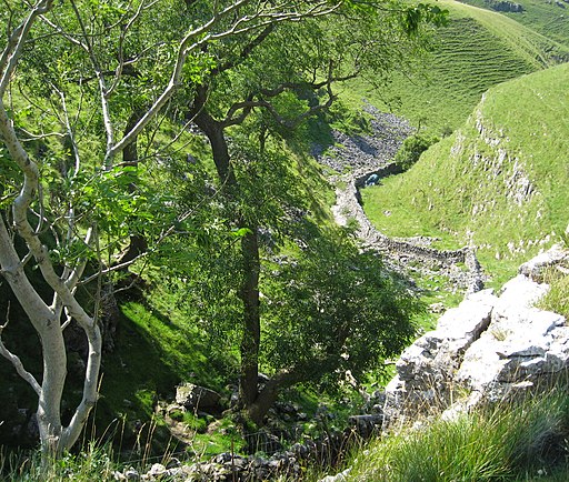
After taking in the views the route turns south and then west to visit Conistone Dib. The dib is in a dry limestone gorge with more interesting scenery to admire. The path through the dib descends into the attractive village of Conistone where there is a stone arch bridge over the River Wharfe and a noteworthy church which dates from around the 12th century.
You can turn it into a circular walk by following Grass Wood Lane south back towards Grassington.
To continue your walking in the area you could head a short distance north west of Conistone to visit Kilnsey Park and enjoy views of the distinctive Kilnsey Crag. In the park there's also the Café by the Lake where you can relax outside and enjoy fine views over the Yorkshire Dales while enjoying a good home cooked dish from the menu.
Grassington to Conistone Walk Ordnance Survey Map  - view and print off detailed OS map
Grassington to Conistone Walk Open Street Map  - view and print off detailed map
Grassington to Conistone Walk OS Map  - Mobile GPS OS Map with Location tracking
Grassington to Conistone Walk Open Street Map  - Mobile GPS Map with Location tracking
Further Information and Other Local Ideas
Just to the west of Grassington you'll find the worthy village of Threshfield. The pretty settlement includes an historic 16th century inn and the nearby Threshfield Quarry. The quarry is an unusual and atmospheric place for a walk with its limestone rocky cliffs and distinctive turquoise lakes.
Cycle Routes and Walking Routes Nearby
Photos
The view from Conistone Pie. Looking up Wharfedale to the complex field pattern below Swineber Scar.
Conistone Dib. Looking down this dry valley from the top end. The rocky gorge at the bottom is out of sight in this photo, as is the rocky scramble out of the top end, which makes a satisfying conclusion to a walk up the valley.


