Great Mis Tor Walk
![]()
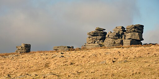
![]() This walk climbs to Great Mis Tor in the Dartmoor National Park.
This walk climbs to Great Mis Tor in the Dartmoor National Park.
You can start the walk from the Merrivale Prehistoric Site car park which lies just to the south of the tor. From here you can pick up a trail heading north to Little Mis Tor and Great Mis Tor. There's some fine rock formations and wonderful views over Dartmoor from here.
If you have time head south from the car park to explore Merrivale's standing stones and ancient stone circle.
Just to the north west you'll find the climb to Great Staple Tor and Roos Tor. The Merrivale Quarry can also be found in this interesting and attractive area.
Great Mis Tor Ordnance Survey Map  - view and print off detailed OS map
Great Mis Tor Open Street Map  - view and print off detailed map
Great Mis Tor OS Map  - Mobile GPS OS Map with Location tracking
Great Mis Tor Open Street Map  - Mobile GPS Map with Location tracking
Cycle Routes and Walking Routes Nearby
Photos
On Great Mis Tor. The tor has been called one of the grandest hills in Devon and lies above the River Walkham, about 4 miles north-east of Princetown. There is a notable rock basin on the peak, called the Mis Tor Pan or The Devil's Frying Pan.


