Hackfall Woods
![]()
![]() These peaceful woods near Grewelthorpe have miles of nice walking trails to try. It's a special place with grottos, old temples, follies, waterfalls and riverside paths along the River Ure. There's also a nice pond with a fountain, carpets of bluebells in the spring and a variety of woodland birds to look out for.
These peaceful woods near Grewelthorpe have miles of nice walking trails to try. It's a special place with grottos, old temples, follies, waterfalls and riverside paths along the River Ure. There's also a nice pond with a fountain, carpets of bluebells in the spring and a variety of woodland birds to look out for.
The woods include the famous viewpoint at Limehouse Hill. The climb is well worth the effort as there are splendid views of Masham Church, The Ruin and Mowbray Castle which was famously painted by Turner.
The Ripon Rowel long distance walking route passes through the woods so you have the option of extending your walk along the River Ure in either direction. This walk starts from the car park near the woods but you could also start from the nearby town of Masham and follow the Ripon Rowel along the river to the woods. It's about a 2 mile walk from the town. For a longer circular walk see our Grewelthorpe Walk which starts from the nearby village.
Just to the west of the woods you will find Nutwith Common where there are miles of forest trails to try.
Postcode
HG4 3DE - Please note: Postcode may be approximate for some rural locationsHackfall Woods Ordnance Survey Map  - view and print off detailed OS map
Hackfall Woods Open Street Map  - view and print off detailed map
Hackfall Woods OS Map  - Mobile GPS OS Map with Location tracking
Hackfall Woods Open Street Map  - Mobile GPS Map with Location tracking
Pubs/Cafes
Head to The Crown Inn in Grewelthorpe for some refreshments after your walk. The country pub is a popular draw for walkers coming from the woods. It has a good menu, a beer garden for fine days and is also very dog friendly. You can find it just to the south of the woods on Main Street in the pretty little village. Postcode is HG43BS for your sat navs.
Dog Walking
The woods are a splendid place for a dog walk with miles of trails. There is some farmland around so it's best to keep the dogs on leads in these areas.
Further Information and Other Local Ideas
At easter time there's the lovely Peter Rabbit & Friends Easter Woodland Adventure Trail where the children can search for easter eggs around the woods.
Just to the east you can visit the neighbouring village of West Tanfield. Here you'll find the 15th century Marmion Tower, a fine 17th century riverside pub and the lovely Nosterfield Nature Reserve.
Cycle Routes and Walking Routes Nearby
Photos
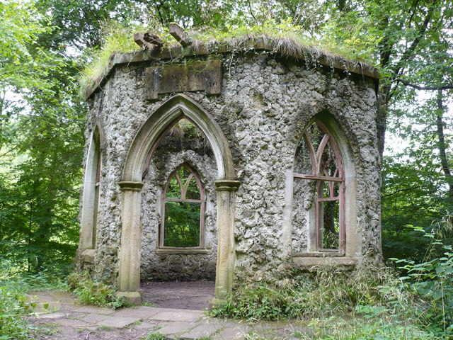
Fisher's Hall in Hackfall Woods, near to Grewelthorpe. Built for the Head Gardener by William Aislabie in the 18th century
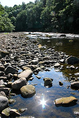
The River Ure. Photographed from the northern shore, looking east, the River Ure twists its way through the Hackfall gorge deep in the woods. Popular with canoeists.


